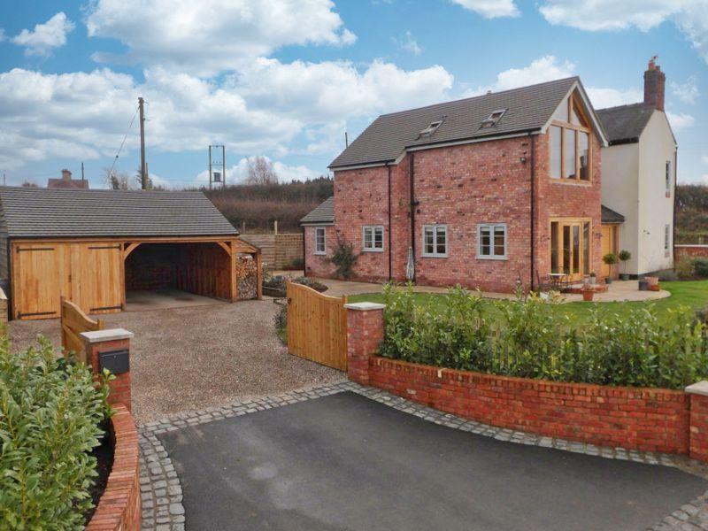
14 NEWCASTLE ROAD
CREWE, WOORE, SHROPSHIRE CW3 9RE
£525,000
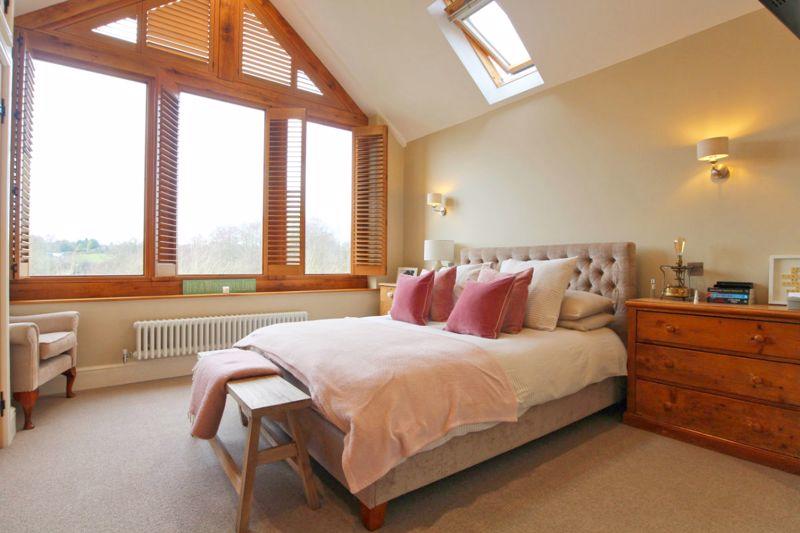
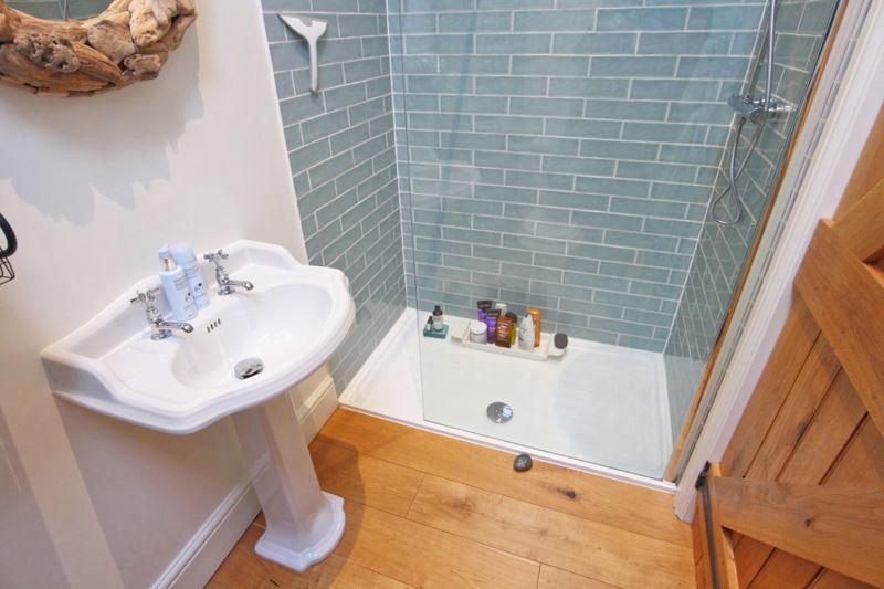
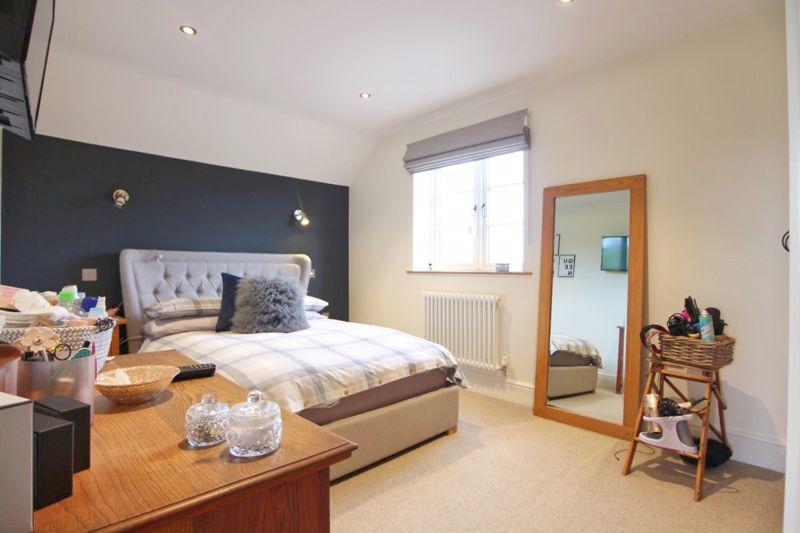
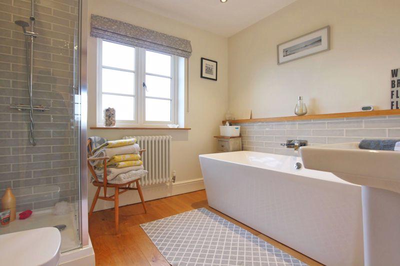
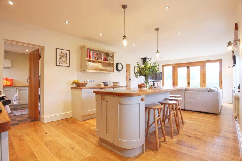
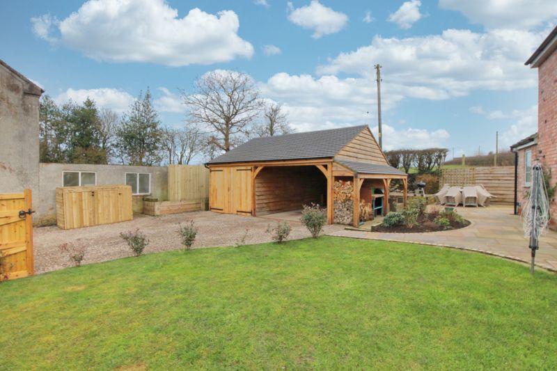
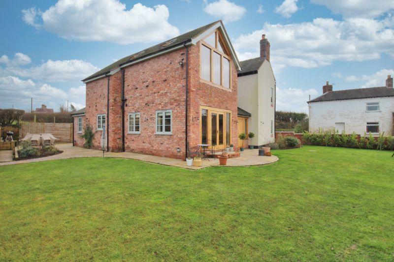
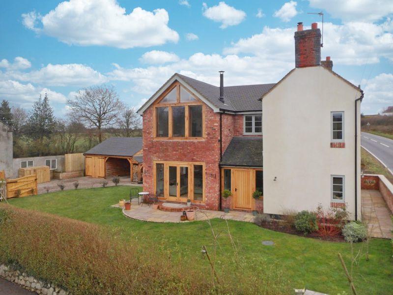
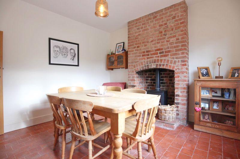
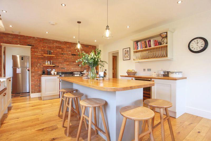
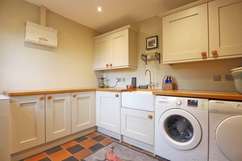
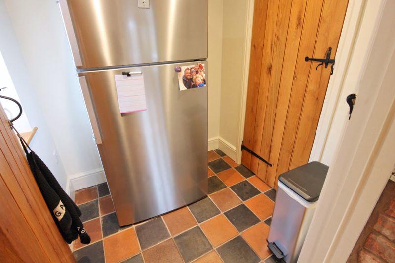
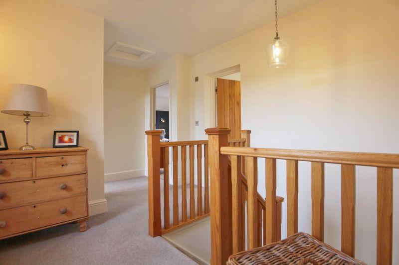
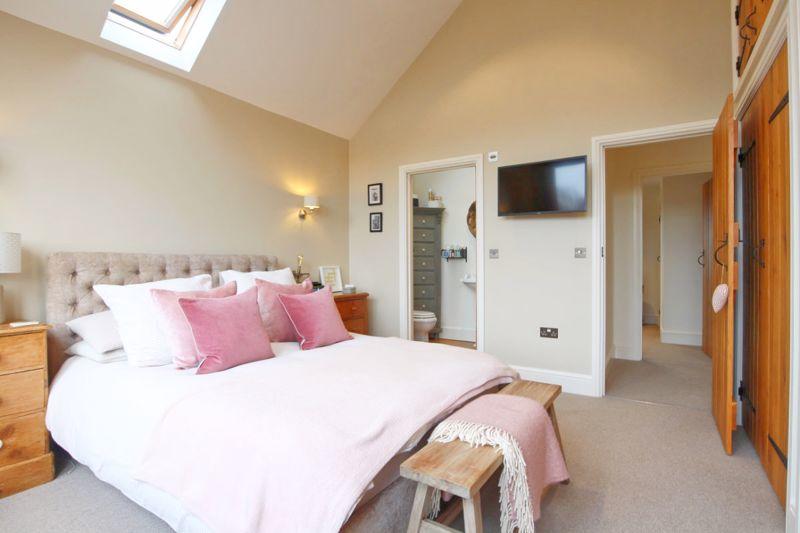
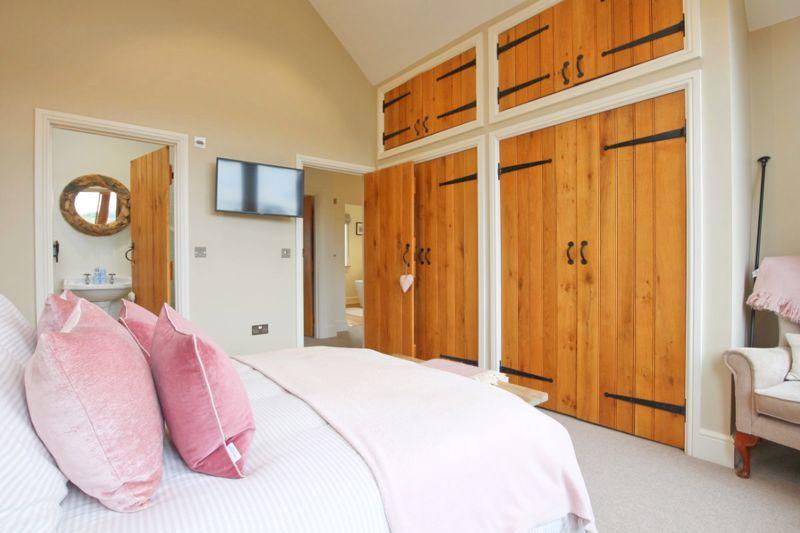

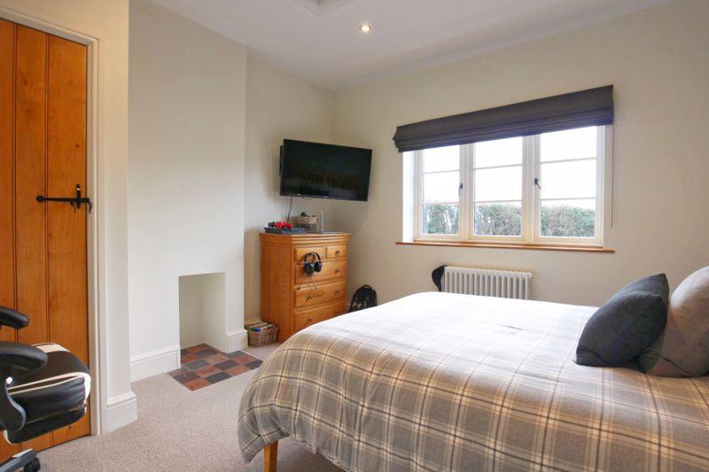
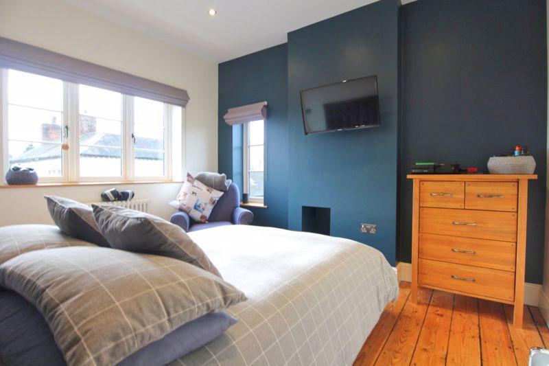
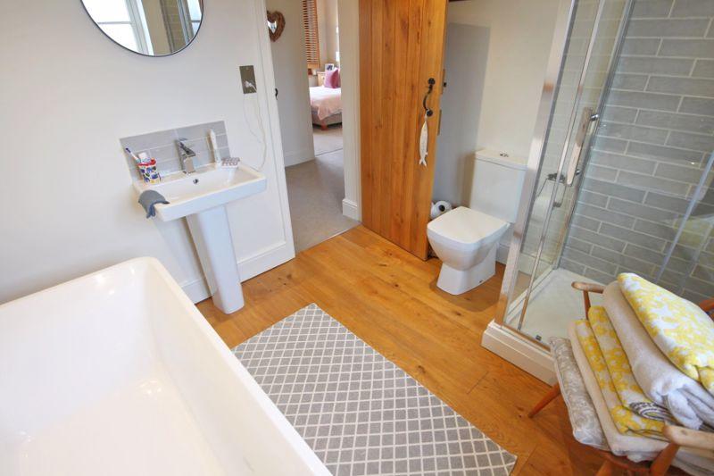
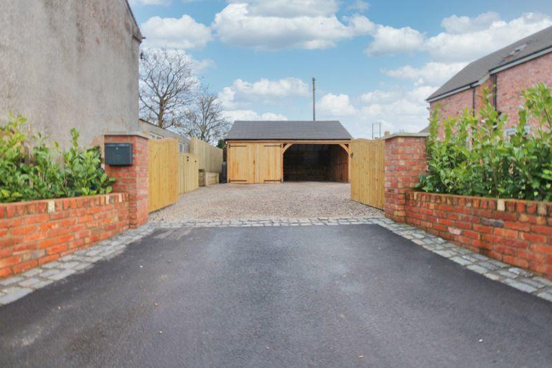
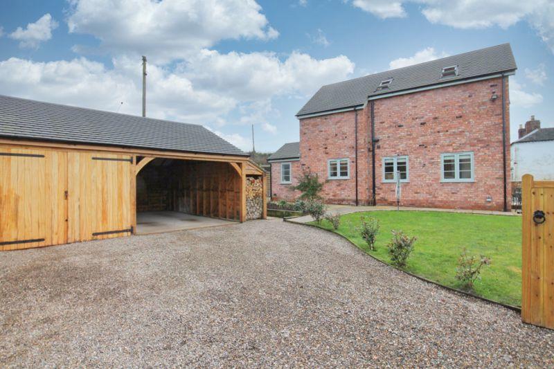
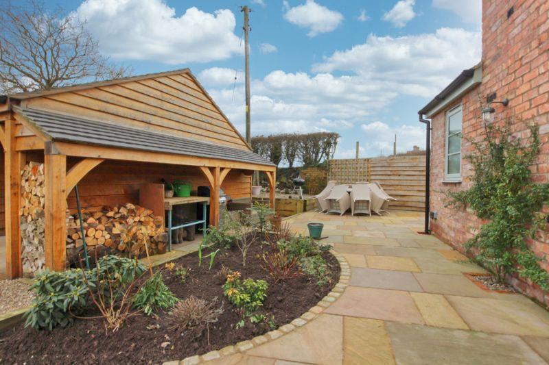
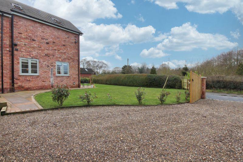
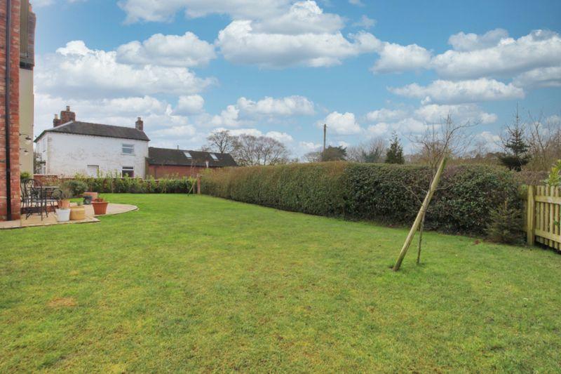
Front Elevation Kitchen/Breakf... Kitchen/Breakf... Sitting Room Master Bedroom En-suite Bedroom Two Family Bathroom Kitchen/Breakf... Parking Garden Front Elevation Entrance Hallway Entrance Hallway Cloakroom Dining Room Dining Room Kitchen/Breakf... Utility Room Storage Room/P... First Floor La... Master Bedroom Master Bedroom Bedroom Two Bedroom Three Bedroom Four Family Bathroom Entrance Parking Patio Garden Garden
/ 32
Property details
Floor area
93 m²
Last sold
£595,000 Oct 2021
Local average
£435,107 (+20.7%)
Deprivation
Decile 7 (22,351 of 33,755)
Street crime
5 incidents within 1 mile (Apr 2026)
Key features
- FOUR BED DETACHED FAMILY HOME SET ON THE OUTSKIRTS OF THE SEMI-RURAL VILLAGE OF WOORE
- IDEAL FOR TODAY'S EVER GROWING FAMILY OFFERING SPACIOUS LIVING TO THE GROUND FLOOR AND AMPLE UPPER FLOOR ACCOMODATION
- HAVING GONE THROUGH A WEALTH OF RENOVATION AND EXTENSION BY THE CURRENT OWNERS, THE PROPERTY IS PRESENTED IMMACULATELY
- WITHIN WALKING DISTANCE TO VILLAGE CONVENIENCE STORE WITH POST OFFICE, PRIMARY SCHOOL AND COUNTRY PUBS
- THE LARGER MARKET TOWNS OF NANTWICH AND NEWCASTLE-UNDER-LYME ARE BOTH A SHORT DRIVE AWAY AND OFFER A PLETHORA OF SUPER MARKETS, CAFE'S, EATERIES AND FURTHER AMENITIES
Additional details
- Parking
- Yes
- Garden
- Yes
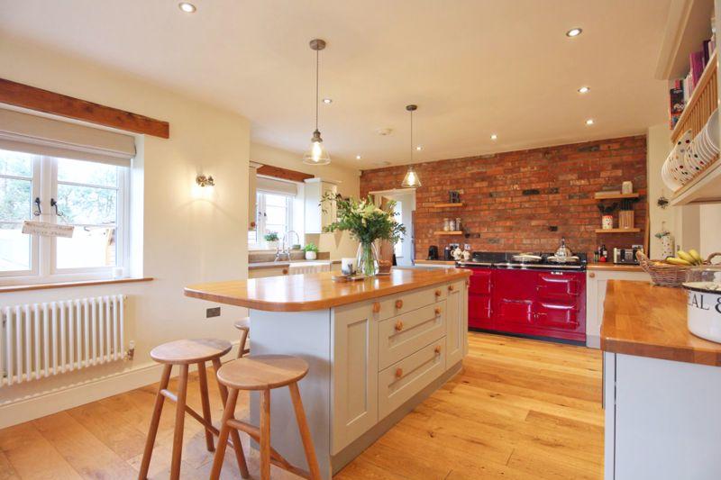
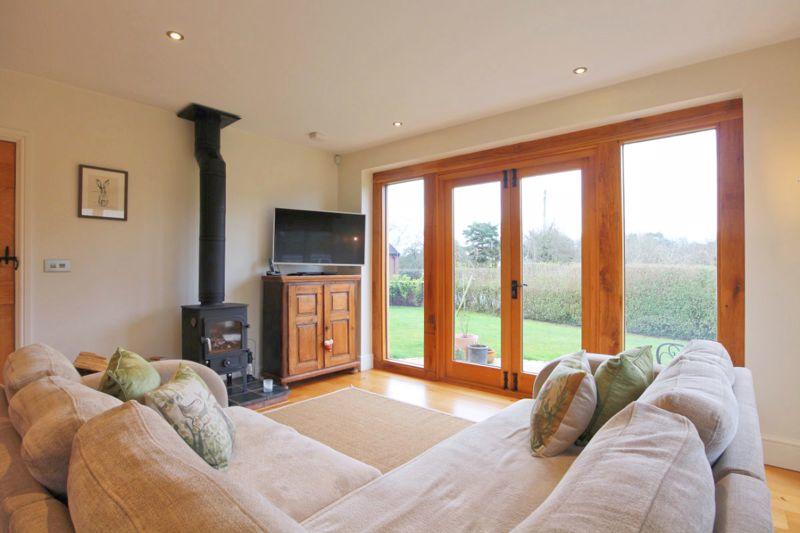
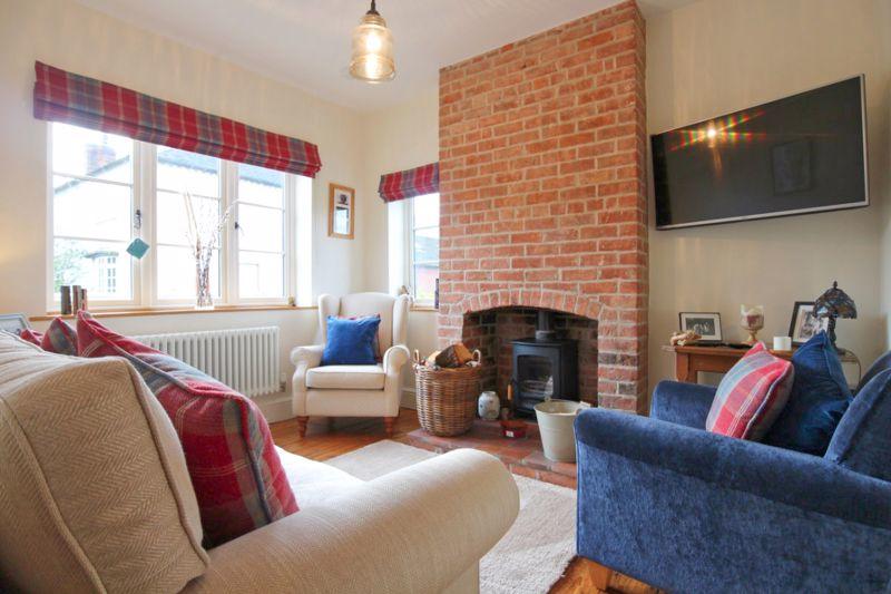
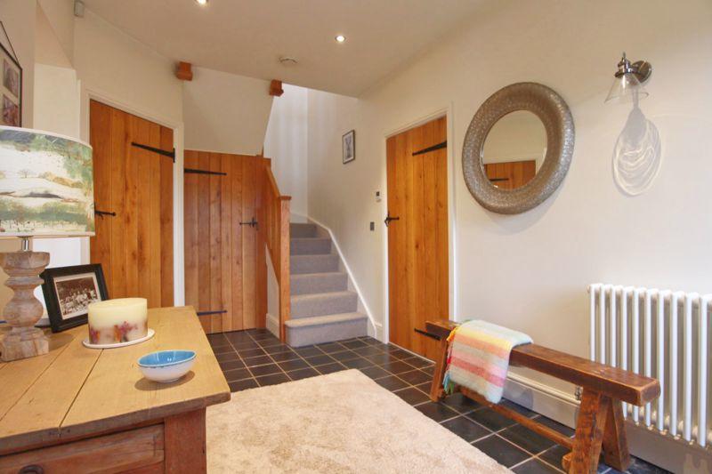
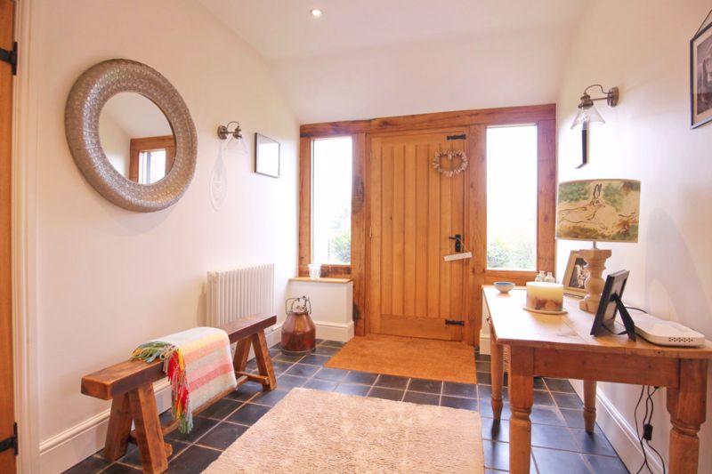
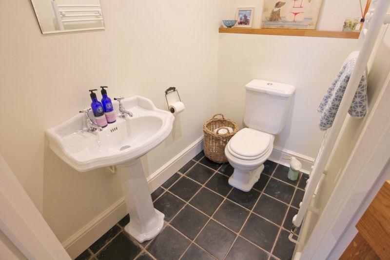
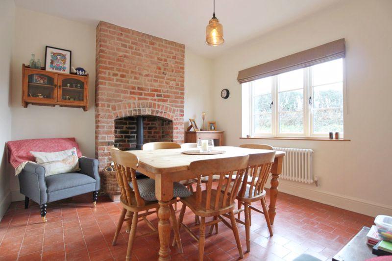
Description
Listed by
Nantwich
James Du Pavey Ltd
Reference: 102231761
EPC Rating & Upgrade Cost
Fetching EPC data… Refresh this page in a moment.
Flood risk
Zone: 1
Risk: Low
Job (default Low)
Floorplans
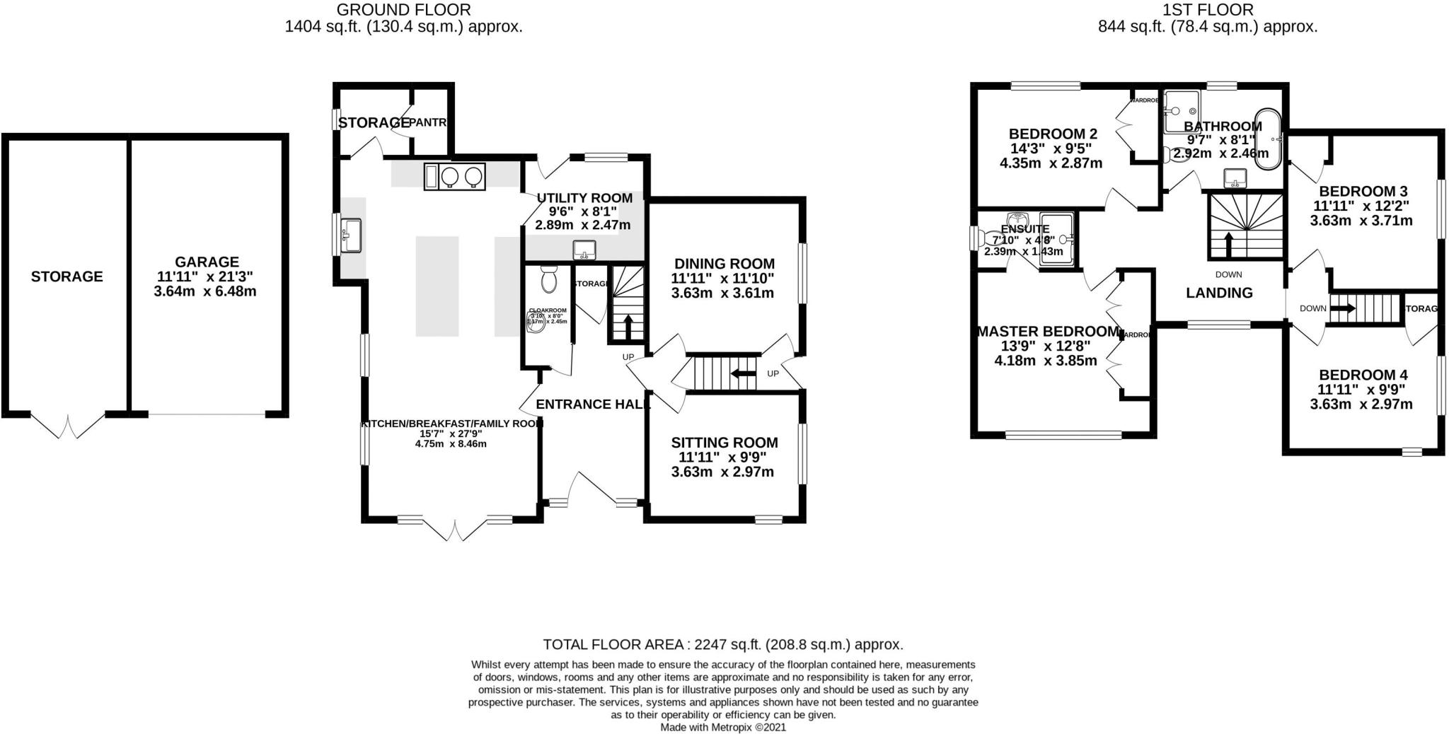
Floorplan 1
EPC Graphs
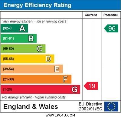
EPC Graph

Energy Perform...

EPC Link
FENSA Certificates
This property has 1 FENSA certificate(s) on record, indicating window/door installations by FENSA-approved installers.
FENSA Certificate #6003733
Property Details
Street: 14 Newcastle Road
Town: Woore
Postcode: CW3 9RE
Installation Details
Items: 4 windows and 1 door
Certificate Issued: 22/09/2008
Work Completed: 08/09/2008
This certificate data was retrieved from FENSA's database
What is FENSA? FENSA (Fenestration Self-Assessment Scheme) is a government-authorised scheme that monitors building regulation compliance for replacement windows and doors. Certificates indicate that work was completed by FENSA-approved installers.
Price history
222% since 2017
| Event | Date | Price | % change |
|---|---|---|---|
| Sold | 20/10/2021 (4 years ago) | £595,000 | +12.2% |
| Sold | 31/03/2021 (5 years ago) | £530,250 | +186.6% |
| Sold | 17/02/2017 (9 years ago) | £185,000 | — |
Source: HM Land Registry Price Paid Data. Crown copyright.
Sold Comparables
Same street and nearby sales within 0.25 miles (last 5 years). Data from Land Registry Price Paid.
| Address | Price | Date | Type |
|---|---|---|---|
| Same street BARN INDIA NEWCASTLE ROAD, WOORE, CREWE, SHROPSHIRE, CW3 9RE | £625,000 | 14/07/2023 | Other |
Street average: £625,000 (1 sale)
Capital growth trend
Land Registry outcode average: last 12 months vs 5y and 10y ago (from sold prices).
House Price Index (HM Land Registry — official index, not sold-price averages): Shropshire. Series: Detached. As of March 2026.
Rental Range
Estimated market rent for Shropshire. Low = conservative, Realistic = average, Optimistic = best case.
Based on Local Authority from postcode lookup → Shropshire.
LHA (30th percentile) floor for South Cheshire: £992/mo (Apr 2025 – Mar 2026)
Location
Address
Newcastle Road
Nearby
Nearest stations, universities and amenities (distance from property).
| Type | Name | Distance |
|---|---|---|
| Shop | Woore Country Stores | 0.5 miles |
| Bus stop | Station Road | 0.9 miles |
| Shop | Bridgemere Garden World | 1.1 miles |
| Bus stop | Bridgemere, Off London Road / Bridgemere Garden World | 1.3 miles |
| University | Keele University | 5.2 miles |
| Train station | Silverdale | 6.4 miles |
| Train station | Apedale Road | 6.6 miles |
| Hospital | North Staffordshire Nuffield Hospital | 7.0 miles |
| Hospital | Royal Stoke University Hospital | 7.6 miles |
| University | University of Buckingham Crewe Campus | 8.1 miles |
Street-level crime
| Category | Count |
|---|---|
| Violence and sexual offences | 2 |
| Criminal damage and arson | 1 |
| Other crime | 1 |
| Public order | 1 |
| Total incidents | 5 |
Within 1 mile during Apr 2026. Source: data.police.uk (England & Wales).
Schools nearby
Nearest open schools with Ofsted ratings (England). Closed schools are not shown. Data from Get Information about Schools and Ofsted.
| Name | Type | Distance | Ofsted |
|---|---|---|---|
| Woore Primary and Nursery School | Primary | 0.5 miles | Good — 10 Dec 2023 |
| Sir John Offley CofE (VC) Primary School | Primary | 2.4 miles | Good — 16 Mar 2023 |
| Bridgemere CofE Primary School | Primary | 2.4 miles | Good — 23 Jul 2018 |
| Madeley High School | Secondary | 2.7 miles | Good — 7 Feb 2013 |
| St Mary's CofE (A) Primary School | Primary | 3.3 miles | Good — 10 Jun 2015 |
Rental Comparables
Loading rental comparables for this postcode. Refresh in a few minutes.
Rent-driven metrics
Based on Area rent estimate.
- Rent ratio — Monthly rent ÷ purchase price (1% rule). 1%+ = strong, 0.8–1% = okay, <0.8% = weak for cashflow.
- Max investor price — Rent ÷ 0.8%; the price at which rent would be 0.8% of price (Stoke-style target).
- Target investor price — Rent ÷ 1%; the price at which rent would be 1% of price (strong cashflow band).
- Gross yield — Annual rent as % of purchase price (no costs).