42 HATHAWAY GARDENS
LONDON, GREATER LONDON W13 0DH
£1,950 pcm
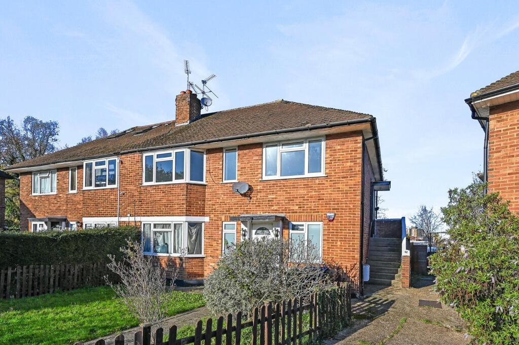
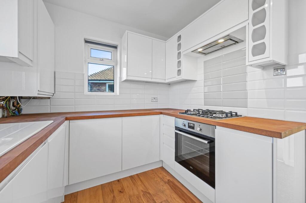
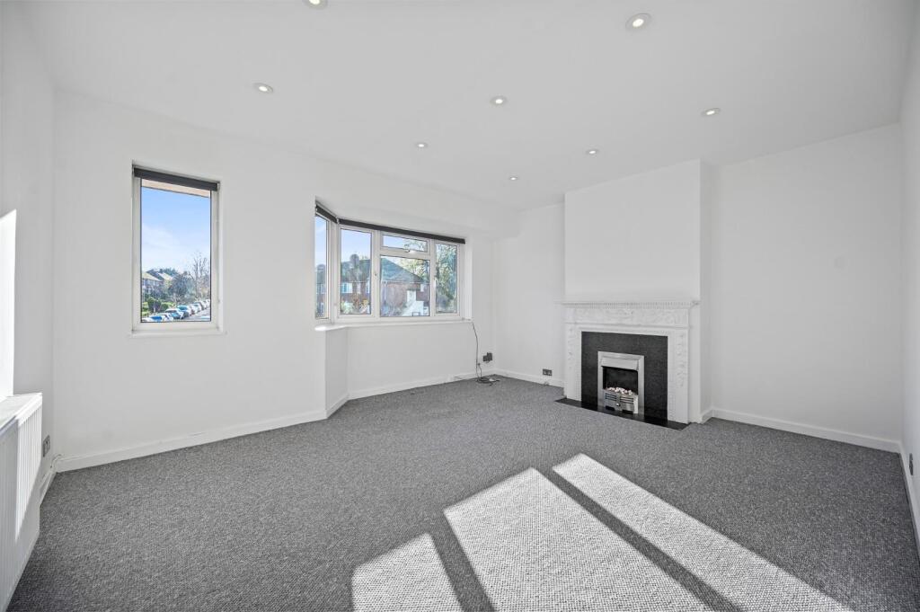
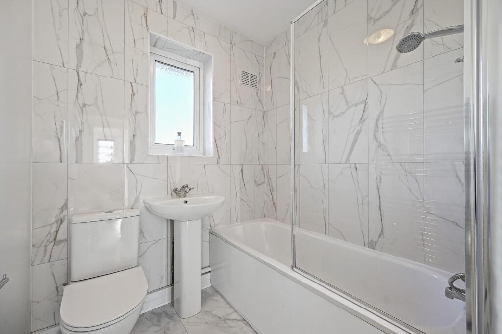

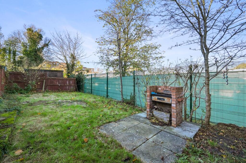
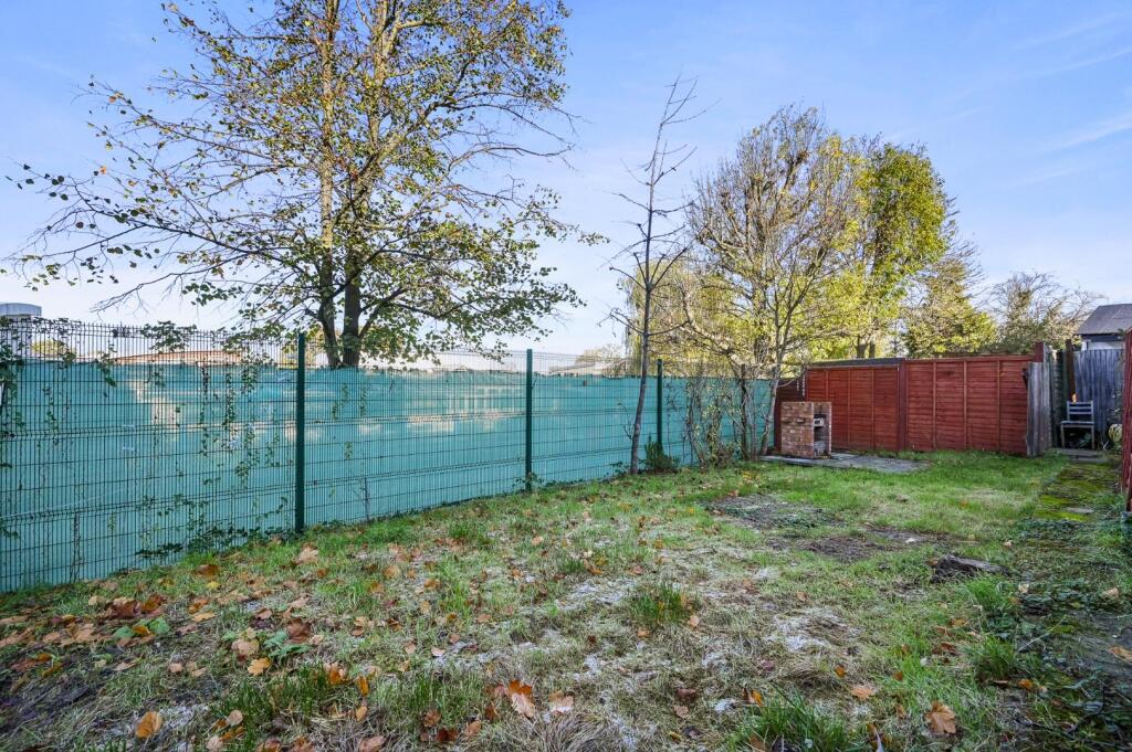
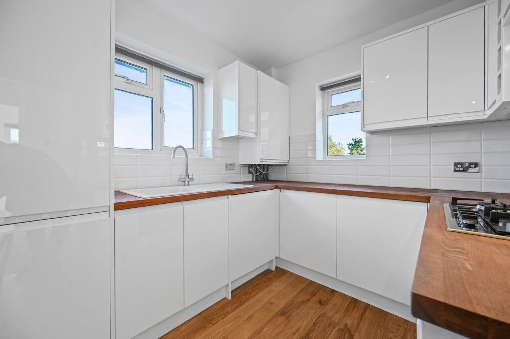
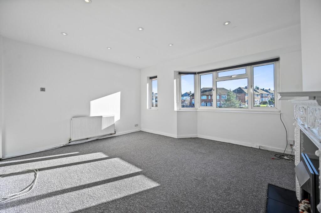
Photo 1 Photo 2 Photo 3 Photo 4 Photo 5 Photo 6 Photo 7 Photo 8 Photo 9
/ 9
Property details
Floor area
61 m²
Council tax band
D
EPC rating
C
Year built
England and Wales: 1930-1949
Deprivation
Decile 1 (1,544 of 33,755)
Street crime
489 incidents within 1 mile (Apr 2026)
Key features
- Two double bedrooms
- First floor maisonette
- Excellent condition
- Private rear gardens
- Double glazing and gas central heating
- Unfurnished
- Available now
- EPC rating: C / council tax band: D
Additional details
- Heating
- Gas central
- Garden
- Yes
- Restrictions
- Yes
- Flooded in last 5 years
- No
Description
Listed by
Ealing
Rolfe East
Reference: 169418768
EPC Rating & Upgrade Cost
Current rating: C
Potential rating: C
Inspection date: 25/03/2022
Current heating cost: £377/year
Potential heating cost: £309/year
Est. upgrade cost to C: £1,025
Recommendations
- Cavity wall insulation (£500 - £1,500)
- Low energy lighting for all fixed outlets (£25)
Flood risk
Zone: 1
Risk: Low
Job (default Low)
Floorplans
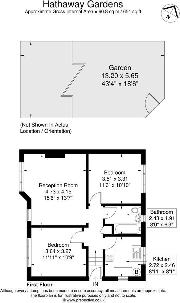
Floorplan 1
EPC Graphs
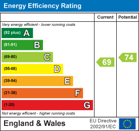
EE Rating
Company ownership
Registered legal owner is a company.
Rental Range
Estimated market rent for Ealing. Low = conservative, Realistic = average, Optimistic = best case.
Based on Local Authority from postcode lookup → Ealing.
LHA (30th percentile) floor for Stevenage & North Herts: £972/mo (Apr 2025 – Mar 2026)
Location
Nearby
Nearest stations, universities and amenities (distance from property).
| Type | Name | Distance |
|---|---|---|
| Train station | Castle Bar Park | 0.1 miles |
| Bus stop | Castle Bar Park | 0.1 miles |
| Bus stop | Castle Bar Park Station | 0.1 miles |
| Shop | Dan's Convenience Store | 0.4 miles |
| Shop | Betfred | 0.4 miles |
| Train station | Drayton Green | 0.5 miles |
| University | University of West London | 1.1 miles |
| University | University of West London - Hellenic Institute Of Maritime Studies | 1.1 miles |
| Hospital | Hounslow Medical Centre | 4.2 miles |
| Hospital | Bridge Lane Health Centre | 7.8 miles |
Street-level crime
| Category | Count |
|---|---|
| Anti-social behaviour | 130 |
| Violence and sexual offences | 111 |
| Vehicle crime | 62 |
| Public order | 39 |
| Criminal damage and arson | 36 |
| Burglary | 27 |
| Shoplifting | 26 |
| Other theft | 18 |
| Drugs | 15 |
| Theft from the person | 11 |
| Bicycle theft | 5 |
| Robbery | 5 |
| Other crime | 2 |
| Possession of weapons | 2 |
| Total incidents | 489 |
Within 1 mile during Apr 2026. Source: data.police.uk (England & Wales).
Schools nearby
Nearest open schools with Ofsted ratings (England). Closed schools are not shown. Data from Get Information about Schools and Ofsted.
| Name | Type | Distance | Ofsted |
|---|---|---|---|
| Castlebar School | Other | 0.0 miles | Outstanding — 10 Jul 2014 |
| Woodlands Academy | Primary | 0.1 miles | Good — 26 Jun 2024 |
| Ealing Alternative Provision | Other | 0.3 miles | Good — 23 Sep 2015 |
| Ysgol Gymraeg Llundain, London Welsh School | Other | 0.3 miles | Good — 20 Mar 2023 |
| Springhallow School | Other | 0.3 miles | Good — 24 Mar 2024 |
Rental Comparables
Residential lets from OpenRent and Rightmove for the area (same bedroom count). Use to validate rent estimates. Student lets are excluded.
| Title | Rent | Beds | Distance | As seen on |
|---|---|---|---|---|
| 2 Bed Flat, Templeman Road, W7 | £1,900/mo | 2 | 0.19 miles | OpenRent |
| 2 Bed Flat, Manor Road, W13 | £2,500/mo | 2 | 0.62 miles | OpenRent |
| 2 Bed Maisonette, Felix Road, W13 | £2,250/mo | 2 | 0.72 miles | OpenRent |
Average rent: £2,217/mo (3 listings)