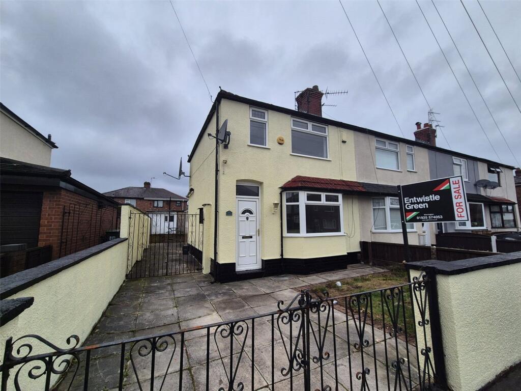
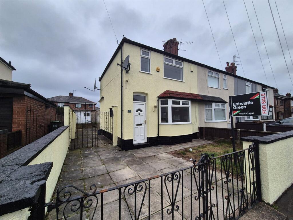
34 SOUTH AVENUE
WARRINGTON, WARRINGTON WA2 8BQ
Property details
Tenure
LEASEHOLD
Floor area
68 m²
Council tax band
A
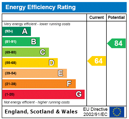
EPC rating
D
Year built
England and Wales: 1930-1949
Last sold
£84,000 Mar 2016
Price per m²
£2,353/m²
Local average
£171,667 (-6.8%)
Deprivation
Decile 3 (8,284 of 33,755)
Street crime
409 incidents within 1 mile (Apr 2026)
Additional details
- Parking
- Yes
- Garden
- Yes
Description
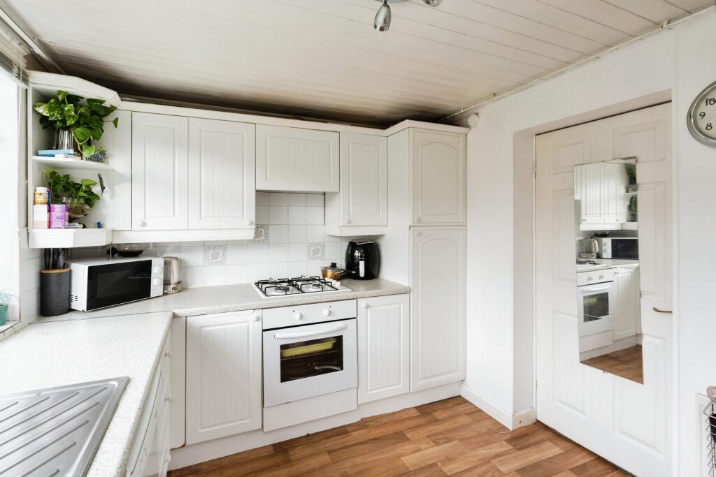
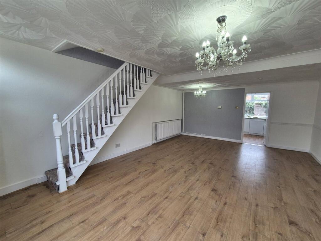
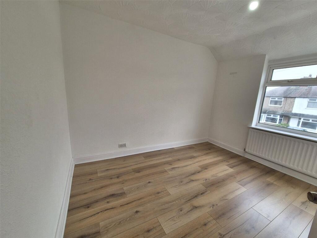
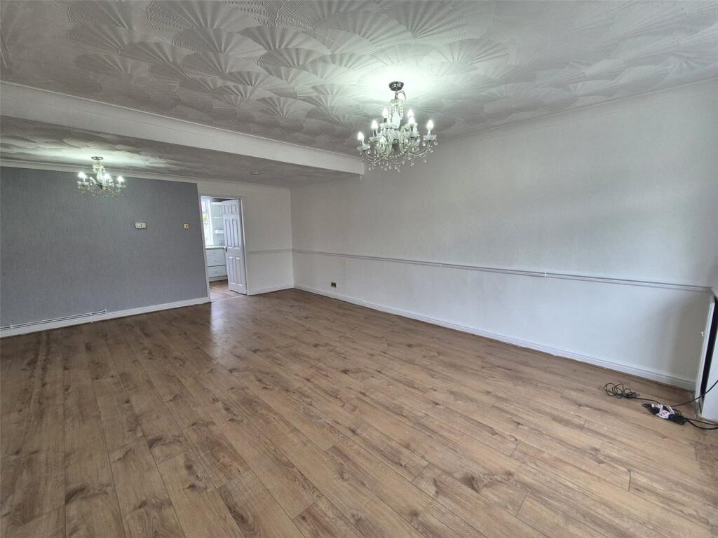
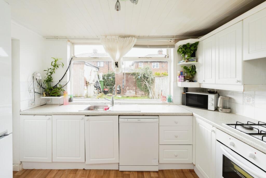
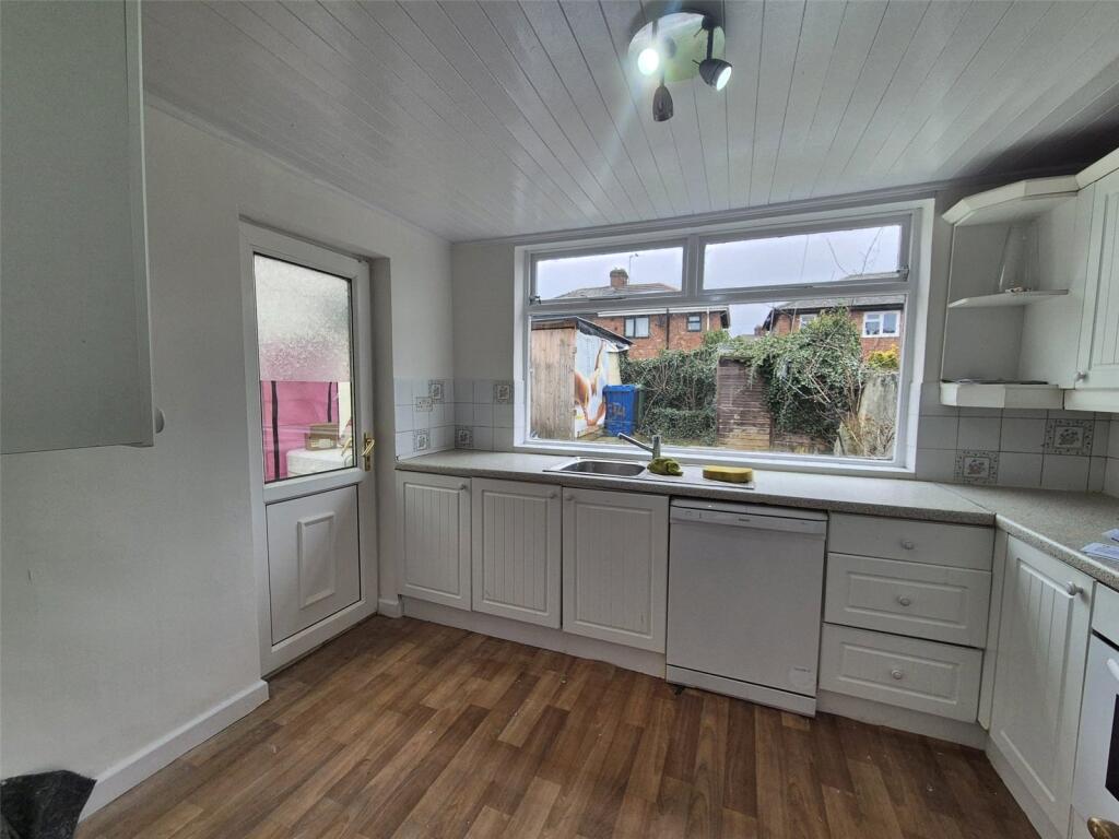
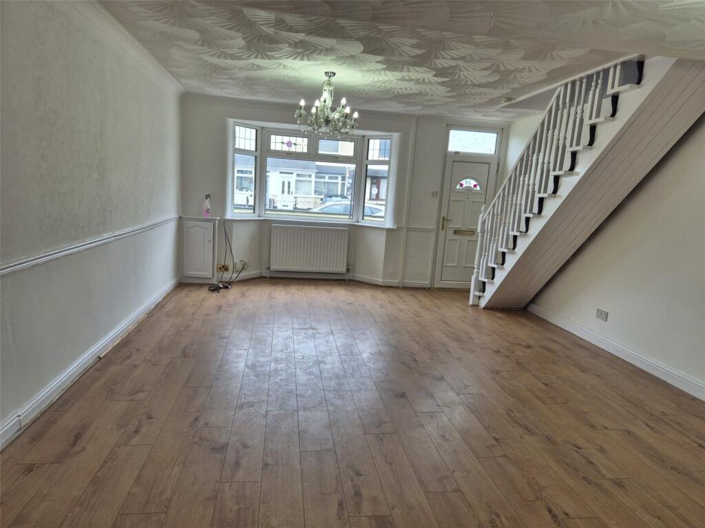
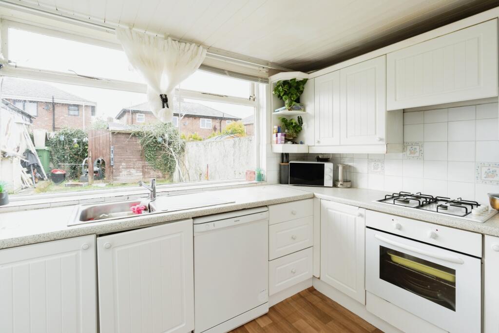
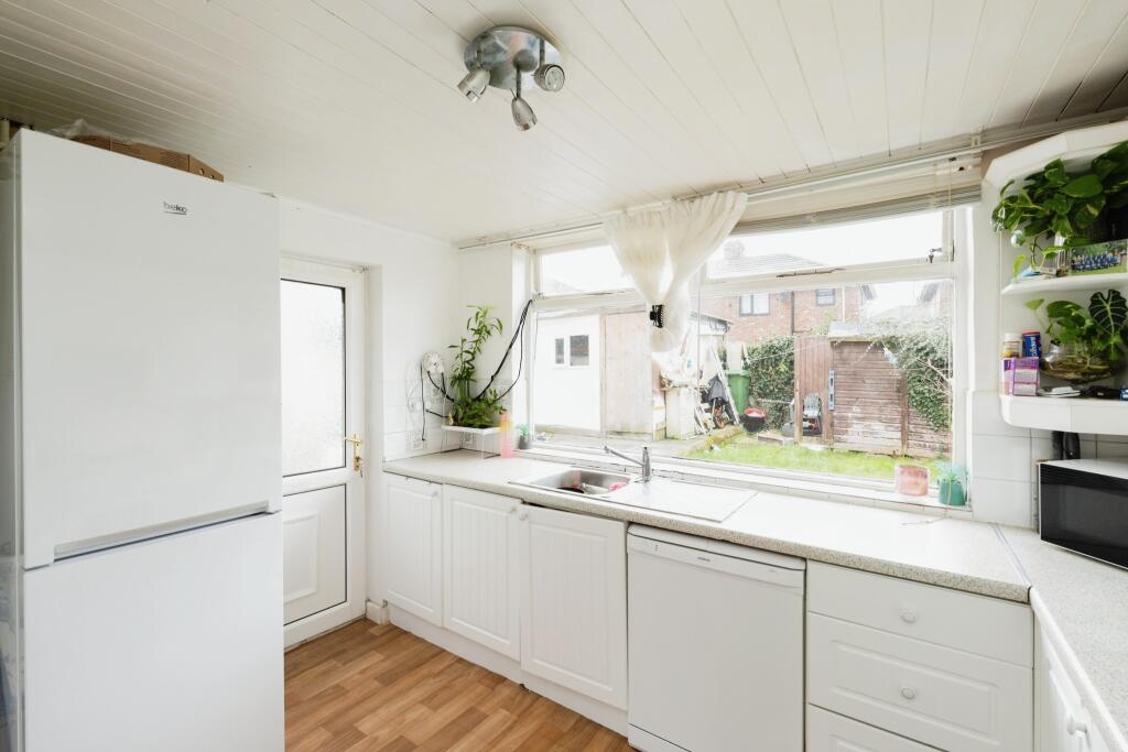
The accommodation consists briefly of a large living room and a kitchen which presents access to the rear garden.
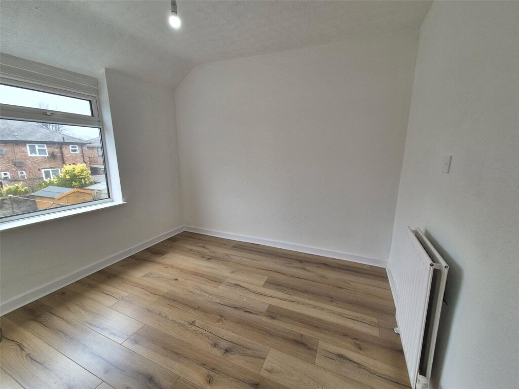
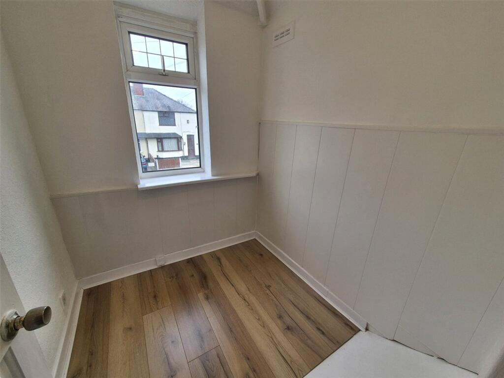
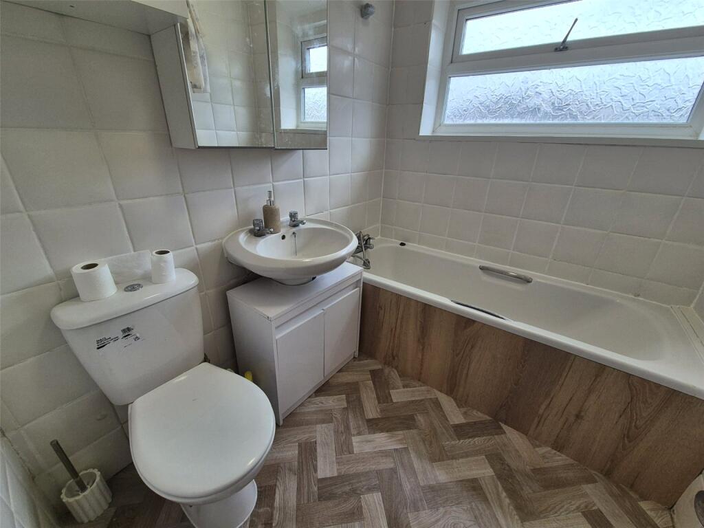
To the first floor you are welcomed by a landing space giving access to the three bedrooms and three piece family bathroom.
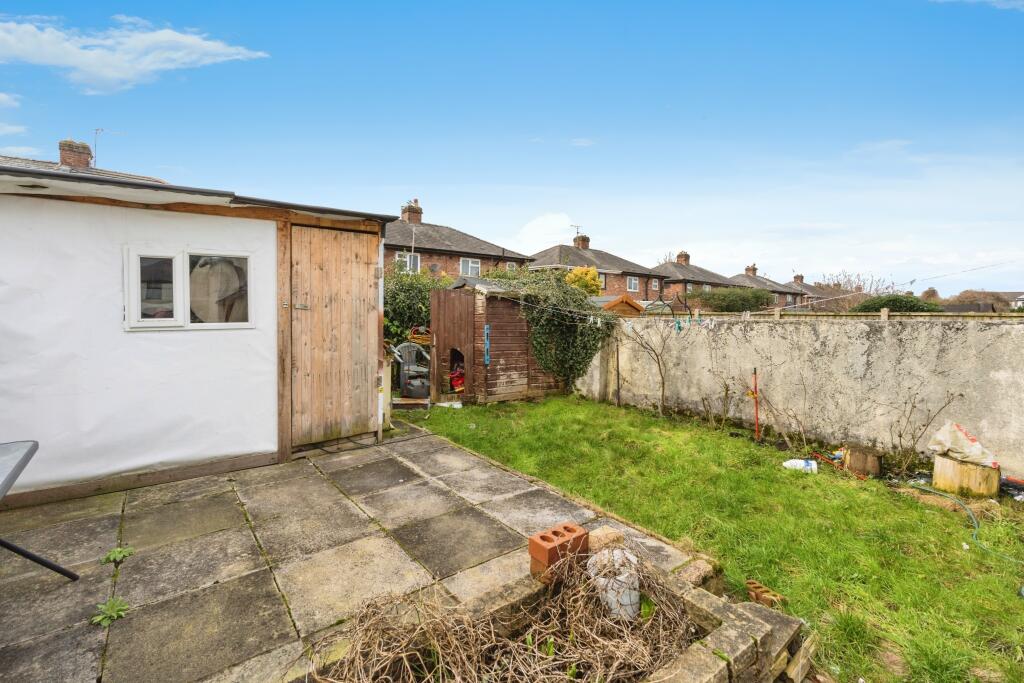
Externally you have garden to the front and rear and also off road parking.
This property is within close proximity to numerous local amenities and transport links presenting access right across the North West with motorway access also available.
Listed by
Warrington
Countrywide UK Sales - Connells
Reference: 173181365
EPC Rating & Upgrade Cost
Current rating: D
Potential rating: B
Inspection date: 26/02/2025
Expiry date: 25/02/2035
Current heating cost: £822/year
Potential heating cost: £603/year
Est. upgrade cost to C: £24,500
Recommendations
- Cavity wall insulation (£500 - £1,500)
- 50 mm internal or external wall insulation (£4,000 - £14,000)
- Floor insulation (solid floor) (£4,000 - £6,000)
- Solar water heating (£4,000 - £6,000)
- Solar photovoltaic panels, 2.5 kWp (£3,500 - £5,500)
Flood risk
Zone: 1
Risk: Low
Job (default Low)
Floorplans
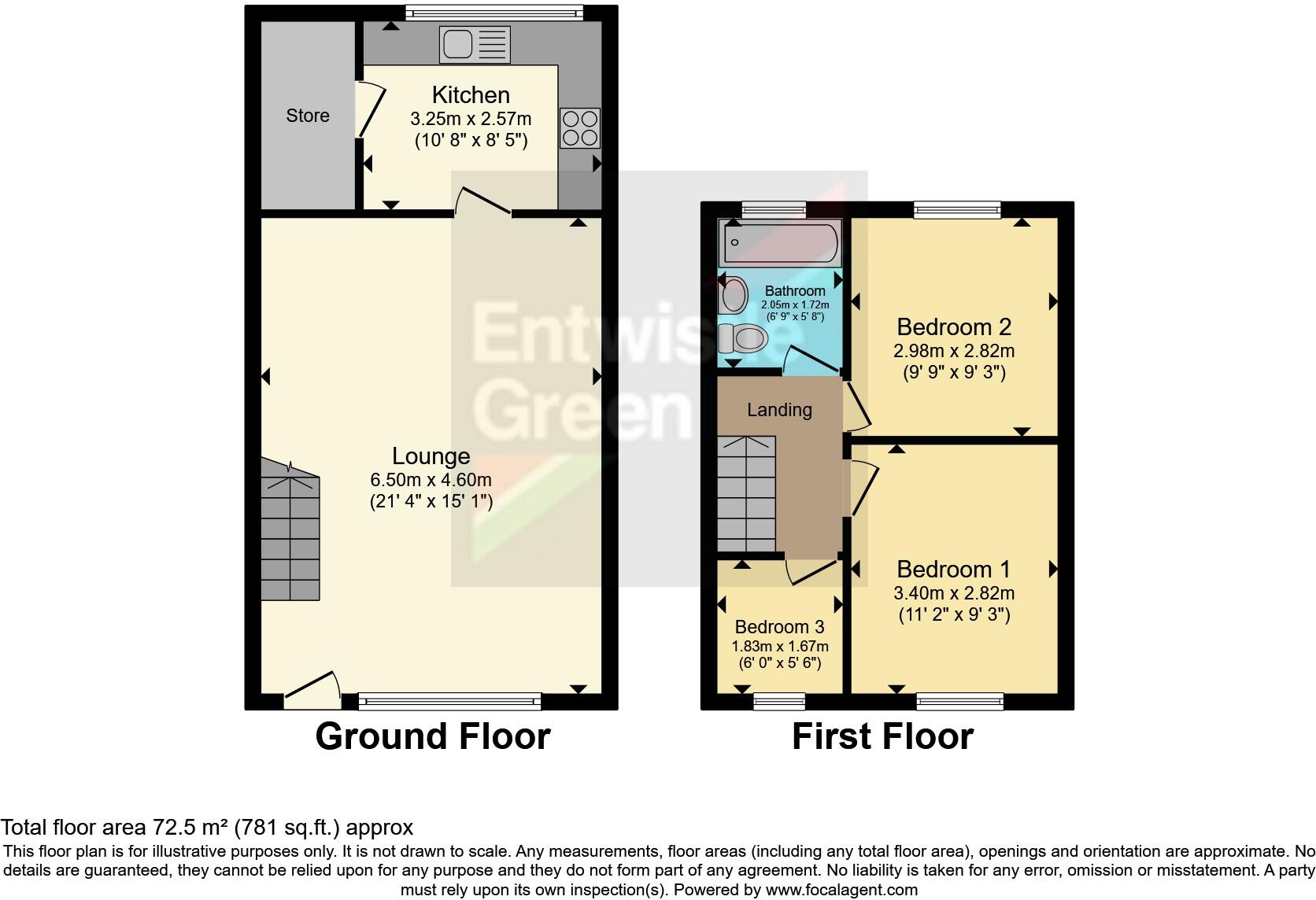
FLOOR-PLAN
EPC Graphs
EPC Rating Graph
Price history
| Event | Date | Price | % change |
|---|---|---|---|
| Listed for sale | — | £160,000 | +90.5% |
| Sold | 17/03/2016 (10 years ago) | £84,000 | — |
Source: HM Land Registry Price Paid Data. Crown copyright.
Sold Comparables
Same street and nearby sales within 0.25 miles (last 5 years). Data from Land Registry Price Paid.
| Address | Price | Date | Type |
|---|---|---|---|
| 21 CROSS STREET, WARRINGTON, WA2 7PL | £140,000 | 11/12/2025 | Terraced |
| 68 WEST AVENUE, ORFORD, WARRINGTON, WA2 8BE | £150,000 | 17/11/2023 | Terraced |
| 9 SHAWS AVENUE, ORFORD, WARRINGTON, WA2 8AU | £140,000 | 18/10/2023 | Terraced |
| 45 SOUTH AVENUE, WARRINGTON, WA2 8AS | £150,000 | 16/10/2023 | Terraced |
| 13 VALE AVENUE, WARRINGTON, WA2 8AY | £109,763 | 14/12/2022 | Terraced |
| 20 VALE AVENUE, WARRINGTON, WA2 8AY | £159,000 | 04/11/2022 | Terraced |
| 6 CORBET AVENUE, WARRINGTON, WA2 8BW | £100,000 | 28/10/2022 | Terraced |
| 95 ALDER LANE, WARRINGTON, WA2 8AW | £160,000 | 28/10/2022 | Terraced |
| 7 CORBET AVENUE, WARRINGTON, WA2 8BW | £185,000 | 21/10/2022 | Terraced |
| 62 WEST AVENUE, ORFORD, WARRINGTON, WA2 8BE | £110,000 | 14/10/2022 | Terraced |
| 9 WEST AVENUE, ORFORD, WARRINGTON, WA2 8BG | £190,000 | 04/08/2022 | Terraced |
| 24 VALE AVENUE, WARRINGTON, WA2 8AY | £100,000 | 20/07/2022 | Terraced |
| 13 SOUTH AVENUE, WARRINGTON, WA2 8AS | £148,000 | 01/07/2022 | Terraced |
| 65 ALDER LANE, WARRINGTON, WA2 8AP | £180,000 | 29/06/2022 | Terraced |
| 14 VALE AVENUE, WARRINGTON, WA2 8AY | £152,000 | 17/06/2022 | Terraced |
| 2 VALE AVENUE, WARRINGTON, WA2 8AY | £105,000 | 17/06/2022 | Terraced |
| 71 SHAWS AVENUE, ORFORD, WARRINGTON, WA2 8BB | £158,000 | 10/06/2022 | Terraced |
| 27 EARL STREET, WARRINGTON, WA2 7PW | £105,000 | 25/02/2022 | Terraced |
| 10 GRACE AVENUE, WARRINGTON, WA2 8BT | £125,500 | 04/02/2022 | Terraced |
| 35 SOUTH AVENUE, WARRINGTON, WA2 8AS | £137,500 | 17/01/2022 | Terraced |
Area average: £140,238 (20 sales)
Capital growth trend
Land Registry outcode average: last 12 months vs 5y and 10y ago (from sold prices).
House Price Index (HM Land Registry — official index, not sold-price averages): Warrington. Series: Terraced. As of March 2026.
Rental Range
Estimated market rent for Warrington. Low = conservative, Realistic = average, Optimistic = best case.
Based on Local Authority from postcode lookup → Warrington.
LHA (30th percentile) floor for North Cheshire: £693/mo (Apr 2025 – Mar 2026)
Location
Nearby
Nearest stations, universities and amenities (distance from property).
| Type | Name | Distance |
|---|---|---|
| Shop | Haliwell Jones Mini | 0.1 miles |
| Shop | Halliwell Jones BMW | 0.1 miles |
| Bus stop | Ireland Street | 0.1 miles |
| Bus stop | Alder Lane | 0.1 miles |
| Hospital | Saint Mary's Hospital | 0.2 miles |
| Hospital | Lea Court | 0.6 miles |
| Train station | Warrington Central | 0.8 miles |
| Train station | Warrington Bank Quay | 1.3 miles |
| University | University of Chester - Warrington Campus | 2.0 miles |
Street-level crime
| Category | Count |
|---|---|
| Violence and sexual offences | 187 |
| Public order | 49 |
| Anti-social behaviour | 35 |
| Criminal damage and arson | 34 |
| Other theft | 25 |
| Shoplifting | 25 |
| Drugs | 18 |
| Burglary | 10 |
| Other crime | 10 |
| Vehicle crime | 10 |
| Robbery | 4 |
| Bicycle theft | 2 |
| Total incidents | 409 |
Within 1 mile during Apr 2026. Source: data.police.uk (England & Wales).
Schools nearby
Nearest open schools with Ofsted ratings (England). Closed schools are not shown. Data from Get Information about Schools and Ofsted.
| Name | Type | Distance | Ofsted |
|---|---|---|---|
| Warrington St Ann's CofE Primary School | Primary | 0.1 miles | Good — 18 Jul 2024 |
| Beamont Collegiate Academy | Secondary | 0.3 miles | Good — 13 Jul 2017 |
| Warrington and Vale Royal College | Other | 0.4 miles | — (No rating) |
| Beamont Primary School | Primary | 0.4 miles | Good — 24 Nov 2022 |
| St Margaret's CofE Voluntary Aided Primary School | Primary | 0.5 miles | Good — 4 Oct 2013 |
Rental Comparables
Loading rental comparables for this postcode. Refresh in a few minutes.
Rent-driven metrics
Based on Area rent estimate.
- Rent ratio — Monthly rent ÷ purchase price (1% rule). 1%+ = strong, 0.8–1% = okay, <0.8% = weak for cashflow.
- Max investor price — Rent ÷ 0.8%; the price at which rent would be 0.8% of price (Stoke-style target).
- Target investor price — Rent ÷ 1%; the price at which rent would be 1% of price (strong cashflow band).
- Gross yield — Annual rent as % of purchase price (no costs).