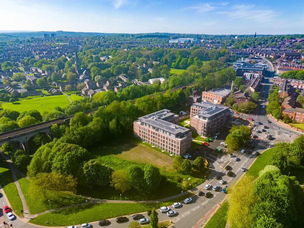
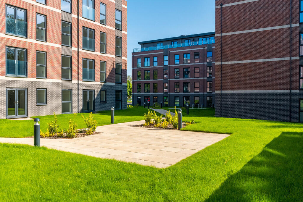
Alexandra Park
Willow Road, Leeds, LS4, LS4 2ET
Property details
Council tax band
A
Deprivation
Decile 3 (7,114 of 33,755)
Street crime
714 incidents within 1 mile (Apr 2026)
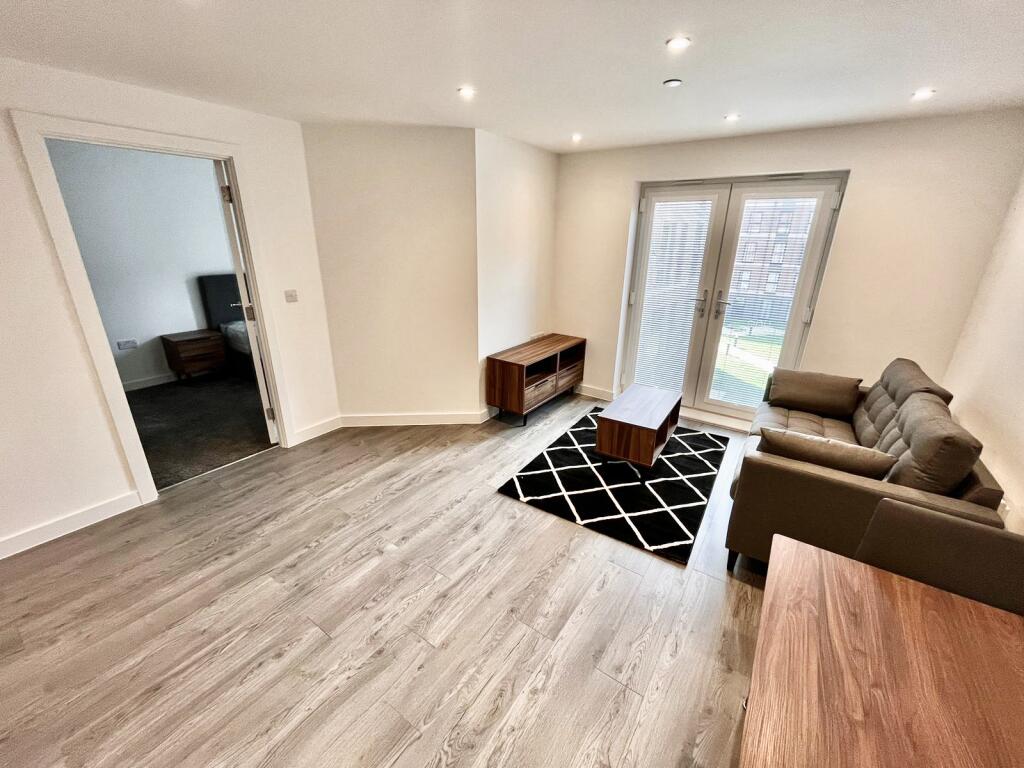
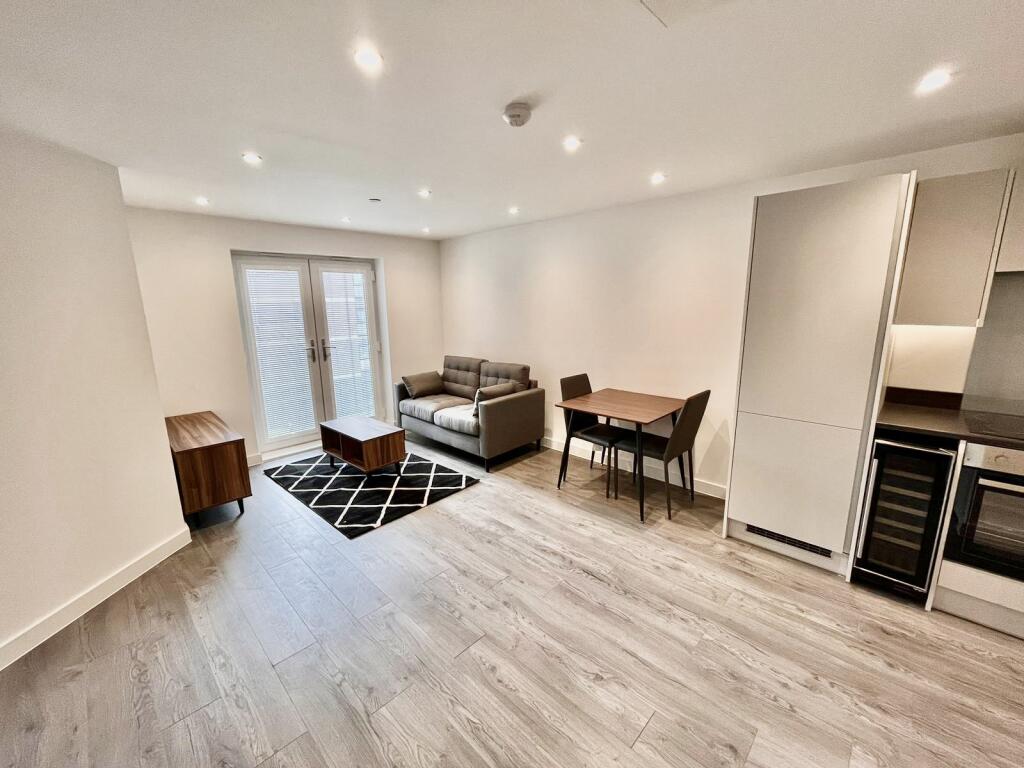
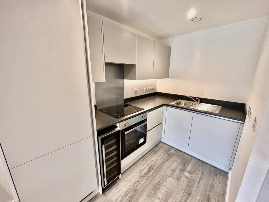
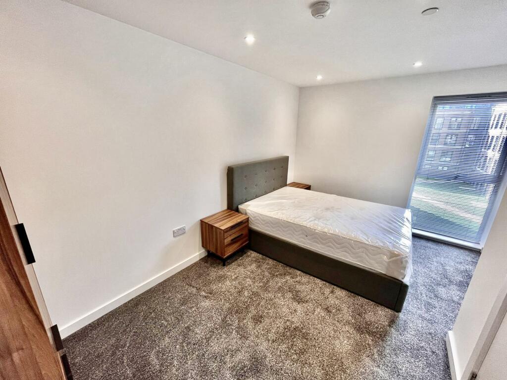
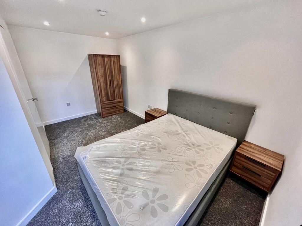
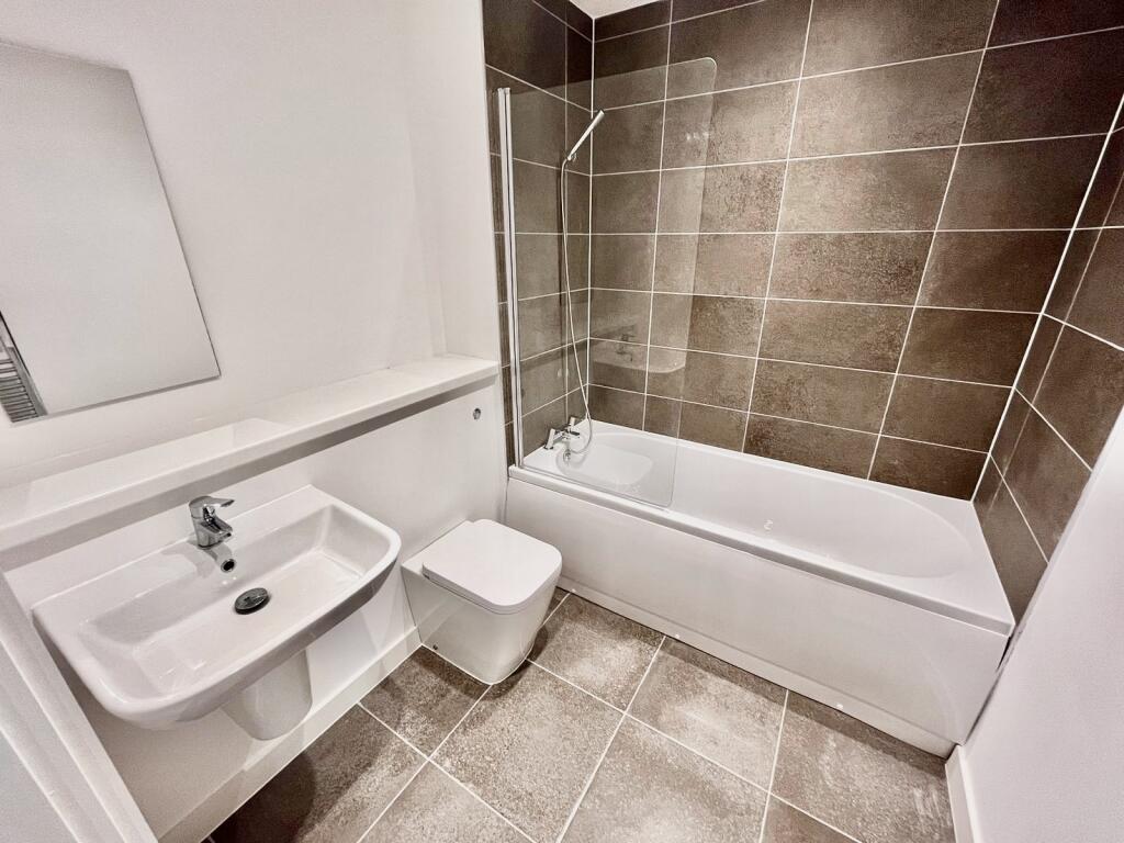
Key features
- ONE BEDROOM APARTMENT
- BRAND NEW DEVELOPMENT
- PARKING AVAILABLE
- GREAT LOCATION
- FULLY FURNISHED
- AVAILABLE NOVEMBER
- COUNCIL TAX BAND A
- EPC RATING B
Additional details
- Parking
- Yes
Description
Listed by
Leeds
North Property Group Ltd
Reference: 165068270
EPC ratings on this postcode
We don't have a matched EPC for this property yet. Below are efficiency scores and details for other addresses on this postcode.
| Address | Current | Potential | Floor area | Age band | Type |
|---|---|---|---|---|---|
| 247 Burley Road, LEEDS | 61 | 85 | 94 m² | England and Wales: before 1900 | Detached |
Flood risk
Zone: 1
Risk: Low
Job (default Low)
Floorplans
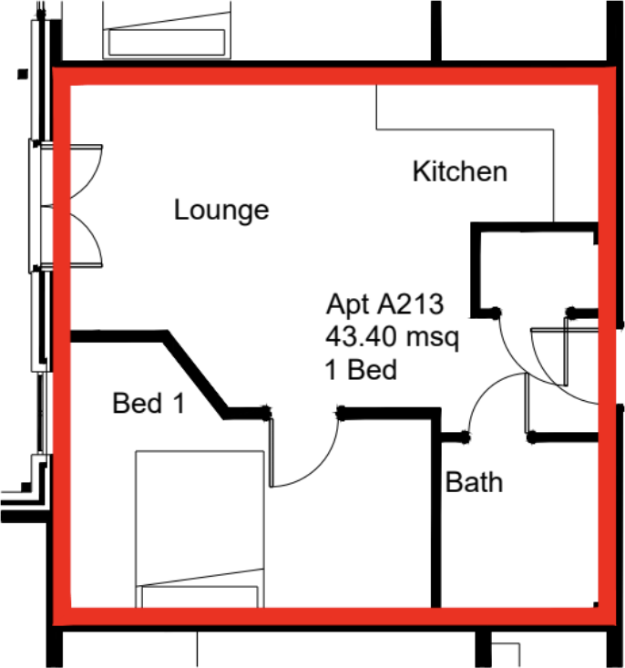
Floorplan
Rental Range
Estimated market rent for Leeds. Low = conservative, Realistic = average, Optimistic = best case.
Based on Local Authority from postcode lookup → Leeds.
LHA (30th percentile) floor for Leeds: £673/mo (Apr 2025 – Mar 2026)
Location
Address
Alexandra Park
Nearby
Nearest stations, universities and amenities (distance from property).
| Type | Name | Distance |
|---|---|---|
| Bus stop | Burley Road Willow Road | 0.0 miles |
| Bus stop | Kirkstall Road Burley Place | 0.1 miles |
| Shop | Machine Mart | 0.1 miles |
| Shop | GSF Car Parts | 0.1 miles |
| Train station | Burley Park | 0.4 miles |
| University | University of Leeds (West Campus) | 0.6 miles |
| University | Leeds Beckett University | 0.7 miles |
| Hospital | The Mount | 0.7 miles |
| Hospital | Parkside Lodge | 0.7 miles |
| Train station | Headingley | 1.1 miles |
Street-level crime
| Category | Count |
|---|---|
| Violence and sexual offences | 238 |
| Shoplifting | 77 |
| Vehicle crime | 76 |
| Criminal damage and arson | 64 |
| Other theft | 49 |
| Anti-social behaviour | 48 |
| Public order | 38 |
| Burglary | 29 |
| Drugs | 28 |
| Robbery | 24 |
| Other crime | 19 |
| Bicycle theft | 9 |
| Possession of weapons | 8 |
| Theft from the person | 7 |
| Total incidents | 714 |
Within 1 mile during Apr 2026. Source: data.police.uk (England & Wales).
Schools nearby
Nearest open schools with Ofsted ratings (England). Closed schools are not shown. Data from Get Information about Schools and Ofsted.
| Name | Type | Distance | Ofsted |
|---|---|---|---|
| Burley St Matthias Church of England Voluntary Controlled Primary School | Primary | 0.3 miles | Good — 10 Mar 2020 |
| Rosebank Primary School | Primary | 0.4 miles | Good — 5 Feb 2023 |
| Kirkstall Valley Primary School | Primary | 0.5 miles | Good — 16 Feb 2022 |
| Brudenell Primary School | Primary | 0.6 miles | Good — 26 Apr 2018 |
| Armley Park Primary School | Primary | 0.6 miles | Good — 23 May 2024 |
Rental Comparables
Rental comparables are temporarily unavailable while listing-site fetches are paused. Try again later.
Enter House Number
Enter the house number to help us retrieve more accurate pricing history and property data.
Please log in to submit or correct the house number for this listing.
Log in to continue