Ashland Road
Withywood, Bristol, BS13, BS13 9BP
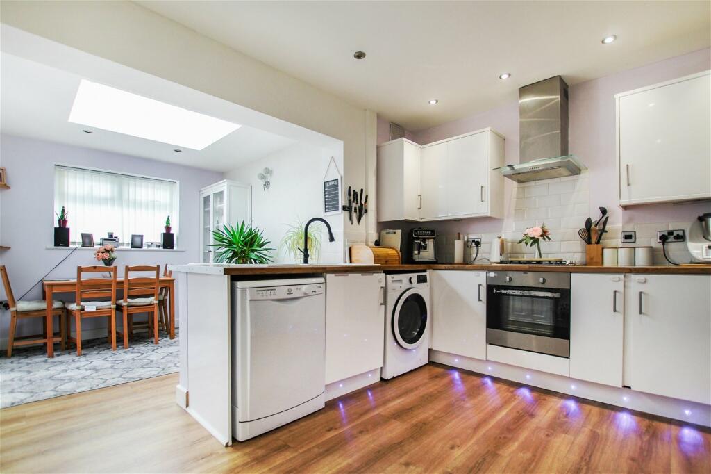
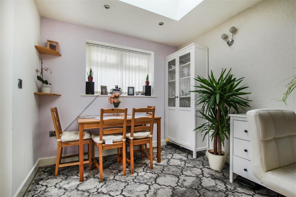
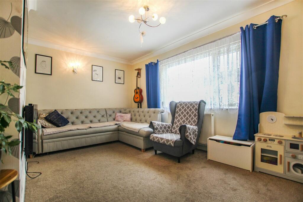
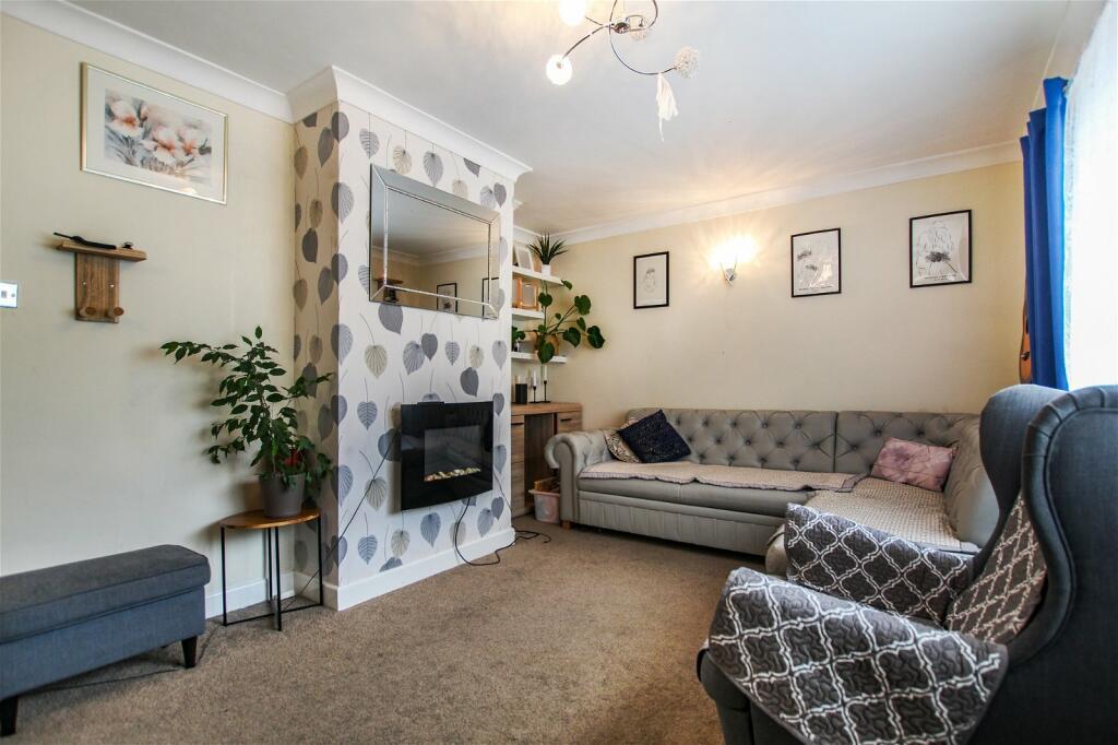
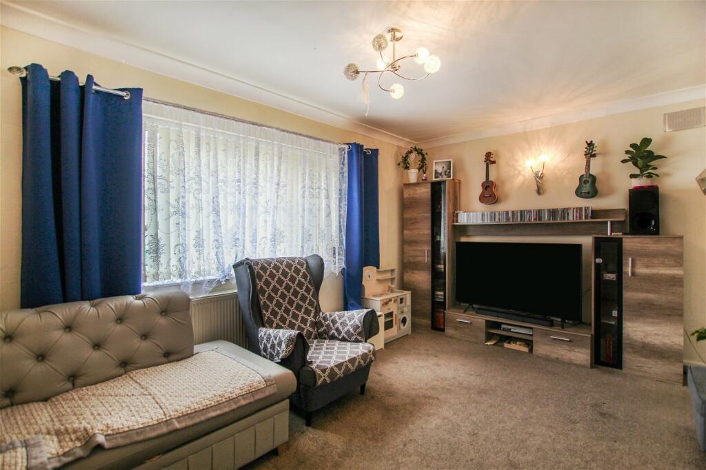
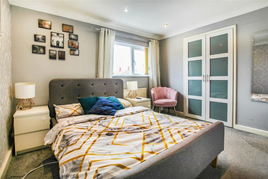
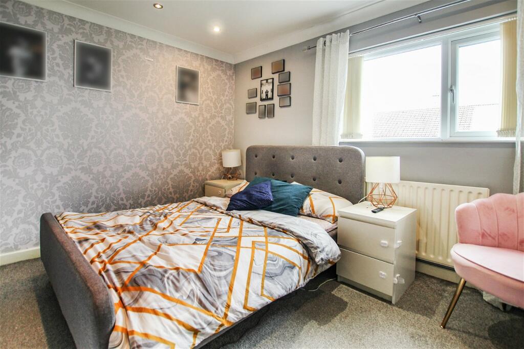
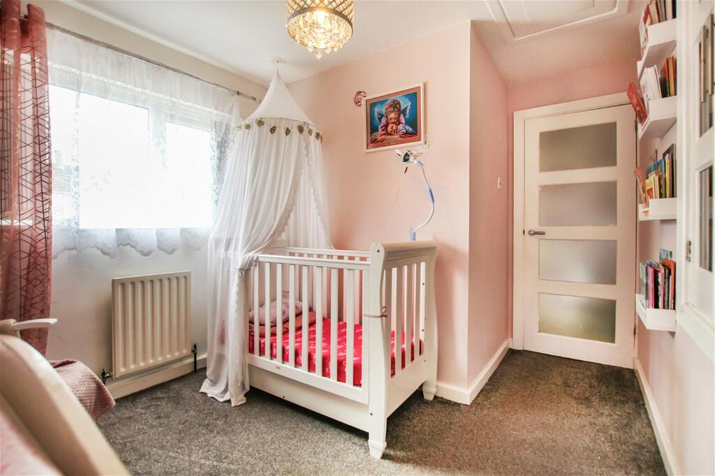
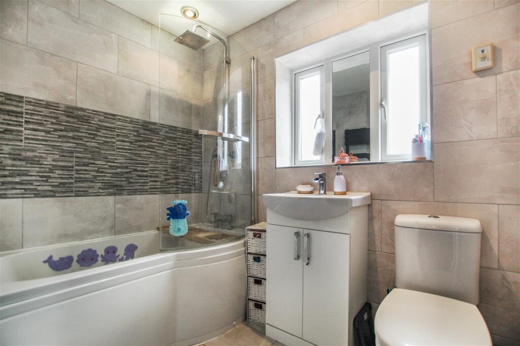
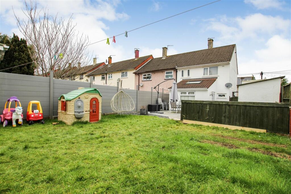
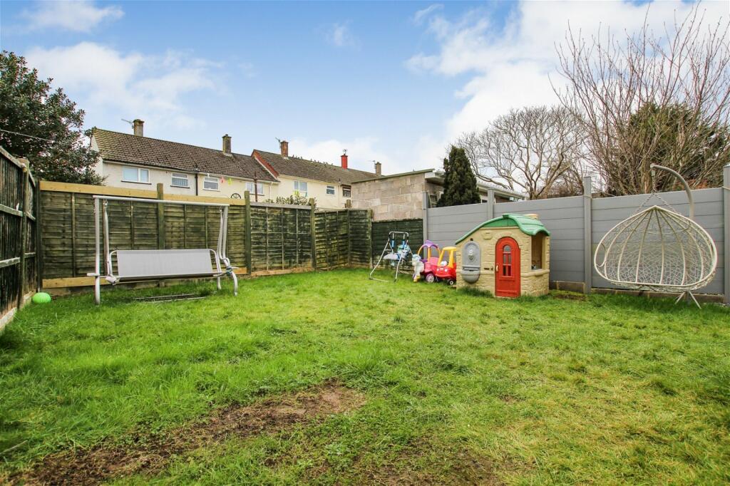
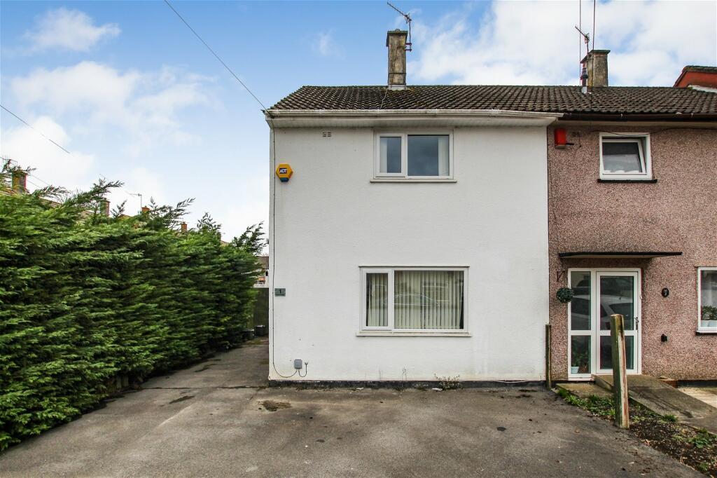
Photo 1 Photo 2 Photo 3 Photo 4 Photo 5 Photo 6 Photo 7 Photo 8 Photo 9 Photo 10 Photo 11 Photo 12 Photo 13
/ 13
Property details
Tenure
FREEHOLD
Council tax band
B
Last sold
£255,000
Local average
£288,316 (-11.6%)
Deprivation
Decile 2 (5,210 of 33,755)
Street crime
451 incidents within 1 mile (Apr 2026)
Key features
- Two Bedrooms
- End Terrace
- Excellent Condition
- Off Street Parking
- Large Garden With Side Access
- Kitchen/Diner Extension
- Master Bedroom With Walk-In-Wardrobe
- Modern Bathroom
- Spacious Lounge
- Short Walk To Shops, Schools & Bus Links
Additional details
- Heating
- Gas, Double glazing
- Parking
- Off street
- Garden
- Yes
Description
Located only a short walk to surrounding shops, school and bus links. Also, within easy access of Central Bristol via Colliters Way.
Benefits include off street parking and a large garden with side access.
The property also features an entrance hall, lounge, extended kitchen/diner, two bedrooms upstairs and a three piece bathroom suite. The master bedrooms features a walk-in-wardrobe.
Perfect if you?re looking for your first home or next step on the property ladder! Viewings are highly recommended to appreciate all this property has to offer.
Council Tax Band: B.
Listed by
Bristol
GARRETT AND BRADLY LIMITED
Reference: 145818134
EPC Rating & Upgrade Cost
Fetching EPC data… Refresh this page in a moment.
Flood risk
Zone: 1
Risk: Low
Job (default Low)
Floorplans
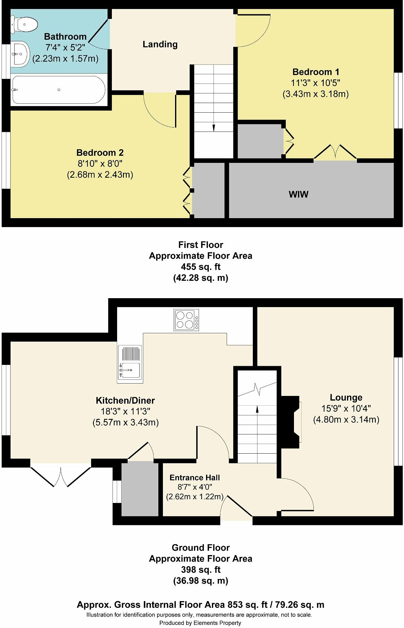
Floorplan 1
EPC Graphs

EPC 1
FENSA Certificates
This property has 1 FENSA certificate(s) on record, indicating window/door installations by FENSA-approved installers.
FENSA Certificate #7728123
Property Details
Street: 9 Ashland Road
Town: BRISTOL
Postcode: BS13 9BP
Installation Details
Items: 1 window
Certificate Issued: 25/10/2010
Work Completed: 08/10/2010
This certificate data was retrieved from FENSA's database
What is FENSA? FENSA (Fenestration Self-Assessment Scheme) is a government-authorised scheme that monitors building regulation compliance for replacement windows and doors. Certificates indicate that work was completed by FENSA-approved installers.
Price history
364% since 2001
| Event | Date | Price | % change |
|---|---|---|---|
| Sold | 01/01/2025 (1 year ago) | £255,000 | +15.9% |
| Sold | 01/01/2019 (7 years ago) | £220,000 | +76% |
| Sold | 01/01/2013 (13 years ago) | £124,995 | +127.3% |
| Sold | 01/01/2001 (25 years ago) | £54,995 | — |
Source: HM Land Registry Price Paid Data. Crown copyright.
Sold Comparables
Same street and nearby sales within 0.25 miles (last 5 years). Data from Land Registry Price Paid.
| Address | Price | Date | Type |
|---|---|---|---|
| Same street 1 ASHLAND ROAD, BRISTOL, CITY OF BRISTOL, BS13 9BP | £255,000 | 10/10/2025 | Terraced |
| 16 HOSEY WALK, BRISTOL, CITY OF BRISTOL, BS13 9AF | £260,000 | 27/09/2024 | Terraced |
| 4 MOLESWORTH CLOSE, BRISTOL, CITY OF BRISTOL, BS13 9BE | £260,000 | 24/11/2023 | Terraced |
| 32 WHITING ROAD, BRISTOL, CITY OF BRISTOL, BS13 9EX | £220,000 | 20/11/2023 | Terraced |
| 30 WHITING ROAD, BRISTOL, CITY OF BRISTOL, BS13 9EX | £265,000 | 12/10/2023 | Terraced |
| Same street 2 ASHLAND ROAD, BRISTOL, CITY OF BRISTOL, BS13 9BP | £282,500 | 09/08/2023 | Semi-detached |
| 87A FAIR FURLONG, BRISTOL, CITY OF BRISTOL, BS13 9HZ | £320,000 | 18/11/2022 | Terraced |
| 22 GATEHOUSE AVENUE, BRISTOL, CITY OF BRISTOL, BS13 9AA | £265,000 | 04/11/2022 | Terraced |
| 87 FAIR FURLONG, BRISTOL, CITY OF BRISTOL, BS13 9HZ | £245,000 | 17/10/2022 | Terraced |
| 4 ARTHURSWOOD ROAD, BRISTOL, CITY OF BRISTOL, BS13 9EZ | £273,000 | 11/10/2022 | Terraced |
| 32 ELVARD ROAD, BRISTOL, CITY OF BRISTOL, BS13 9BW | £287,500 | 31/08/2022 | Terraced |
| 14 MOLESWORTH DRIVE, BRISTOL, CITY OF BRISTOL, BS13 9BN | £202,000 | 31/08/2022 | Terraced |
| 34 GATEHOUSE AVENUE, BRISTOL, CITY OF BRISTOL, BS13 9AD | £225,000 | 28/07/2022 | Terraced |
| 5 ELVARD CLOSE, BRISTOL, CITY OF BRISTOL, BS13 9BT | £220,000 | 29/06/2022 | Terraced |
| 14 MOLESWORTH DRIVE, BRISTOL, CITY OF BRISTOL, BS13 9BN | £170,000 | 26/05/2022 | Terraced |
| 30 ELVARD ROAD, BRISTOL, CITY OF BRISTOL, BS13 9BW | £249,000 | 12/05/2022 | Terraced |
| 14 RODMEAD WALK, BRISTOL, CITY OF BRISTOL, BS13 9HU | £263,500 | 22/04/2022 | Terraced |
| 1 HOSEY WALK, BRISTOL, CITY OF BRISTOL, BS13 9AF | £228,000 | 25/03/2022 | Terraced |
| 11 CULVERWELL ROAD, BRISTOL, CITY OF BRISTOL, BS13 9EU | £195,000 | 07/03/2022 | Terraced |
| 7 WHITING ROAD, BRISTOL, CITY OF BRISTOL, BS13 9EX | £232,500 | 04/03/2022 | Terraced |
| 62 FAIR FURLONG, BRISTOL, CITY OF BRISTOL, BS13 9HX | £240,000 | 28/02/2022 | Terraced |
| 4 SHEEPSCROFT, BRISTOL, CITY OF BRISTOL, BS13 9BA | £255,000 | 11/02/2022 | Terraced |
Street average: £268,750 (2 sales)
Area average: £243,775 (20 sales)
Capital growth trend
Land Registry outcode average: last 12 months vs 5y and 10y ago (from sold prices).
House Price Index (HM Land Registry — official index, not sold-price averages): City of Bristol. Series: Terraced. As of March 2026.
Rental Range
Estimated market rent for Bristol, City of. Low = conservative, Realistic = average, Optimistic = best case.
Based on Local Authority from postcode lookup → Bristol, City of.
LHA (30th percentile) floor for Bristol: £1,092/mo (Apr 2025 – Mar 2026)
Location
Address
9 Ashland Road
Nearby
Nearest stations, universities and amenities (distance from property).
| Type | Name | Distance |
|---|---|---|
| Bus stop | Newland Drive | 0.2 miles |
| Shop | Aisle of Style | 0.2 miles |
| Shop | Withywood Off Licence | 0.2 miles |
| Hospital | South Bristol NHS Community Hospital | 1.5 miles |
| Train station | Parson Street | 1.7 miles |
| Train station | Bedminster | 2.4 miles |
| University | E | 2.5 miles |
| University | UWE Bower Ashton Campus | 2.5 miles |
| Hospital | Callington Road Hospital | 3.0 miles |
Street-level crime
| Category | Count |
|---|---|
| Violence and sexual offences | 148 |
| Anti-social behaviour | 89 |
| Shoplifting | 79 |
| Criminal damage and arson | 41 |
| Public order | 29 |
| Vehicle crime | 15 |
| Other theft | 12 |
| Other crime | 10 |
| Robbery | 10 |
| Burglary | 9 |
| Drugs | 4 |
| Possession of weapons | 3 |
| Bicycle theft | 1 |
| Theft from the person | 1 |
| Total incidents | 451 |
Within 1 mile during Apr 2026. Source: data.police.uk (England & Wales).
Schools nearby
Nearest open schools with Ofsted ratings (England). Closed schools are not shown. Data from Get Information about Schools and Ofsted.
| Name | Type | Distance | Ofsted |
|---|---|---|---|
| E-Act Venturers' Academy | Other | 0.1 miles | Requires improvement — 18 Jun 2024 |
| Fair Furlong Primary School | Primary | 0.2 miles | Outstanding — 15 Jul 2015 |
| E-Act Merchants' Academy | Other | 0.3 miles | Inadequate — 15 May 2024 |
| Belgrave School | Other | 0.5 miles | — (No rating) |
| Four Acres Academy | Primary | 0.5 miles | Good — 23 Nov 2023 |
Rental Comparables
Loading rental comparables for this postcode. Refresh in a few minutes.
Rent-driven metrics
Based on Area rent estimate.
- Rent ratio — Monthly rent ÷ purchase price (1% rule). 1%+ = strong, 0.8–1% = okay, <0.8% = weak for cashflow.
- Max investor price — Rent ÷ 0.8%; the price at which rent would be 0.8% of price (Stoke-style target).
- Target investor price — Rent ÷ 1%; the price at which rent would be 1% of price (strong cashflow band).
- Gross yield — Annual rent as % of purchase price (no costs).