25 WATERBARN STREET
BURNLEY, BURNLEY, LANCASHIRE BB10 1RN
£325 pcm
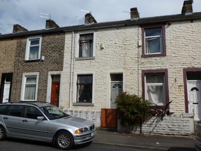
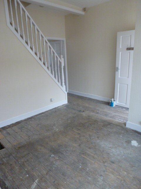
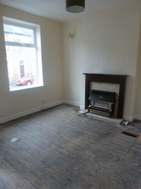
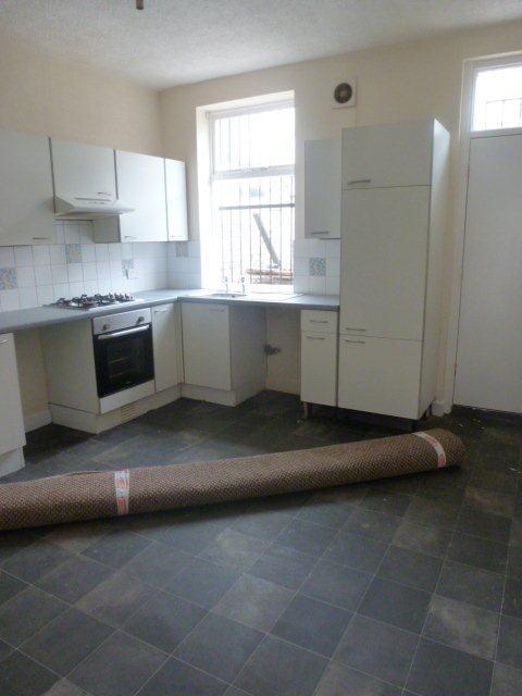
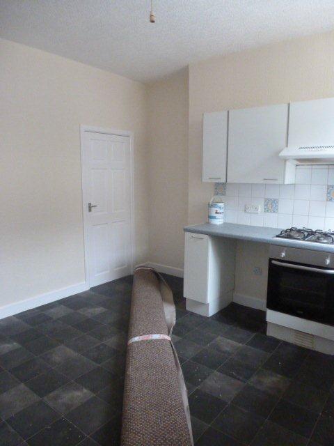
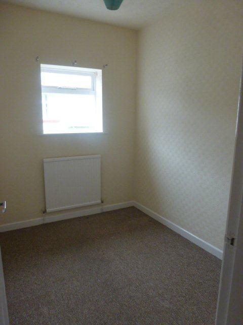
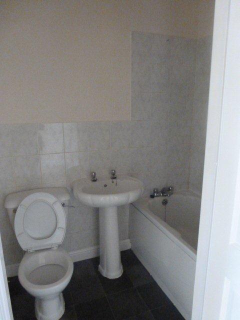
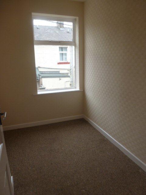
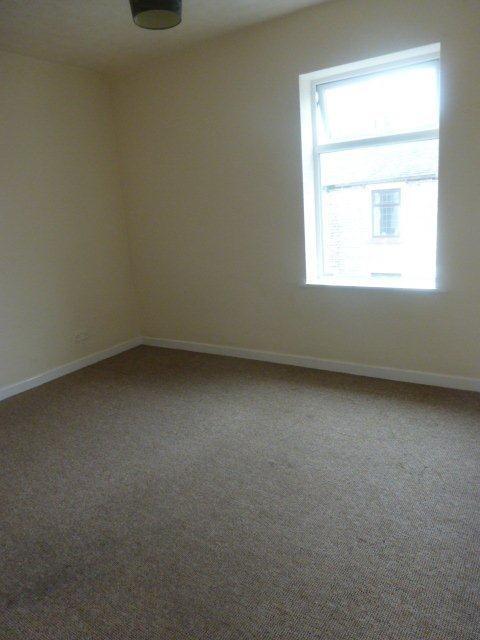
Photo 1 Photo 2 Photo 3 Photo 4 Photo 5 Photo 6 Photo 7 Photo 8 Photo 9
/ 9
Property details
Floor area
65 m²
EPC rating
D
Year built
England and Wales: 1900-1929
Deprivation
Decile 1 (917 of 33,755)
Street crime
335 incidents within 1 mile (Apr 2026)
Key features
- Central Heating
- Lounge
- Double Glazed
Description
Waterbarn Street - £325 PCM or £75 PW + Fees - AVALIABLE NOW
3 bed mid terraced house
Recently refurbished
Large kitchen/diner
Family bathroom
Carpeted throughout
DG
GCH
Close to the town and all amenities
DSS considered with suitable guarantor
*FOR INFO PLEASE CALL 07715438491 *
£100 application fee, successful applicant will receive £50 back off their first month's rent
Listed by
Newton-le-Willows
Think Rentals Ltd
Reference: 43764335
EPC Rating & Upgrade Cost
Current rating: D
Potential rating: C
Inspection date: 19/08/2024
Expiry date: 18/08/2034
Est. upgrade cost to C: £19,900
Recommendations
- 50 mm internal or external wall insulation (£4,000 - £14,000)
- Floor insulation (suspended floor) (£800 - £1,200)
- Upgrade heating controls (£350 - £450)
- Solar water heating (£4,000 - £6,000)
- Solar photovoltaic panels, 2.5 kWp (£3,500 - £5,500)
Flood risk
Zone: 1
Risk: Low
Job (default Low)
Rental Range
Estimated market rent for Burnley. Low = conservative, Realistic = average, Optimistic = best case.
Based on Local Authority from postcode lookup → Burnley.
LHA (30th percentile) floor for West Pennine: £504/mo (Apr 2025 – Mar 2026)
Location
Nearby
Nearest stations, universities and amenities (distance from property).
| Type | Name | Distance |
|---|---|---|
| Bus stop | Newman Street | 0.0 miles |
| Shop | William Hill | 0.3 miles |
| Shop | Asda Opticians | 0.7 miles |
| Train station | Burnley Central | 0.8 miles |
| University | UClan burnley temp | 1.2 miles |
| Train station | Burnley Barracks | 1.3 miles |
| Hospital | health center | 4.6 miles |
| University | University of Bradford Oxenhope Field Site | 10.3 miles |
| Hospital | The Beardwood Hospital | 11.8 miles |
Street-level crime
| Category | Count |
|---|---|
| Violence and sexual offences | 119 |
| Shoplifting | 55 |
| Anti-social behaviour | 45 |
| Criminal damage and arson | 23 |
| Drugs | 19 |
| Vehicle crime | 17 |
| Burglary | 16 |
| Public order | 13 |
| Other theft | 9 |
| Robbery | 9 |
| Other crime | 6 |
| Bicycle theft | 2 |
| Possession of weapons | 1 |
| Theft from the person | 1 |
| Total incidents | 335 |
Within 1 mile during Apr 2026. Source: data.police.uk (England & Wales).
Schools nearby
Nearest open schools with Ofsted ratings (England). Closed schools are not shown. Data from Get Information about Schools and Ofsted.
| Name | Type | Distance | Ofsted |
|---|---|---|---|
| Rawdhatul Uloom | Other | 0.2 miles | Good — 16 Mar 2023 |
| Barden Primary School | Primary | 0.2 miles | Good — 18 Jul 2024 |
| Reedley Hallows Nursery School | Nursery | 0.2 miles | Good — 26 Sep 2024 |
| Holly Grove School | Other | 0.2 miles | Outstanding — 28 May 2014 |
| Heasandford Primary School | Primary | 0.3 miles | Good — 28 Apr 2024 |
Rental Comparables
Rental listings exist nearby, but none matched the 3-bedroom count for this property.