2
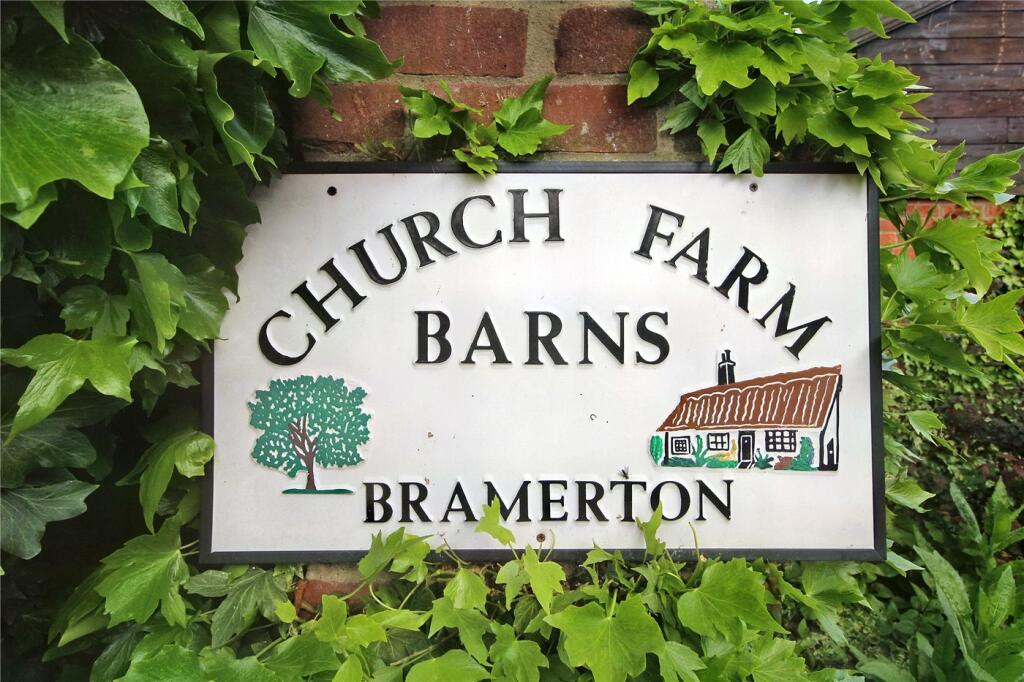
CHURCH FARM BARNS, THE STREET, NORWICH, BRAMERTON, NORFOLK NR14 7DW
Property details
Tenure
FREEHOLD
Floor area
192 m²
Council tax band
TBC
EPC rating
D
Year built
England and Wales: 1983-1990
Last sold
£375,000 Oct 2018
Price per m²
£885/m²
Local average
£726,438 (-76.6%)
Deprivation
Decile 8 (23,694 of 33,755)
Street crime
0 incidents within 1 mile (Apr 2026)
Key features
- Guide Price £170,000 - £180,000
- No Onward Chain
- Discreetly Positioned Within An Idyllic Location
- Handful Of Neighbouring Properties
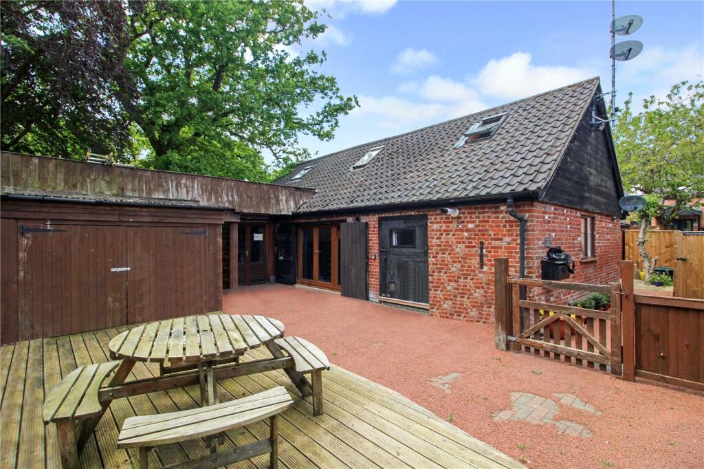
- Unique Barn Conversion
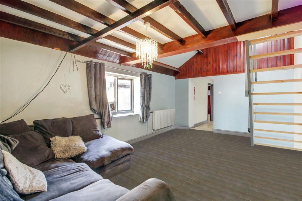
- Sizeable Reception Room & Welcoming Hallway
- Ground Floor Bedroom & Additional Mezzanine Bedroom
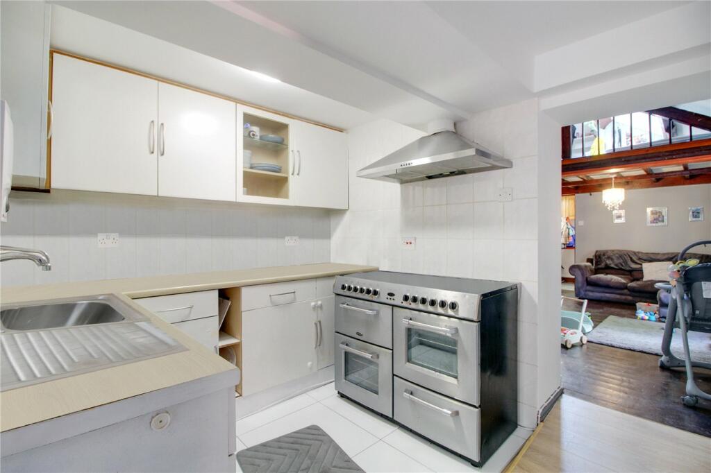
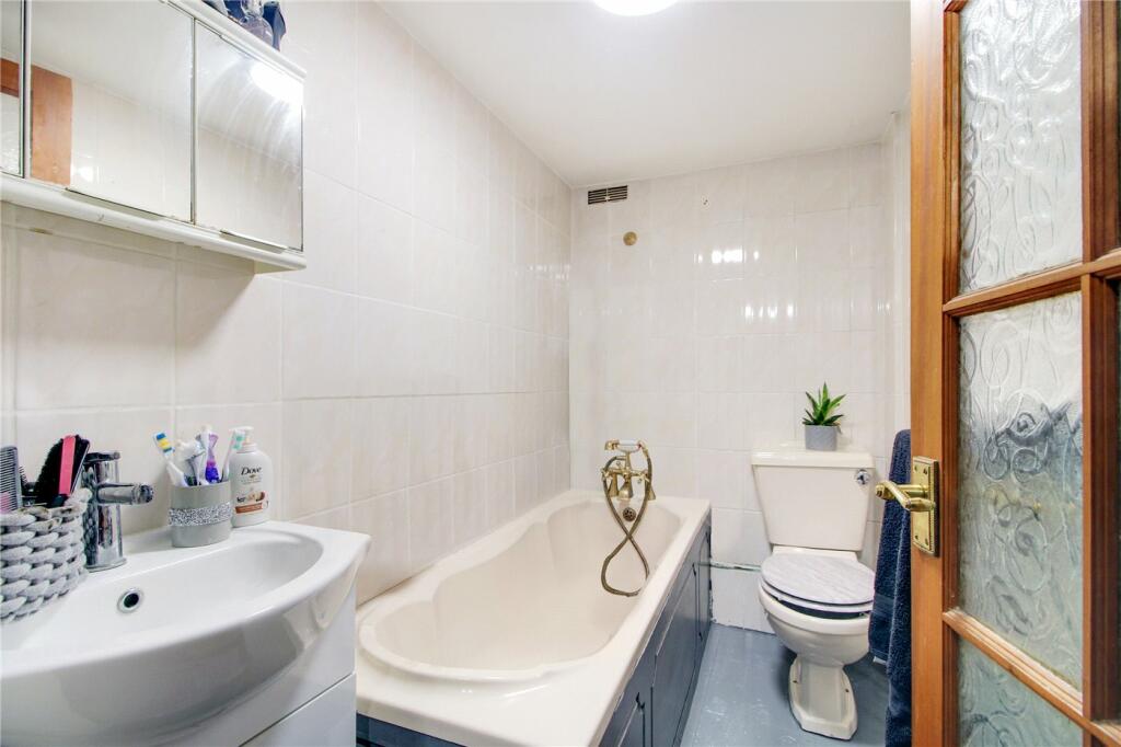
- Both Kitchen & Bathroom In Good Condition
- Perfect For Homeowners & Investors Alike
- Close Proximity Of Bramerton Common, The River & Easy Reach Of Norwich's City Centre
Additional details
- Parking
- Yes
Description
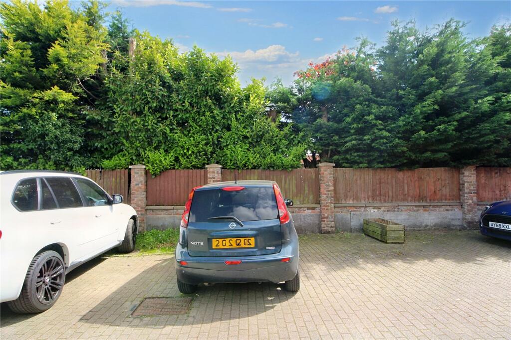
Located in one of Norwich's most desirable villages this characterful home is a must see and is offered with no onward chain.
The impressive reception room offers ample entertaining space and the kitchen is adjacent. The bathroom is in good condition and is found on the ground floor along with the principal bedroom. A quirky mezzanine bedroom is found to the first floor and the welcoming hallway provides ample space for coats and shoes.
This unique home comes complete with full use of the communal garden along with an allocated parking space and full use of the visitors parking bays
The village of Bramerton is perfect for those seeking quiet but convenient living, the rural village is located off the A146 just 5 miles southeast of the Cathedral City of Norwich. Direct bus routes to the local schools and into the heart of Norwich pick up nearby to this home and the picturesque locality is popular with walkers. The Water’s Edge Restaurant & Bar is moments away and is one of Norfolk’s hidden gems, situated on the side of the River Yare with stunning unspoilt views.
Listed by
Poringland
Winkworth
Reference: 135600497
EPC Rating & Upgrade Cost
Current rating: D
Potential rating: C
Inspection date: 11/04/2018
Expiry date: 10/04/2028
Est. upgrade cost to C: £19,090
Recommendations
- Floor insulation (solid floor) (£4,000 - £6,000)
- Low energy lighting for all fixed outlets (£90)
- High heat retention storage heaters (£2,000 - £3,000)
- Solar water heating (£4,000 - £6,000)
- Solar photovoltaic panels, 2.5 kWp (£5,000 - £8,000)
Flood risk
Zone: 1
Risk: Low
Job (default Low)
Floorplans
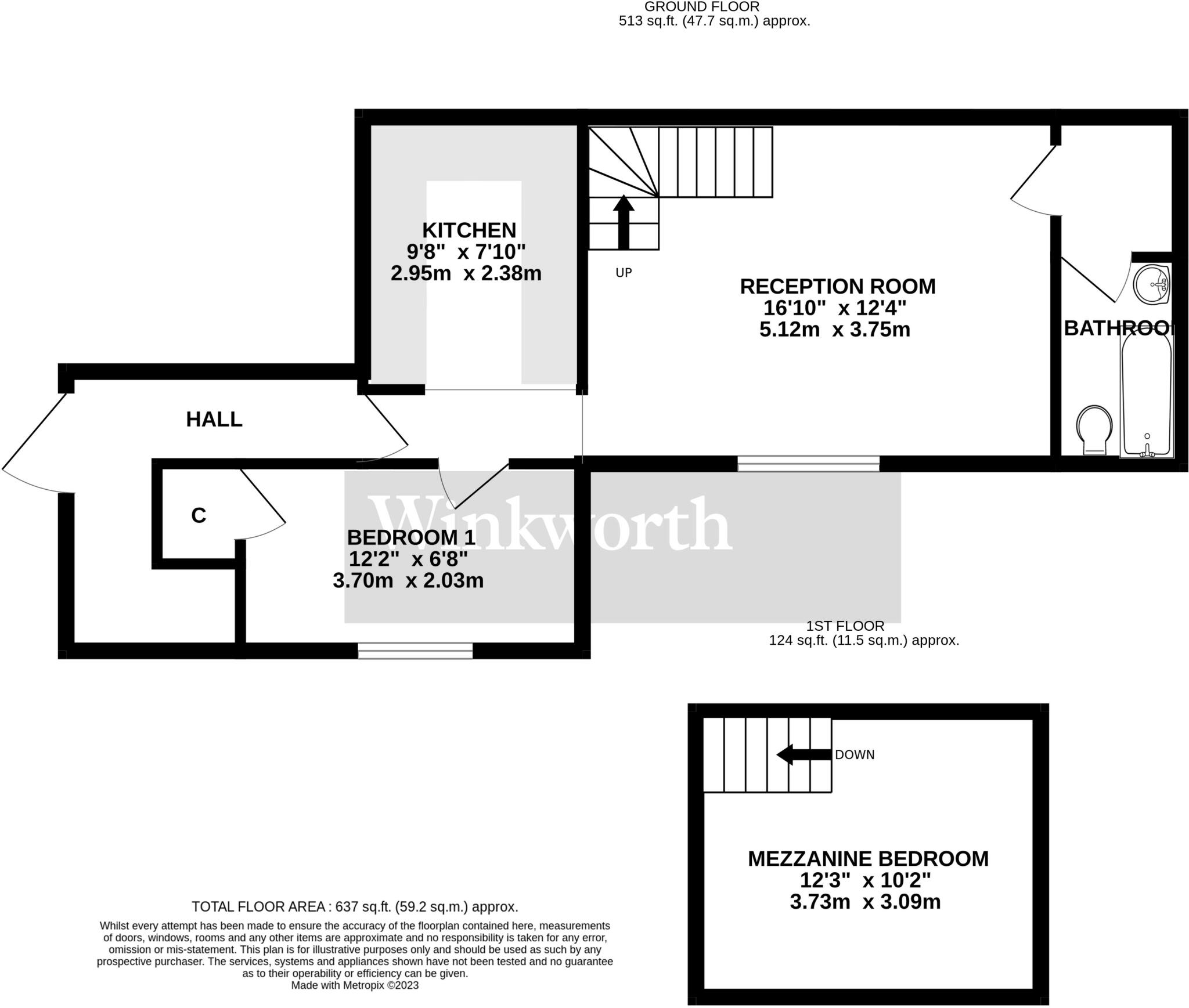
Floorplan
Price history
241% since 1997
| Event | Date | Price | % change |
|---|---|---|---|
| Sold | 12/10/2018 (7 years ago) | £375,000 | +20.6% |
| Sold | 11/04/2008 (18 years ago) | £311,000 | +11.1% |
| Sold | 05/06/2006 (20 years ago) | £280,000 | +55.6% |
| Sold | 09/03/2001 (25 years ago) | £180,000 | +63.6% |
| Sold | 27/02/1997 (29 years ago) | £110,000 | — |
Source: HM Land Registry Price Paid Data. Crown copyright.
Sold Comparables
Same street and nearby sales within 0.25 miles (last 5 years). Data from Land Registry Price Paid.
| Address | Price | Date | Type |
|---|---|---|---|
| 3A CHURCH FARM CLOSE, BRAMERTON, NORWICH, SOUTH NORFOLK, NORFOLK, NR14 7FD | £650,000 | 15/12/2022 | Other |
| 3A CHURCH FARM CLOSE, BRAMERTON, NORWICH, SOUTH NORFOLK, NORFOLK, NR14 7FD | £180,000 | 30/05/2022 | Other |
Area average: £415,000 (2 sales)
Capital growth trend
Land Registry outcode average: last 12 months vs 5y and 10y ago (from sold prices).
House Price Index (HM Land Registry — official index, not sold-price averages): South Norfolk. Series: All dwelling types. As of March 2026.
Rental Range
Estimated market rent for South Norfolk. Low = conservative, Realistic = average, Optimistic = best case.
Based on Local Authority from postcode lookup → South Norfolk.
LHA (30th percentile) floor for Central Norfolk & Norwich: £693/mo (Apr 2025 – Mar 2026)
Location
Nearby
Nearest stations, universities and amenities (distance from property).
| Type | Name | Distance |
|---|---|---|
| Bus stop | Rockland Road, adj | 0.1 miles |
| Bus stop | Hall, adj | 0.3 miles |
| Shop | Applebee Orchard and Apiary | 0.4 miles |
| Shop | Yelverton Garage | 0.9 miles |
| Train station | Brundall Gardens | 2.5 miles |
| Train station | Brundall | 2.9 miles |
| University | Broadcast House | 5.0 miles |
| Hospital | Norfolk and Norwich University Hospital:Emergency Department | 7.3 miles |
| University | Easton College | 10.3 miles |
Street-level crime
| Category | Count |
|---|---|
| Total incidents | 0 |
Within 1 mile during Apr 2026. Source: data.police.uk (England & Wales).
Schools nearby
Nearest open schools with Ofsted ratings (England). Closed schools are not shown. Data from Get Information about Schools and Ofsted.
| Name | Type | Distance | Ofsted |
|---|---|---|---|
| Rockland St Mary Primary School | Primary | 1.1 miles | Good — 15 Mar 2022 |
| Surlingham Primary School | Primary | 1.5 miles | Good — 20 Mar 2022 |
| Alpington and Bergh Apton Church of England Voluntary Aided Primary School | Primary | 1.8 miles | Outstanding — 9 Sep 2015 |
| Poringland Primary School | Primary | 2.2 miles | Good — 6 Jul 2023 |
| Framingham Earl High School | Secondary | 2.3 miles | Good — 6 Nov 2014 |
Rental Comparables
Loading rental comparables for this postcode. Refresh in a few minutes.
Rent-driven metrics
Based on Area rent estimate.
- Rent ratio — Monthly rent ÷ purchase price (1% rule). 1%+ = strong, 0.8–1% = okay, <0.8% = weak for cashflow.
- Max investor price — Rent ÷ 0.8%; the price at which rent would be 0.8% of price (Stoke-style target).
- Target investor price — Rent ÷ 1%; the price at which rent would be 1% of price (strong cashflow band).
- Gross yield — Annual rent as % of purchase price (no costs).