MOORFIELD HOUSE
MOOR LANE, MATLOCK, ELTON, DERBYSHIRE DE4 2DA
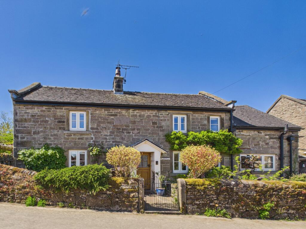
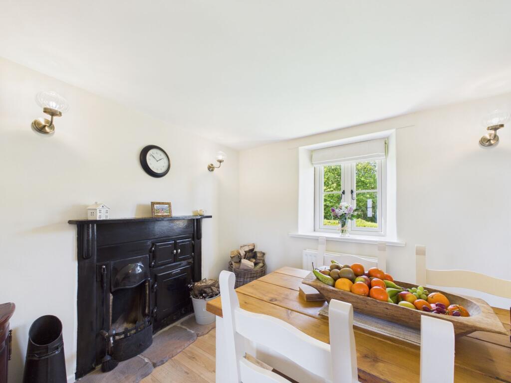
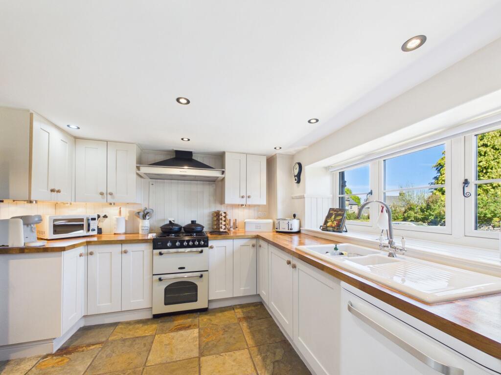
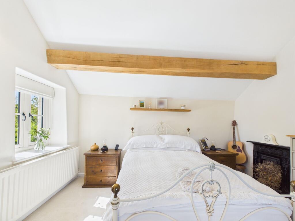
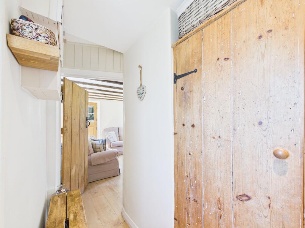
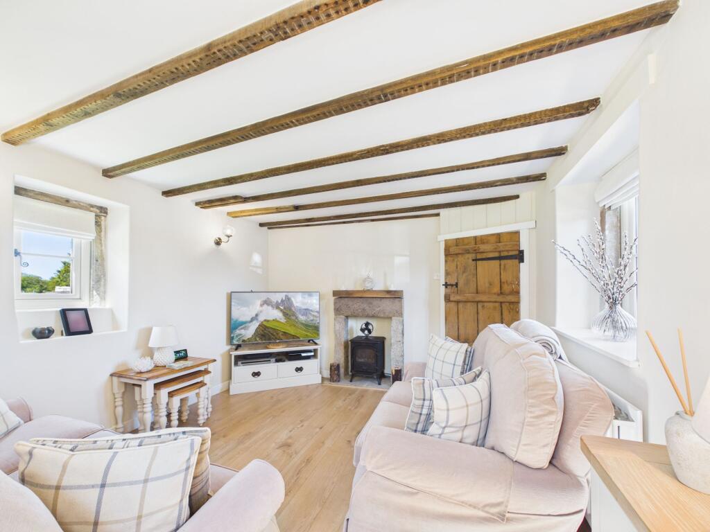
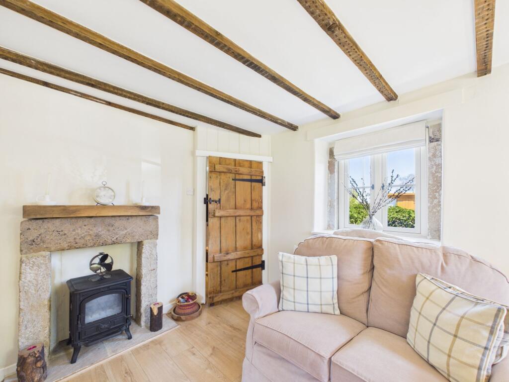
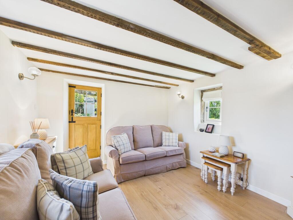
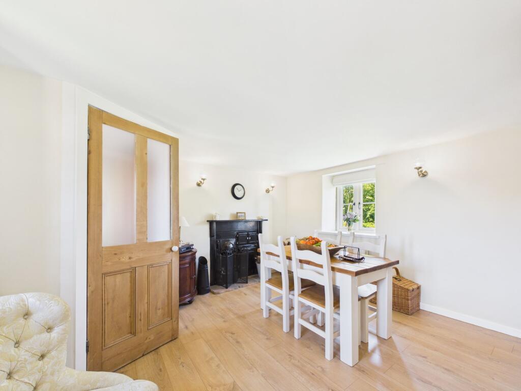
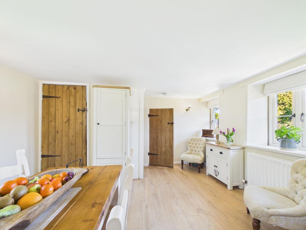
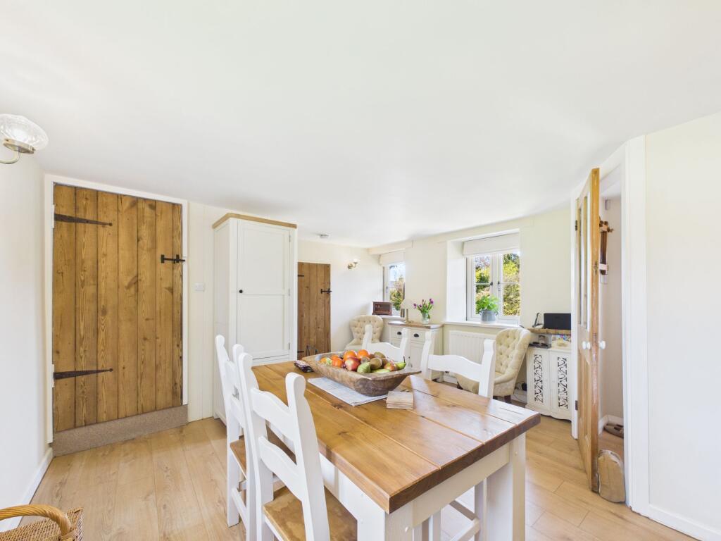
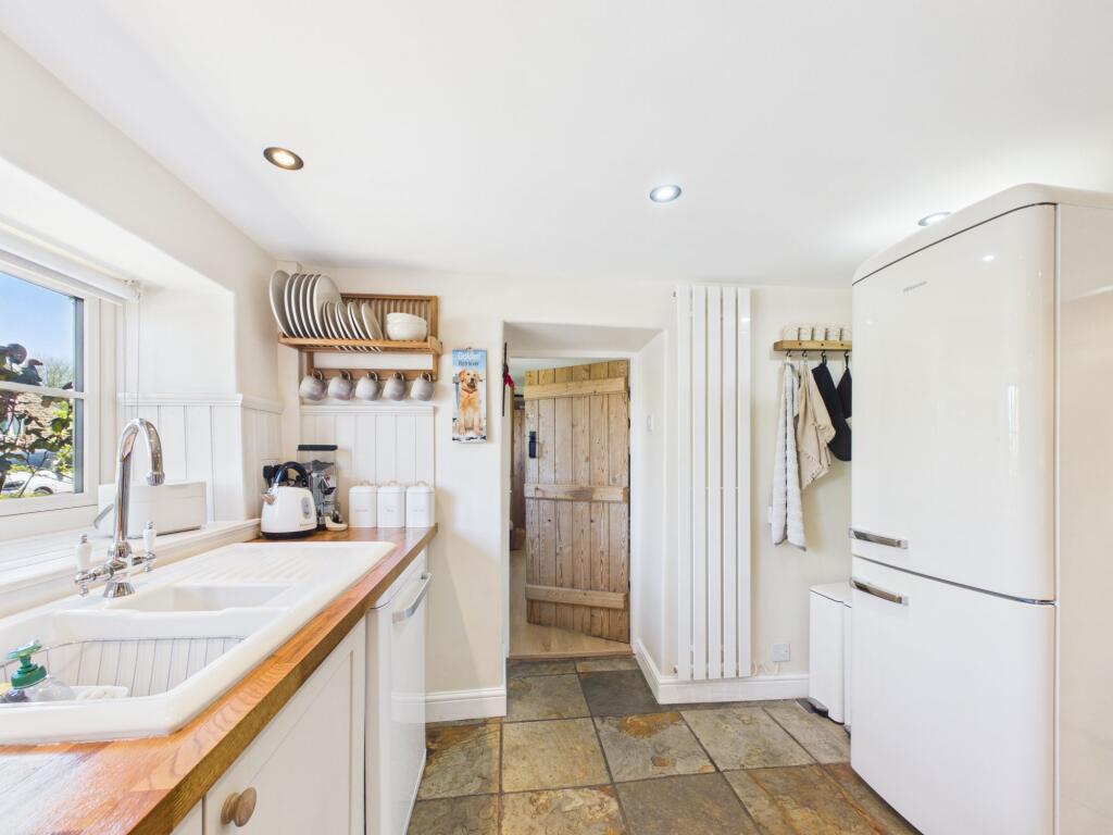
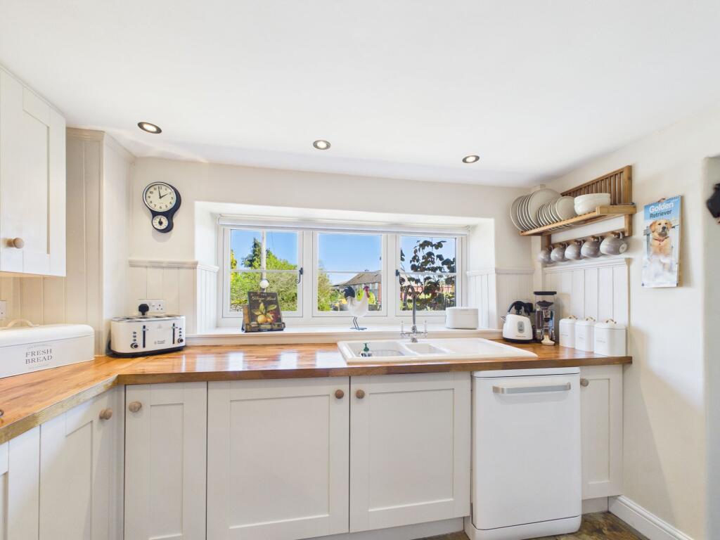
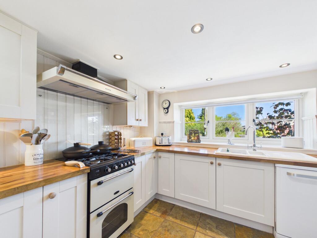
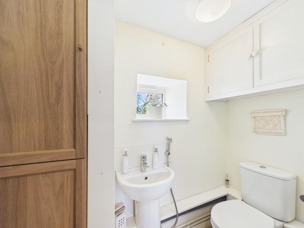
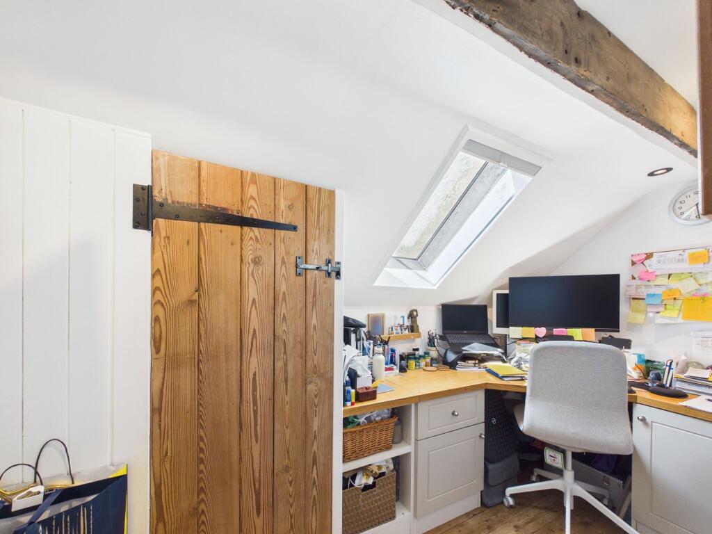
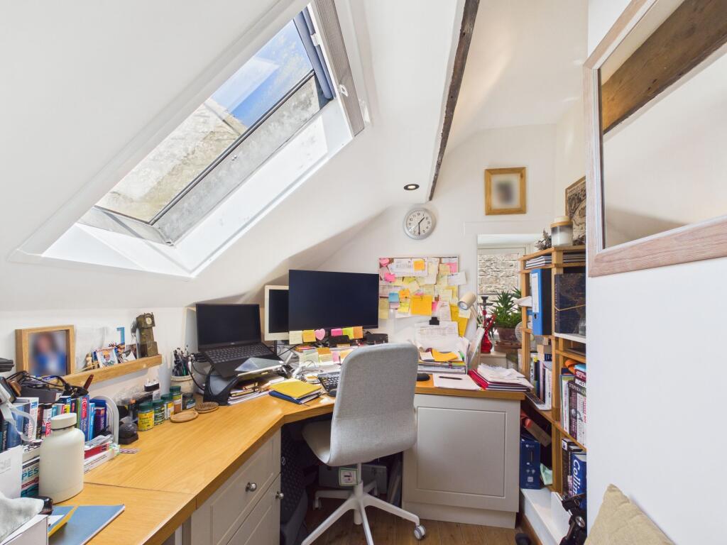
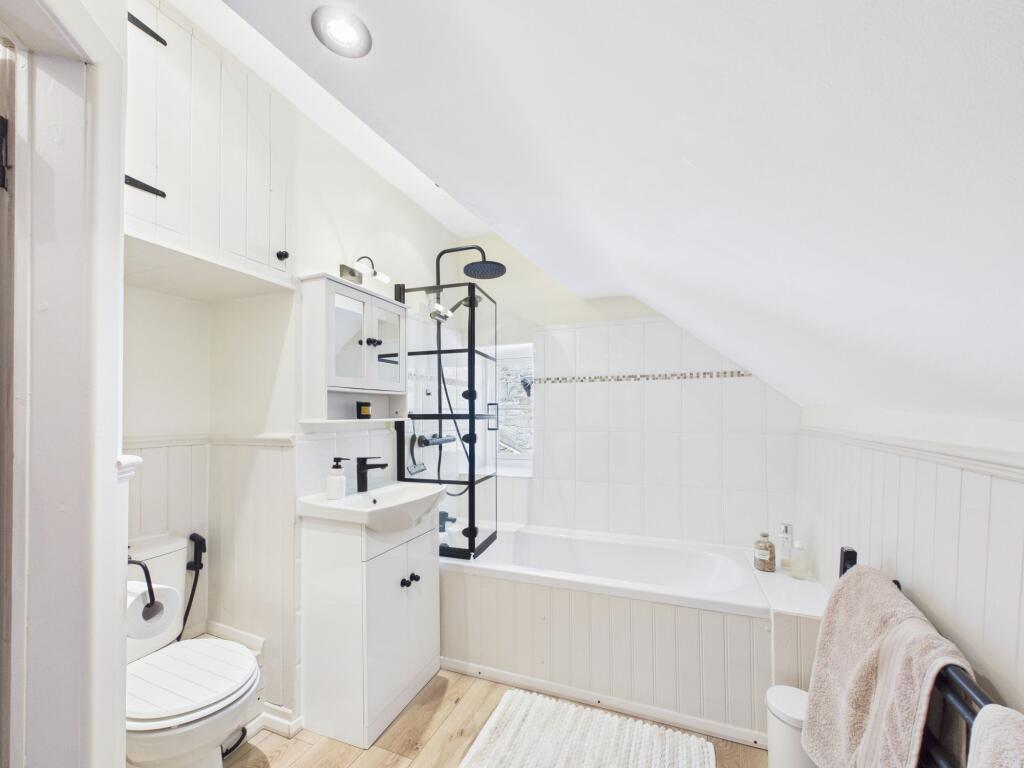
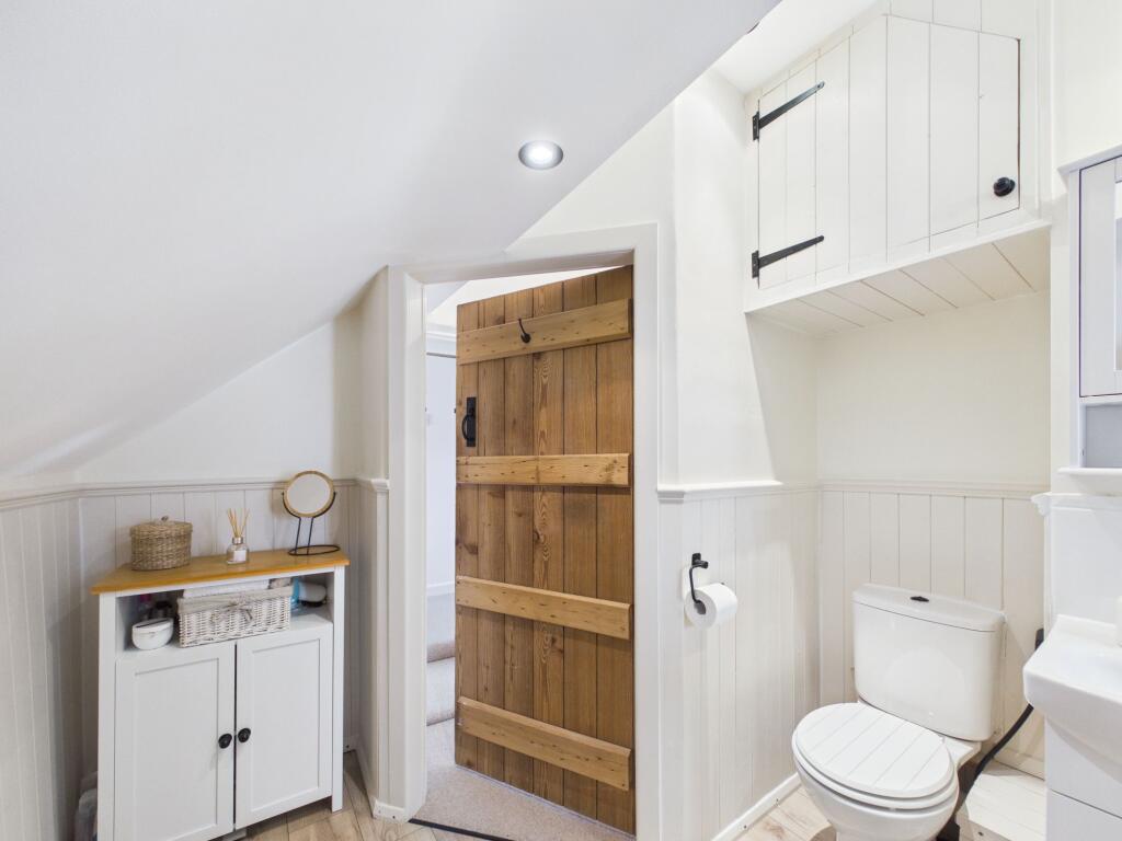

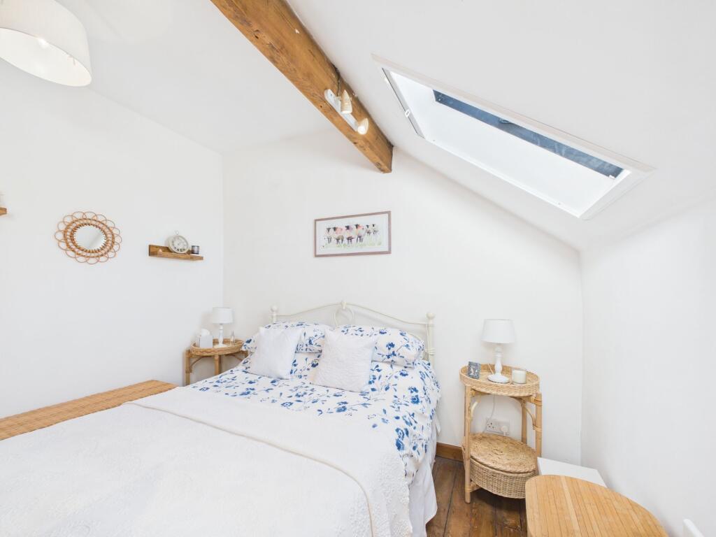
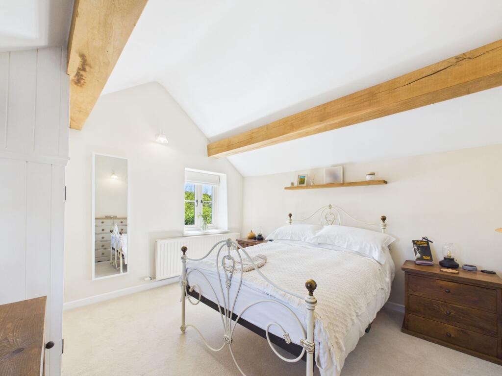
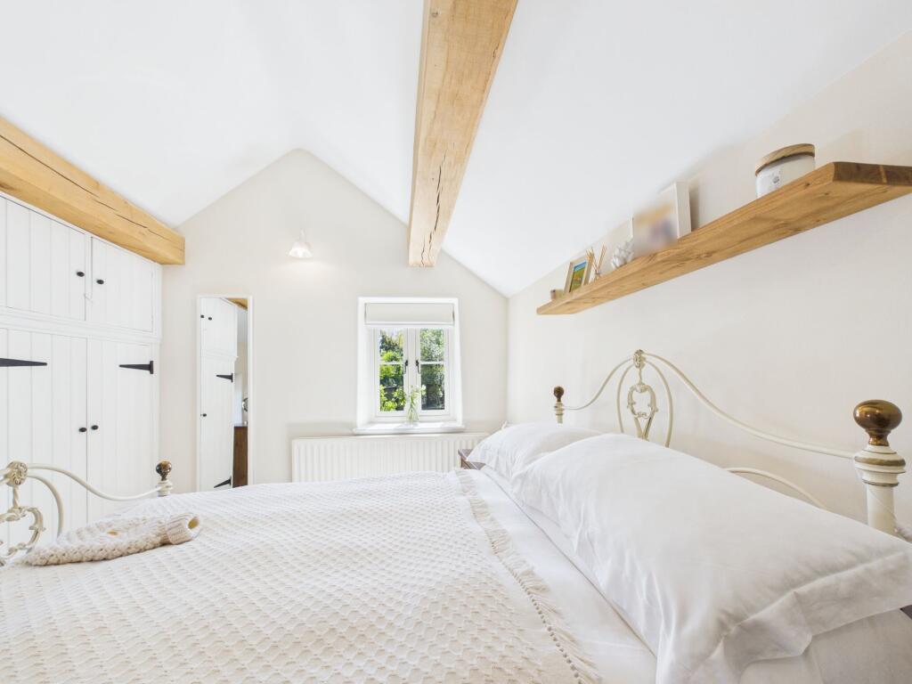
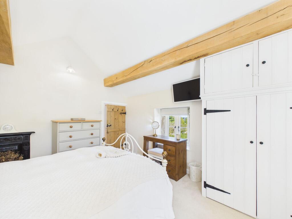
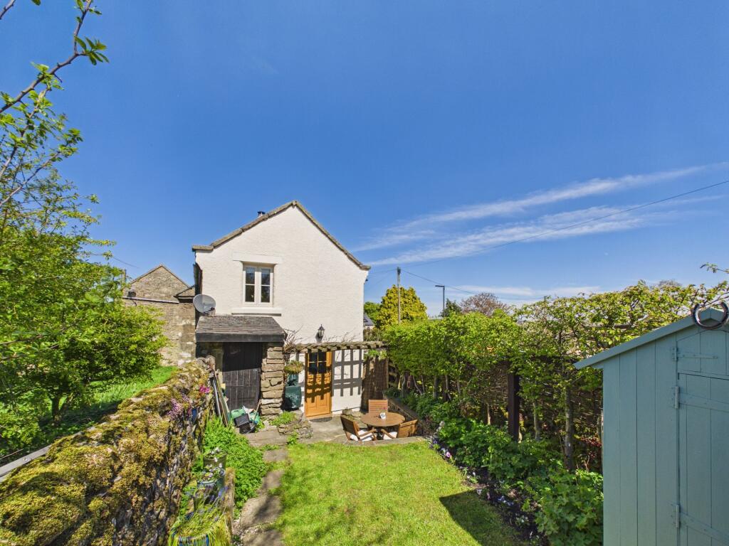
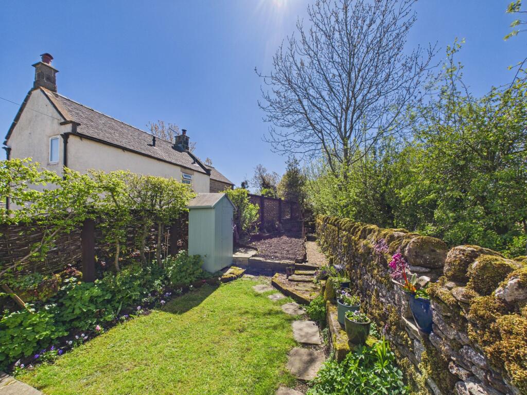
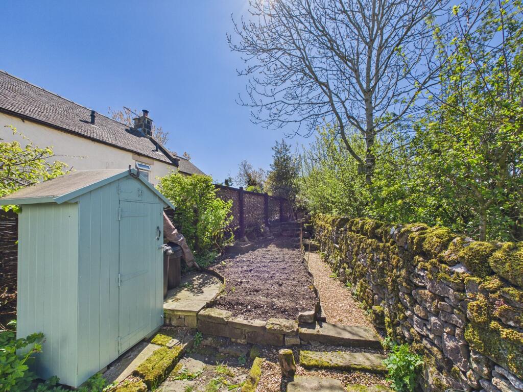
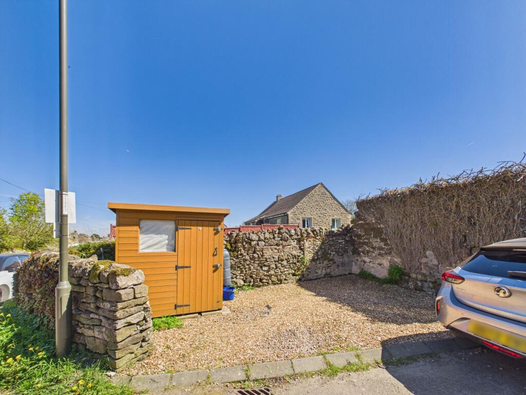
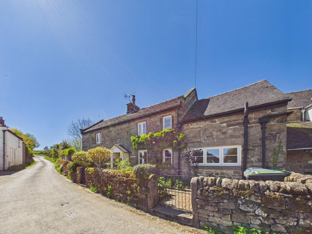
The Location Dining Room Kitchen Photo 4 Entrance Hall Sitting Room Sitting Room Sitting Room Dining Room Dining Room Dining Room Kitchen Kitchen Kitchen Utility & WC Bedroom Three Bedroom Three Family Bathroom Family Bathroom Bedroom Two Bedroom Two Bedroom One Bedroom One Bedroom One Outside Outside Outside Outside The Location
/ 29
Property details
Tenure
FREEHOLD
Floor area
88 m²
Council tax band
D
EPC rating
D
Year built
England and Wales: before 1900
Last sold
£347,500 Feb 2021
Price per m²
£4,432/m²
Local average
£488,382 (-20.1%)
Deprivation
Decile 7 (21,209 of 33,755)
Street crime
0 incidents within 1 mile (Mar 2026)
Key features
- Off Street Parking
- Well Presented Throughout
- Gas Central Heating
- Two Reception Rooms
- Lots of Character & Original Features
- Three Bedroom Cottage
- Simply Must Be Viewed!
- South-Facing Cottage Garden
- New windows and external doors installed throughout the property
Additional details
- Electricity
- Mains supply
- Water
- Mains supply
- Heating
- Gas central
- Parking
- Driveway
- Garden
- Private garden
- Restrictions
- No
- Rights of way
- No
- Flooded in last 5 years
- No
- Flood defences
- No
Description
Listed by
Wirksworth
SmartLet (Derbyshire) Ltd
Reference: 87867348
EPC Rating & Upgrade Cost
Current rating: D
Potential rating: B
Inspection date: 10/08/2020
Current heating cost: £1,037/year
Potential heating cost: £568/year
Est. upgrade cost to C: £23,500
Recommendations
- 50 mm internal or external wall insulation (£4,000 - £14,000)
- Floor insulation (solid floor) (£4,000 - £6,000)
- Solar water heating (£4,000 - £6,000)
- Solar photovoltaic panels, 2.5 kWp (£3,500 - £5,500)
Flood risk
Zone: 1
Risk: Low
Job (default Low)
Floorplans
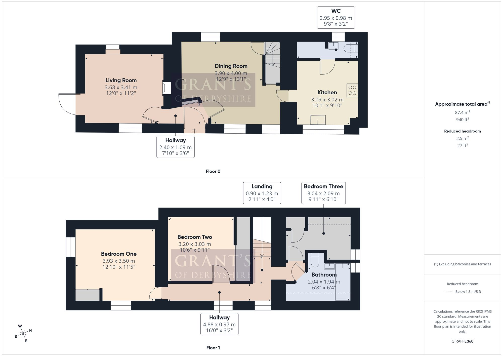
All
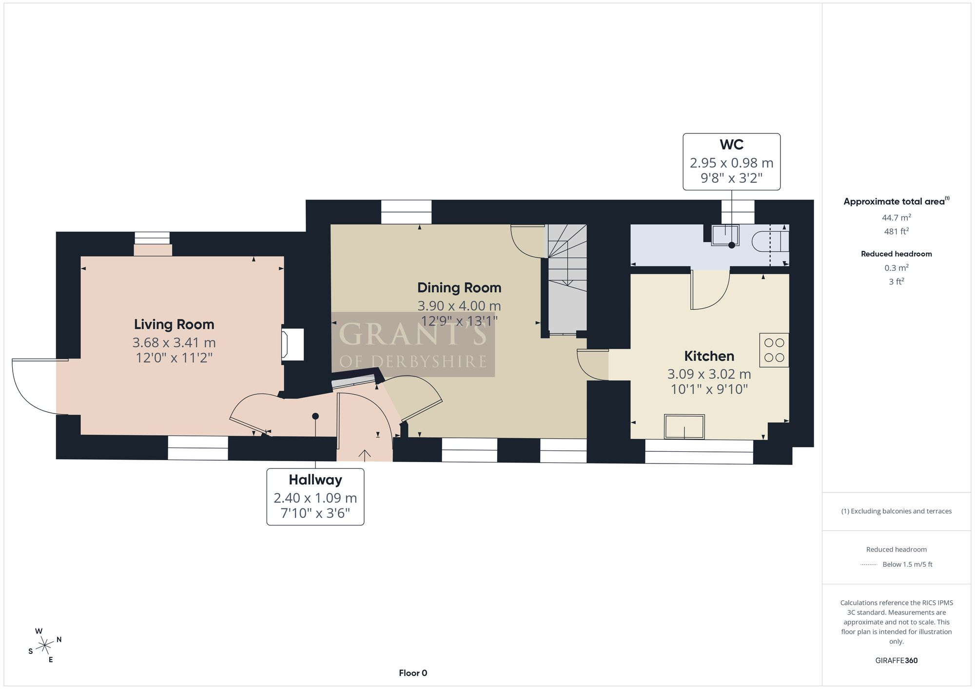
Ground Floor
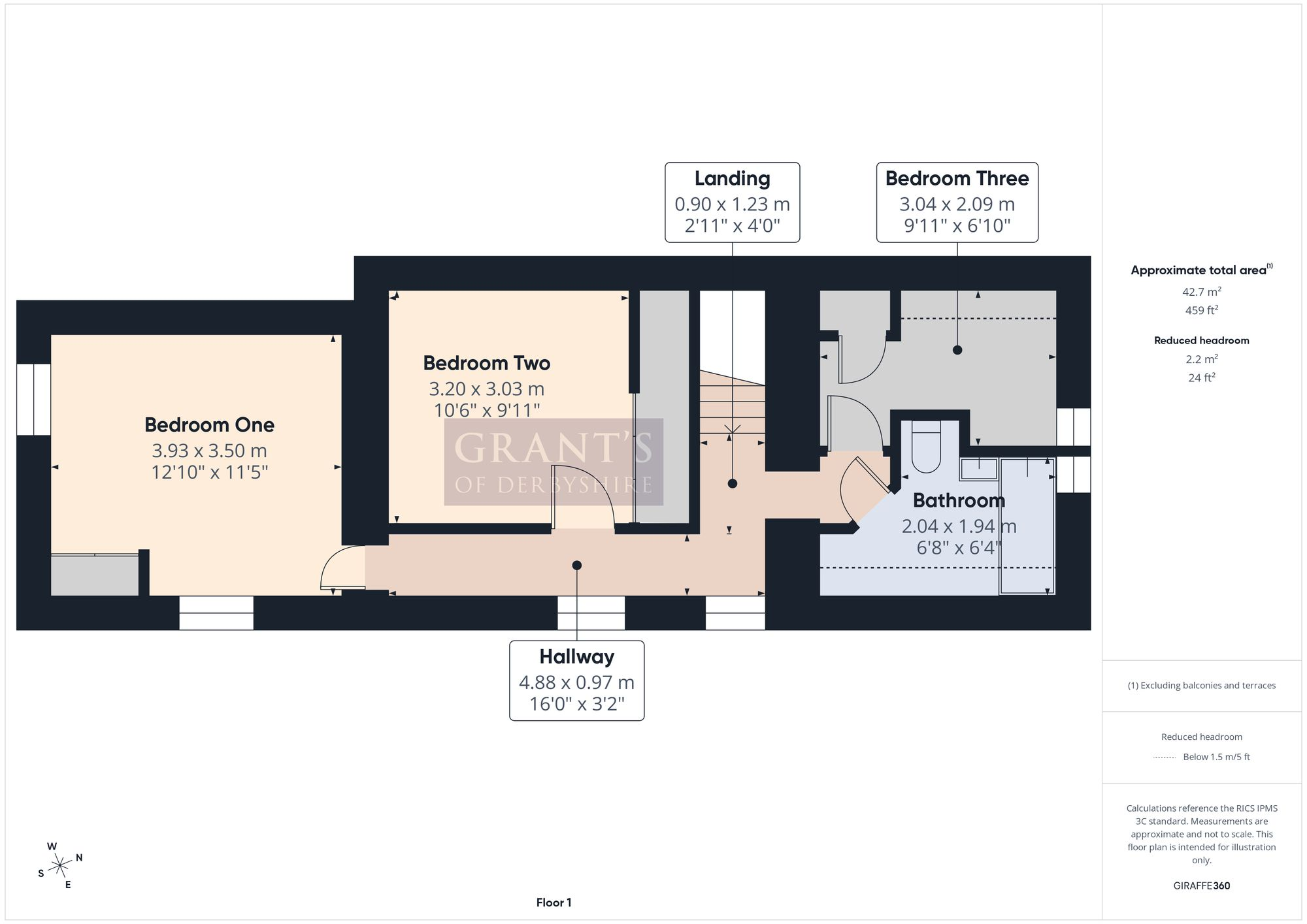
First Floor
Price history
214% since 2002
| Event | Date | Price | % change |
|---|---|---|---|
| Listed for sale | — | £389,995 | +12.2% |
| Sold | 12/02/2021 (5 years ago) | £347,500 | +39% |
| Sold | 03/08/2005 (20 years ago) | £250,000 | +126.2% |
| Sold | 04/09/2002 (23 years ago) | £110,500 | — |
Source: HM Land Registry Price Paid Data. Crown copyright.
Sold Comparables
Same street and nearby sales within 0.25 miles (last 5 years). Data from Land Registry Price Paid.
| Address | Price | Date | Type |
|---|---|---|---|
| THE COTTAGE BACK LANE, ELTON, MATLOCK, DERBYSHIRE DALES, DERBYSHIRE, DE4 2DB | £150,000 | 24/01/2025 | Detached |
| Same street ROCK COTTAGE 2 MOOR LANE, ELTON, MATLOCK, DERBYSHIRE DALES, DERBYSHIRE, DE4 2DA | £330,000 | 26/08/2022 | Semi-detached |
| NEW HOUSE BACK LANE, ELTON, MATLOCK, DERBYSHIRE DALES, DERBYSHIRE, DE4 2DB | £410,000 | 04/05/2022 | Detached |
| BLAKELOW HOUSE BACK LANE, ELTON, MATLOCK, DERBYSHIRE DALES, DERBYSHIRE, DE4 2DB | £360,000 | 01/04/2022 | Detached |
| IVY COTTAGE IVY LANE, ELTON, MATLOCK, DERBYSHIRE DALES, DERBYSHIRE, DE4 2BX | £315,000 | 15/12/2021 | Detached |
| MERE CLOSE BACK LANE, ELTON, MATLOCK, DERBYSHIRE DALES, DERBYSHIRE, DE4 2DB | £445,000 | 30/09/2021 | Detached |
Street average: £330,000 (1 sale)
Area average: £336,000 (5 sales)
Capital growth trend
Land Registry outcode average: last 12 months vs 5y and 10y ago (from sold prices).
House Price Index (HM Land Registry — official index, not sold-price averages): Derbyshire Dales. Series: Detached. As of February 2026.
Rental Range
Estimated market rent for Derbyshire Dales. Low = conservative, Realistic = average, Optimistic = best case.
Based on Local Authority from postcode lookup → Derbyshire Dales.
LHA (30th percentile) floor for Peaks & Dales: £693/mo (Apr 2025 – Mar 2026)
Location
Address
Moor Lane
Nearby
Nearest stations, universities and amenities (distance from property).
| Type | Name | Distance |
|---|---|---|
| Bus stop | Unknown | 0.2 miles |
| Shop | Tonise Hairdressing Salon | 1.2 miles |
| Shop | Winster Village Shop | 1.2 miles |
| Train station | Rowsley South | 3.3 miles |
| Train station | Unknown | 3.3 miles |
| University | University of Derby | 3.5 miles |
| Hospital | Whitworth Hospital | 4.0 miles |
| Hospital | Newholme Hospital | 5.2 miles |
| University | Cliff College | 8.4 miles |
Street-level crime
| Category | Count |
|---|---|
| Total incidents | 0 |
Within 1 mile during Mar 2026. Source: data.police.uk (England & Wales).
Schools nearby
Nearest open schools with Ofsted ratings (England). Closed schools are not shown. Data from Get Information about Schools and Ofsted.
| Name | Type | Distance | Ofsted |
|---|---|---|---|
| Elton CofE Primary School | Primary | 0.1 miles | Inadequate — 23 Jul 2024 |
| Winster CofE Primary School | Primary | 1.5 miles | Good — 8 Mar 2013 |
| Youlgrave, All Saints' CofE (VA) Primary School | Primary | 2.3 miles | Good — 26 Jun 2015 |
| Stanton-in-Peak CofE Primary School | Primary | 2.5 miles | Outstanding — 10 Jun 2024 |
| South Darley CofE Primary School | Primary | 2.9 miles | Good — 26 Jun 2019 |
Rental Comparables
Loading rental comparables for this postcode. Refresh in a few minutes.
Rent-driven metrics
Based on Area rent estimate.
- Rent ratio — Monthly rent ÷ purchase price (1% rule). 1%+ = strong, 0.8–1% = okay, <0.8% = weak for cashflow.
- Max investor price — Rent ÷ 0.8%; the price at which rent would be 0.8% of price (Stoke-style target).
- Target investor price — Rent ÷ 1%; the price at which rent would be 1% of price (strong cashflow band).
- Gross yield — Annual rent as % of purchase price (no costs).