10 MARCLIFF GROVE
KNUTSFORD, KNUTSFORD, CHESHIRE WA16 6JE
£325,000
Property details
Tenure
FREEHOLD
Floor area
82 m²
Council tax band
C
EPC rating
D
Year built
England and Wales: 1900-1929
Last sold
£51,290 Aug 2002
Price per m²
£3,963/m²
Local average
£481,162 (-32.5%)
Deprivation
Decile 7 (21,198 of 33,755)
Street crime
55 incidents within 1 mile (May 2026)
Additional details
- Parking
- Yes
- Garden
- Yes
Description
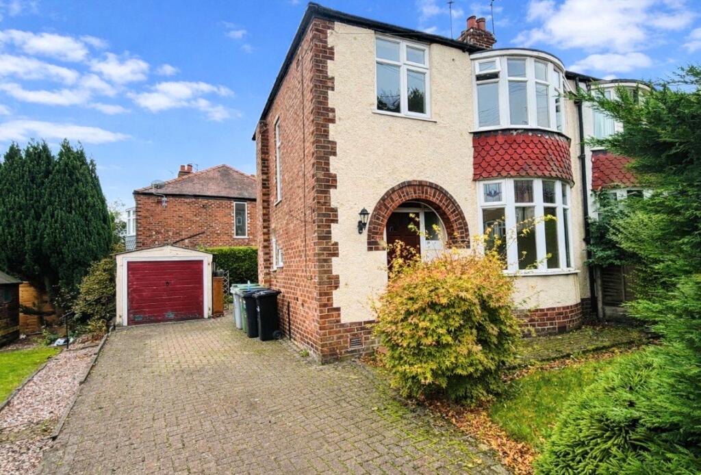
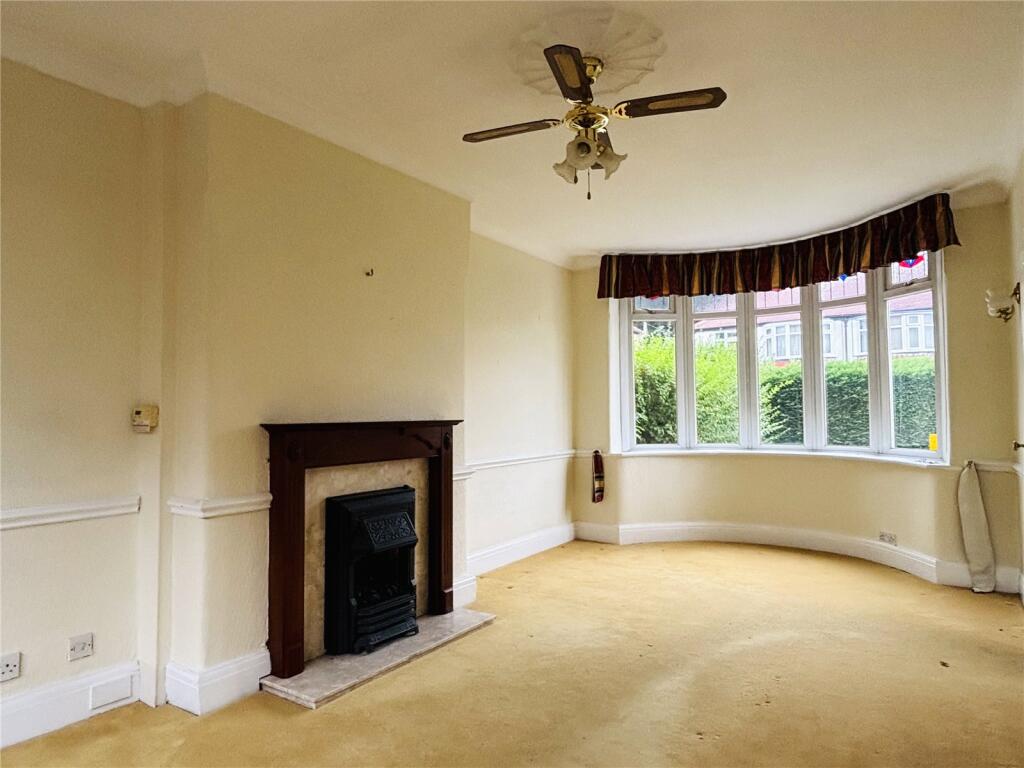
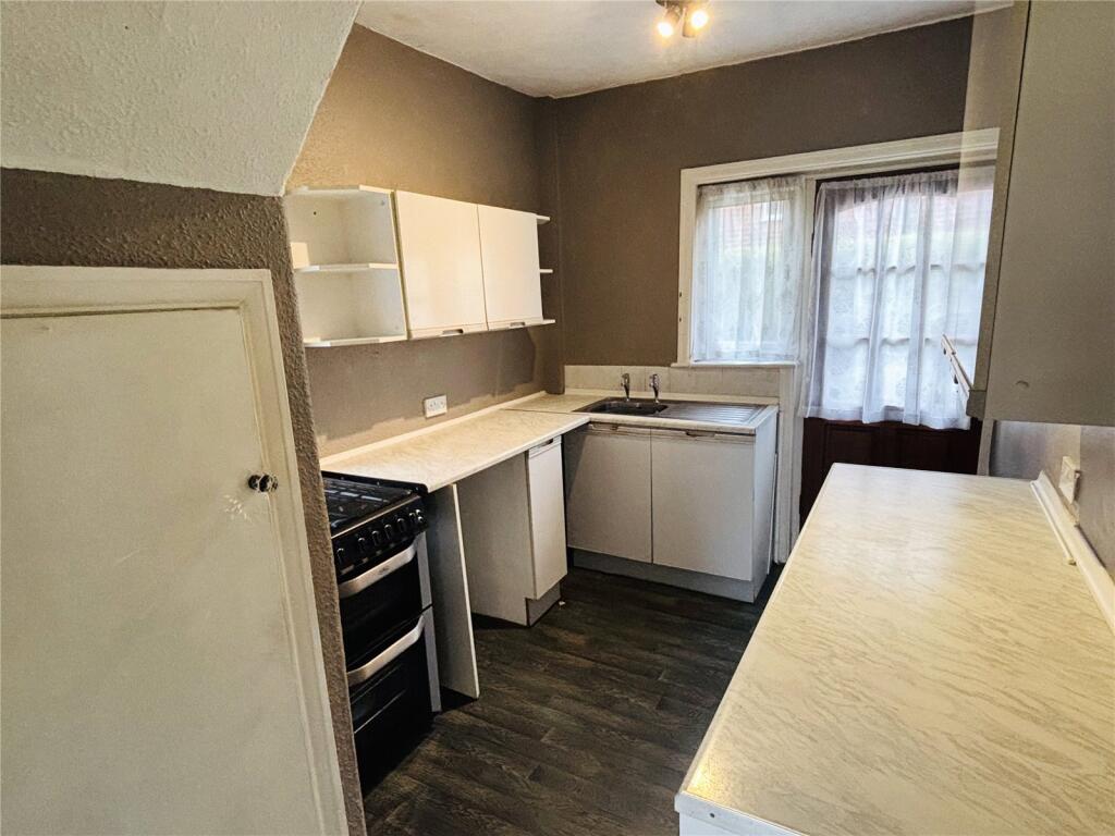
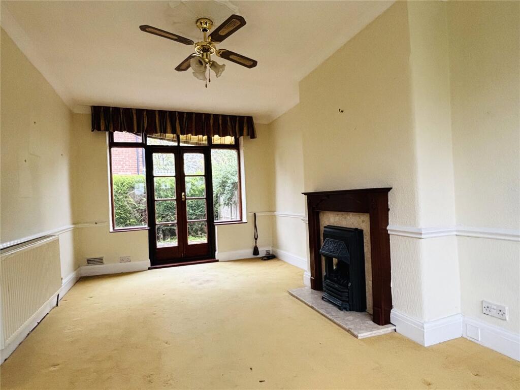
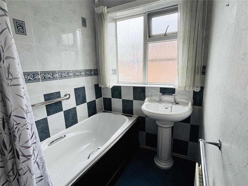
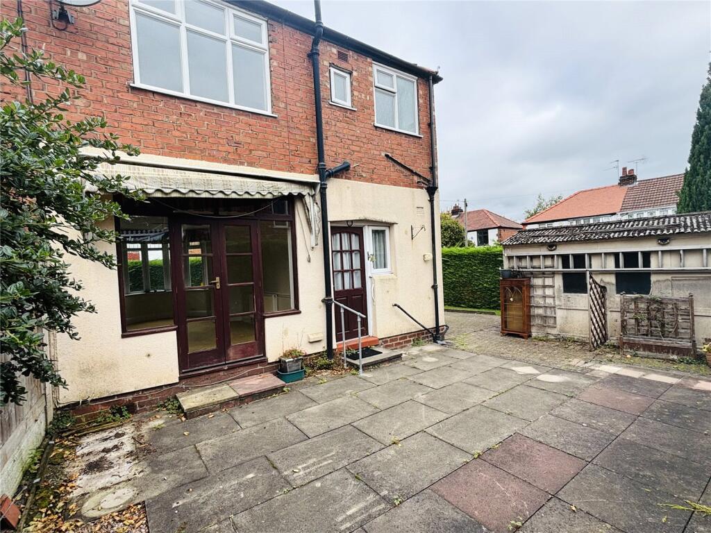
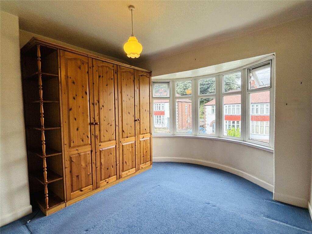
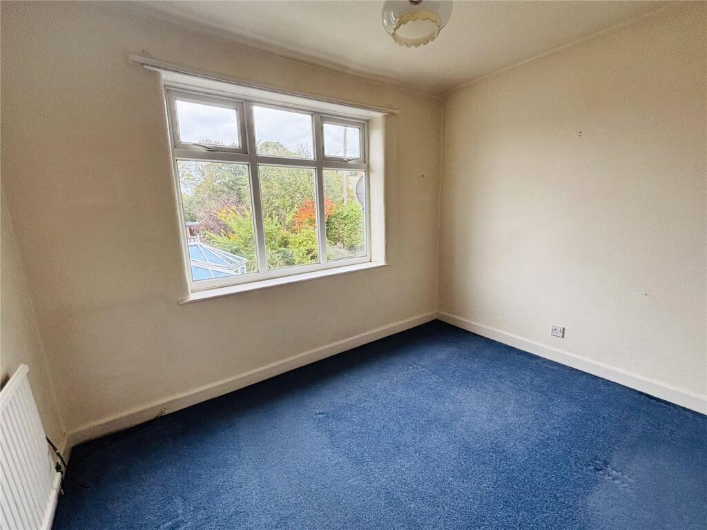
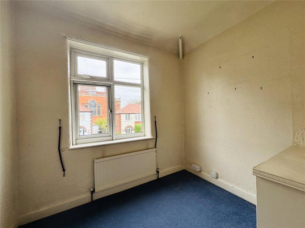
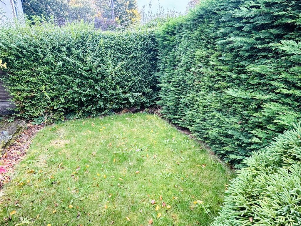
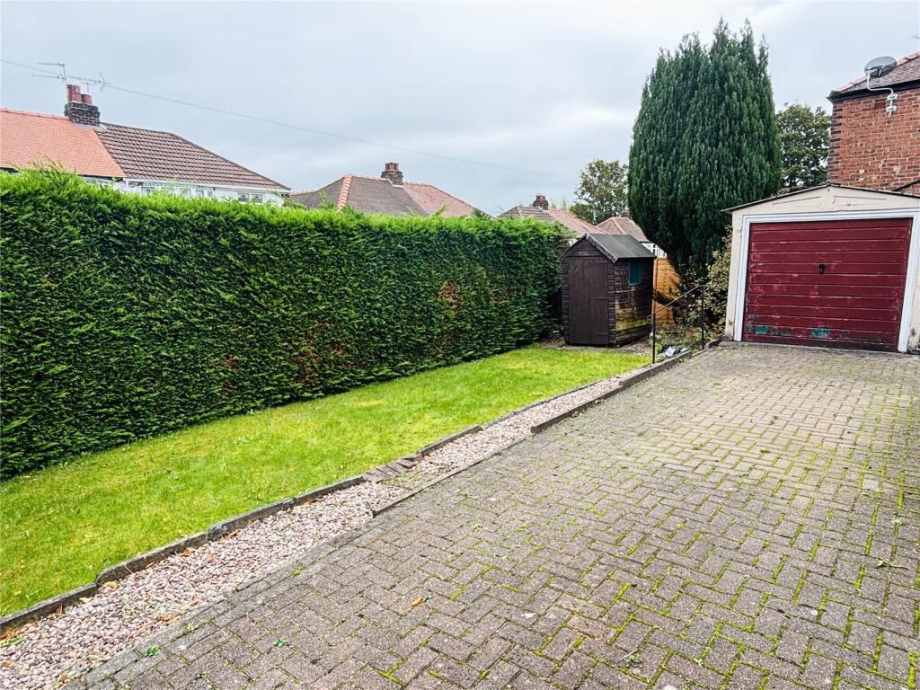
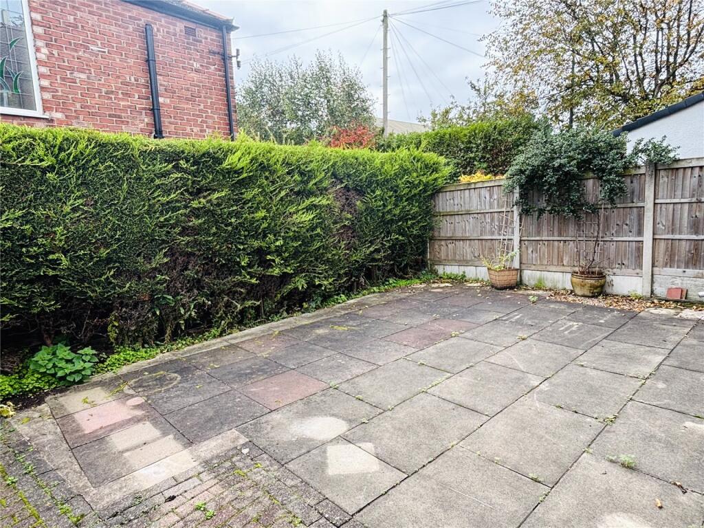
Ideal for extension / further development subject to the buyer's own requirements and gaining the relevant planning consent, the property, in brief, comprises a hallway, open lounge and dining room with double door access to the rear and a fitted kitchen. The first floor consists of a landing, family bathroom, separate WC and three well-proportioned bedrooms. Externally, there is a single detached garage, driveway for 2-3 cars, established gardens to the front and side, and a paved rear.
The location is within easy walking distance to the many iconic boutiques, pubs and restaurants Knutsford has to offer. The property is close to the historic Tatton Park, well placed for renowned local schooling and ideal for those looking to commute to Manchester, Manchester Airport and across Cheshire.
Listed by
Knutsford
Countrywide UK Sales - Connells
Reference: 172169432
EPC Rating & Upgrade Cost
Current rating: D
Potential rating: C
Inspection date: 18/02/2026
Expiry date: 17/02/2036
Current heating cost: £975/year
Potential heating cost: £567/year
Est. upgrade cost to C: £27,180
Recommendations
- Increase loft insulation to 270 mm (£900 - £1,200)
- 50 mm internal or external wall insulation (£7,500 - £11,000)
- Floor insulation (solid floor) (£5,000 - £10,000)
- Increase hot water cylinder insulation (£20 - £40)
- Low energy lighting for all fixed outlets (£180 - £210)
- Hot water cylinder thermostat (£130 - £180)
- Solar photovoltaic panels, 2.5 kWp (£8,000 - £10,000)
Flood risk
Zone: 1
Risk: Low
Job (default Low)
Floorplans
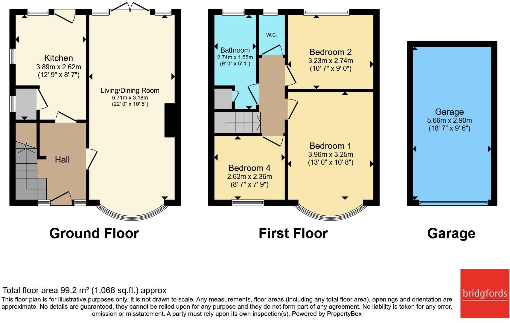
Floorplan
EPC Graphs
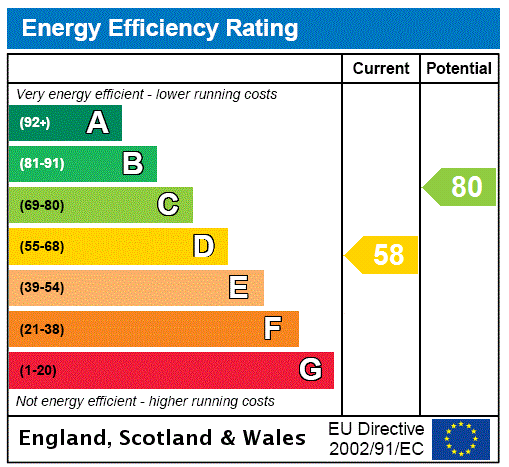
EPC Rating Graph
Price history
| Event | Date | Price | % change |
|---|---|---|---|
| Listed for sale | — | £325,000 | +533.7% |
| Sold | 22/08/2002 (23 years ago) | £51,290 | — |
Source: HM Land Registry Price Paid Data. Crown copyright.
Sold Comparables
Same street and nearby sales within 0.25 miles (last 5 years). Data from Land Registry Price Paid.
| Address | Price | Date | Type |
|---|---|---|---|
| 6A KING STREET, KNUTSFORD, CHESHIRE EAST, WA16 6DL | £250,000 | 14/03/2022 | Semi-detached |
| Same street 27 MARCLIFF GROVE, KNUTSFORD, CHESHIRE EAST, WA16 6JE | £425,000 | 03/11/2021 | Semi-detached |
| Same street 11 MARCLIFF GROVE, KNUTSFORD, CHESHIRE EAST, WA16 6JE | £325,000 | 03/09/2021 | Semi-detached |
Street average: £375,000 (2 sales)
Area average: £250,000 (1 sale)
Capital growth trend
Land Registry outcode average: last 12 months vs 5y and 10y ago (from sold prices).
House Price Index (HM Land Registry — official index, not sold-price averages): Cheshire East. Series: Semi-detached. As of April 2026.
Company ownership
Registered legal owner is a company.
Company: BRIDGEWATER (HOME REVERSIONS NUMBER 1) LIMITED (04348479)
Rental Range
Estimated market rent for Cheshire East. Low = conservative, Realistic = average, Optimistic = best case.
Based on Local Authority from postcode lookup → Cheshire East.
LHA (30th percentile) floor for East Lancs: £593/mo (Apr 2025 – Mar 2026)
Location
Nearby
Nearest stations, universities and amenities (distance from property).
| Type | Name | Distance |
|---|---|---|
| Shop | Christal Tips | 0.1 miles |
| Shop | Innovations | 0.1 miles |
| Train station | Knutsford | 0.1 miles |
| Bus stop | Knutsford, King Edward Road / Church Hill | 0.1 miles |
| Bus stop | Knutsford, Adams Hill / Railway Station | 0.1 miles |
| Train station | Mobberley | 2.5 miles |
| Hospital | Altrincham Hospital | 5.8 miles |
| Hospital | Altrincham Health and Wellbeing Centre | 5.9 miles |
| University | University of Chester - Warrington Campus | 10.7 miles |
| University | Fallowfield Reception and Richmond Amenities Building | 11.8 miles |
Street-level crime
| Category | Count |
|---|---|
| Violence and sexual offences | 27 |
| Public order | 9 |
| Shoplifting | 4 |
| Anti-social behaviour | 3 |
| Drugs | 3 |
| Other theft | 3 |
| Burglary | 2 |
| Criminal damage and arson | 2 |
| Vehicle crime | 2 |
| Total incidents | 55 |
Within 1 mile during May 2026. Source: data.police.uk (England & Wales).
Schools nearby
Nearest open schools with Ofsted ratings (England). Closed schools are not shown. Data from Get Information about Schools and Ofsted.
| Name | Type | Distance | Ofsted |
|---|---|---|---|
| Egerton Primary School | Primary | 0.2 miles | Good — 13 Feb 2023 |
| Knutsford Academy | Secondary | 0.4 miles | Good — 25 Nov 2011 |
| Cheshire Studio School | Secondary | 0.4 miles | Good — 3 May 2017 |
| St Vincent De Paul Catholic Primary School | Primary | 0.5 miles | Good — 6 Jun 2013 |
| Manor Park Primary School and Nursery | Primary | 0.6 miles | Good — 13 Sep 2023 |
Rental Comparables
Loading rental comparables for this postcode. Refresh in a few minutes.
Rent-driven metrics
Based on Area rent estimate.
- Rent ratio — Monthly rent ÷ purchase price (1% rule). 1%+ = strong, 0.8–1% = okay, <0.8% = weak for cashflow.
- Max investor price — Rent ÷ 0.8%; the price at which rent would be 0.8% of price (Stoke-style target).
- Target investor price — Rent ÷ 1%; the price at which rent would be 1% of price (strong cashflow band).
- Gross yield — Annual rent as % of purchase price (no costs).