9 GATHORNE ROAD
LONDON, GREATER LONDON N22 5ND
£1,500 pcm
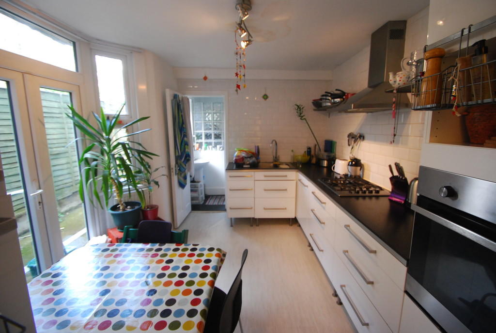
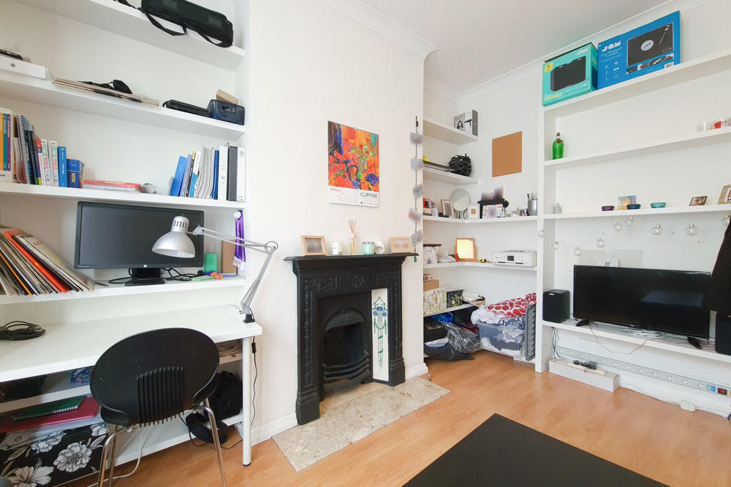

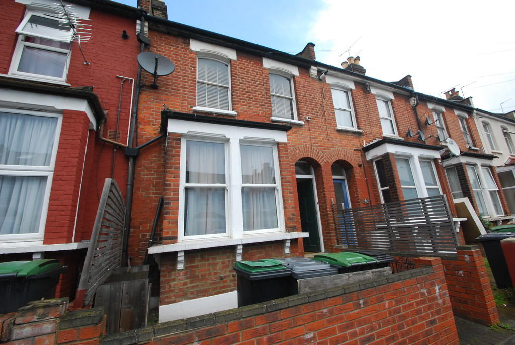
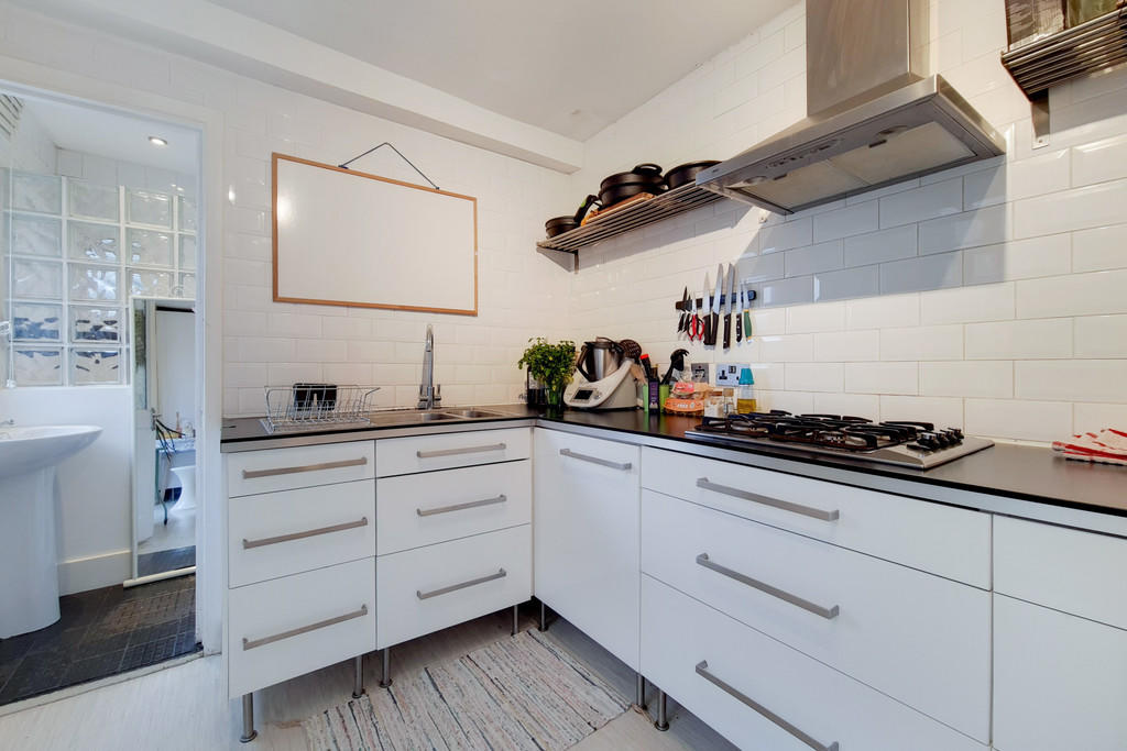
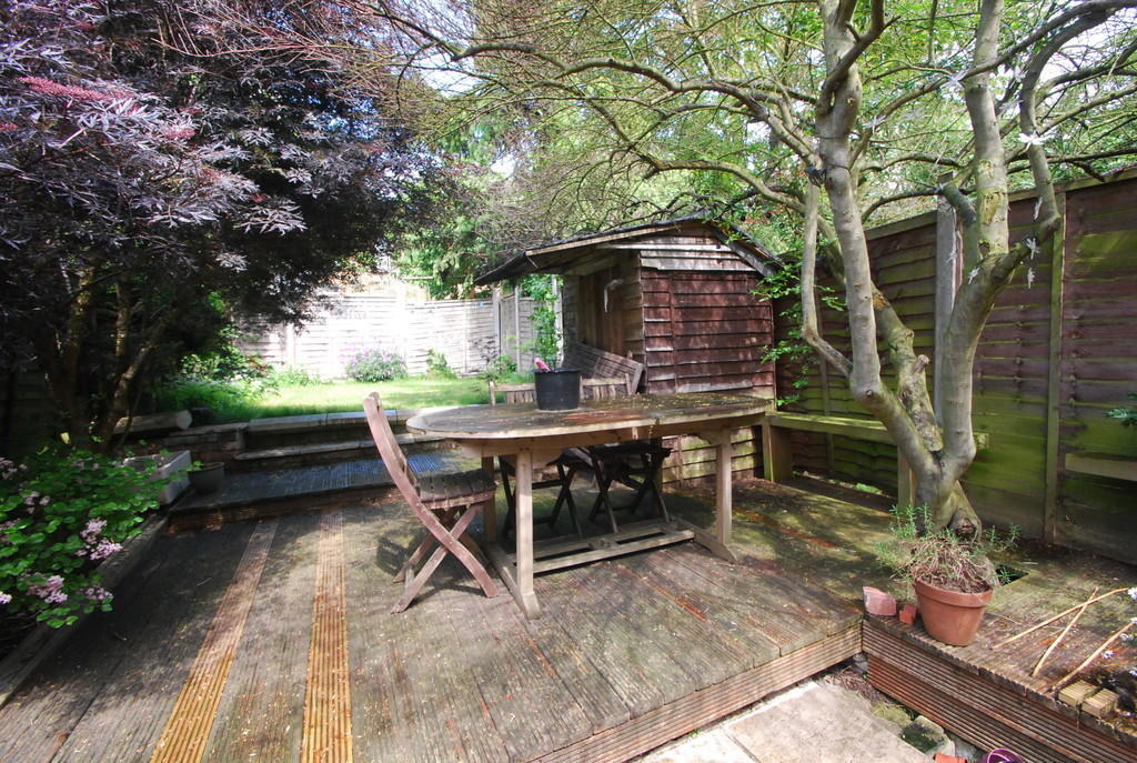

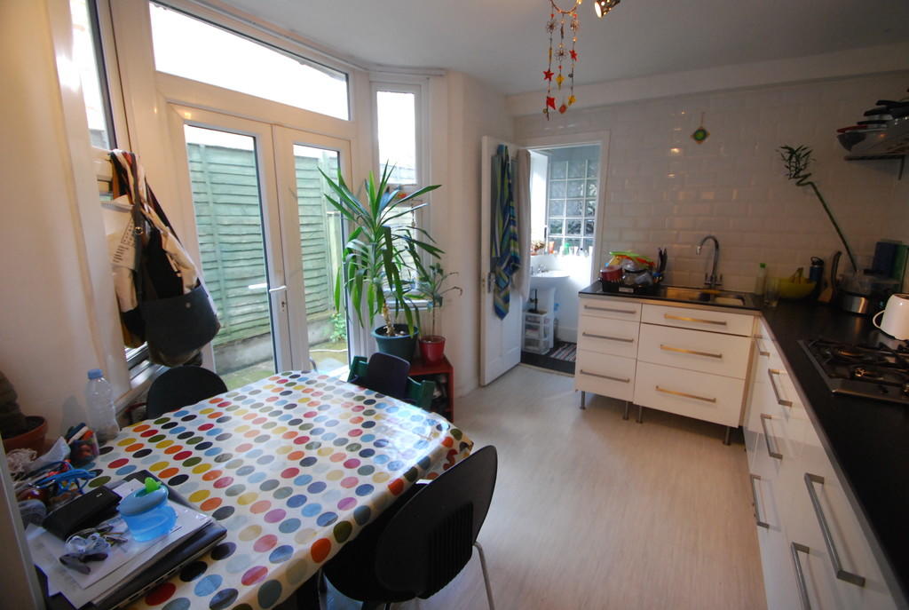
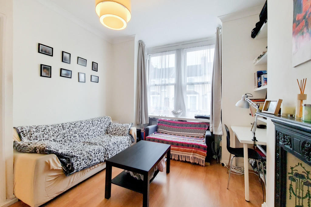


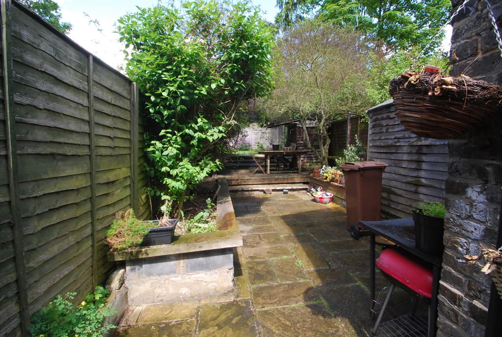
Photo 1 Photo 2 Photo 3 Photo 4 Photo 5 Photo 6 Photo 7 Photo 8 Photo 9 Photo 10 Photo 11 Photo 12 Photo 13
/ 13
Property details
Floor area
46 m²
Deprivation
Decile 2 (5,014 of 33,755)
Street crime
888 incidents within 1 mile (Apr 2026)
Key features
- One-Double Bedroom Ground Floor
- Spacious Lounge
- Close to Transport Links
- Large Private Rear Garden
- Bathroom with Shower/WC
- Gas Central Heating
- Furnished
- Modern fitted Kitchen / Diner
- Available End February
- 20/25 Mins City/West End
Additional details
- Parking
- Permit
- Garden
- Yes
Description
Listed by
London North
Linkside Limited
Reference: 131246321
EPC Rating & Upgrade Cost
Fetching EPC data… Refresh this page in a moment.
Flood risk
Zone: 1
Risk: Low
Job (default Low)
Floorplans

Floorplan 1

Floorplan 2
EPC Graphs

EPC 1
Rental Range
Estimated market rent for Haringey. Low = conservative, Realistic = average, Optimistic = best case.
Based on Local Authority from postcode lookup → Haringey.
LHA (30th percentile) floor for Outer North London: £1,147/mo (Apr 2025 – Mar 2026)
Location
Nearby
Nearest stations, universities and amenities (distance from property).
| Type | Name | Distance |
|---|---|---|
| Bus stop | Redvers Road | 0.0 miles |
| Shop | Unknown | 0.1 miles |
| Shop | Brabant Food Express | 0.1 miles |
| Train station | Wood Green | 0.1 miles |
| Train station | Alexandra Palace | 0.5 miles |
| Hospital | North London Hospice Winchmore Hill | 2.0 miles |
| Hospital | Priory Hospital | 2.4 miles |
| University | Central Belsize Square | 4.4 miles |
| University | University of Wales Trinity Saint David London | 4.5 miles |
Street-level crime
| Category | Count |
|---|---|
| Violence and sexual offences | 232 |
| Anti-social behaviour | 202 |
| Theft from the person | 69 |
| Vehicle crime | 66 |
| Other theft | 58 |
| Public order | 57 |
| Shoplifting | 53 |
| Criminal damage and arson | 37 |
| Drugs | 34 |
| Burglary | 32 |
| Robbery | 32 |
| Bicycle theft | 7 |
| Other crime | 6 |
| Possession of weapons | 3 |
| Total incidents | 888 |
Within 1 mile during Apr 2026. Source: data.police.uk (England & Wales).
Schools nearby
Nearest open schools with Ofsted ratings (England). Closed schools are not shown. Data from Get Information about Schools and Ofsted.
| Name | Type | Distance | Ofsted |
|---|---|---|---|
| St Michael's CofE Primary School | Primary | 0.3 miles | Good — 12 Nov 2012 |
| Trinity Primary Academy | Primary | 0.3 miles | Outstanding — 7 Jul 2016 |
| Noel Park Primary School | Primary | 0.3 miles | Outstanding — 23 Apr 2019 |
| St Paul's Catholic Primary School | Primary | 0.3 miles | Good — 8 Nov 2010 |
| Greek Secondary School of London | Other | 0.3 miles | Inadequate — 29 Feb 2024 |
Rental Comparables
Residential lets from OpenRent and Rightmove for the area (same bedroom count). Use to validate rent estimates. Student lets are excluded.
| Title | Rent | Beds | Distance | As seen on |
|---|---|---|---|---|
| Studio Flat, London, N22 | £975/mo | 1 | 0.06 miles | OpenRent |
| Bedsit, Stuart Crescent, N22 | £750/mo | 1 | 0.13 miles | OpenRent |
| Bedsit, Stuart Crescent, N22 | £750/mo | 1 | 0.13 miles | OpenRent |
| Studio Flat, Lyndum Court, N22 | £1,300/mo | 1 | 0.19 miles | OpenRent |
Average rent: £944/mo (4 listings)