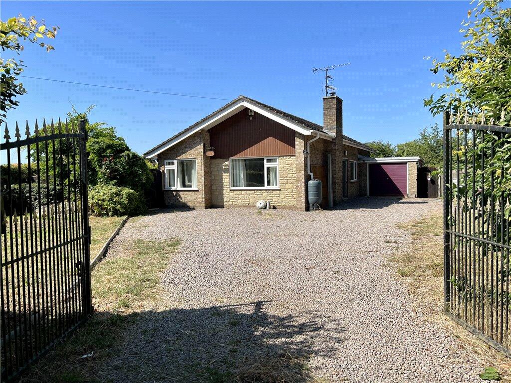
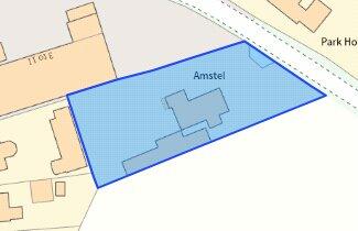
Amstel
PARK LANE, SPALDING, SURFLEET, LINCOLNSHIRE PE11 4AF
£275,000
Property details
Tenure
FREEHOLD
Floor area
68 m²
Council tax band
B
Year built
England and Wales: 1967-1975
Last sold
£265,750 Feb 2024
Price per m²
£4,044/m²
Local average
£318,370 (-13.6%)
Deprivation
Decile 5 (16,110 of 33,755)
Street crime
8 incidents within 1 mile (Apr 2026)
Key features
- *** NO CHAIN ***
- THREE BEDROOMS
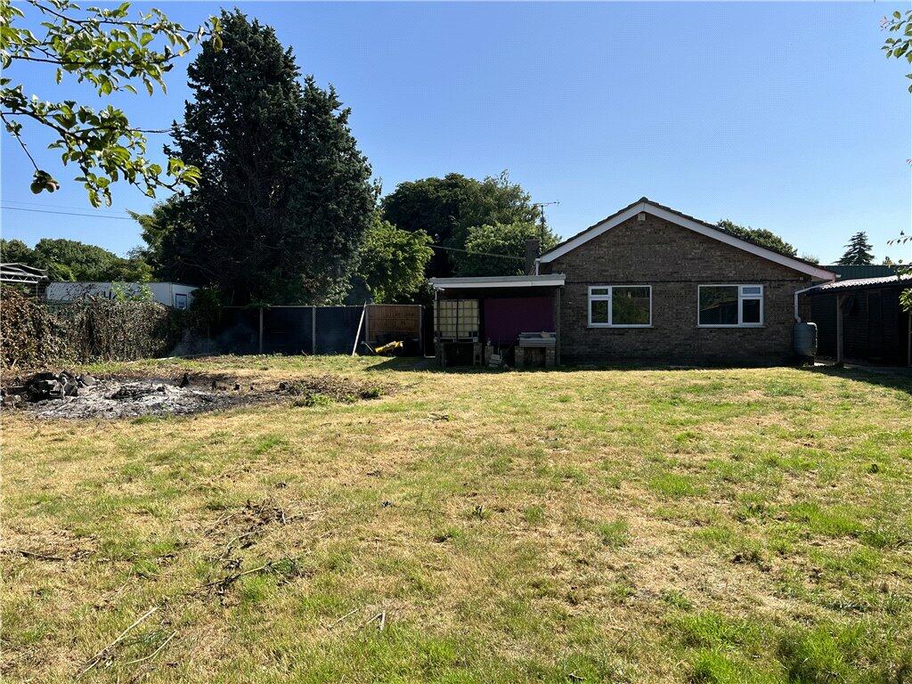
- DETACHED BUNGALOW
- LOCATED IN SURFLEET
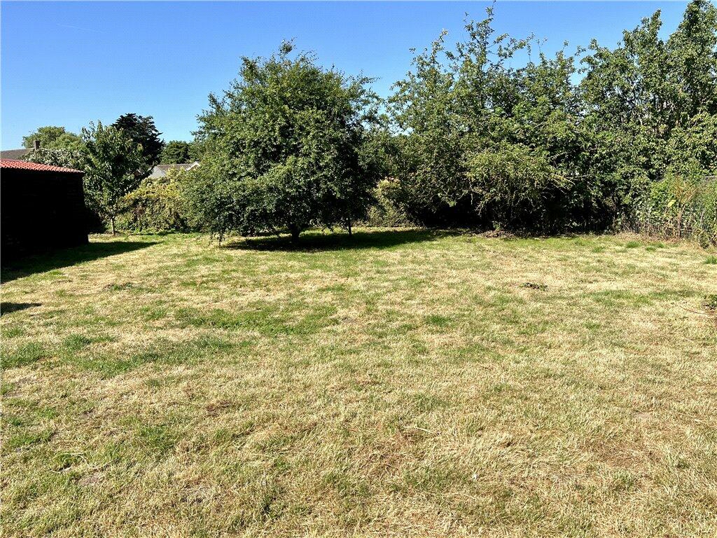
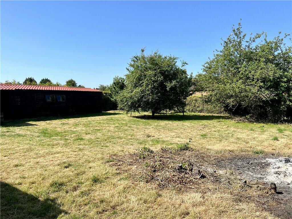
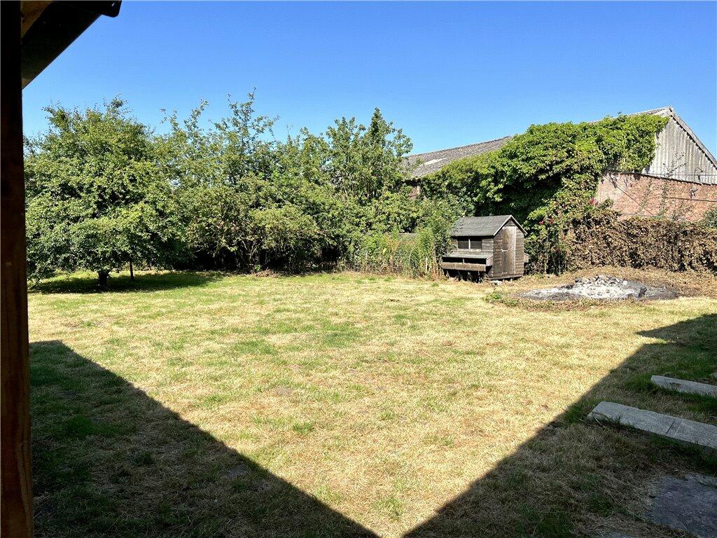
- 1/3 ACRE PLOT
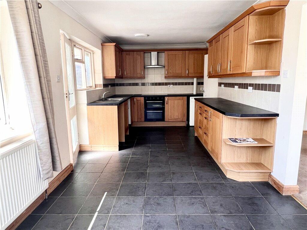
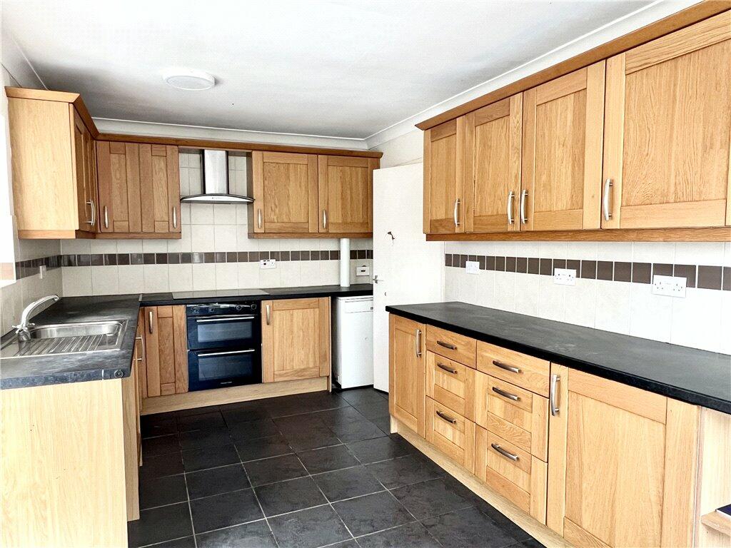
- KITCHEN DINER
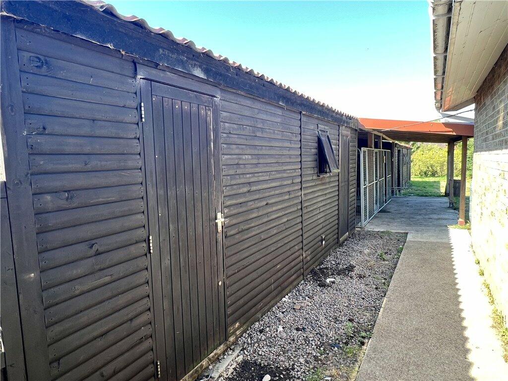
- LARGE WORKSHOP/SHEDS
- POTENTIAL OF KENNELS
Additional details
- Parking
- Yes
- Garden
- Yes
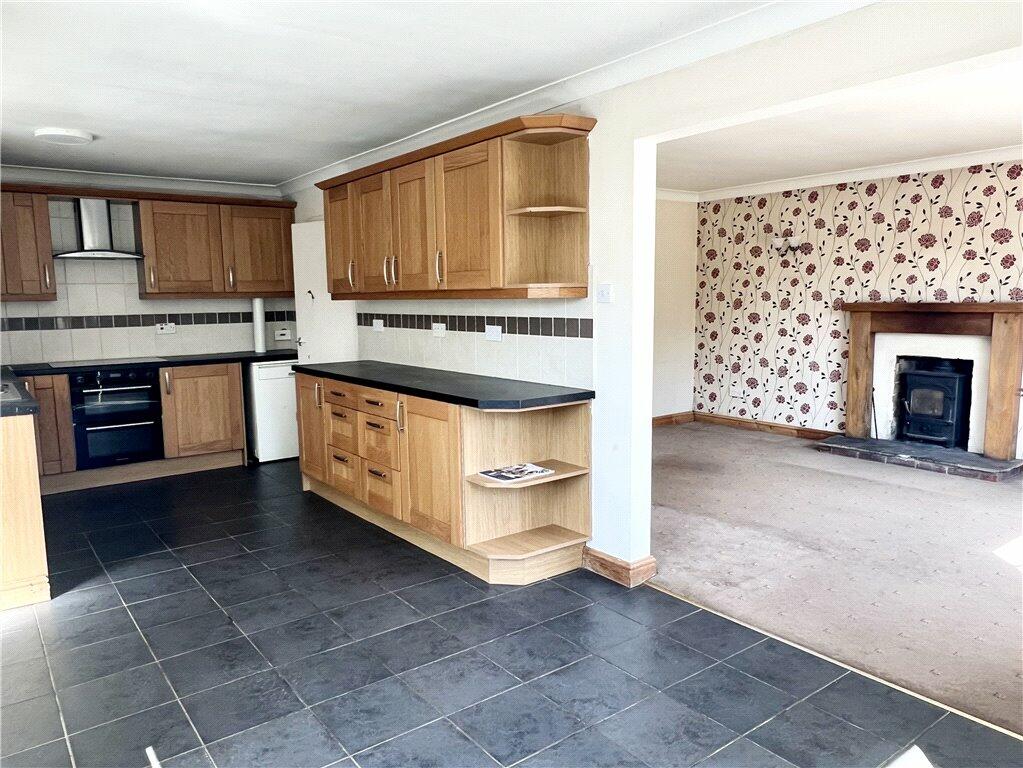
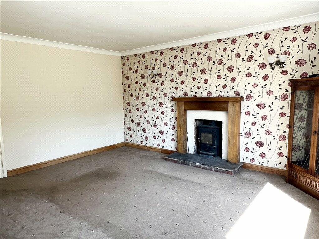
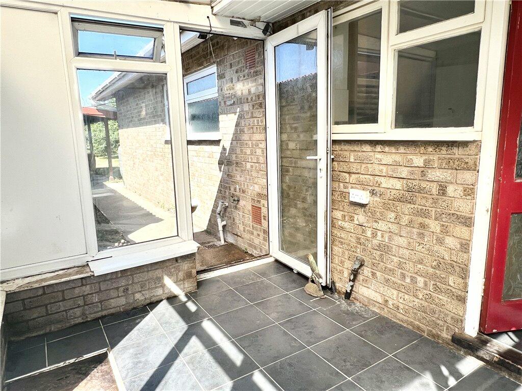
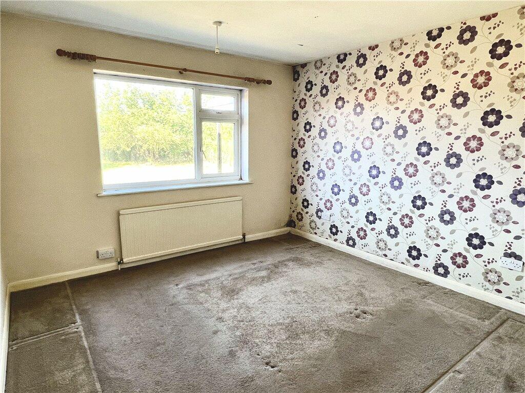
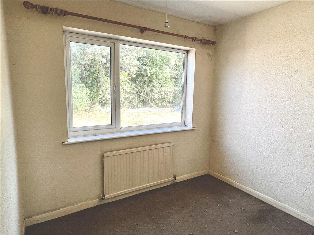
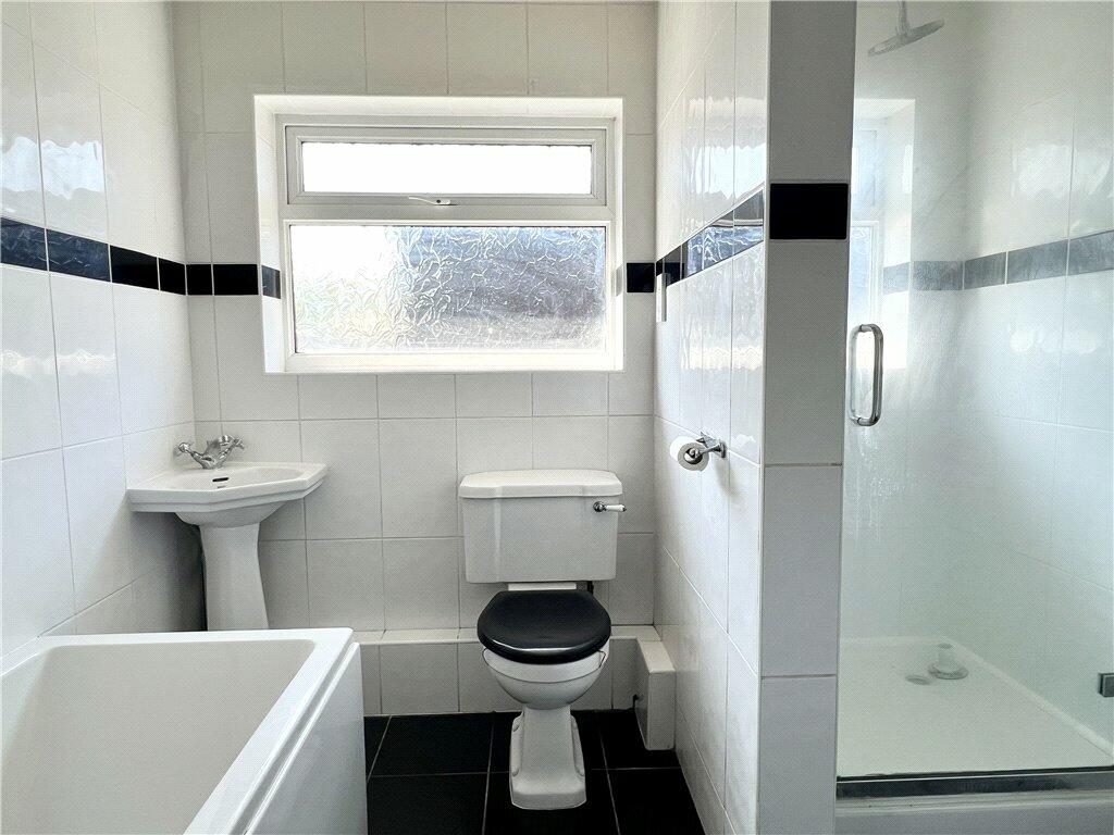
Description
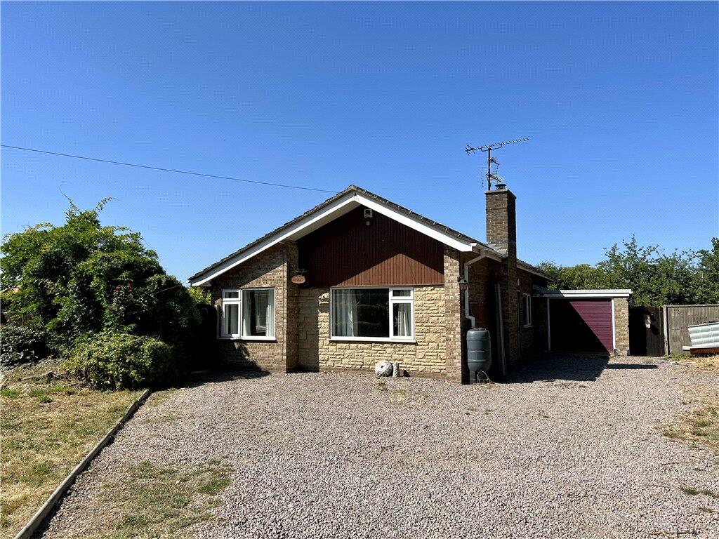
Property has an electric gated entrance and is situated down a quiet lane in the village of Surfleet, offering privacy and exceptional sized plot.
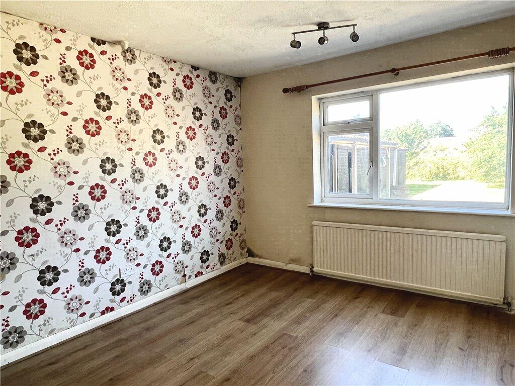
Accommodation comprises of entrance hall, living room, kitchen diner, bathroom, two double bedrooms, single bedroom, garage and workshops/sheds/kennels in the garden.
Listed by
Spalding
Leaders and Romans Group
Reference: 137100632
EPC ratings on this postcode
We don't have a matched EPC for this property yet. Below are efficiency scores and details for other addresses on this postcode.
| Address | Current | Potential | Floor area | Age band | Type |
|---|---|---|---|---|---|
| 1 Park Lane, Surfleet, SPALDING | 22 | 75 | 153 m² | England and Wales: 1967-1975 | Detached |
| Amstel, Park Lane, Surfleet, SPALDING | 46 | 82 | 68 m² | England and Wales: 1967-1975 | Detached |
| Flat 1 Annexe, Bridge House, Park Lane, Surfleet, Spalding | 74 | 74 | 41 m² | — | Flat |
| Newlands Cottage, Park Lane, Surfleet, SPALDING | 43 | 78 | 157 m² | England and Wales: 1950-1966 | Detached |
Flood risk
Zone: 1
Risk: Low
Job (default Low)
Floorplans
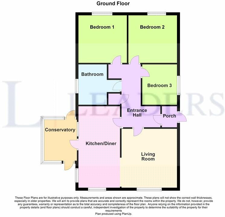
Floorplan
EPC Graphs
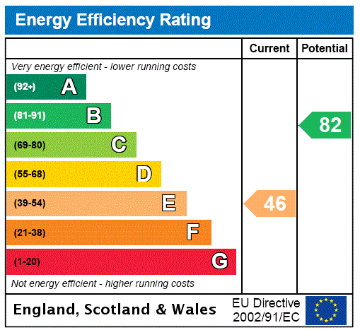
EPC Rating Graph
Price history
66% since 2013
| Event | Date | Price | % change |
|---|---|---|---|
| Sold | 09/02/2024 (2 years ago) | £265,750 | +66.1% |
| Sold | 30/08/2013 (12 years ago) | £160,000 | — |
Source: HM Land Registry Price Paid Data. Crown copyright.
Sold Comparables
Same street and nearby sales within 0.25 miles (last 5 years). Data from Land Registry Price Paid.
| Address | Price | Date | Type |
|---|---|---|---|
| Same street 1 PARK LANE, SURFLEET, SPALDING, SOUTH HOLLAND, LINCOLNSHIRE, PE11 4AF | £150,000 | 08/08/2025 | Other |
| Same street PINE VIEW HOUSE PARK LANE, SURFLEET, SPALDING, SOUTH HOLLAND, LINCOLNSHIRE, PE11 4AF | £250,000 | 31/07/2023 | Detached |
| 20 GOSBERTON ROAD, SURFLEET, SPALDING, SOUTH HOLLAND, LINCOLNSHIRE, PE11 4AB | £400,000 | 23/12/2022 | Detached |
| Same street PARK FARM PARK LANE, SURFLEET, SPALDING, SOUTH HOLLAND, LINCOLNSHIRE, PE11 4AF | £80,000 | 20/12/2022 | Other |
| 1 SUNNYDALE CLOSE, SURFLEET, SPALDING, SOUTH HOLLAND, LINCOLNSHIRE, PE11 4BS | £390,000 | 20/09/2021 | Detached |
| 38 STATION ROAD, SURFLEET, SPALDING, SOUTH HOLLAND, LINCOLNSHIRE, PE11 4DA | £382,500 | 17/08/2021 | Detached |
Street average: £160,000 (3 sales)
Area average: £390,833 (3 sales)
Capital growth trend
Land Registry outcode average: last 12 months vs 5y and 10y ago (from sold prices).
House Price Index (HM Land Registry — official index, not sold-price averages): South Holland. Series: Detached. As of March 2026.
Rental Range
Estimated market rent for South Holland. Low = conservative, Realistic = average, Optimistic = best case.
Based on Local Authority from postcode lookup → South Holland.
LHA (30th percentile) floor for Lincolnshire Fens: £733/mo (Apr 2025 – Mar 2026)
Location
Address
Park Lane
Nearby
Nearest stations, universities and amenities (distance from property).
| Type | Name | Distance |
|---|---|---|
| Bus stop | St Laurence's Church | 0.1 miles |
| Shop | B & M Autos | 0.1 miles |
| Shop | The Studio | 0.3 miles |
| Hospital | Johnson Community Hospital | 2.4 miles |
| Train station | Unknown | 2.7 miles |
| Train station | Spalding | 3.3 miles |
| University | University of Lincoln - Holbeach Campus | 6.5 miles |
Street-level crime
| Category | Count |
|---|---|
| Anti-social behaviour | 3 |
| Violence and sexual offences | 2 |
| Bicycle theft | 1 |
| Burglary | 1 |
| Other theft | 1 |
| Total incidents | 8 |
Within 1 mile during Apr 2026. Source: data.police.uk (England & Wales).
Schools nearby
Nearest open schools with Ofsted ratings (England). Closed schools are not shown. Data from Get Information about Schools and Ofsted.
| Name | Type | Distance | Ofsted |
|---|---|---|---|
| Surfleet Primary School | Primary | 0.5 miles | Good — 3 Jul 2024 |
| The Pinchbeck East Church of England Primary Academy | Primary | 1.7 miles | Good — 24 Apr 2024 |
| Gosberton Academy | Primary | 2.1 miles | Good — 26 Jul 2023 |
| Gosberton House Academy | Other | 2.5 miles | Outstanding — 17 Apr 2012 |
| St Paul's Community Primary and Nursery School, Spalding | Primary | 2.9 miles | Good — 8 Sep 2024 |
Rental Comparables
Loading rental comparables for this postcode. Refresh in a few minutes.
Rent-driven metrics
Based on Area rent estimate.
- Rent ratio — Monthly rent ÷ purchase price (1% rule). 1%+ = strong, 0.8–1% = okay, <0.8% = weak for cashflow.
- Max investor price — Rent ÷ 0.8%; the price at which rent would be 0.8% of price (Stoke-style target).
- Target investor price — Rent ÷ 1%; the price at which rent would be 1% of price (strong cashflow band).
- Gross yield — Annual rent as % of purchase price (no costs).
Enter House Number
Enter the house number to help us retrieve more accurate pricing history and property data.
Please log in to submit or correct the house number for this listing.
Log in to continue