Sparrow Terrace
ST5, ST5 8PD
£900 pcm
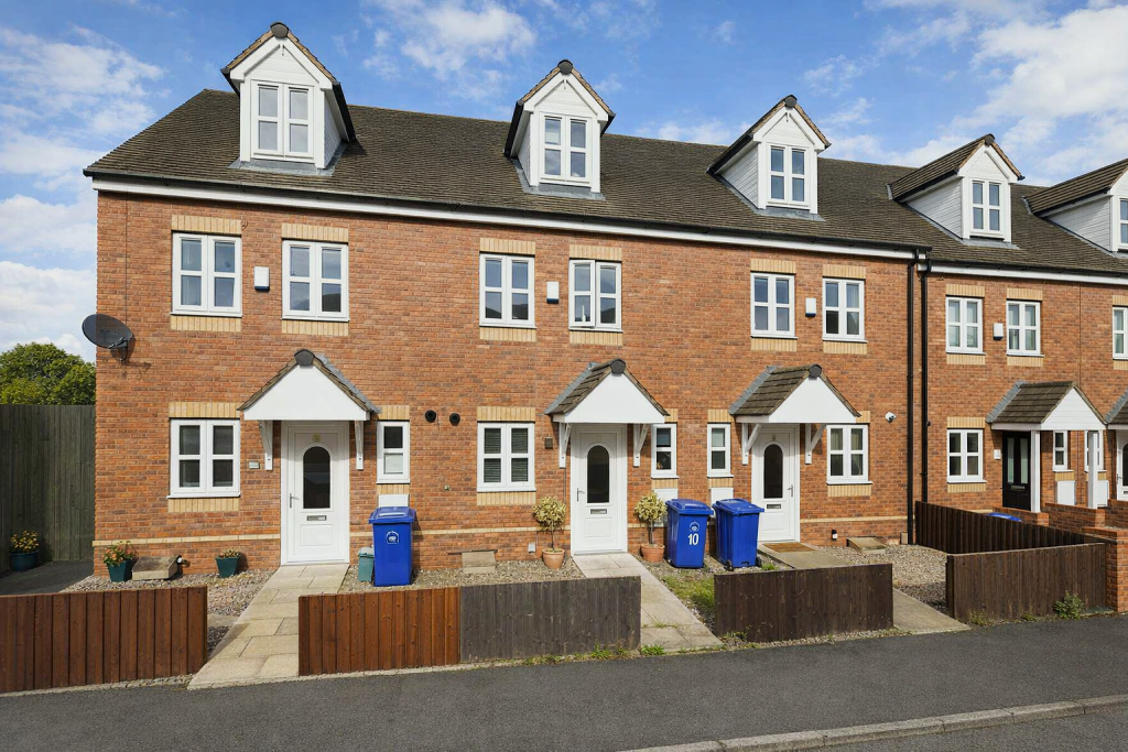
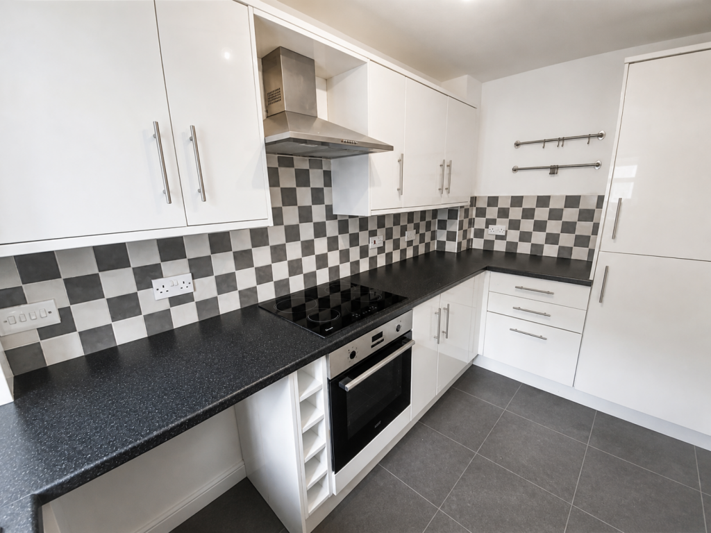
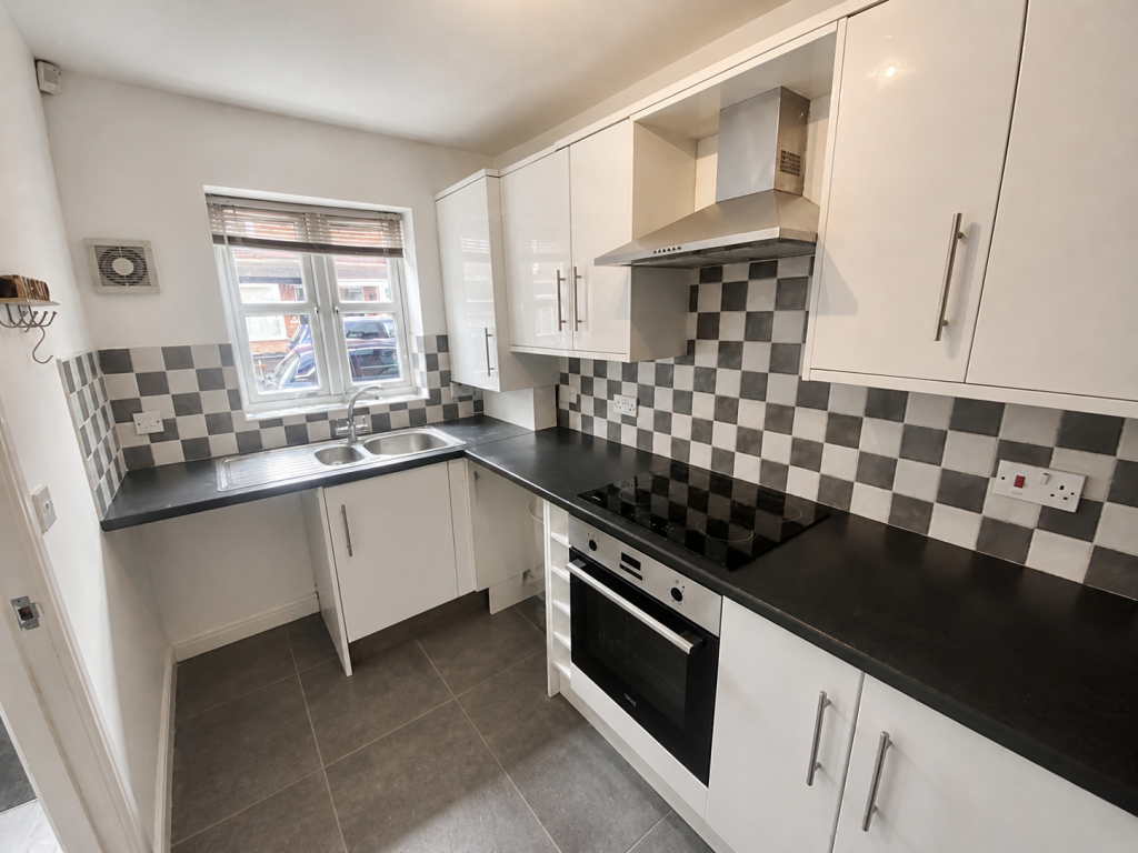
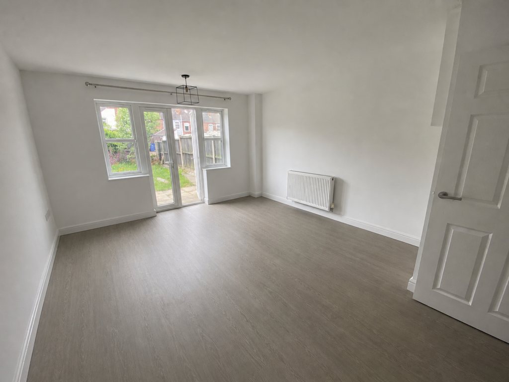
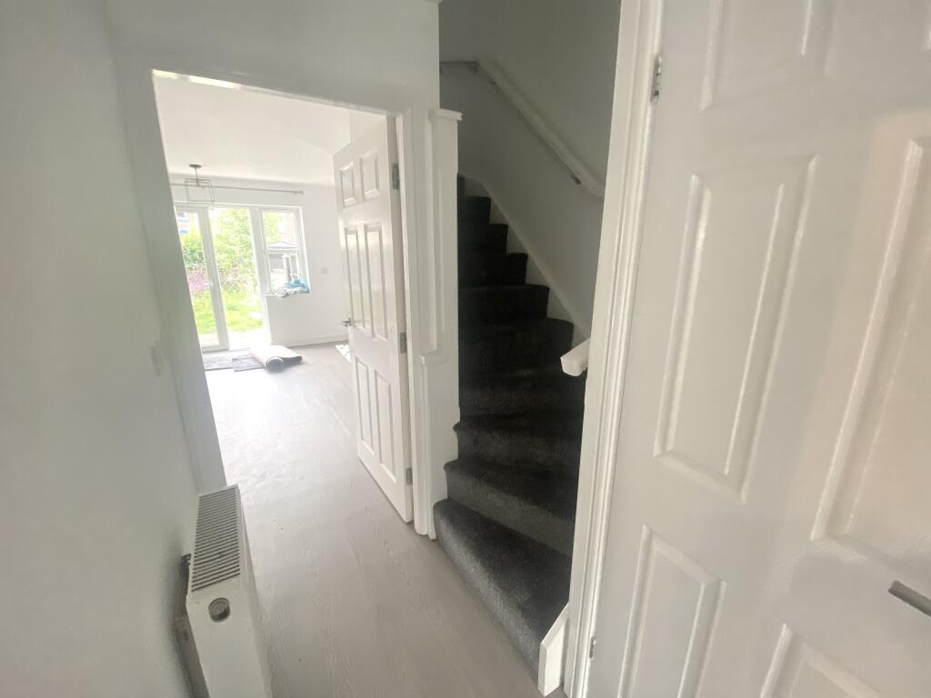
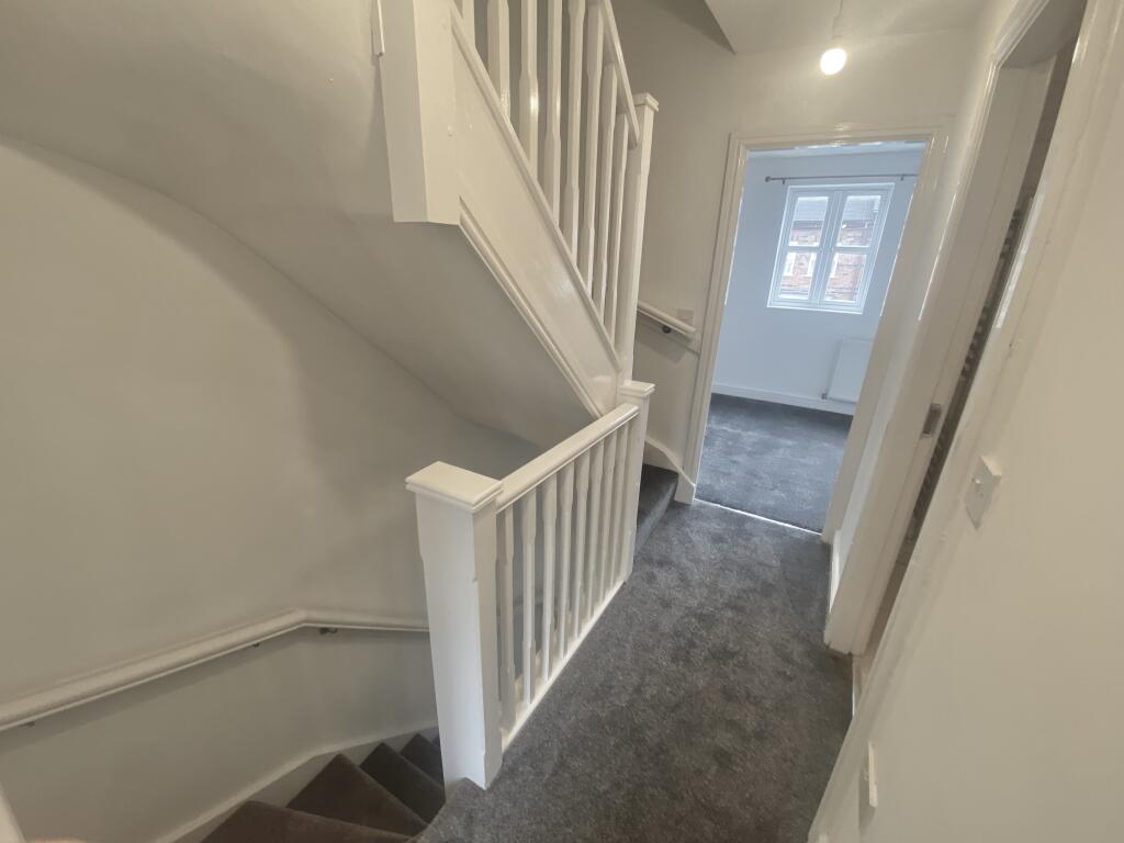
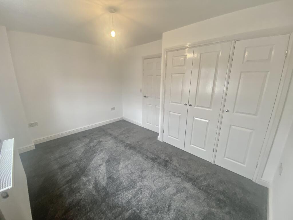
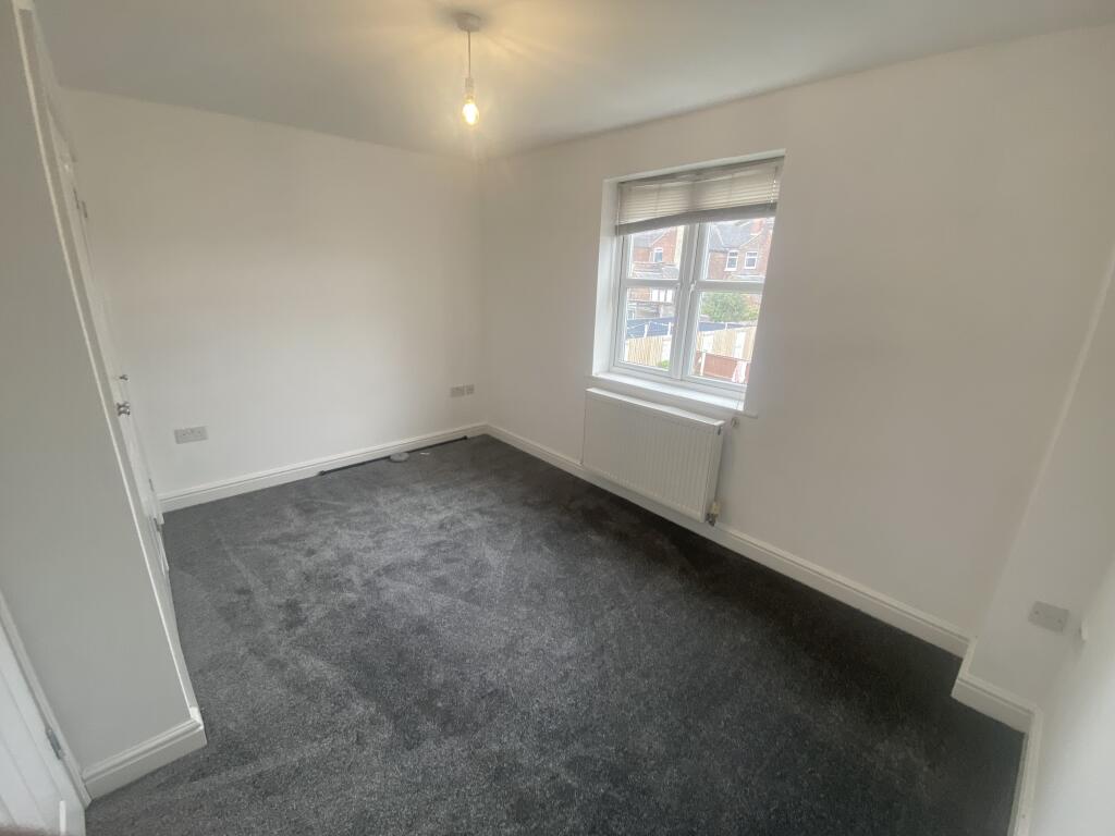
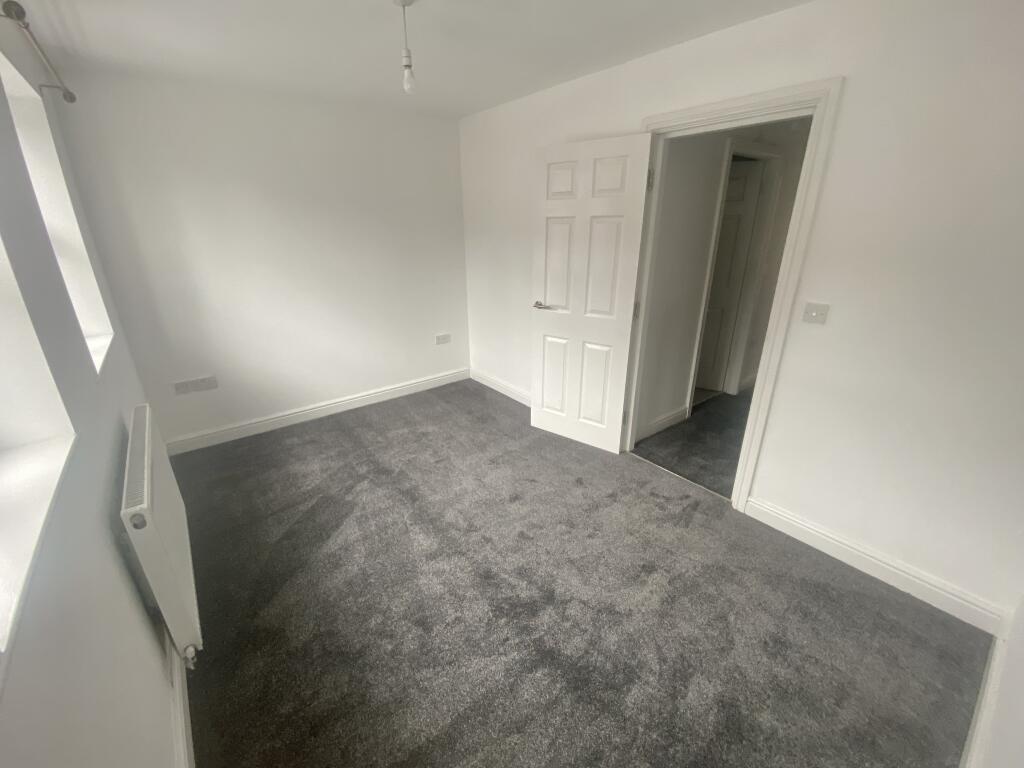
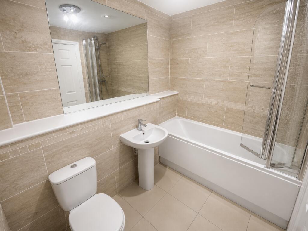
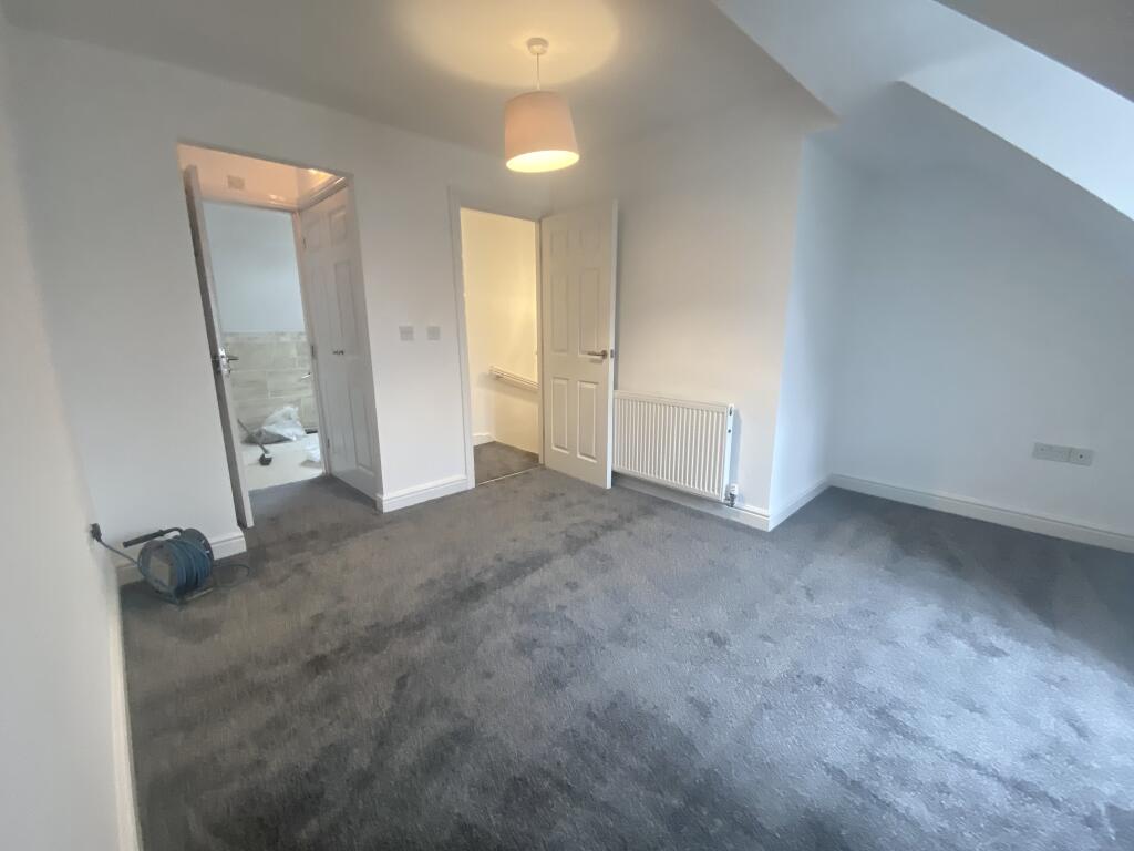
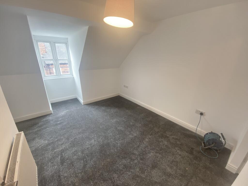
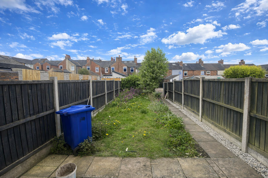
Photo 1 Photo 2 Photo 3 Photo 4 Photo 5 Photo 6 Photo 7 Photo 8 Photo 9 Photo 10 Photo 11 Photo 12 Photo 13
/ 13
Property details
Council tax band
C
Deprivation
Decile 6 (16,958 of 33,755)
Street crime
217 incidents within 1 mile (Mar 2026)
Key features
- Council Tax Band : C
- Three double bedrooms
- Three-story property
- Main bedroom with large en-suite
- Two allocated parking spaces
- White goods included
- Large rear garden
Additional details
- Parking
- Yes
- Garden
- Yes
Description
We have the pleasure of marketing this beautiful Three Bedroom, Three-story property.
This beautifully decorated three-story terrace home offers a perfect blend of modern living and stylish design. As you enter, you are welcomed by a spacious and elegantly appointed living area. The ground floor features a convenient downstairs toilet and a contemporary kitchen, making it ideal for both everyday living and entertaining.
On the first floor, you will find two generously sized double bedrooms, each filled with natural light and built in wardrobes. The main bathroom on this level is tastefully designed with shower of bath providing a comfortable and relaxing space.
The top floor is dedicated to the luxurious main bedroom, complete with an en-suite bathroom. This private retreat offers peace and tranquillity.
Outside, the property boasts a large, well-kept garden, perfect for outdoor dining, gardening, or simply enjoying the fresh air. Additionally, there are two allocated parking spaces conveniently located at the back of the property, providing ease and security.
Council Tax Band : C Council Tax Band: C Holding Deposit: £207.00
Listed by
Crewe
Countrywide UK Lettings - Connells
Reference: 88035810
EPC ratings on this postcode
We don't have a matched EPC for this property yet. Below are efficiency scores and details for other addresses on this postcode.
| Address | Current | Potential | Floor area | Age band | Type |
|---|---|---|---|---|---|
| 1, Sparrow Terrace, NEWCASTLE | 60 | 85 | 72 m² | England and Wales: 1900-1929 | Terraced |
| 1, Sparrow Terrace, NEWCASTLE | 75 | 75 | 70 m² | England and Wales: 1900-1929 | Flat |
| 10 Sparrow Terrace, NEWCASTLE | 80 | 92 | 90 m² | England and Wales: 2007-2011 | Terraced |
| 10a, Sparrow Terrace, NEWCASTLE | 79 | 89 | 88 m² | England and Wales: 2007-2011 | Terraced |
| 11, Sparrow Terrace, NEWCASTLE | 48 | 84 | 82 m² | England and Wales: 1900-1929 | Terraced |
| 11, Sparrow Terrace, NEWCASTLE | 36 | 71 | 80 m² | England and Wales: 1900-1929 | Terraced |
| 13 Sparrow Terrace, NEWCASTLE | 72 | 79 | 80 m² | England and Wales: 1900-1929 | Terraced |
| 13, Sparrow Terrace, NEWCASTLE | 54 | 83 | 78 m² | England and Wales: before 1900 | Terraced |
| 14, Sparrow Terrace, NEWCASTLE | 44 | 83 | 92 m² | England and Wales: 1900-1929 | Terraced |
| 14, Sparrow Terrace, NEWCASTLE | 51 | 85 | 91 m² | England and Wales: before 1900 | Terraced |
| 16 Sparrow Terrace, NEWCASTLE | 63 | 82 | 59 m² | England and Wales: before 1900 | Terraced |
| 17, Sparrow Terrace, NEWCASTLE | 65 | 89 | 80 m² | England and Wales: 1900-1929 | Terraced |
| 19, Sparrow Terrace, NEWCASTLE | 14 | 85 | 73 m² | England and Wales: before 1900 | Terraced |
| 1a Sparrow Terrace, NEWCASTLE | 80 | 80 | 75 m² | England and Wales: 1900-1929 | Flat |
| 2, Sparrow Terrace, NEWCASTLE | 75 | 75 | 70 m² | England and Wales: 1900-1929 | Flat |
Flood risk
Zone: 1
Risk: Low
Job (default Low)
Rental Range
Estimated market rent for Newcastle-under-Lyme. Low = conservative, Realistic = average, Optimistic = best case.
Based on Local Authority from postcode lookup → Newcastle-under-Lyme.
LHA (30th percentile) floor for Staffordshire North: £593/mo (Apr 2025 – Mar 2026)
Location
Address
Sparrow Terrace
Nearby
Nearest stations, universities and amenities (distance from property).
| Type | Name | Distance |
|---|---|---|
| Shop | Unknown | 0.1 miles |
| Bus stop | St Andrew's Church | 0.1 miles |
| Shop | The co-operative food | 0.3 miles |
| Train station | Longport | 0.6 miles |
| Train station | Apedale Road | 1.7 miles |
| Hospital | Haywood Hospital Walk-in Centre | 2.0 miles |
| Hospital | Royal Stoke University Hospital | 2.3 miles |
| University | Keele University | 3.1 miles |
| University | University of Buckingham Crewe Campus | 9.1 miles |
Street-level crime
| Category | Count |
|---|---|
| Violence and sexual offences | 77 |
| Anti-social behaviour | 67 |
| Public order | 15 |
| Vehicle crime | 14 |
| Shoplifting | 9 |
| Burglary | 8 |
| Other theft | 7 |
| Criminal damage and arson | 6 |
| Other crime | 5 |
| Drugs | 4 |
| Bicycle theft | 2 |
| Robbery | 2 |
| Possession of weapons | 1 |
| Total incidents | 217 |
Within 1 mile during Mar 2026. Source: data.police.uk (England & Wales).
Schools nearby
Nearest open schools with Ofsted ratings (England). Closed schools are not shown. Data from Get Information about Schools and Ofsted.
| Name | Type | Distance | Ofsted |
|---|---|---|---|
| Kaleidoscope School | Other | 0.1 miles | Good — 10 Dec 2023 |
| Cedars - Newcastle, Moorlands and Darwin Bases | Other | 0.2 miles | Good — 26 Jun 2015 |
| Oaklands Nursery School | Nursery | 0.2 miles | Outstanding — 15 Feb 2013 |
| Ellison Primary Academy | Primary | 0.4 miles | Good — 14 Sep 2023 |
| St Margaret's CofE (VC) Junior School | Primary | 0.6 miles | Good — 1 May 2014 |
Rental Comparables
Residential lets from OpenRent and Rightmove for the area (same bedroom count). Use to validate rent estimates. Student lets are excluded.
Average rent: £956/mo (32 listings)
Enter House Number
Enter the house number to help us retrieve more accurate pricing history and property data.
Please log in to submit or correct the house number for this listing.
Log in to continue