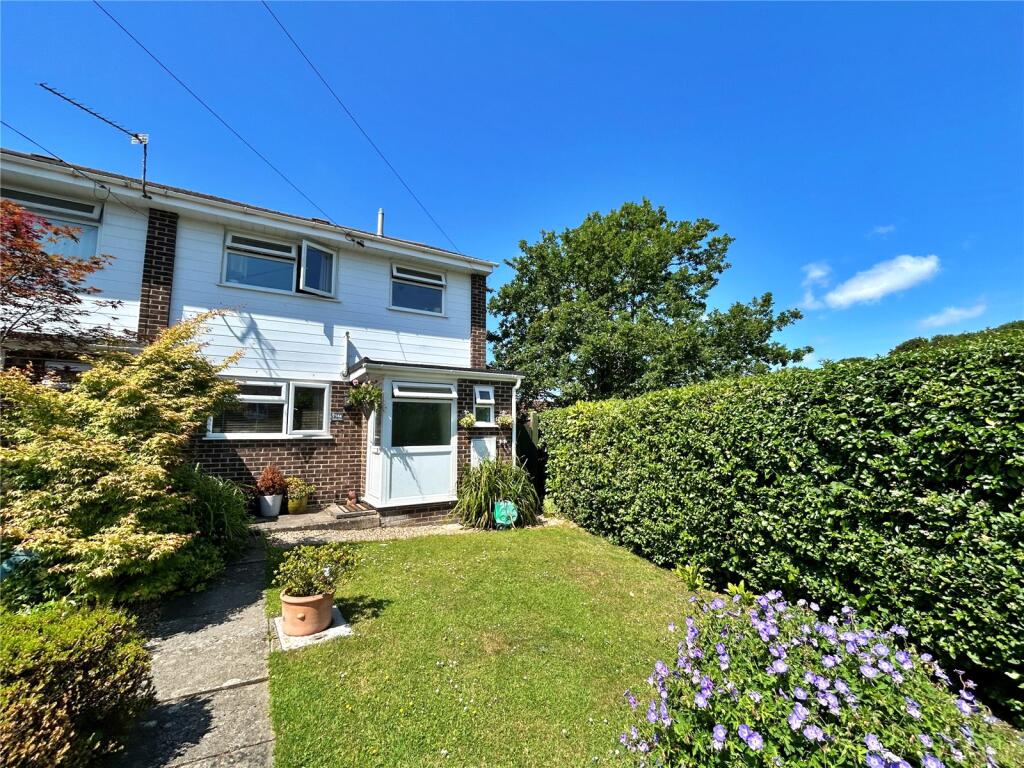
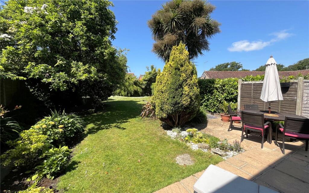
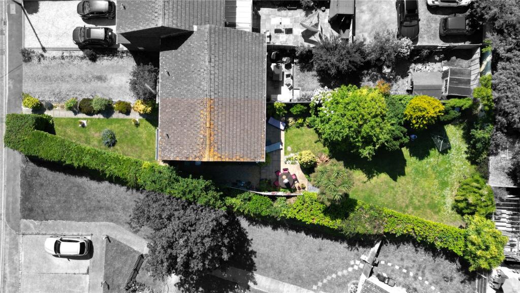
14A SEATON ROAD
HIGHCLIFFE, CHRISTCHURCH, BOURNEMOUTH, CHRISTCHURCH AND POOLE, BH23 5HW
£400,000
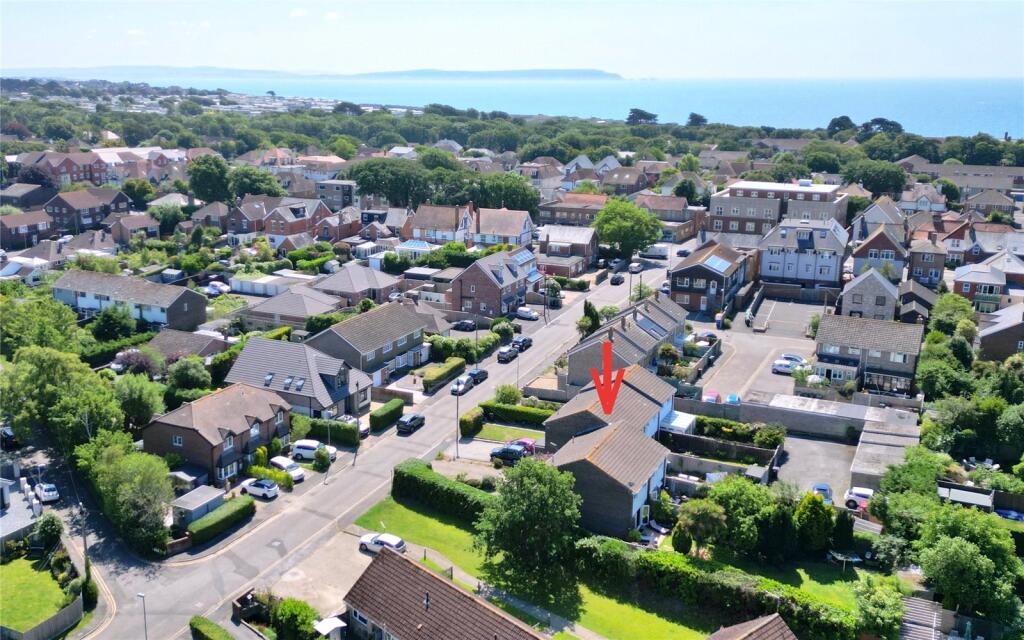
Location
Nearby
Nearest stations, universities and amenities (distance from property).
| Type | Name | Distance |
|---|---|---|
| Shop | AV Ridout Funeral Directors | 0.1 miles |
| Bus stop | Sea Corner | 0.1 miles |
| Train station | Hinton Admiral | 1.0 miles |
| University | Bournemouth University (Lansdowne Campus) | 7.5 miles |
| Hospital | Nuffield Health Bournemouth Hospital | 7.7 miles |
Property details
Tenure
Freehold
Property type
Semi-detached
Bedrooms
3
Bathrooms
2
Floor area
86 m²
EPC rating
D
Year built
England and Wales: 1967-1975
Last sold
£400,000 Mar 2026
Price per m²
£4,651/m²
Local average
£399,961 (51 sales)
Street crime
17 incidents within 1 mile (Apr 2026)
EPC Rating & Upgrade Cost
Current rating: D
Potential rating: B
Inspection date: 09/08/2024
Expiry date: 08/08/2034
Current heating cost: £985/year
Potential heating cost: £745/year
Est. upgrade cost to C: £15,500
Recommendations
- Cavity wall insulation (£500 - £1,500)
- Floor insulation (solid floor) (£4,000 - £6,000)
- Solar water heating (£4,000 - £6,000)
- Solar photovoltaic panels, 2.5 kWp (£3,500 - £5,500)
Price history
| Event | Date | Price | Type | % change | Today’s value (HPI) | Action |
|---|---|---|---|---|---|---|
| Sold | 18/03/2026 | £400,000 | Semi-detached | — | £400,000 to March 2026 | View transaction |
Historic listings
Listing and sale events only where we matched the listing page to a Land Registry sale already on record for this address.
| Event | Date | Price |
|---|---|---|
| sold | 01/01/2026 | £400,000 |
| listed | 18/06/2025 | £405,000 |
| sold | 01/01/2005 | £225,000 |
| sold | 01/01/2004 | £200,000 |
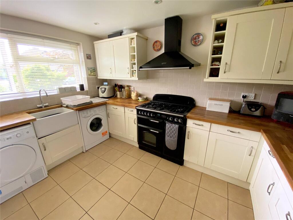
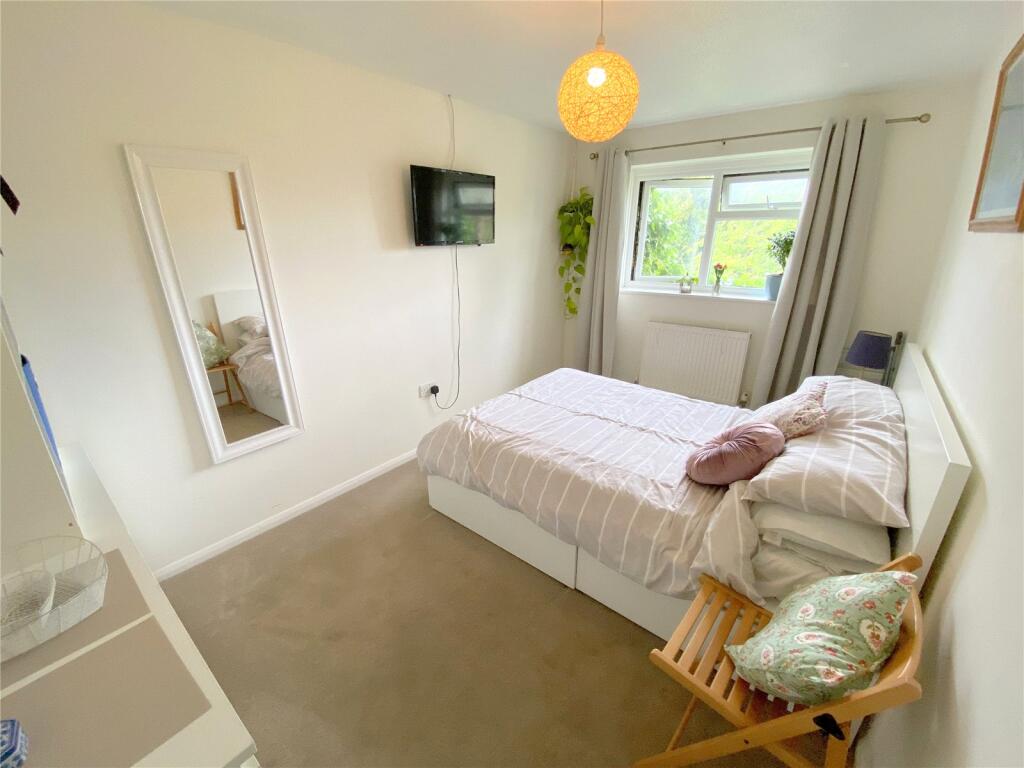
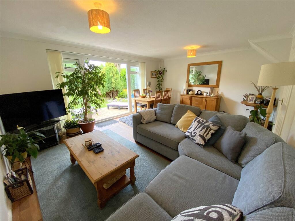
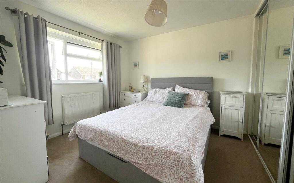
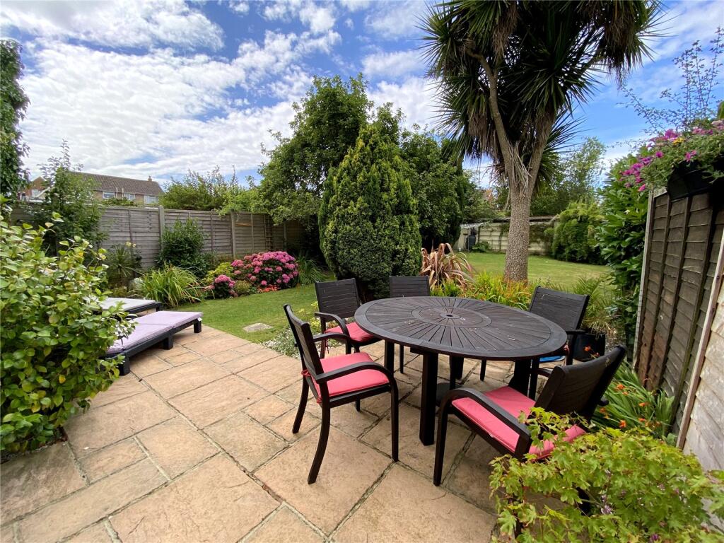
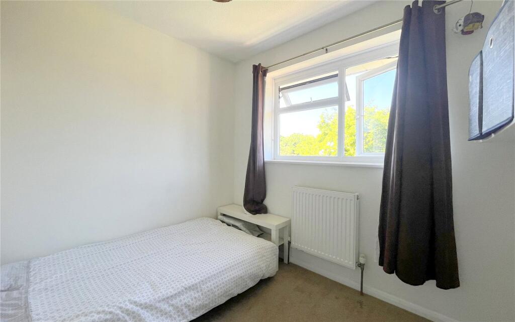
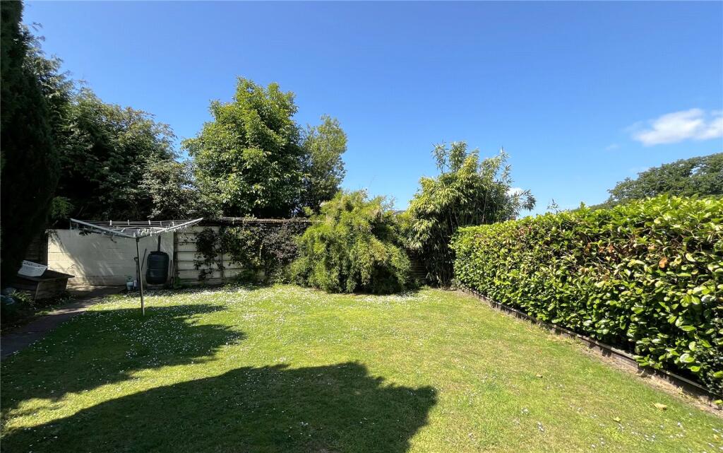
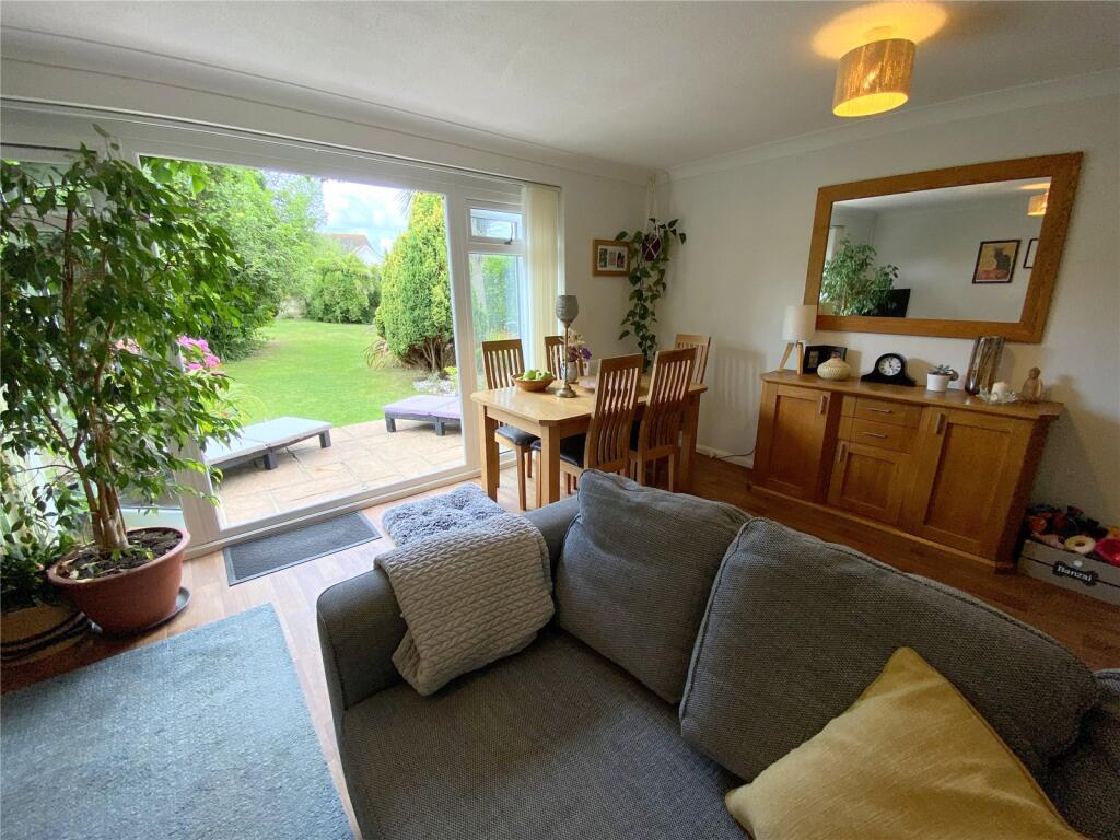
Photos · Open listing
 Open image 1 from listing 163478819
 Open image 2 from listing 163478819
 Open image 3 from listing 163478819
 Open image 4 from listing 163478819
 Open image 5 from listing 163478819
 Open image 6 from listing 163478819
 Open image 7 from listing 163478819
 Open image 8 from listing 163478819
 Open image 9 from listing 163478819
 Open image 10 from listing 163478819
 Open image 11 from listing 163478819
 Open image 12 from listing 163478819
Sold comparables
Same street and nearby sales within 0.25 miles (last 5 years). Land Registry Price Paid Data.
| Address | Price | Date | Type |
|---|---|---|---|
| 430 LYMINGTON ROAD, HIGHCLIFFE, CHRISTCHURCH, BOURNEMOUTH, CHRISTCHURCH AND POOLE, BH23 5HF | £530,000 | 08/12/2023 | Semi-detached |
| 22A GORDON ROAD, HIGHCLIFFE, CHRISTCHURCH, BOURNEMOUTH, CHRISTCHURCH AND POOLE, BH23 5HN | £500,000 | 25/11/2021 | Semi-detached |
| 11 BANKSIDE CLOSE, HIGHCLIFFE, CHRISTCHURCH, BOURNEMOUTH, CHRISTCHURCH AND POOLE, BH23 5FL | £135,000 | 20/09/2021 | Semi-detached |
Area average: £388,333 (3 sales)
For sale comparables
No active for-sale comparables found within 1 mile for the same bedrooms and property type.
Capital growth trend
Land Registry outcode average: last 12 months vs 5y and 10y ago (from sold prices).
House Price Index (HM Land Registry — official index, not sold-price averages): Bournemouth Christchurch and Poole. Series: Semi-detached. As of March 2026.
Rental Range
Estimated market rent for Bournemouth, Christchurch and Poole. Low = conservative, Realistic = average, Optimistic = best case.
Based on Local Authority from postcode lookup → Bournemouth, Christchurch and Poole.
LHA (30th percentile) floor for Salisbury: Apr 2025 – Mar 2026
Rental Comparables
Residential lets in the area (all bedroom counts shown — none matched the 3-bedroom count for this property). Student lets are excluded.
| Title | Rent | Beds | Distance | As seen on |
|---|---|---|---|---|
| 1 Bed Maisonette, Gordon Road, BH23 | £1,000/mo | 1 | 0.06 miles | OpenRent |
| 2 Bed Detached House, Highcliffe Mews, BH23 | £1,500/mo | 2 | 0.12 miles | OpenRent |
| 2 Bed Maisonette, Waterfors Rd, BH23 | £1,300/mo | 2 | 0.12 miles | OpenRent |
| 4 Bed Detached House, Montagu Road, BH23 | £2,750/mo | 4 | 0.29 miles | OpenRent |
| 2 Bed Bungalow, Glenville Road, BH23 | £1,450/mo | 2 | 0.58 miles | OpenRent |
Average rent: £1,600/mo (5 listings)
Rent-driven metrics
Based on OpenRent comparables.
- Rent ratio — Monthly rent ÷ purchase price (1% rule). 1%+ = strong, 0.8–1% = okay, <0.8% = weak for cashflow.
- Max investor price — Rent ÷ 0.8%; the price at which rent would be 0.8% of price (Stoke-style target).
- Target investor price — Rent ÷ 1%; the price at which rent would be 1% of price (strong cashflow band).
- Gross yield — Annual rent as % of purchase price (no costs).
- Cost-to-rent — Price ÷ annual rent (from OpenRent comparables). Under 14× = strong, 14–16× = acceptable, 17×+ = compressed.
- Cashflow — Rent minus mortgage, 10% maintenance, £25/mo compliance. Assumes 75% LTV, 3.95% APR (5yr fixed), 25yr term.
- ROI — Annual profit ÷ cash in (deposit + 4% purchase costs).
Flood risk
Zone: 1
Risk: Low
Not in Flood Risk Area (no data)
Street-level crime
| Category | Count |
|---|---|
| Violence and sexual offences | 7 |
| Anti-social behaviour | 4 |
| Criminal damage and arson | 2 |
| Burglary | 1 |
| Drugs | 1 |
| Other theft | 1 |
| Shoplifting | 1 |
| Total incidents | 17 |
Within 1 mile during Apr 2026. Source: data.police.uk (England & Wales).
Schools nearby
Nearest open schools with Ofsted ratings (England). Closed schools are not shown. Data from Get Information about Schools and Ofsted.
| Name | Type | Distance | Ofsted |
|---|---|---|---|
| Highcliffe St Mark Primary School | Primary | 0.4 miles | Requires improvement — 1 Oct 2024 |
| Highcliffe School | Secondary | 1.1 miles | Good — 27 Nov 2017 |
| The Eaglewood School | Other | 1.3 miles | Good — 10 Sep 2019 |
| The Arnewood School | Secondary | 1.5 miles | Inadequate — 23 May 2024 |
| New Milton Junior School | Primary | 1.6 miles | Good — 10 Jun 2013 |
FENSA
Window and door installation certificates found for this address.
| Issued | Work completed | Windows | Doors |
|---|---|---|---|
| 03/11/2008 | 15/09/2008 | 7 | 1 |