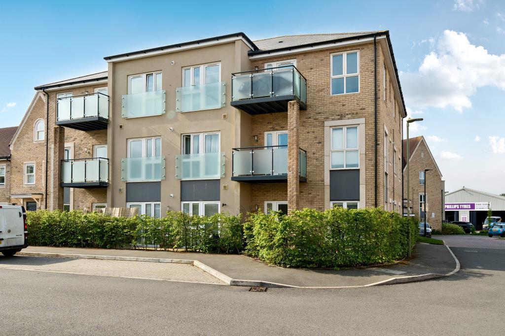
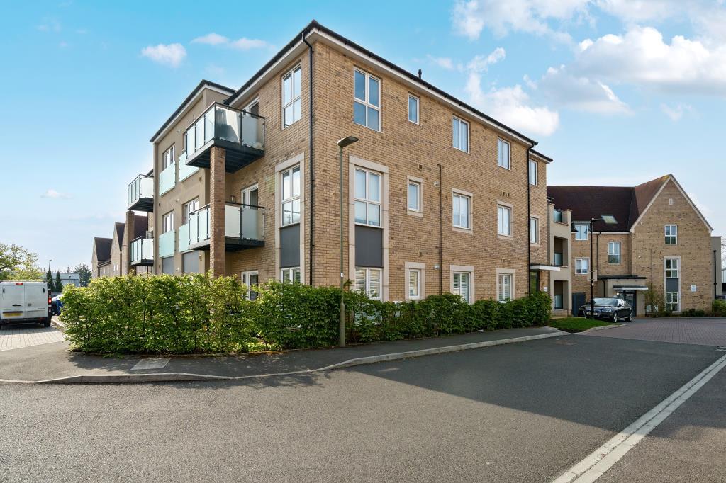
17 CLIFTON CLOSE
BICESTER, CHERWELL, OXFORDSHIRE, OX26 6GQ
£261,000
Location
Nearby
Nearest stations, universities and amenities (distance from property).
| Type | Name | Distance |
|---|---|---|
| Shop | Space Module | 0.0 miles |
| Bus stop | Bristol Road | 0.4 miles |
| Train station | Bicester North | 0.4 miles |
| University | Vinson Building | 9.2 miles |
| Hospital | John Radcliffe Hospital | 9.9 miles |
Property details
Tenure
Leasehold
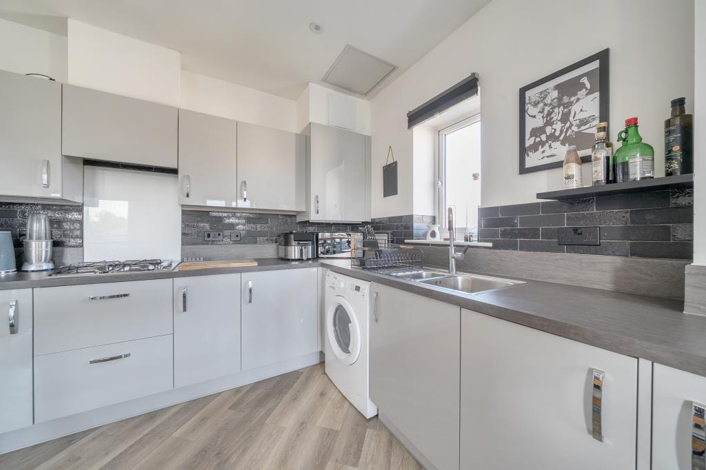
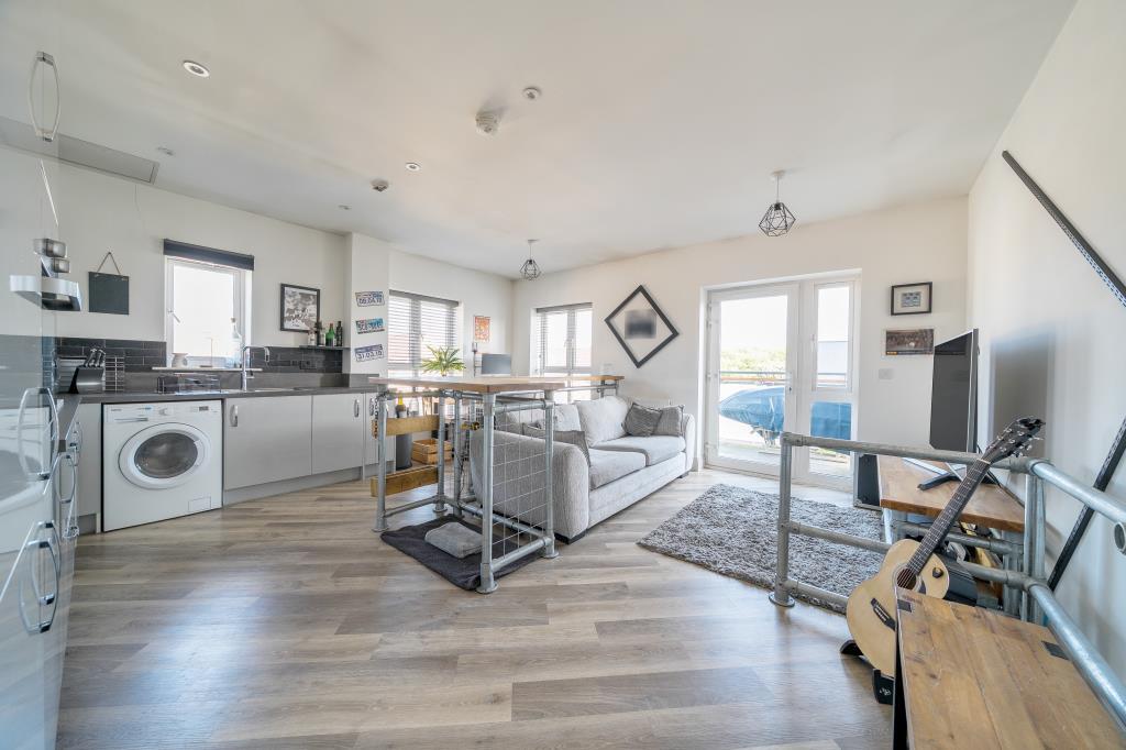
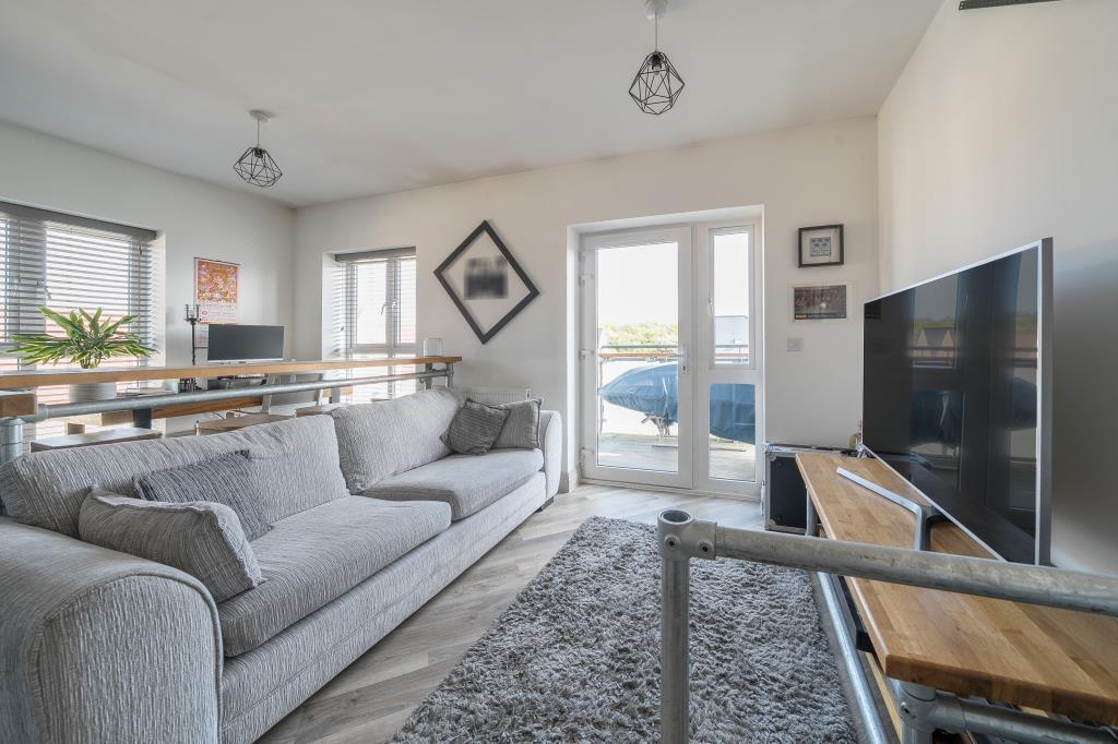
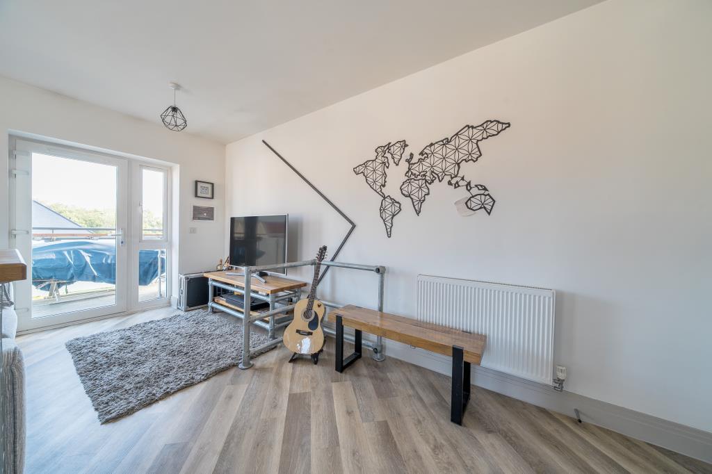
Property type
Flat
Bedrooms
2
Bathrooms
2
Floor area
73 m²
EPC rating
B
Last sold
£261,000 Feb 2026
Price per m²
£3,575/m²
Local average
£210,934 (16 sales)
Street crime
188 incidents within 1 mile (Apr 2026)
EPC Rating & Upgrade Cost
Current rating: B
Potential rating: B
Inspection date: 25/09/2019
Expiry date: 24/09/2029
Current heating cost: £200/year
Potential heating cost: £200/year
Price history
| Event | Date | Price | Type | % change | Today’s value (HPI) | Action |
|---|---|---|---|---|---|---|
| Sold | 19/02/2026 | £261,000 | Flat | +7.4% | £262,098 to March 2026 | View transaction |
| Sold | 29/11/2019 | £243,000 | Flat | — | £278,255 to March 2026 | View transaction |
Historic listings
Listing and sale events only where we matched the listing page to a Land Registry sale already on record for this address.
| Event | Date | Price |
|---|---|---|
| sold | 01/01/2026 | £261,000 |
| listed | 26/04/2025 | £260,000 |
| sold | 01/01/2019 | £243,000 |
Photos · Open listing
 Open image 1 from listing 161170844
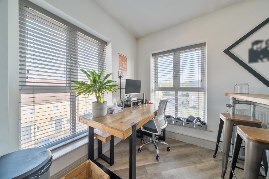
 Open image 2 from listing 161170844
 Open image 3 from listing 161170844
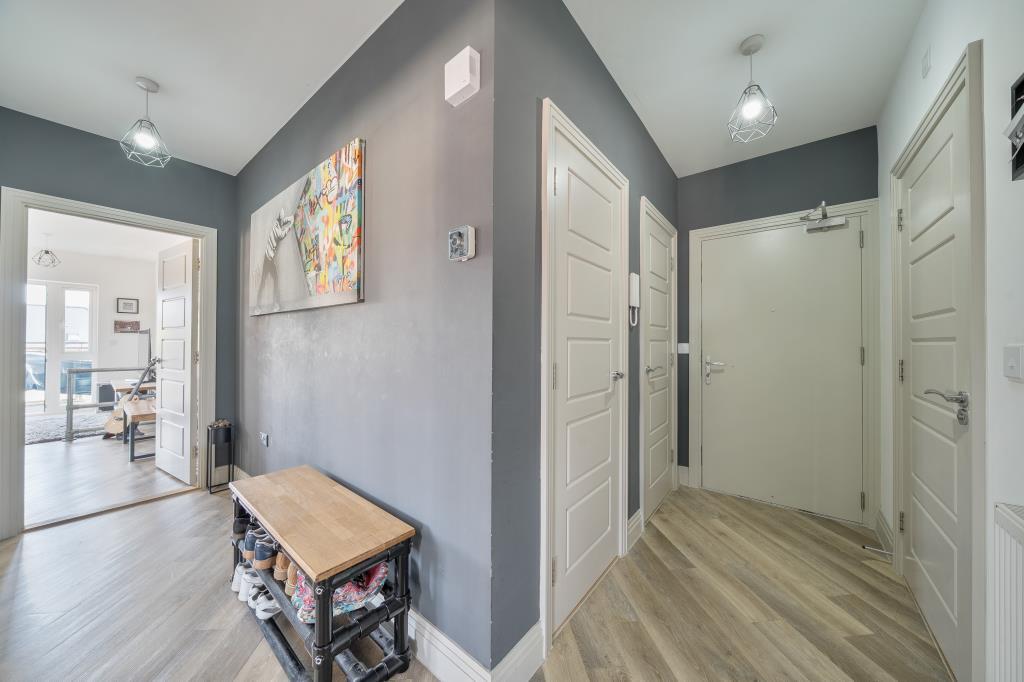
 Open image 4 from listing 161170844
 Open image 5 from listing 161170844
 Open image 6 from listing 161170844
 Open image 7 from listing 161170844
 Open image 8 from listing 161170844
 Open image 9 from listing 161170844
 Open image 10 from listing 161170844
 Open image 11 from listing 161170844
 Open image 12 from listing 161170844
Sold comparables
Same street and nearby sales within 0.25 miles (last 5 years). Land Registry Price Paid Data.
| Address | Price | Date | Type |
|---|---|---|---|
| 19 CLIFTON CLOSE, BICESTER, CHERWELL, OXFORDSHIRE, OX26 6GQ | £255,000 | 25/11/2025 | Flat |
| 10 CLIFTON CLOSE, BICESTER, CHERWELL, OXFORDSHIRE, OX26 6GQ | £210,000 | 15/09/2022 | Flat |
| 52 MOOR POND CLOSE, BICESTER, CHERWELL, OXFORDSHIRE, OX26 6GB | £166,000 | 21/01/2022 | Flat |
| 36 CLIFTON CLOSE, BICESTER, CHERWELL, OXFORDSHIRE, OX26 6GQ | £61,250 | 27/09/2021 | Flat |
Area average: £173,063 (4 sales)
For sale comparables
No active for-sale comparables found within 1 mile for the same bedrooms and property type.
Capital growth trend
Land Registry outcode average: last 12 months vs 5y and 10y ago (from sold prices).
House Price Index (HM Land Registry — official index, not sold-price averages): Cherwell. Series: Flats and maisonettes. As of March 2026.
Rental Range
Estimated market rent for Cherwell. Low = conservative, Realistic = average, Optimistic = best case.
Based on Local Authority from postcode lookup → Cherwell.
LHA (30th percentile) floor for Cherwell Valley: Apr 2025 – Mar 2026
Rental Comparables
Loading rental comparables for this postcode. Refresh in a few minutes.
Rent-driven metrics
Based on Area rent estimate.
- Rent ratio — Monthly rent ÷ purchase price (1% rule). 1%+ = strong, 0.8–1% = okay, <0.8% = weak for cashflow.
- Max investor price — Rent ÷ 0.8%; the price at which rent would be 0.8% of price (Stoke-style target).
- Target investor price — Rent ÷ 1%; the price at which rent would be 1% of price (strong cashflow band).
- Gross yield — Annual rent as % of purchase price (no costs).
Flood risk
Zone: 1
Risk: Low
Not in Flood Risk Area (no data)
Street-level crime
| Category | Count |
|---|---|
| Violence and sexual offences | 59 |
| Shoplifting | 39 |
| Criminal damage and arson | 17 |
| Anti-social behaviour | 15 |
| Other theft | 13 |
| Public order | 11 |
| Vehicle crime | 10 |
| Bicycle theft | 6 |
| Burglary | 6 |
| Drugs | 4 |
| Theft from the person | 3 |
| Other crime | 2 |
| Robbery | 2 |
| Possession of weapons | 1 |
| Total incidents | 188 |
Within 1 mile during Apr 2026. Source: data.police.uk (England & Wales).
Schools nearby
Nearest open schools with Ofsted ratings (England). Closed schools are not shown. Data from Get Information about Schools and Ofsted.
| Name | Type | Distance | Ofsted |
|---|---|---|---|
| Longfields Primary and Nursery School | Primary | 0.2 miles | Good — 11 Apr 2013 |
| The Cooper School | Secondary | 0.6 miles | Requires improvement — 30 Jan 2023 |
| Langford Village Community Primary School | Primary | 0.6 miles | Good — 27 Jun 2013 |
| Brookside Primary School | Primary | 0.7 miles | Good — 1 Jan 2011 |
| St Mary's Catholic Primary School, Bicester | Primary | 0.7 miles | Good — 13 Mar 2013 |
FENSA
No FENSA certificates found for this address.