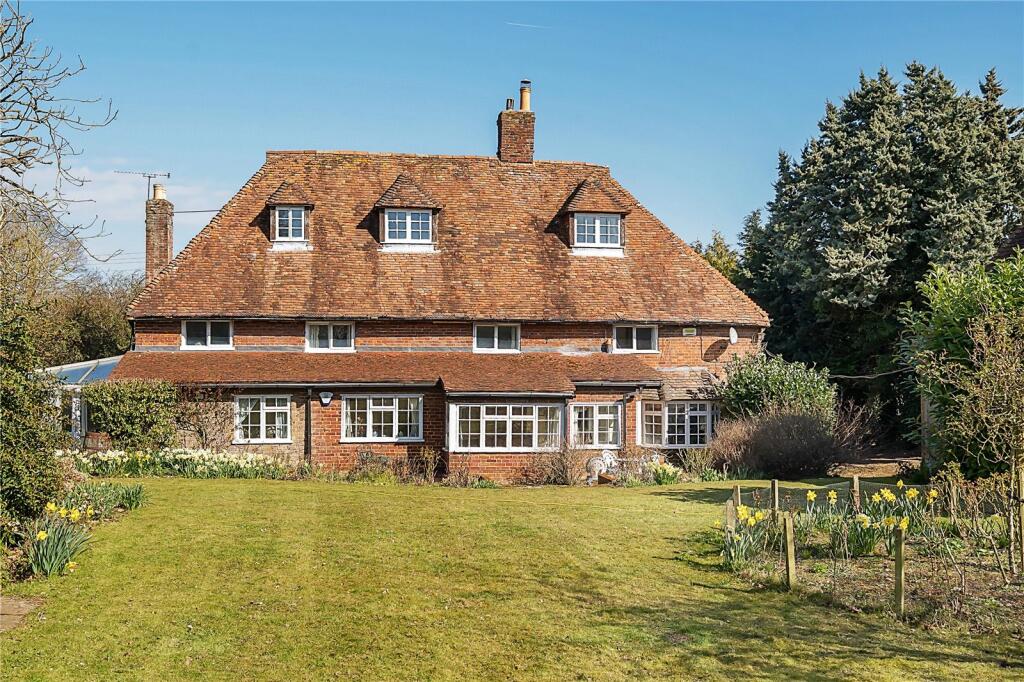
HOAD HOUSE OAD STREET
BORDEN, SITTINGBOURNE, SWALE, KENT, ME9 8LB
£705,000
Location
Nearby
Nearest stations, universities and amenities (distance from property).
| Type | Name | Distance |
|---|---|---|
| Shop | Oad Street Food and Crafts | 0.1 miles |
| Bus stop | Sutton Baron Road | 0.5 miles |
| Train station | Newington | 1.9 miles |
| Hospital | Sittingbourne Memorial Hospital | 2.3 miles |
| University | Canterbury Christ Church University | 4.2 miles |
Property details
Tenure
Freehold
Property type
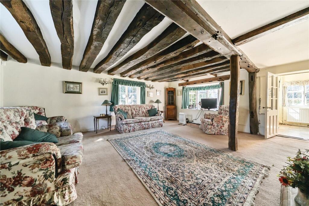
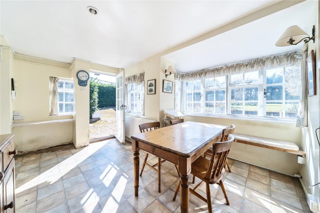
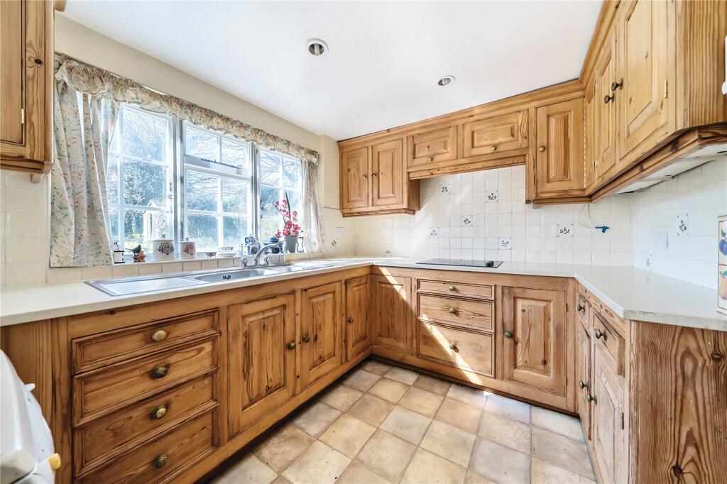
Detached
Bathrooms
2
Floor area
266 m²
EPC rating
G
Year built
England and Wales: before 1900
Last sold
£705,000 Mar 2026
Price per m²
£2,650/m²
Local average
£580,185 (27 sales)
Street crime
5 incidents within 1 mile (Apr 2026)
EPC Rating & Upgrade Cost
Current rating: G
Potential rating: F
Inspection date: 02/10/2025
Expiry date: 01/10/2035
Current heating cost: £12,564/year
Potential heating cost: £6,256/year
Est. upgrade cost to C: £37,985
Recommendations
- Flat roof or sloping ceiling insulation (£900 - £1,200)
- 50 mm internal or external wall insulation (£7,500 - £11,000)
- Floor insulation (suspended floor) (£5,000 - £10,000)
- Draughtproof single-glazed windows (£150 - £250)
- Upgrade heating controls (£220 - £250)
- Solar water heating (£4,000 - £7,000)
- Replace single glazed windows with low-E double glazing (£4,500 - £6,000)
- Solar photovoltaic panels, 2.5 kWp (£8,000 - £10,000)
Price history
| Event | Date | Price | Type | % change | Today’s value (HPI) | Action |
|---|---|---|---|---|---|---|
| Sold | 12/03/2026 | £705,000 | Detached | +166% | £705,000 to March 2026 | View transaction |
| Sold | 02/12/1996 | £265,000 | Detached | — | £1,416,847 to March 2026 | View transaction |
Historic listings
Listing and sale events only where we matched the listing page to a Land Registry sale already on record for this address.
| Event | Date | Price |
|---|---|---|
| sold | 01/01/2026 | £705,000 |
| listed | 21/06/2025 | £750,000 |
| sold | 01/01/1996 | £265,000 |
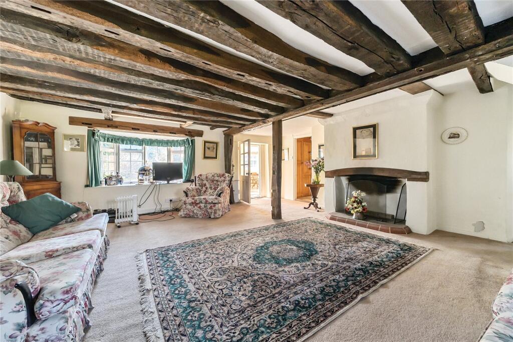
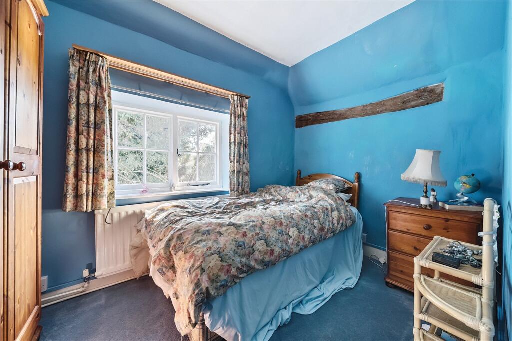
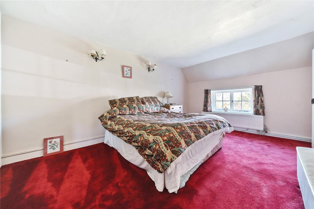
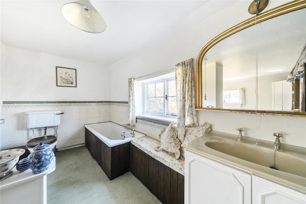
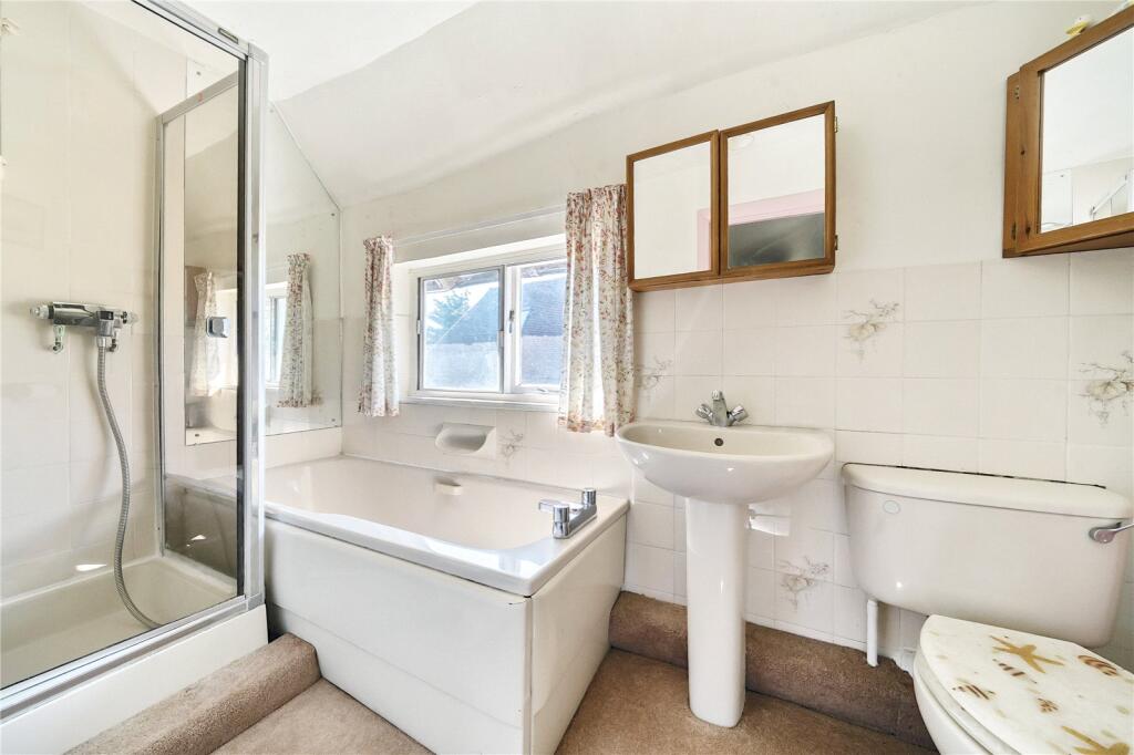
Photos · Open listing
 Open image 1 from listing 163629815
 Open image 2 from listing 163629815
 Open image 3 from listing 163629815
 Open image 4 from listing 163629815
 Open image 5 from listing 163629815
 Open image 6 from listing 163629815
 Open image 7 from listing 163629815
 Open image 8 from listing 163629815
 Open image 9 from listing 163629815
 Open image 10 from listing 163629815
 Open image 11 from listing 163629815
 Open image 12 from listing 163629815
Sold comparables
Same street and nearby sales within 0.25 miles (last 5 years). Land Registry Price Paid Data.
| Address | Price | Date | Type |
|---|---|---|---|
| THE CHAPEL OAD STREET, BORDEN, SITTINGBOURNE, SWALE, KENT, ME9 8LB | £270,000 | 12/04/2023 | Detached |
Area average: £270,000 (1 sale)
For sale comparables
No active for-sale comparables found within 1 mile for the same property type.
Capital growth trend
Land Registry outcode average: last 12 months vs 5y and 10y ago (from sold prices).
House Price Index (HM Land Registry — official index, not sold-price averages): Swale. Series: Detached. As of March 2026.
Rental Range
Estimated market rent for Swale. Low = conservative, Realistic = average, Optimistic = best case.
Based on Local Authority from postcode lookup → Swale.
Rental Comparables
Loading rental comparables for this postcode. Refresh in a few minutes.
Rent-driven metrics
Based on Area rent estimate.
- Rent ratio — Monthly rent ÷ purchase price (1% rule). 1%+ = strong, 0.8–1% = okay, <0.8% = weak for cashflow.
- Max investor price — Rent ÷ 0.8%; the price at which rent would be 0.8% of price (Stoke-style target).
- Target investor price — Rent ÷ 1%; the price at which rent would be 1% of price (strong cashflow band).
- Gross yield — Annual rent as % of purchase price (no costs).
Flood risk
Zone: 1
Risk: Low
Job (default Low)
Street-level crime
| Category | Count |
|---|---|
| Violence and sexual offences | 3 |
| Anti-social behaviour | 2 |
| Total incidents | 5 |
Within 1 mile during Apr 2026. Source: data.police.uk (England & Wales).
Schools nearby
Nearest open schools with Ofsted ratings (England). Closed schools are not shown. Data from Get Information about Schools and Ofsted.
| Name | Type | Distance | Ofsted |
|---|---|---|---|
| Borden Church of England Primary School | Primary | 0.9 miles | — (Inspected (no overall grade)) |
| Bredgar Church of England Primary School | Primary | 1.3 miles | Good — 27 Feb 2012 |
| Westlands School | Secondary | 1.6 miles | Good — 20 Mar 2019 |
| Minterne Junior School | Primary | 1.8 miles | Good — 7 May 2014 |
| Westlands Primary School | Primary | 1.8 miles | — (Inspected (no overall grade)) |
FENSA
No FENSA certificates found for this address.