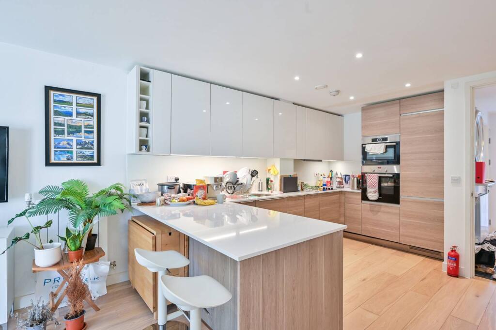
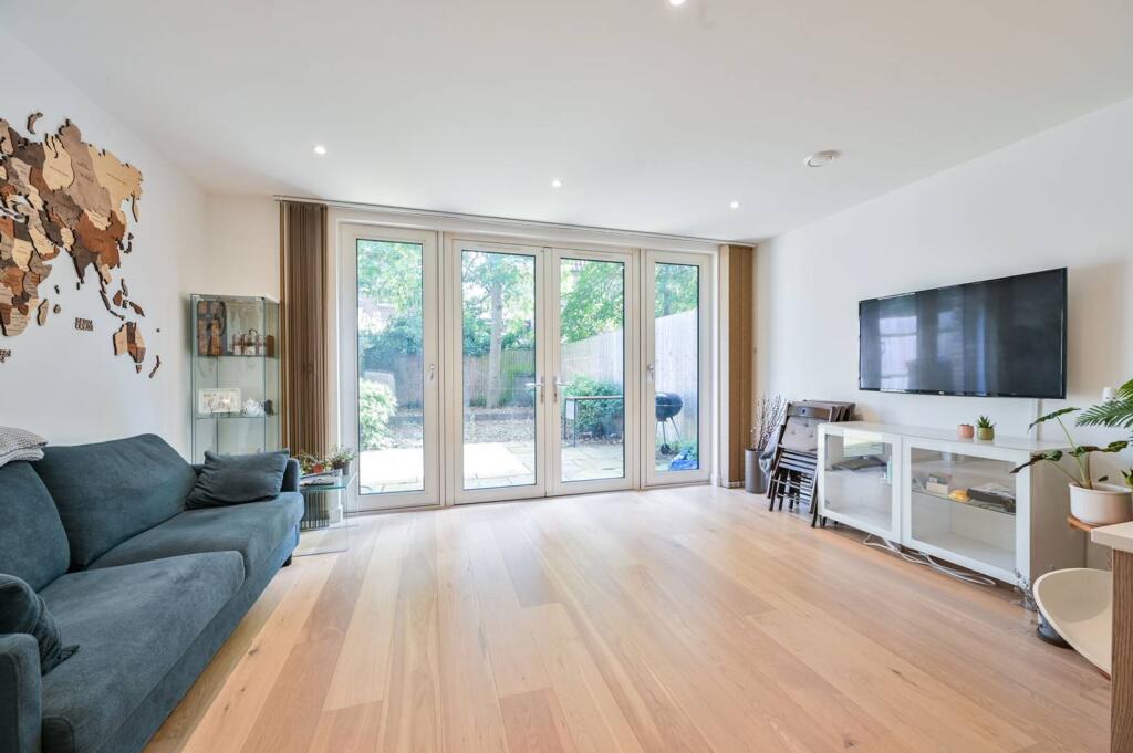
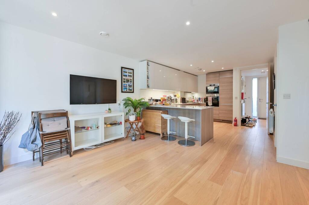
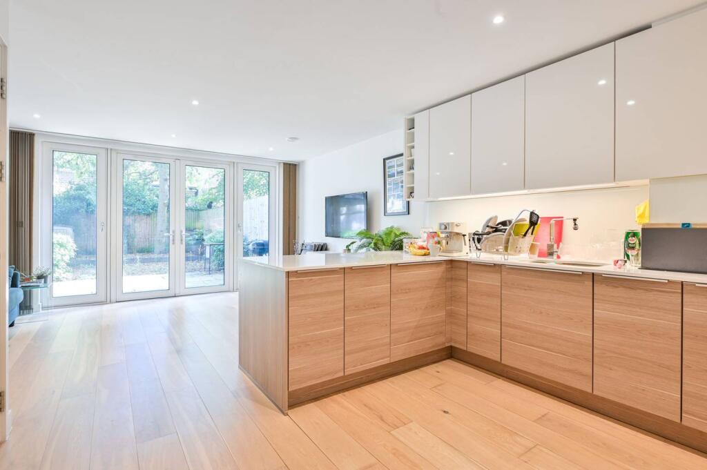
84 MARY ROSE SQUARE
LONDON, LEWISHAM, GREATER LONDON, SE16 7EL
£995,000
Location
Nearby
Nearest stations, universities and amenities (distance from property).
| Type | Name | Distance |
|---|---|---|
| Shop | Headcase | 0.1 miles |
| Bus stop | Windlass Place | 0.1 miles |
| Train station | Surrey Quays | 0.5 miles |
| University | University of Greenwich | 1.4 miles |
| Hospital | Dental Hospital | 2.8 miles |
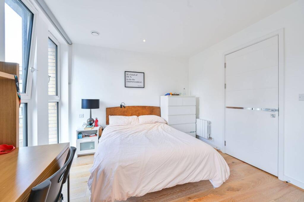
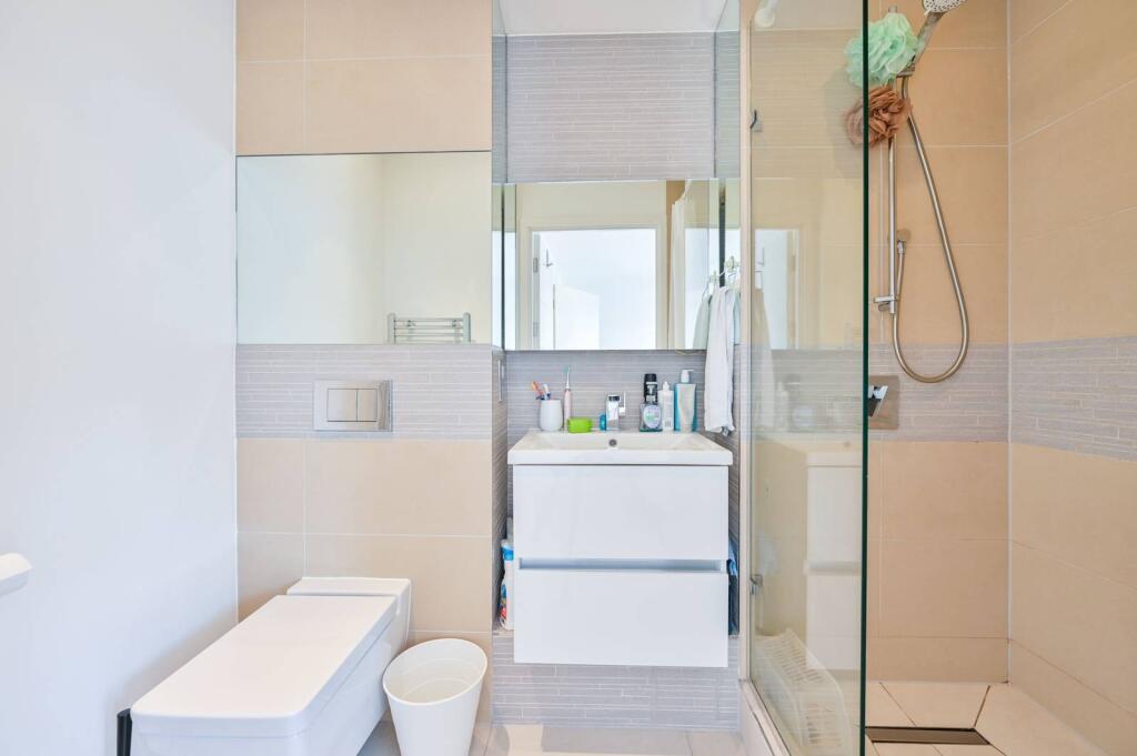
Property details
Tenure
Freehold
Property type
Terraced
Bedrooms
4
Bathrooms
4
Floor area
139 m²
EPC rating
B
Last sold
£995,000 Mar 2026
Price per m²
£7,158/m²
Local average
£730,262 (21 sales)
Street crime
788 incidents within 1 mile (Apr 2026)
EPC Rating & Upgrade Cost
Current rating: B
Potential rating: A
Inspection date: 26/02/2016
Expiry date: 25/02/2026 (expired)
Current heating cost: £248/year
Potential heating cost: £250/year
Est. upgrade cost to C: £11,500
Recommendations
- Solar water heating (£4,000 - £6,000)
- Solar photovoltaic panels, 2.5 kWp (£5,000 - £8,000)
Price history
| Event | Date | Price | Type | % change | Today’s value (HPI) | Action |
|---|---|---|---|---|---|---|
| Sold | 11/03/2026 | £995,000 | Terraced | +11.8% | £995,000 to March 2026 | View transaction |
| Sold | 31/03/2016 | £890,000 | Terraced | — | £1,128,184 to March 2026 | View transaction |
Historic listings
Listing and sale events only where we matched the listing page to a Land Registry sale already on record for this address.
| Event | Date | Price |
|---|---|---|
| sold | 01/01/2026 | £995,000 |
| listed | 17/09/2025 | £995,000 |
| sold | 01/01/2016 | £890,000 |
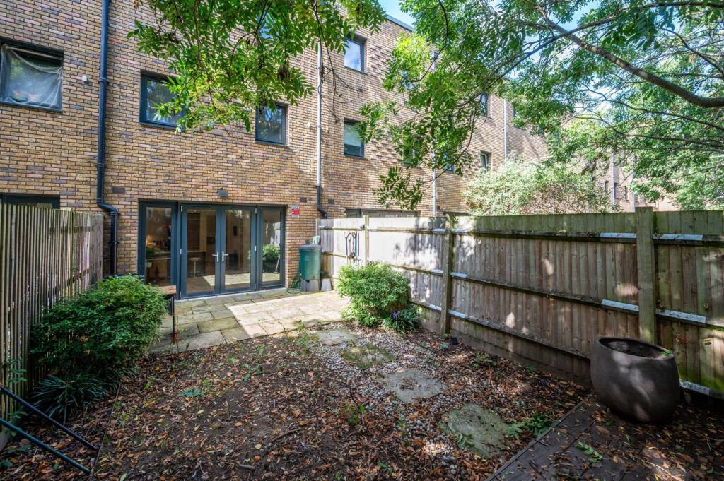
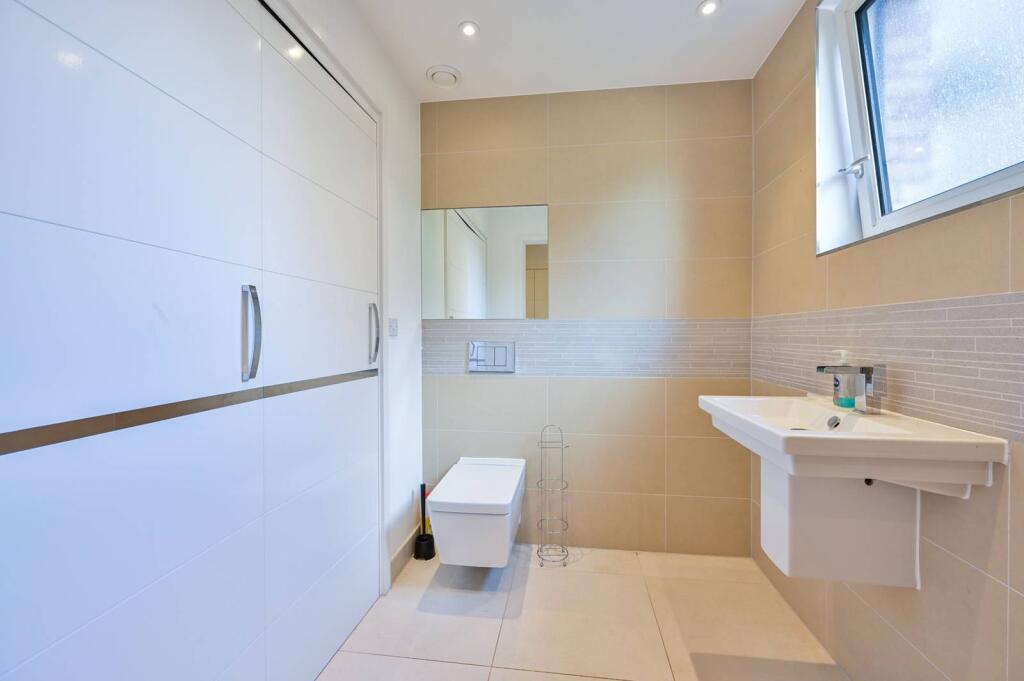
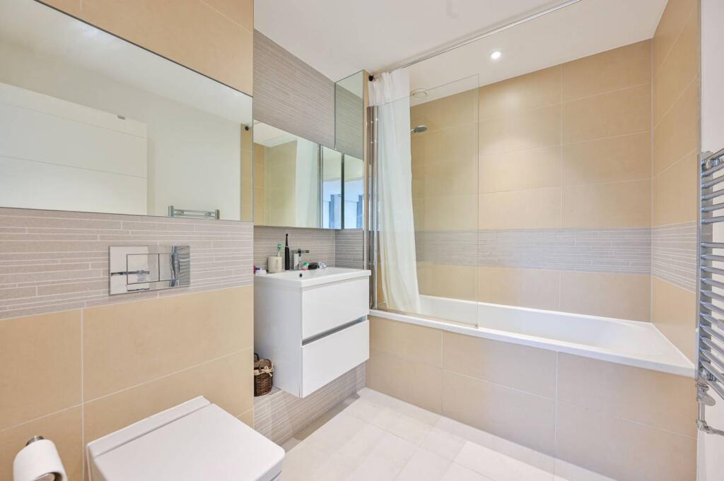
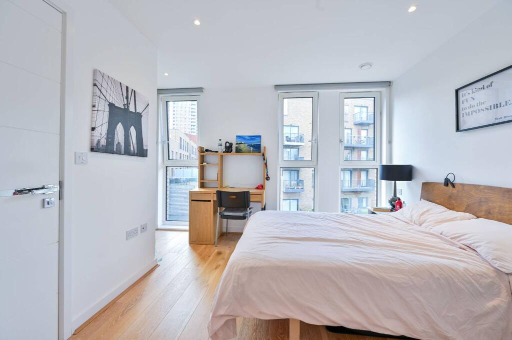
Photos · Open listing
 Open image 1 from listing 167111150
 Open image 2 from listing 167111150
 Open image 3 from listing 167111150
 Open image 4 from listing 167111150
 Open image 5 from listing 167111150
 Open image 6 from listing 167111150
 Open image 7 from listing 167111150
 Open image 8 from listing 167111150
 Open image 9 from listing 167111150
 Open image 10 from listing 167111150
 Open image 11 from listing 167111150
 Open image 12 from listing 167111150
Sold comparables
Same street and nearby sales within 0.25 miles (last 5 years). Land Registry Price Paid Data.
| Address | Price | Date | Type |
|---|---|---|---|
| 169 PLOUGH WAY, LONDON, SOUTHWARK, GREATER LONDON, SE16 7FN | £700,000 | 13/01/2026 | Terraced |
| 24 CARTERET WAY, LONDON, LEWISHAM, GREATER LONDON, SE8 3QA | £601,000 | 23/09/2022 | Terraced |
| 77 MARY ROSE SQUARE, LONDON, LEWISHAM, GREATER LONDON, SE16 7EL | £975,000 | 16/09/2022 | Terraced |
| 203 PLOUGH WAY, LONDON, SOUTHWARK, GREATER LONDON, SE16 7FN | £1,000,000 | 22/07/2022 | Terraced |
| 197 PLOUGH WAY, LONDON, SOUTHWARK, GREATER LONDON, SE16 7FN | £775,000 | 26/01/2022 | Terraced |
| 1 HOCKETT CLOSE, LONDON, LEWISHAM, GREATER LONDON, SE8 3PX | £561,000 | 22/12/2021 | Terraced |
Area average: £768,667 (6 sales)
For sale comparables
No active for-sale comparables found within 1 mile for the same bedrooms and property type.
Capital growth trend
Land Registry outcode average: last 12 months vs 5y and 10y ago (from sold prices).
House Price Index (HM Land Registry — official index, not sold-price averages): Lewisham. Series: Terraced. As of March 2026.
Rental Range
Estimated market rent for Lewisham. Low = conservative, Realistic = average, Optimistic = best case.
Based on Local Authority from postcode lookup → Lewisham.
LHA (30th percentile) floor for Cambridge: Apr 2025 – Mar 2026
Rental Comparables
Loading rental comparables for this postcode. Refresh in a few minutes.
Rent-driven metrics
Based on Area rent estimate.
- Rent ratio — Monthly rent ÷ purchase price (1% rule). 1%+ = strong, 0.8–1% = okay, <0.8% = weak for cashflow.
- Max investor price — Rent ÷ 0.8%; the price at which rent would be 0.8% of price (Stoke-style target).
- Target investor price — Rent ÷ 1%; the price at which rent would be 1% of price (strong cashflow band).
- Gross yield — Annual rent as % of purchase price (no costs).
Flood risk
Zone: 1
Risk: Low
Not in Flood Risk Area (no data)
Street-level crime
| Category | Count |
|---|---|
| Violence and sexual offences | 219 |
| Anti-social behaviour | 169 |
| Theft from the person | 91 |
| Other theft | 48 |
| Burglary | 47 |
| Vehicle crime | 40 |
| Criminal damage and arson | 34 |
| Shoplifting | 31 |
| Public order | 30 |
| Drugs | 29 |
| Robbery | 26 |
| Bicycle theft | 14 |
| Other crime | 7 |
| Possession of weapons | 3 |
| Total incidents | 788 |
Within 1 mile during Apr 2026. Source: data.police.uk (England & Wales).
Schools nearby
Nearest open schools with Ofsted ratings (England). Closed schools are not shown. Data from Get Information about Schools and Ofsted.
| Name | Type | Distance | Ofsted |
|---|---|---|---|
| Deptford Park Primary School | Primary | 0.2 miles | Good — 3 Sep 2013 |
| Marathon Science School | Other | 0.2 miles | Inadequate — 28 Jun 2023 |
| Twin Oaks Primary School | Primary | 0.4 miles | Good — 2 Mar 2022 |
| Clyde Nursery School. | Nursery | 0.5 miles | Good — 27 May 2024 |
| Arnhem Wharf Primary School | Primary | 0.5 miles | Good — 11 Jul 2013 |
FENSA
No FENSA certificates found for this address.