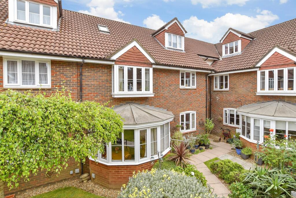
BRIARWOOD 2 HIGH STREET
BANSTEAD, REIGATE AND BANSTEAD, SURREY, SM7 2JA
£345,000
Location
Nearby
Nearest stations, universities and amenities (distance from property).
| Type | Name | Distance |
|---|---|---|
| Shop | Shortlands | 0.0 miles |
| Bus stop | Banstead / Marks & Spencer | 0.1 miles |
| Train station | Banstead | 0.7 miles |
| Hospital | SpaMedica Epsom | 2.8 miles |
| University | Horton Halls Reception | 8.0 miles |
Property details
Tenure
Leasehold
Property type
Flat
Bedrooms
2
Bathrooms
1
Last sold
£345,000 Jan 2026
Local average
£321,538 (13 sales)
Street crime
53 incidents within 1 mile (Apr 2026)
EPC Rating & Upgrade Cost
Fetching EPC data… Refresh this page in a moment.
Price history
| Event | Date | Price | Type | % change | Today’s value (HPI) | Action |
|---|---|---|---|---|---|---|
| Sold | 23/01/2026 | £345,000 | Flat | +50% | £357,268 to March 2026 | View transaction |
| Sold | 17/06/2014 | £230,000 | Flat | — | £301,954 to March 2026 | View transaction |
Historic listings
Listing and sale events only where we matched the listing page to a Land Registry sale already on record for this address.
| Event | Date | Price |
|---|---|---|
| sold | 01/01/2026 | £345,000 |
| listed | 11/06/2025 | £360,000 |
| sold | 01/01/2014 | £230,000 |
| sold | 01/01/2003 | £170,000 |
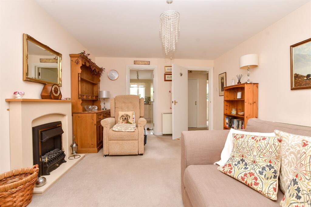
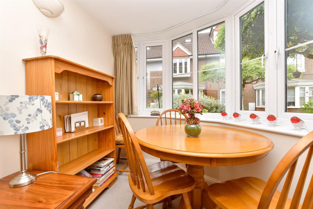
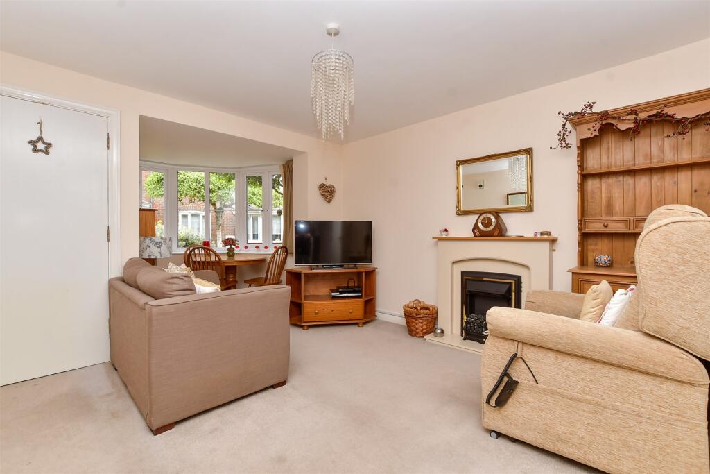
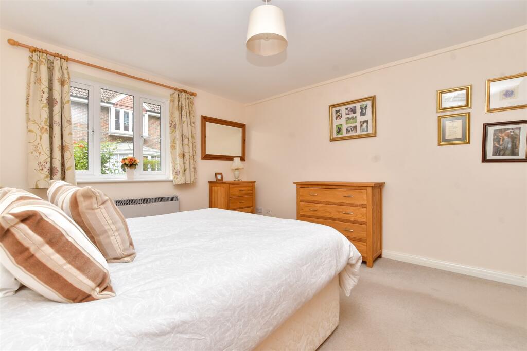
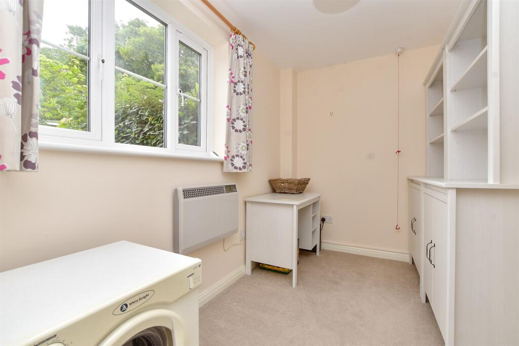
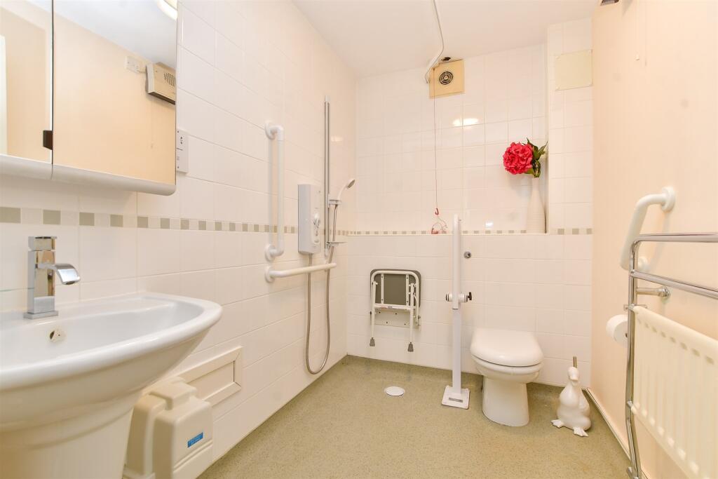
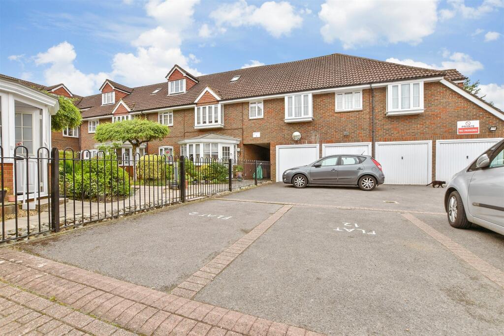
Photos · Open listing
 Open image 1 from listing 163158005
 Open image 2 from listing 163158005
 Open image 3 from listing 163158005
 Open image 4 from listing 163158005
 Open image 5 from listing 163158005
 Open image 6 from listing 163158005
 Open image 7 from listing 163158005
 Open image 8 from listing 163158005
 Open image 9 from listing 163158005
 Open image 10 from listing 163158005
 Open image 11 from listing 163158005
Sold comparables
Same street and nearby sales within 0.25 miles (last 5 years). Land Registry Price Paid Data.
| Address | Price | Date | Type |
|---|---|---|---|
| BRIARWOOD 7 HIGH STREET, BANSTEAD, REIGATE AND BANSTEAD, SURREY, SM7 2JA | £285,000 | 06/09/2022 | Flat |
| BRIARWOOD 4 HIGH STREET, BANSTEAD, REIGATE AND BANSTEAD, SURREY, SM7 2JA | £255,000 | 08/11/2021 | Flat |
Area average: £270,000 (2 sales)
For sale comparables
No active for-sale comparables found within 1 mile for the same bedrooms and property type.
Capital growth trend
Land Registry outcode average: last 12 months vs 5y and 10y ago (from sold prices).
House Price Index (HM Land Registry — official index, not sold-price averages): Reigate and Banstead. Series: Flats and maisonettes. As of March 2026.
Rental Range
Estimated market rent for Reigate and Banstead. Low = conservative, Realistic = average, Optimistic = best case.
Based on Local Authority from postcode lookup → Reigate and Banstead.
LHA (30th percentile) floor for Stevenage & North Herts: Apr 2025 – Mar 2026
Rental Comparables
Residential lets in the area (all bedroom counts shown — none matched the 2-bedroom count for this property). Student lets are excluded.
| Title | Rent | Beds | Distance | As seen on |
|---|---|---|---|---|
| 1 Bed Flat, Bolters Lane, SM7 | £1,550/mo | 1 | 0.06 miles | OpenRent |
Average rent: £1,550/mo (1 listing)
Rent-driven metrics
Based on OpenRent comparables.
- Rent ratio — Monthly rent ÷ purchase price (1% rule). 1%+ = strong, 0.8–1% = okay, <0.8% = weak for cashflow.
- Max investor price — Rent ÷ 0.8%; the price at which rent would be 0.8% of price (Stoke-style target).
- Target investor price — Rent ÷ 1%; the price at which rent would be 1% of price (strong cashflow band).
- Gross yield — Annual rent as % of purchase price (no costs).
- Cost-to-rent — Price ÷ annual rent (from OpenRent comparables). Under 14× = strong, 14–16× = acceptable, 17×+ = compressed.
- Cashflow — Rent minus mortgage, 10% maintenance, £25/mo compliance. Assumes 75% LTV, 3.95% APR (5yr fixed), 25yr term.
- ROI — Annual profit ÷ cash in (deposit + 4% purchase costs).
Flood risk
Zone: 1
Risk: Low
Job (default Low)
Street-level crime
| Category | Count |
|---|---|
| Violence and sexual offences | 14 |
| Anti-social behaviour | 13 |
| Vehicle crime | 9 |
| Public order | 6 |
| Criminal damage and arson | 4 |
| Burglary | 2 |
| Other crime | 2 |
| Other theft | 2 |
| Drugs | 1 |
| Total incidents | 53 |
Within 1 mile during Apr 2026. Source: data.police.uk (England & Wales).
Schools nearby
Nearest open schools with Ofsted ratings (England). Closed schools are not shown. Data from Get Information about Schools and Ofsted.
| Name | Type | Distance | Ofsted |
|---|---|---|---|
| St Anne's Catholic Primary School | Primary | 0.1 miles | Good — 26 Jun 2014 |
| Banstead Community Junior School | Primary | 0.2 miles | Good — 26 Jul 2023 |
| Banstead Infant School | Primary | 0.3 miles | Good — 4 Nov 2018 |
| Banstead Preparatory School | Other | 0.7 miles | — (No rating) |
| The Beacon School | Secondary | 0.7 miles | Requires improvement — 29 Jun 2023 |
FENSA
Checking FENSA certificates for this address. Refresh in a few minutes.