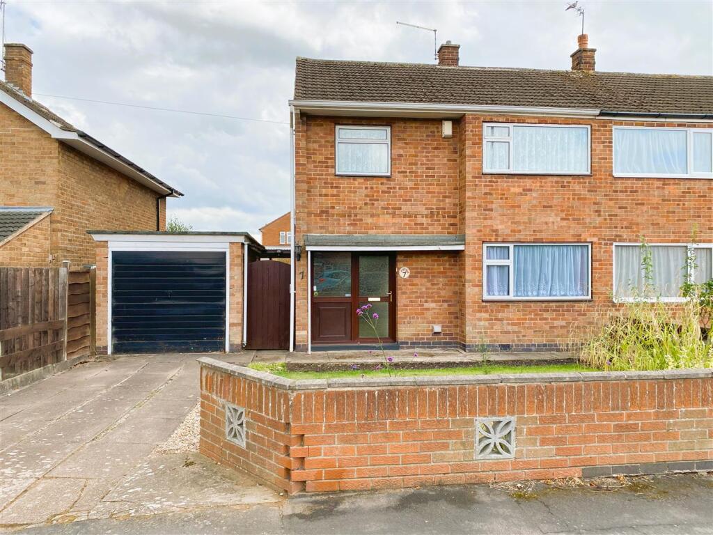
7 ALLINGTON DRIVE
BIRSTALL, LEICESTER, CHARNWOOD, LEICESTERSHIRE, LE4 4FD
£240,000
Location
Nearby
Nearest stations, universities and amenities (distance from property).
| Type | Name | Distance |
|---|---|---|
| Bus stop | Windmill Avenue | 0.2 miles |
| Shop | Bargain Booze | 0.5 miles |
| Train station | Leicester North | 1.3 miles |
| Hospital | Leicester Nuffield Hospital | 3.2 miles |
| University | University of Leicester | 4.9 miles |
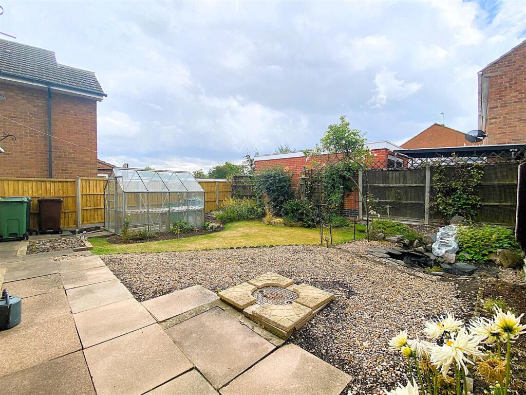
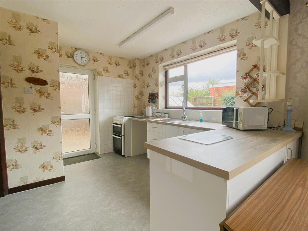
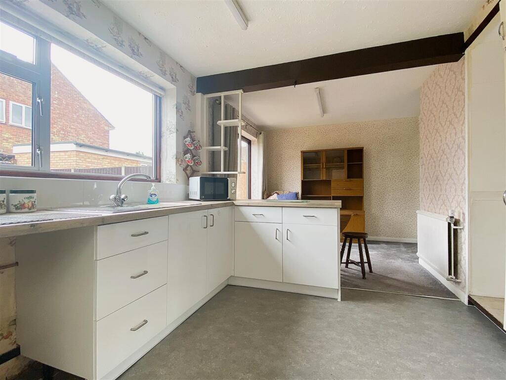
Property details
Tenure
Freehold
Property type
Semi-detached
Bedrooms
3
Bathrooms
1
Floor area
81 m²
EPC rating
C
Year built
England and Wales: 1950-1966
Last sold
£240,000 Mar 2026
Price per m²
£2,963/m²
Local average
£272,716 (101 sales)
Street crime
112 incidents within 1 mile (Apr 2026)
EPC Rating & Upgrade Cost
Current rating: C
Potential rating: B
Inspection date: 22/07/2025
Expiry date: 21/07/2035
Current heating cost: £778/year
Potential heating cost: £721/year
Est. upgrade cost to C: £16,500
Recommendations
- Floor insulation (solid floor) (£5,000 - £10,000)
- Solar photovoltaic panels, 2.5 kWp (£8,000 - £10,000)
Price history
| Event | Date | Price | Type | % change | Today’s value (HPI) | Action |
|---|---|---|---|---|---|---|
| Sold | 17/03/2026 | £240,000 | Semi-detached | — | £240,000 to March 2026 | View transaction |
Historic listings
Listing and sale events only where we matched the listing page to a Land Registry sale already on record for this address.
| Event | Date | Price |
|---|---|---|
| sold | 01/01/2026 | £240,000 |
| listed | 18/07/2025 | £270,000 |
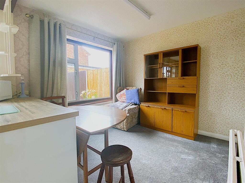
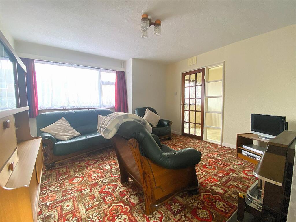
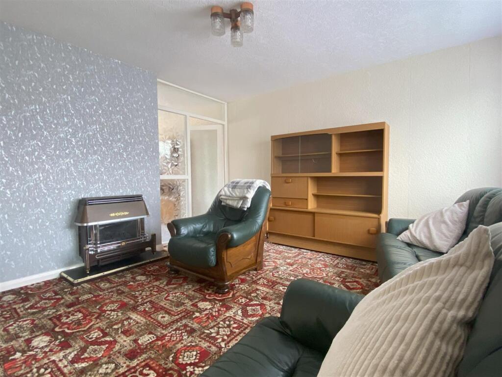
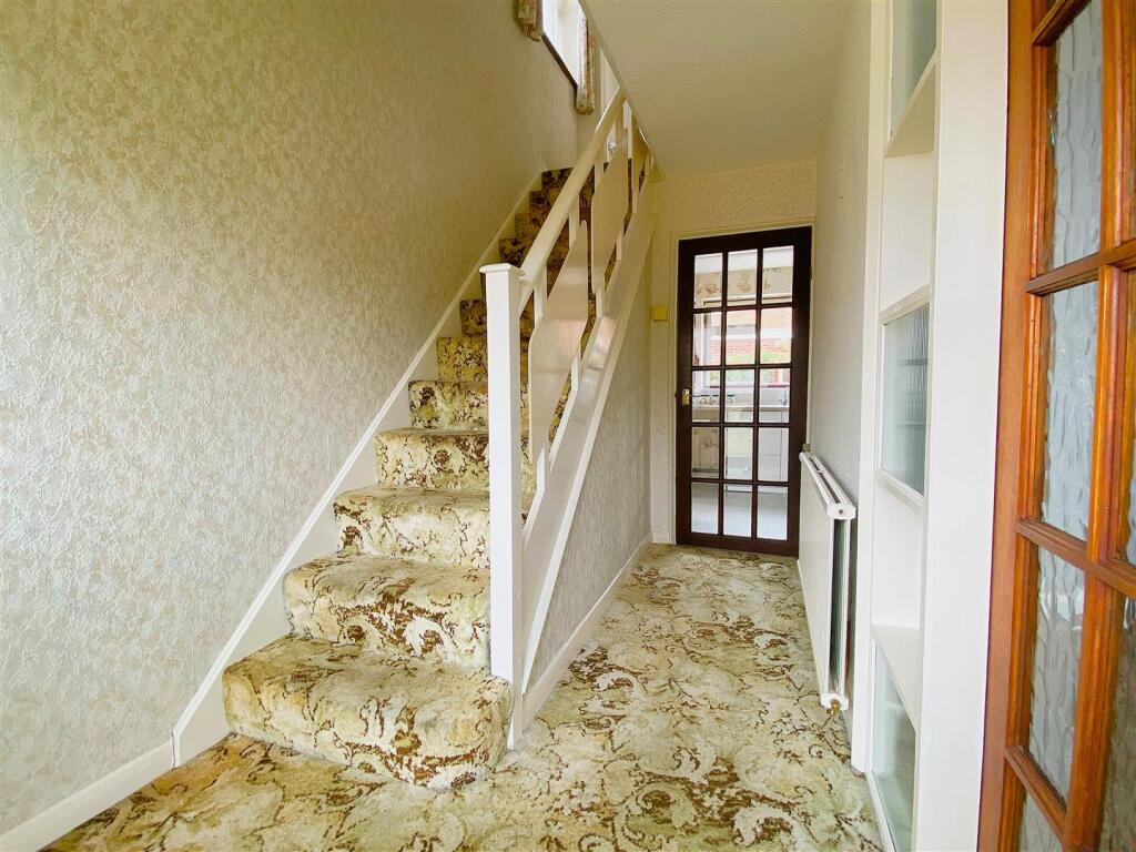
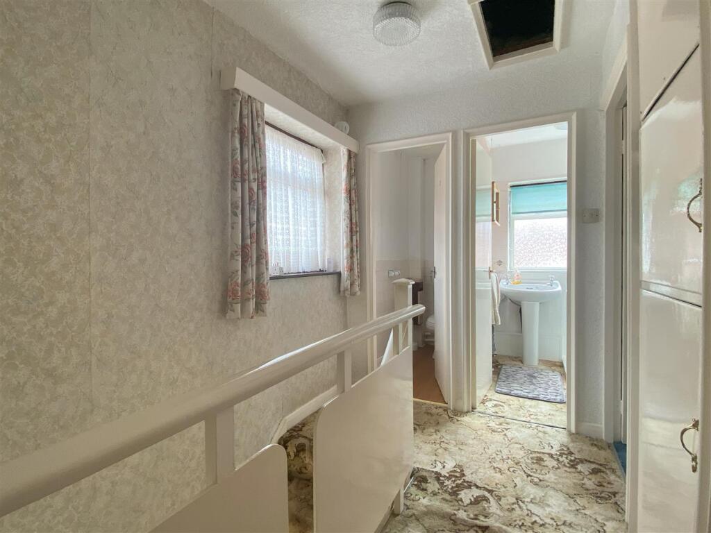
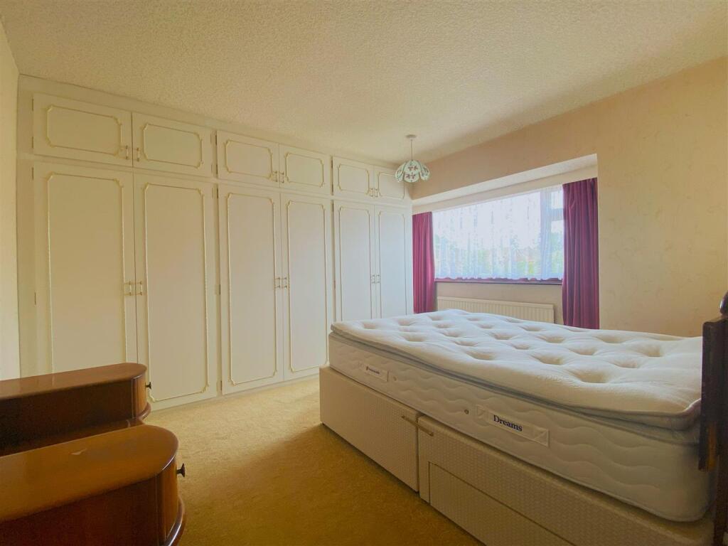
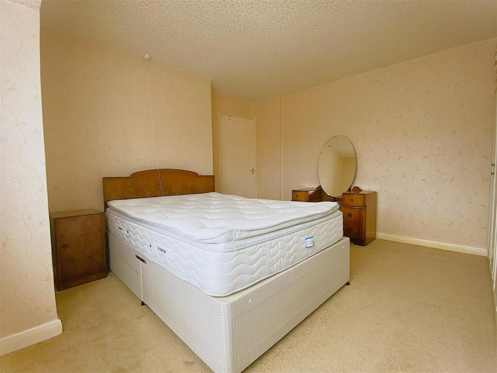
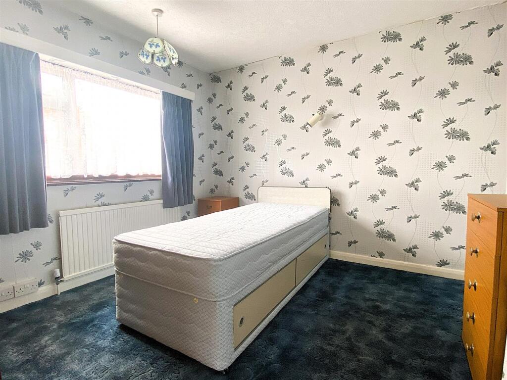
Photos · Open listing
 Open image 1 from listing 164702489
 Open image 2 from listing 164702489
 Open image 3 from listing 164702489
 Open image 4 from listing 164702489
 Open image 5 from listing 164702489
 Open image 6 from listing 164702489
 Open image 7 from listing 164702489
 Open image 8 from listing 164702489
 Open image 9 from listing 164702489
 Open image 10 from listing 164702489
 Open image 11 from listing 164702489
 Open image 12 from listing 164702489
Sold comparables
Same street and nearby sales within 0.25 miles (last 5 years). Land Registry Price Paid Data.
| Address | Price | Date | Type |
|---|---|---|---|
| 14 BRAMLEY ROAD, BIRSTALL, LEICESTER, CHARNWOOD, LEICESTERSHIRE, LE4 4FG | £240,000 | 12/12/2025 | Semi-detached |
| 32 ALLINGTON DRIVE, BIRSTALL, LEICESTER, CHARNWOOD, LEICESTERSHIRE, LE4 4FA | £265,000 | 08/08/2025 | Semi-detached |
| 239 WANLIP LANE, BIRSTALL, LEICESTER, CHARNWOOD, LEICESTERSHIRE, LE4 4GP | £210,000 | 01/08/2025 | Semi-detached |
| 71 BLENHEIM ROAD, BIRSTALL, LEICESTER, CHARNWOOD, LEICESTERSHIRE, LE4 4FP | £250,000 | 31/03/2025 | Semi-detached |
| 103 ALLINGTON DRIVE, BIRSTALL, LEICESTER, CHARNWOOD, LEICESTERSHIRE, LE4 4FE | £292,000 | 28/03/2025 | Semi-detached |
| 36 ALLINGTON DRIVE, BIRSTALL, LEICESTER, CHARNWOOD, LEICESTERSHIRE, LE4 4FA | £300,000 | 08/12/2023 | Semi-detached |
| 43 BRAMLEY ROAD, BIRSTALL, LEICESTER, CHARNWOOD, LEICESTERSHIRE, LE4 4FH | £255,000 | 17/11/2023 | Semi-detached |
| 16 KESWICK CLOSE, BIRSTALL, LEICESTER, CHARNWOOD, LEICESTERSHIRE, LE4 4FS | £235,000 | 16/10/2023 | Semi-detached |
| 19 ALLINGTON DRIVE, BIRSTALL, LEICESTER, CHARNWOOD, LEICESTERSHIRE, LE4 4FD | £230,000 | 13/07/2023 | Semi-detached |
| 15 KESWICK CLOSE, BIRSTALL, LEICESTER, CHARNWOOD, LEICESTERSHIRE, LE4 4FS | £260,000 | 13/06/2023 | Semi-detached |
| 99 ALLINGTON DRIVE, BIRSTALL, LEICESTER, CHARNWOOD, LEICESTERSHIRE, LE4 4FE | £350,100 | 09/05/2023 | Semi-detached |
| 66 BRAMLEY ROAD, BIRSTALL, LEICESTER, CHARNWOOD, LEICESTERSHIRE, LE4 4FG | £192,000 | 28/04/2023 | Semi-detached |
| 7 ACACIA AVENUE, BIRSTALL, LEICESTER, CHARNWOOD, LEICESTERSHIRE, LE4 4HB | £265,000 | 16/02/2023 | Semi-detached |
| 65 ALLINGTON DRIVE, BIRSTALL, LEICESTER, CHARNWOOD, LEICESTERSHIRE, LE4 4FD | £275,000 | 06/01/2023 | Semi-detached |
| 4 WORCESTER AVENUE, BIRSTALL, LEICESTER, CHARNWOOD, LEICESTERSHIRE, LE4 4GQ | £182,000 | 30/11/2022 | Semi-detached |
| 8 MELBA WAY, BIRSTALL, LEICESTER, CHARNWOOD, LEICESTERSHIRE, LE4 4GT | £277,000 | 25/11/2022 | Semi-detached |
| 50 BLENHEIM ROAD, BIRSTALL, LEICESTER, CHARNWOOD, LEICESTERSHIRE, LE4 4FL | £353,000 | 16/11/2022 | Semi-detached |
| 25 ACACIA AVENUE, BIRSTALL, LEICESTER, CHARNWOOD, LEICESTERSHIRE, LE4 4HB | £230,000 | 07/11/2022 | Semi-detached |
| 81 GWENDOLIN AVENUE, BIRSTALL, LEICESTER, CHARNWOOD, LEICESTERSHIRE, LE4 4HF | £224,000 | 04/11/2022 | Semi-detached |
| 3 MALLING CLOSE, BIRSTALL, LEICESTER, CHARNWOOD, LEICESTERSHIRE, LE4 4FY | £262,500 | 28/10/2022 | Semi-detached |
Area average: £257,380 (20 sales)
For sale comparables
No active for-sale comparables found within 1 mile for the same bedrooms and property type.
Capital growth trend
Land Registry outcode average: last 12 months vs 5y and 10y ago (from sold prices).
House Price Index (HM Land Registry — official index, not sold-price averages): Charnwood. Series: Semi-detached. As of March 2026.
Rental Range
Estimated market rent for Charnwood. Low = conservative, Realistic = average, Optimistic = best case.
Based on Local Authority from postcode lookup → Charnwood.
LHA (30th percentile) floor for Leicester: Apr 2025 – Mar 2026
Rental Comparables
Residential lets from OpenRent and Rightmove for the area (same bedroom count). Use to validate rent estimates. Student lets are excluded.
| Title | Rent | Beds | Distance | As seen on |
|---|---|---|---|---|
| 3 Bed Flat, Libra Parade, LE4 | £1,000/mo | 3 | 0.52 miles | OpenRent |
Average rent: £1,000/mo (1 listing)
Rent-driven metrics
Based on OpenRent comparables.
- Rent ratio — Monthly rent ÷ purchase price (1% rule). 1%+ = strong, 0.8–1% = okay, <0.8% = weak for cashflow.
- Max investor price — Rent ÷ 0.8%; the price at which rent would be 0.8% of price (Stoke-style target).
- Target investor price — Rent ÷ 1%; the price at which rent would be 1% of price (strong cashflow band).
- Gross yield — Annual rent as % of purchase price (no costs).
- Cost-to-rent — Price ÷ annual rent (from OpenRent comparables). Under 14× = strong, 14–16× = acceptable, 17×+ = compressed.
- Cashflow — Rent minus mortgage, 10% maintenance, £25/mo compliance. Assumes 75% LTV, 3.95% APR (5yr fixed), 25yr term.
- ROI — Annual profit ÷ cash in (deposit + 4% purchase costs).
Flood risk
Zone: 2
Risk: In flood risk area
Environment Agency Flood Risk Areas (APSFR)
Street-level crime
| Category | Count |
|---|---|
| Violence and sexual offences | 36 |
| Anti-social behaviour | 19 |
| Criminal damage and arson | 15 |
| Public order | 11 |
| Shoplifting | 7 |
| Vehicle crime | 7 |
| Other theft | 6 |
| Burglary | 4 |
| Drugs | 4 |
| Other crime | 1 |
| Robbery | 1 |
| Theft from the person | 1 |
| Total incidents | 112 |
Within 1 mile during Apr 2026. Source: data.police.uk (England & Wales).
Schools nearby
Nearest open schools with Ofsted ratings (England). Closed schools are not shown. Data from Get Information about Schools and Ofsted.
| Name | Type | Distance | Ofsted |
|---|---|---|---|
| ALP Leicester | Other | 0.4 miles | Good — 12 Jan 2023 |
| The Cedars Academy | Secondary | 0.4 miles | Good — 20 Feb 2018 |
| Riverside Community Primary School Birstall | Primary | 0.4 miles | Good — 28 Apr 2017 |
| Highcliffe Primary School and Community Centre | Primary | 0.8 miles | Good — 25 Apr 2017 |
| Church Hill Infant School | Primary | 1.0 miles | Good — 5 Jun 2014 |
FENSA
Window and door installation certificates found for this address.
| Issued | Work completed | Windows | Doors |
|---|---|---|---|
| 17/03/2008 | 03/03/2008 | — | 1 |