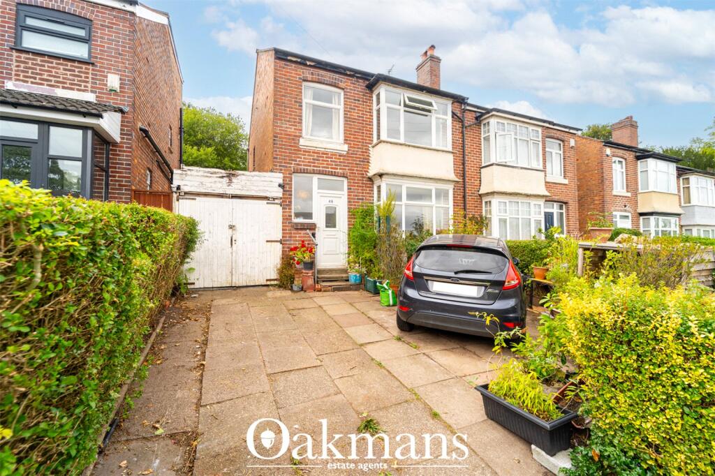
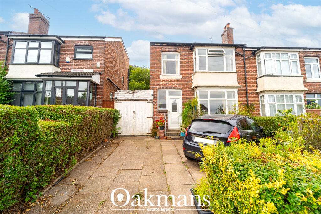
46 LODGE HILL ROAD
BIRMINGHAM, WEST MIDLANDS, B29 6NG
£245,000
Location
Nearby
Nearest stations, universities and amenities (distance from property).
| Type | Name | Distance |
|---|---|---|
| Bus stop | Gibbins Rd / Lodge Hill Rd | 0.1 miles |
| Shop | Araprint | 0.3 miles |
| Train station | Selly Oak | 0.5 miles |
| University | University of Birmingham School of Dentistry | 1.6 miles |
| Hospital | Bromsgove Private Hospital | 7.8 miles |
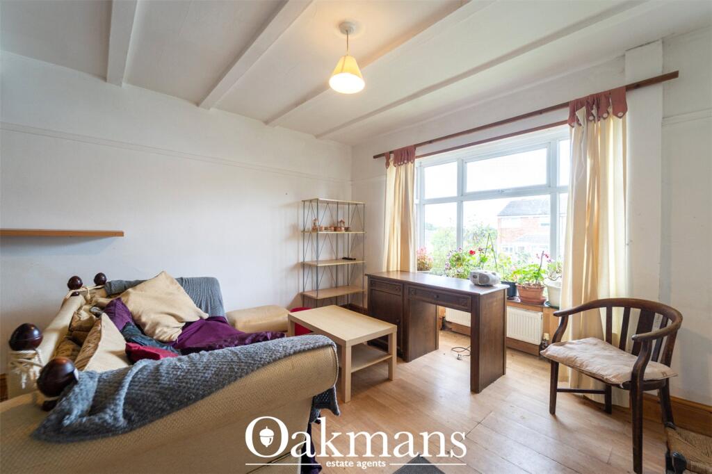
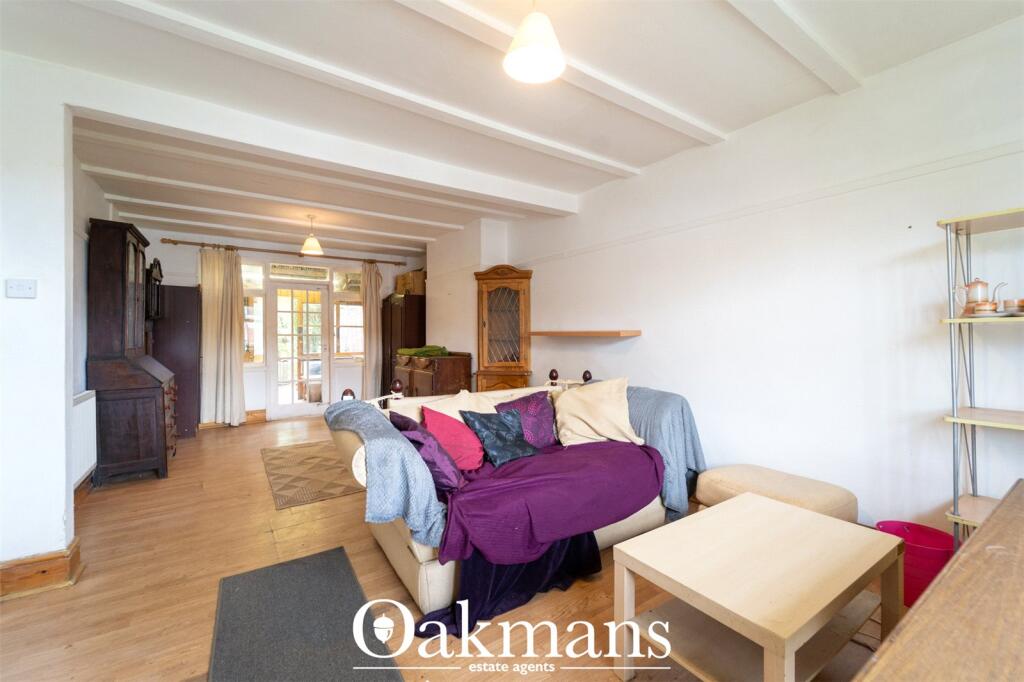
Property details
Tenure
Freehold
Property type
Terraced
Bedrooms
3
Bathrooms
1
Floor area
87 m²
EPC rating
D
Year built
England and Wales: 1930-1949
Last sold
£245,000 Feb 2026
Price per m²
£2,816/m²
Local average
£271,441 (39 sales)
Street crime
464 incidents within 1 mile (Apr 2026)
EPC Rating & Upgrade Cost
Current rating: D
Potential rating: C
Inspection date: 03/09/2025
Expiry date: 02/09/2035
Current heating cost: £1,074/year
Potential heating cost: £693/year
Est. upgrade cost to C: £25,750
Recommendations
- 50 mm internal or external wall insulation (£7,500 - £11,000)
- Floor insulation (suspended floor) (£5,000 - £10,000)
- Solar photovoltaic panels, 2.5 kWp (£8,000 - £10,000)
Price history
| Event | Date | Price | Type | % change | Today’s value (HPI) | Action |
|---|---|---|---|---|---|---|
| Sold | 12/02/2026 | £245,000 | Terraced | — | £246,212 to March 2026 | View transaction |
Historic listings
Listing and sale events only where we matched the listing page to a Land Registry sale already on record for this address.
| Event | Date | Price |
|---|---|---|
| sold | 01/01/2026 | £245,000 |
| listed | 01/09/2025 | £250,000 |
| sold | 01/01/2000 | £46,000 |
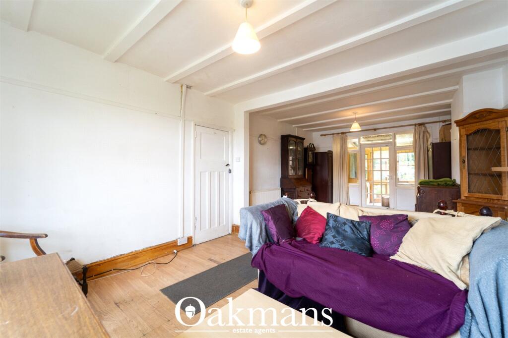
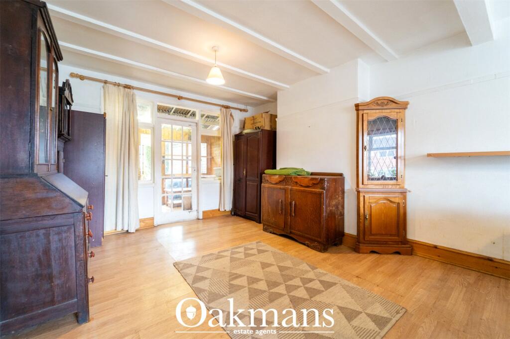
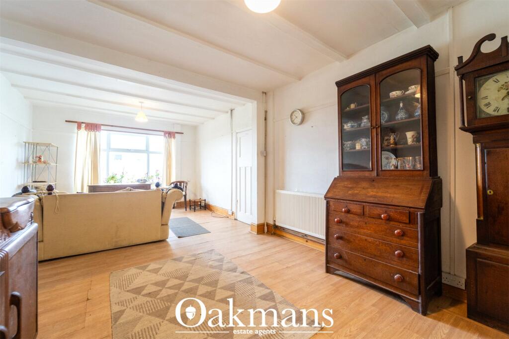
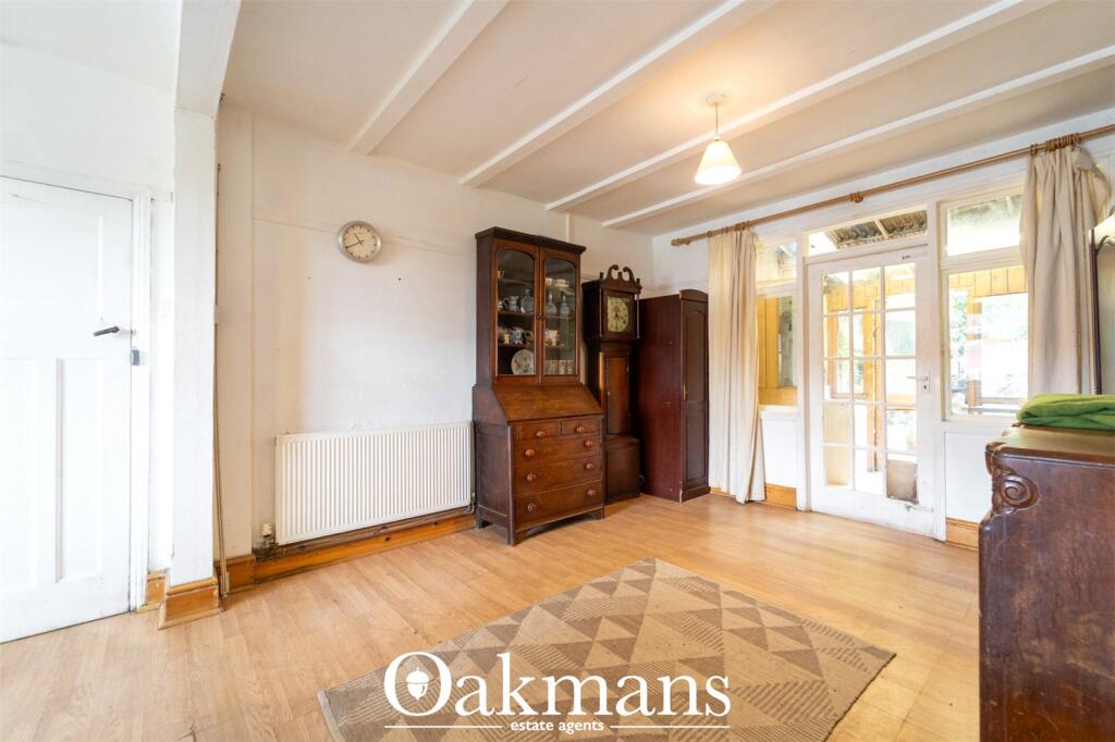
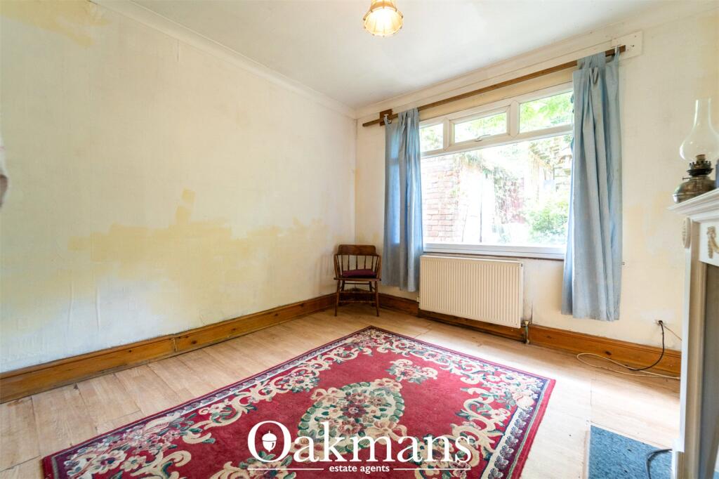
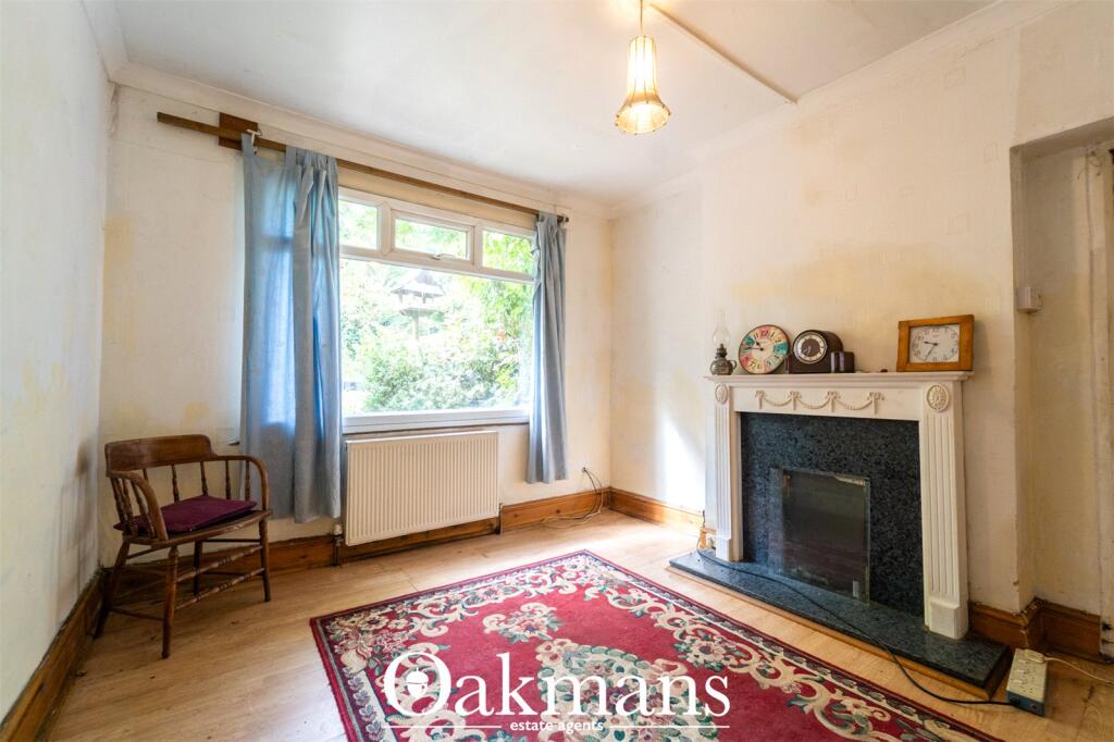
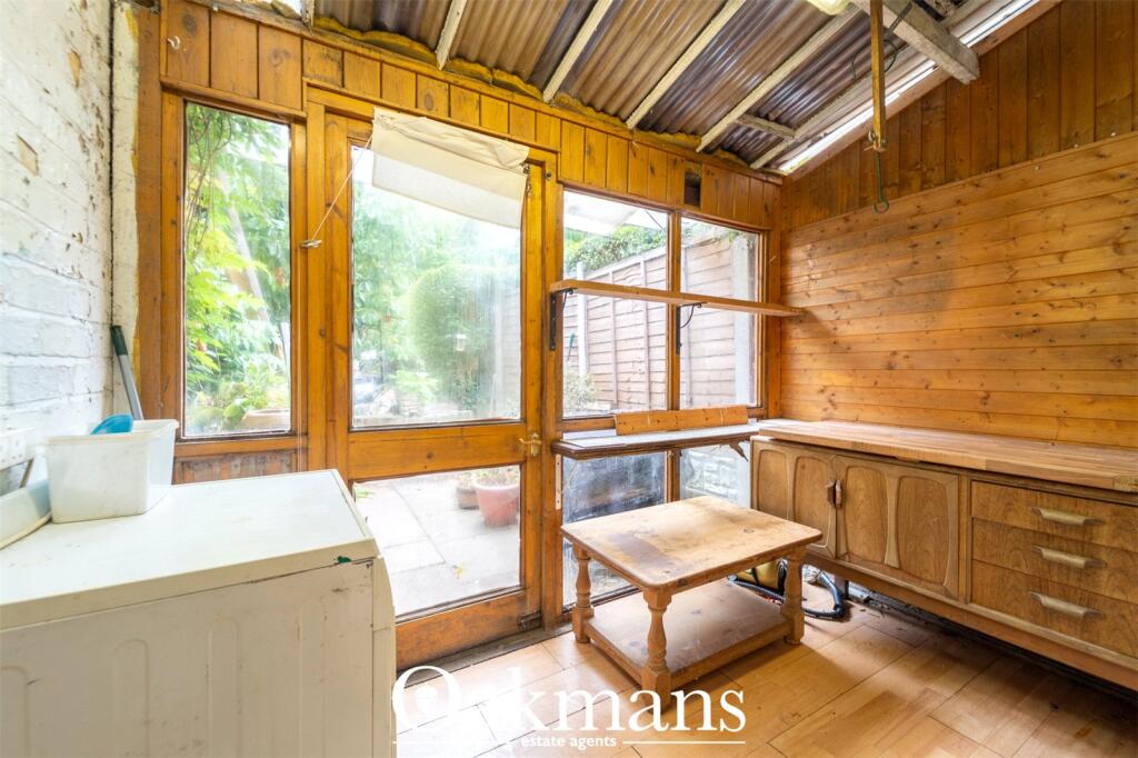
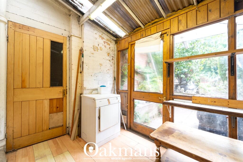
Photos · Open listing
 Open image 1 from listing 166423931
 Open image 2 from listing 166423931
 Open image 3 from listing 166423931
 Open image 4 from listing 166423931
 Open image 5 from listing 166423931
 Open image 6 from listing 166423931
 Open image 7 from listing 166423931
 Open image 8 from listing 166423931
 Open image 9 from listing 166423931
 Open image 10 from listing 166423931
 Open image 11 from listing 166423931
 Open image 12 from listing 166423931
Sold comparables
Same street and nearby sales within 0.25 miles (last 5 years). Land Registry Price Paid Data.
| Address | Price | Date | Type |
|---|---|---|---|
| 10 FLADBURY CRESCENT, BIRMINGHAM, WEST MIDLANDS, B29 6PH | £227,000 | 18/03/2025 | Terraced |
| 8 RACHEL GARDENS, BIRMINGHAM, WEST MIDLANDS, B29 6NY | £228,000 | 08/09/2023 | Terraced |
| 50 FLADBURY CRESCENT, BIRMINGHAM, WEST MIDLANDS, B29 6PH | £215,000 | 27/07/2023 | Terraced |
| 43 FLADBURY CRESCENT, BIRMINGHAM, WEST MIDLANDS, B29 6PL | £185,000 | 07/07/2023 | Terraced |
| 70 WELLMAN CROFT, BIRMINGHAM, WEST MIDLANDS, B29 6NS | £176,000 | 25/11/2022 | Terraced |
| 9 LODGE HILL ROAD, BIRMINGHAM, WEST MIDLANDS, B29 6NU | £280,000 | 30/09/2022 | Terraced |
| 70 WELLMAN CROFT, BIRMINGHAM, WEST MIDLANDS, B29 6NS | £156,000 | 09/09/2022 | Terraced |
| 78 FREDERICK ROAD, SELLY OAK, BIRMINGHAM, WEST MIDLANDS, B29 6PB | £330,000 | 12/08/2022 | Terraced |
| 120 GIBBINS ROAD, BIRMINGHAM, WEST MIDLANDS, B29 6QP | £240,000 | 28/02/2022 | Terraced |
| 61 FREDERICK ROAD, SELLY OAK, BIRMINGHAM, WEST MIDLANDS, B29 6NX | £280,000 | 20/01/2022 | Terraced |
| 43 GIBBINS ROAD, BIRMINGHAM, WEST MIDLANDS, B29 6PQ | £237,500 | 29/09/2021 | Terraced |
Area average: £232,227 (11 sales)
For sale comparables
No active for-sale comparables found within 1 mile for the same bedrooms and property type.
Capital growth trend
Land Registry outcode average: last 12 months vs 5y and 10y ago (from sold prices).
House Price Index (HM Land Registry — official index, not sold-price averages): Birmingham. Series: Terraced. As of March 2026.
Rental Range
Estimated market rent for Birmingham. Low = conservative, Realistic = average, Optimistic = best case.
Based on Local Authority from postcode lookup → Birmingham.
LHA (30th percentile) floor for Birmingham: Apr 2025 – Mar 2026
Rental Comparables
Residential lets from OpenRent and Rightmove for the area (same bedroom count). Use to validate rent estimates. Student lets are excluded.
| Title | Rent | Beds | Distance | As seen on |
|---|---|---|---|---|
| 3 Bed Flat, Bristol Road, B29 | £1,425/mo | 3 | 0.19 miles | OpenRent |
| 3 Bed Semi-Detached House, Strathedene Road, B29 | £1,450/mo | 3 | 0.25 miles | OpenRent |
| 3 Bed Flat, Bristol Road, B29 | £1,500/mo | 3 | 0.34 miles | OpenRent |
| 3 Bed Flat, Bristol Road, B29 | £1,500/mo | 3 | 0.34 miles | OpenRent |
| 3 Bed Flat, Dawlish Road, B29 | £1,500/mo | 3 | 0.35 miles | OpenRent |
| 3 Bed Flat, Bristol Road, B29 | £1,500/mo | 3 | 0.38 miles | OpenRent |
| 3 Bed Semi-Detached House, Reservoir Road, B29 | £1,350/mo | 3 | 0.49 miles | OpenRent |
Average rent: £1,461/mo (7 listings)
Rent-driven metrics
Based on OpenRent comparables.
- Rent ratio — Monthly rent ÷ purchase price (1% rule). 1%+ = strong, 0.8–1% = okay, <0.8% = weak for cashflow.
- Max investor price — Rent ÷ 0.8%; the price at which rent would be 0.8% of price (Stoke-style target).
- Target investor price — Rent ÷ 1%; the price at which rent would be 1% of price (strong cashflow band).
- Gross yield — Annual rent as % of purchase price (no costs).
- Cost-to-rent — Price ÷ annual rent (from OpenRent comparables). Under 14× = strong, 14–16× = acceptable, 17×+ = compressed.
- Cashflow — Rent minus mortgage, 10% maintenance, £25/mo compliance. Assumes 75% LTV, 3.95% APR (5yr fixed), 25yr term.
- ROI — Annual profit ÷ cash in (deposit + 4% purchase costs).
Flood risk
Zone: 2
Risk: In flood risk area
Environment Agency Flood Risk Areas (APSFR)
Street-level crime
| Category | Count |
|---|---|
| Violence and sexual offences | 171 |
| Shoplifting | 63 |
| Vehicle crime | 49 |
| Criminal damage and arson | 42 |
| Public order | 33 |
| Burglary | 31 |
| Other theft | 26 |
| Anti-social behaviour | 12 |
| Drugs | 11 |
| Bicycle theft | 7 |
| Robbery | 7 |
| Other crime | 5 |
| Theft from the person | 4 |
| Possession of weapons | 3 |
| Total incidents | 464 |
Within 1 mile during Apr 2026. Source: data.police.uk (England & Wales).
Schools nearby
Nearest open schools with Ofsted ratings (England). Closed schools are not shown. Data from Get Information about Schools and Ofsted.
| Name | Type | Distance | Ofsted |
|---|---|---|---|
| St Mary's Church of England Primary School | Primary | 0.1 miles | Good — 1 Feb 2012 |
| The University of Birmingham School | Secondary | 0.2 miles | Good — 5 Jun 2018 |
| Cherry Oak School | Other | 0.2 miles | Good — 17 Apr 2024 |
| Fircroft College of Adult Education | Other | 0.4 miles | — (No rating) |
| Selly Oak Trust School | Other | 0.5 miles | Good — 29 Jun 2017 |
FENSA
No FENSA certificates found for this address.