22 ELLA PARK
ANLABY, HULL, EAST RIDING OF YORKSHIRE, HU10 7EP
£162,500
Location
Nearby
Nearest stations, universities and amenities (distance from property).
| Type | Name | Distance |
|---|---|---|
| Bus stop | Kirk Ella Beverley Road | 0.1 miles |
| Shop | Little Bird Boutique | 0.4 miles |
| Hospital | Mill View | 2.0 miles |
| Train station | Hessle | 2.1 miles |
| University | University of Hull | 2.8 miles |
Property details
Tenure
Leasehold
Property type
Flat
Bedrooms
2
Bathrooms
1
Floor area
60 m²
EPC rating
C
Year built
England and Wales: 1983-1990
Last sold
£162,500 Jan 2026
Price per m²
£2,708/m²
Local average
£108,833 (6 sales)
Street crime
110 incidents within 1 mile (Apr 2026)
EPC Rating & Upgrade Cost
Current rating: C
Potential rating: C
Inspection date: 03/09/2025
Expiry date: 02/09/2035
Current heating cost: £567/year
Potential heating cost: £479/year
Est. upgrade cost to C: £7,500
Recommendations
- Floor insulation (solid floor) (£5,000 - £10,000)
Price history
| Event | Date | Price | Type | % change | Today’s value (HPI) | Action |
|---|---|---|---|---|---|---|
| Sold | 27/01/2026 | £162,500 | Flat | +38.9% | £159,847 to March 2026 | View transaction |
| Sold | 19/10/2015 | £117,000 | Flat | +146.3% | £147,243 to March 2026 | View transaction |
| Sold | 15/01/1999 | £47,500 | Flat | — | £176,115 to March 2026 | View transaction |
Historic listings
Listing and sale events only where we matched the listing page to a Land Registry sale already on record for this address.
| Event | Date | Price |
|---|---|---|
| sold | 01/01/2026 | £162,500 |
| listed | 04/09/2025 | £162,500 |
| sold | 01/01/2015 | £117,000 |
| sold | 01/01/1999 | £47,500 |
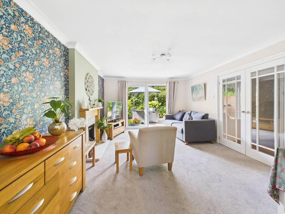
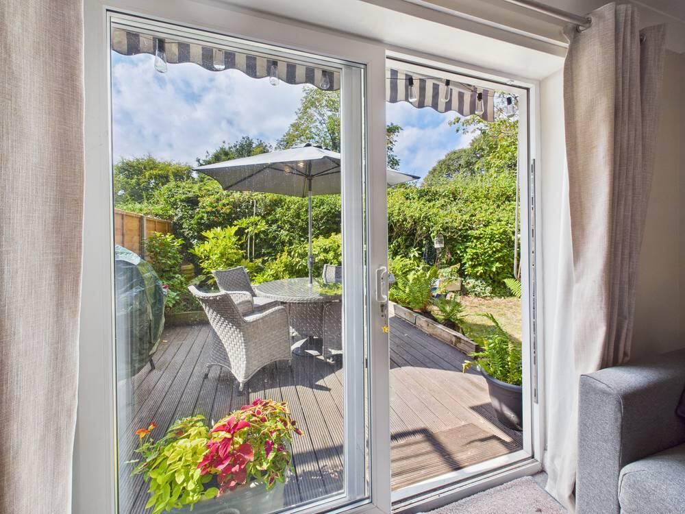
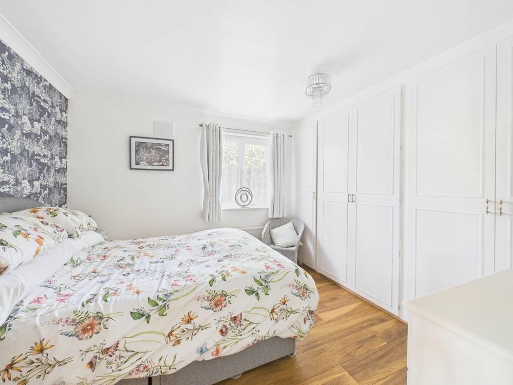
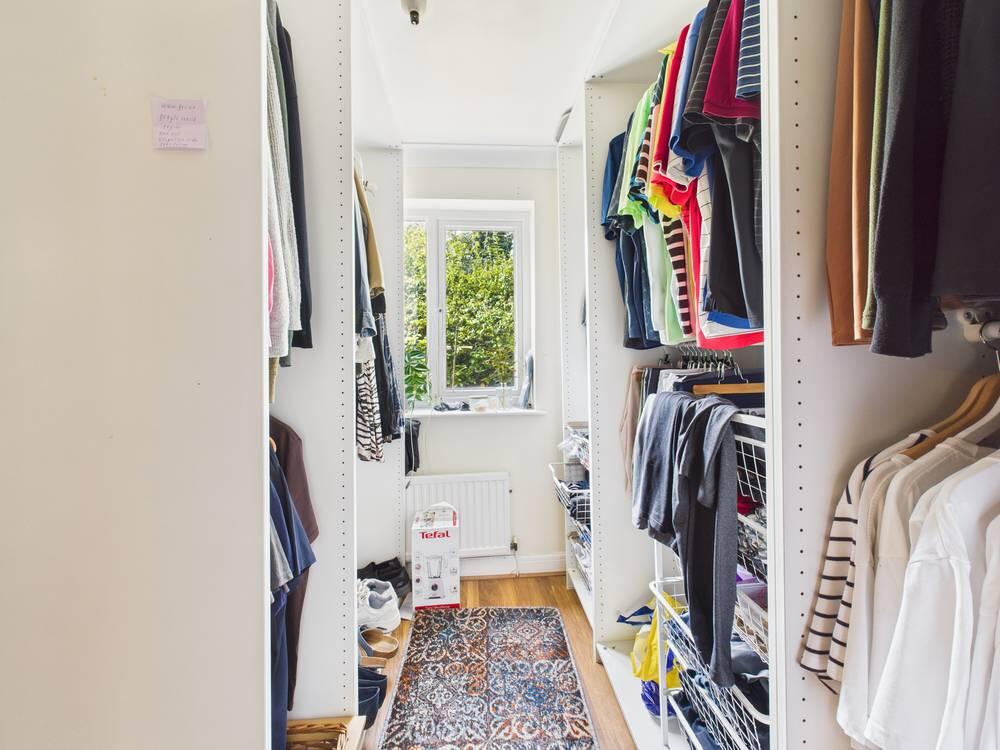
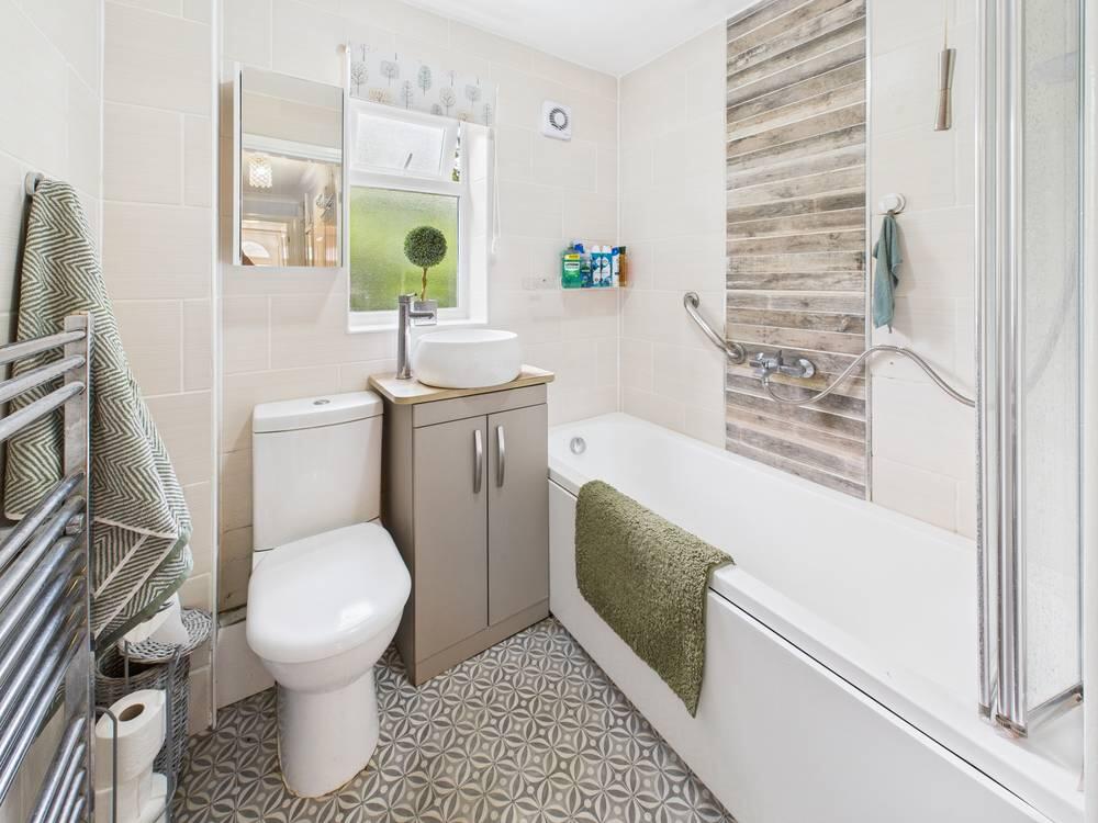
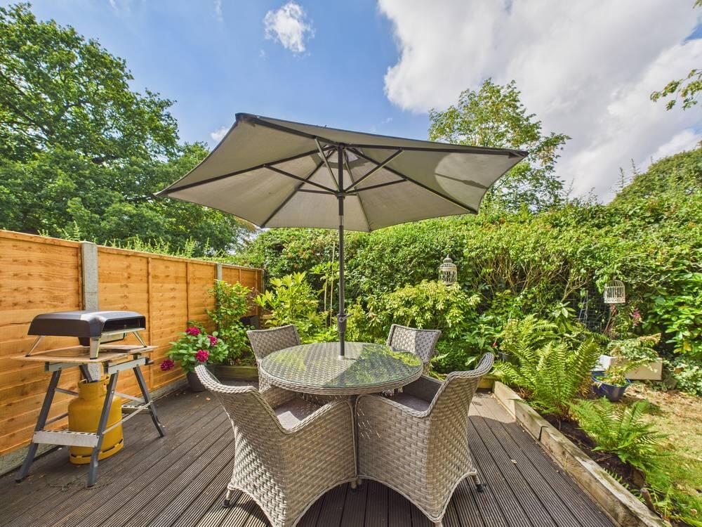
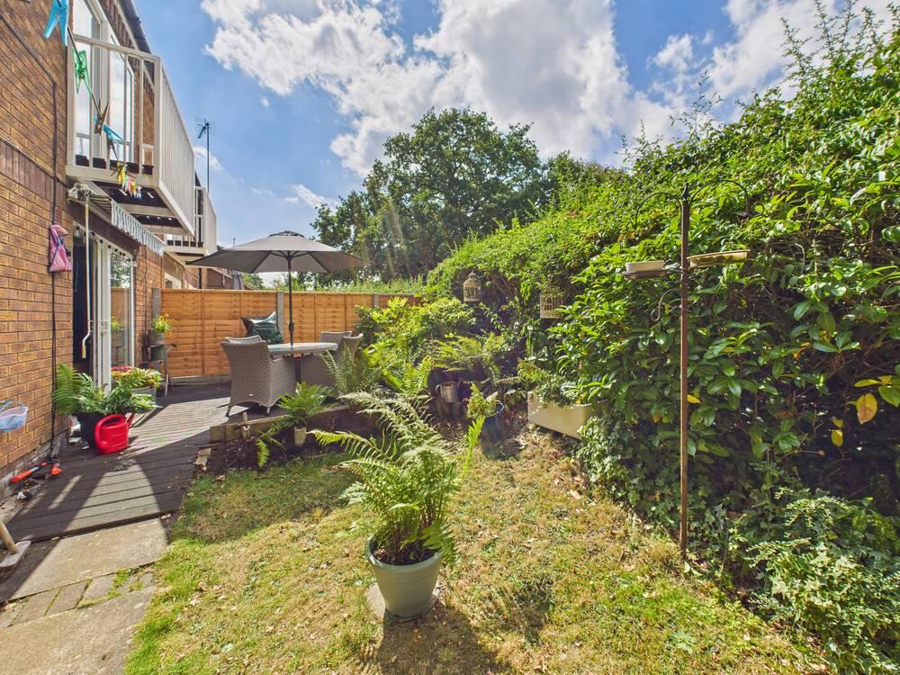
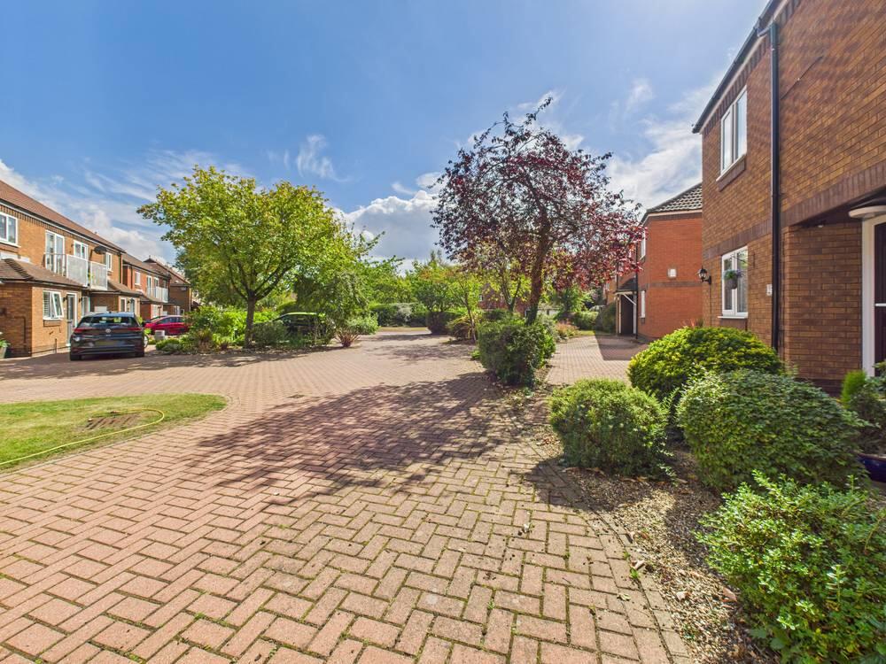
Photos · Open listing
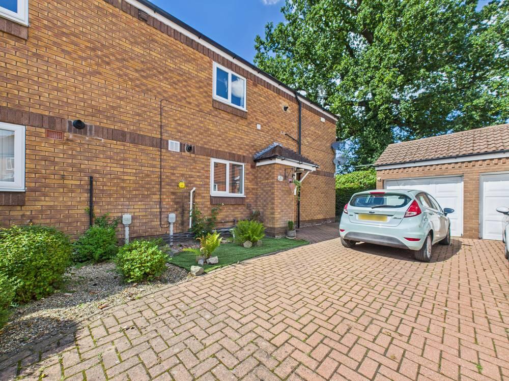 Open image 1 from listing 166573181
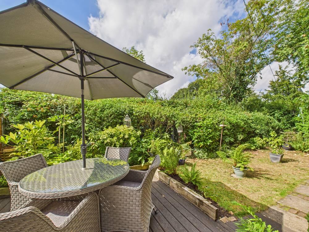 Open image 2 from listing 166573181
 Open image 3 from listing 166573181
 Open image 4 from listing 166573181
 Open image 5 from listing 166573181
 Open image 6 from listing 166573181
 Open image 7 from listing 166573181
 Open image 8 from listing 166573181
 Open image 9 from listing 166573181
 Open image 10 from listing 166573181
 Open image 11 from listing 166573181
 Open image 12 from listing 166573181
Sold comparables
Same street and nearby sales within 0.25 miles (last 5 years). Land Registry Price Paid Data.
| Address | Price | Date | Type |
|---|---|---|---|
| 6 ELLA PARK, ANLABY, HULL, EAST RIDING OF YORKSHIRE, HU10 7EP | £138,000 | 21/12/2022 | Flat |
| 17 SOUTH ELLA WAY, KIRK ELLA, HULL, EAST RIDING OF YORKSHIRE, HU10 7HB | £90,000 | 07/02/2022 | Flat |
Area average: £114,000 (2 sales)
For sale comparables
No active for-sale comparables found within 1 mile for the same bedrooms and property type.
Capital growth trend
Land Registry outcode average: last 12 months vs 5y and 10y ago (from sold prices).
House Price Index (HM Land Registry — official index, not sold-price averages): East Riding of Yorkshire. Series: Flats and maisonettes. As of March 2026.
Rental Range
Estimated market rent for East Riding of Yorkshire. Low = conservative, Realistic = average, Optimistic = best case.
Based on Local Authority from postcode lookup → East Riding of Yorkshire.
LHA (30th percentile) floor for Hull & East Riding: Apr 2025 – Mar 2026
Rental Comparables
Residential lets from OpenRent and Rightmove for the area (same bedroom count). Use to validate rent estimates. Student lets are excluded.
| Title | Rent | Beds | Distance | As seen on |
|---|---|---|---|---|
| 2 Bed Terraced House, Dawnay Drive, HU10 | £750/mo | 2 | 0.73 miles | OpenRent |
Average rent: £750/mo (1 listing)
Rent-driven metrics
Based on OpenRent comparables.
- Rent ratio — Monthly rent ÷ purchase price (1% rule). 1%+ = strong, 0.8–1% = okay, <0.8% = weak for cashflow.
- Max investor price — Rent ÷ 0.8%; the price at which rent would be 0.8% of price (Stoke-style target).
- Target investor price — Rent ÷ 1%; the price at which rent would be 1% of price (strong cashflow band).
- Gross yield — Annual rent as % of purchase price (no costs).
- Cost-to-rent — Price ÷ annual rent (from OpenRent comparables). Under 14× = strong, 14–16× = acceptable, 17×+ = compressed.
- Cashflow — Rent minus mortgage, 10% maintenance, £25/mo compliance. Assumes 75% LTV, 3.95% APR (5yr fixed), 25yr term.
- ROI — Annual profit ÷ cash in (deposit + 4% purchase costs).
Flood risk
Zone: 2
Risk: In flood risk area
Environment Agency Flood Risk Areas (APSFR)
Street-level crime
| Category | Count |
|---|---|
| Shoplifting | 34 |
| Violence and sexual offences | 19 |
| Anti-social behaviour | 13 |
| Criminal damage and arson | 13 |
| Vehicle crime | 12 |
| Public order | 8 |
| Other theft | 4 |
| Other crime | 3 |
| Burglary | 2 |
| Drugs | 1 |
| Robbery | 1 |
| Total incidents | 110 |
Within 1 mile during Apr 2026. Source: data.police.uk (England & Wales).
Schools nearby
Nearest open schools with Ofsted ratings (England). Closed schools are not shown. Data from Get Information about Schools and Ofsted.
| Name | Type | Distance | Ofsted |
|---|---|---|---|
| Springhead Primary School | Primary | 0.4 miles | Good — 24 Oct 2018 |
| Kirk Ella St Andrew's Community Primary School | Primary | 0.4 miles | Good — 19 Jun 2023 |
| Tranby | Other | 0.6 miles | — (No rating) |
| Willerby Carr Lane Primary School | Primary | 0.7 miles | Good — 16 Jul 2012 |
| Wolfreton School and Sixth Form College | Secondary | 0.7 miles | Good — 15 Nov 2013 |
FENSA
Checking FENSA certificates for this address. Refresh in a few minutes.