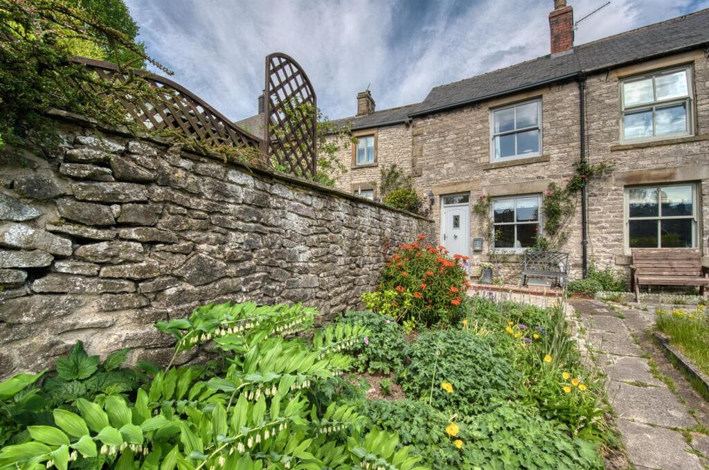
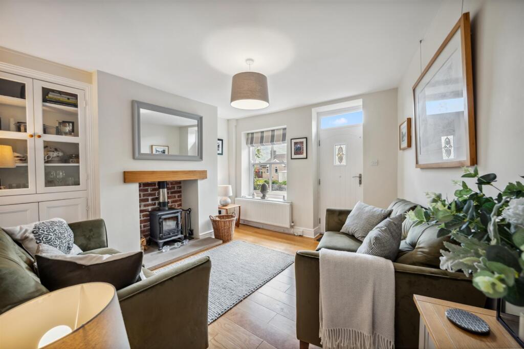
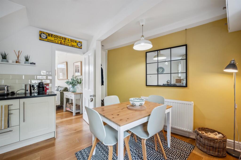
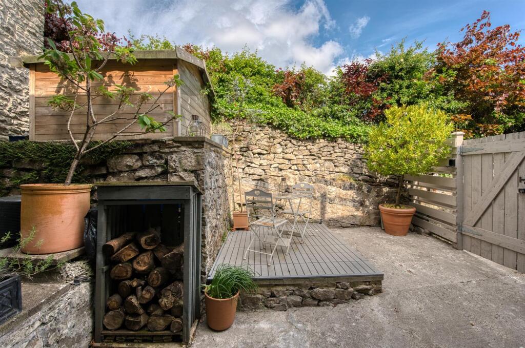
CHERRY TREE COTTAGES 3 SMALLDALE
BRADWELL, HOPE VALLEY, DERBYSHIRE DALES, DERBYSHIRE, S33 9JQ
£290,000
Location
Nearby
Nearest stations, universities and amenities (distance from property).
| Type | Name | Distance |
|---|---|---|
| Bus stop | Bradwell (Memorial Hall) | 0.2 miles |
| Shop | Bradwell Village Shop | 0.2 miles |
| Train station | Hope | 1.3 miles |
| University | University of Derby, Buxton | 8.5 miles |
| Hospital | Corbar hall | 8.6 miles |
Property details
Tenure
Freehold
Property type
Terraced
Bedrooms
2
Bathrooms
1
Last sold
£290,000 Jan 2026
Local average
£312,500 (6 sales)
Street crime
6 incidents within 1 mile (May 2026)
EPC Rating & Upgrade Cost
Fetching EPC data… Refresh this page in a moment.
Price history
| Event | Date | Price | Type | % change | Today’s value (HPI) | Action |
|---|---|---|---|---|---|---|
| Sold | 30/01/2026 | £290,000 | Terraced | +38.8% | £286,340 to April 2026 | View transaction |
| Sold | 13/09/2018 | £209,000 | Terraced | +22.2% | £276,043 to April 2026 | View transaction |
| Sold | 14/09/2012 | £171,000 | Terraced | +21% | £275,605 to April 2026 | View transaction |
| Sold | 30/07/2010 | £141,350 | Terraced | — | £222,528 to April 2026 | View transaction |
Historic listings
Listing and sale events only where we matched the listing page to a Land Registry sale already on record for this address.
| Event | Date | Price |
|---|---|---|
| sold | 01/01/2026 | £290,000 |
| listed | 21/08/2025 | £275,000 |
| sold | 01/01/2018 | £209,000 |
| sold | 01/01/2012 | £171,000 |
| sold | 01/01/2010 | £141,350 |
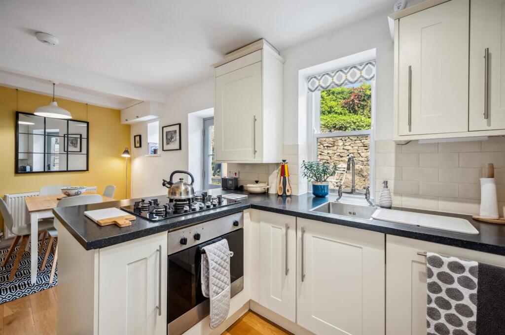
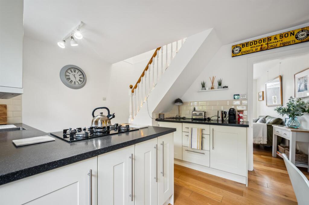
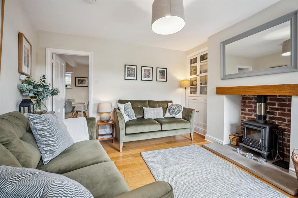
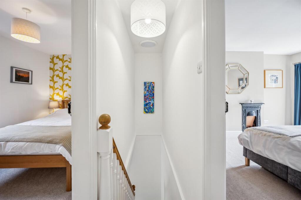
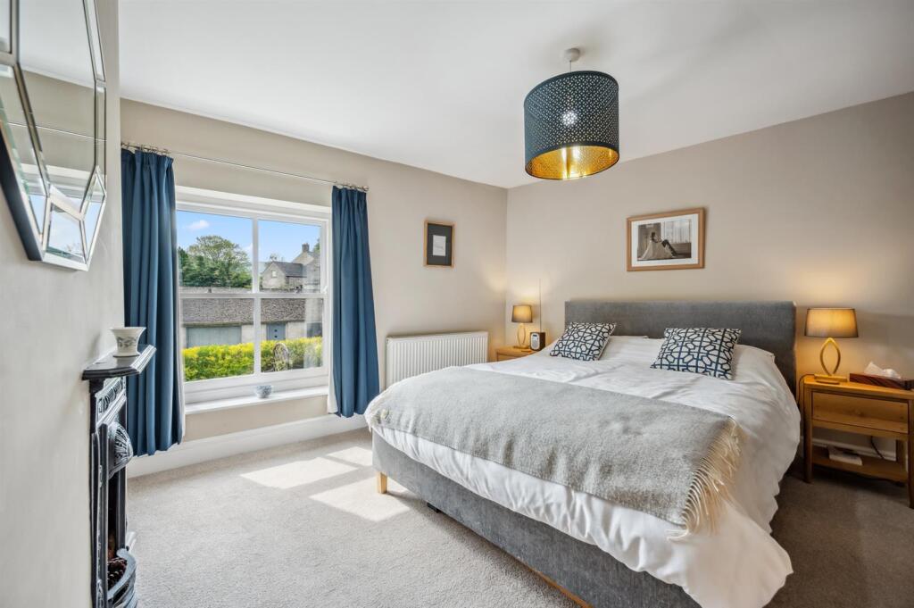
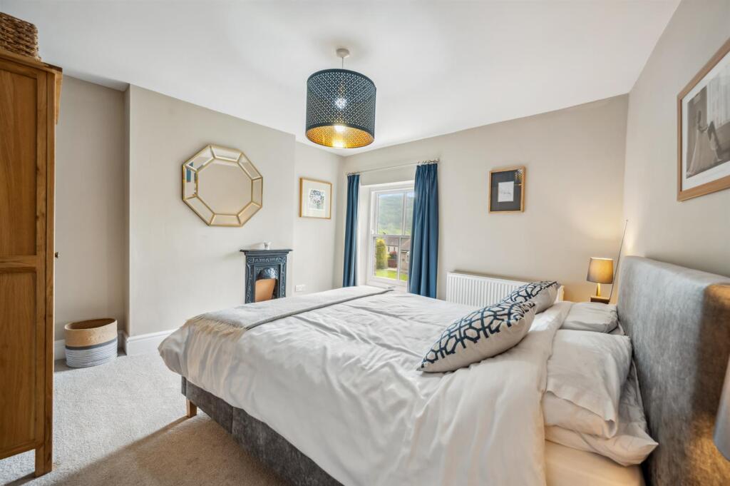
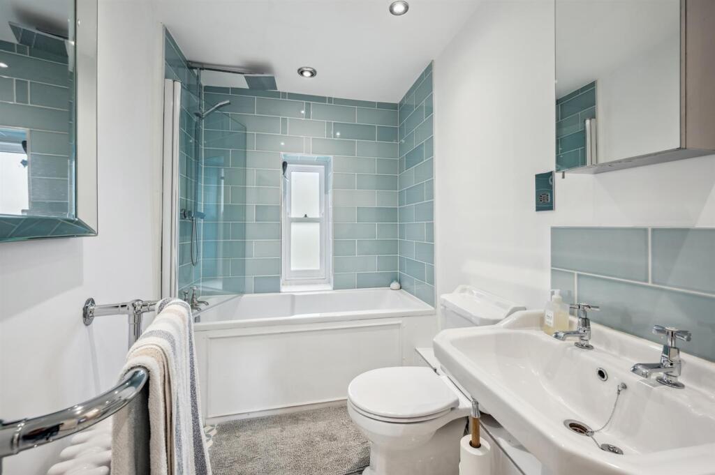
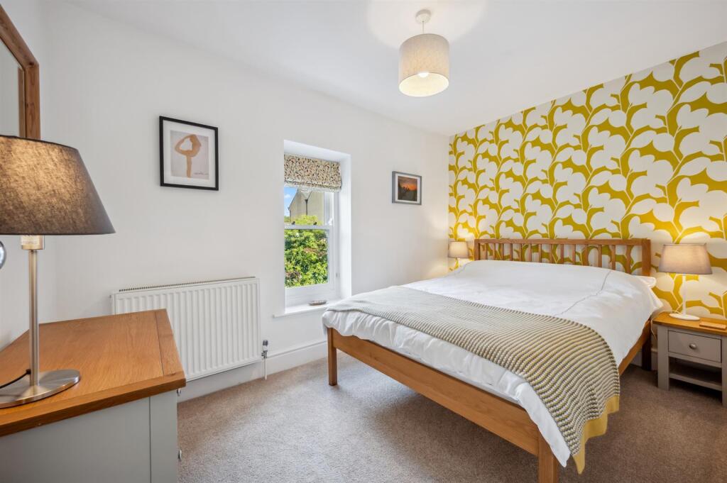
Photos · Open listing
 Open image 1 from listing 166056695
 Open image 2 from listing 166056695
 Open image 3 from listing 166056695
 Open image 4 from listing 166056695
 Open image 5 from listing 166056695
 Open image 6 from listing 166056695
 Open image 7 from listing 166056695
 Open image 8 from listing 166056695
 Open image 9 from listing 166056695
 Open image 10 from listing 166056695
 Open image 11 from listing 166056695
 Open image 12 from listing 166056695
Sold comparables
Same street and nearby sales within 0.25 miles (last 5 years). Land Registry Price Paid Data.
| Address | Price | Date | Type |
|---|---|---|---|
| ROSE DENE HUGH LANE, BRADWELL, HOPE VALLEY, DERBYSHIRE DALES, DERBYSHIRE, S33 9JB | £300,000 | 06/11/2023 | Terraced |
| HOMESTEAD COTTAGE HUGH LANE, BRADWELL, HOPE VALLEY, DERBYSHIRE DALES, DERBYSHIRE, S33 9JB | £186,000 | 10/08/2022 | Terraced |
| INGLESIDE COTTAGES 1 SMALLDALE, BRADWELL, HOPE VALLEY, DERBYSHIRE DALES, DERBYSHIRE, S33 9JQ | £250,000 | 08/08/2022 | Terraced |
Area average: £245,333 (3 sales)
For sale comparables
No active for-sale comparables found within 1 mile for the same bedrooms and property type.
Capital growth trend
Land Registry outcode average: last 12 months vs 5y and 10y ago (from sold prices).
House Price Index (HM Land Registry — official index, not sold-price averages): Derbyshire Dales. Series: Terraced. As of April 2026.
Rental Range
Estimated market rent for Derbyshire Dales. Low = conservative, Realistic = average, Optimistic = best case.
Based on Local Authority from postcode lookup → Derbyshire Dales.
LHA (30th percentile) floor for Peaks & Dales: Apr 2025 – Mar 2026
Rental Comparables
Residential lets from OpenRent and Rightmove for the area (same bedroom count). Use to validate rent estimates. Student lets are excluded.
| Title | Rent | Beds | Distance | As seen on |
|---|---|---|---|---|
| 2 Bed Semi-Detached House, Fern Bank, S33 | £900/mo | 2 | 0.22 miles | OpenRent |
Average rent: £900/mo (1 listing)
Rent-driven metrics
Based on OpenRent comparables.
- Rent ratio — Monthly rent ÷ purchase price (1% rule). 1%+ = strong, 0.8–1% = okay, <0.8% = weak for cashflow.
- Max investor price — Rent ÷ 0.8%; the price at which rent would be 0.8% of price (Stoke-style target).
- Target investor price — Rent ÷ 1%; the price at which rent would be 1% of price (strong cashflow band).
- Gross yield — Annual rent as % of purchase price (no costs).
- Cost-to-rent — Price ÷ annual rent (from OpenRent comparables). Under 14× = strong, 14–16× = acceptable, 17×+ = compressed.
- Cashflow — Rent minus mortgage, 10% maintenance, £25/mo compliance. Assumes 75% LTV, 3.95% APR (5yr fixed), 25yr term.
- ROI — Annual profit ÷ cash in (deposit + 4% purchase costs).
Flood risk
Zone: 1
Risk: Low
Job (default Low)
Street-level crime
| Category | Count |
|---|---|
| Other theft | 2 |
| Violence and sexual offences | 2 |
| Criminal damage and arson | 1 |
| Shoplifting | 1 |
| Total incidents | 6 |
Within 1 mile during May 2026. Source: data.police.uk (England & Wales).
Schools nearby
Nearest open schools with Ofsted ratings (England). Closed schools are not shown. Data from Get Information about Schools and Ofsted.
| Name | Type | Distance | Ofsted |
|---|---|---|---|
| Bradwell Junior School | Primary | 0.2 miles | Inadequate — 26 Feb 2023 |
| Bradwell CofE (Controlled) Infant School | Primary | 0.4 miles | Good — 17 Jun 2024 |
| Hope Valley College | Secondary | 1.2 miles | Good — 4 Dec 2023 |
| Hope Primary School | Primary | 1.4 miles | — (Inspected (no overall grade)) |
| Castleton CofE Primary School | Primary | 1.5 miles | Good — 10 Jun 2024 |
FENSA
Checking FENSA certificates for this address. Refresh in a few minutes.