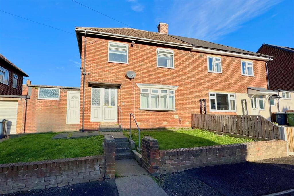
36 PITCAIRN ROAD
PENNYWELL, SUNDERLAND, TYNE AND WEAR, SR4 8ER
£110,000
Location
Nearby
Nearest stations, universities and amenities (distance from property).
| Type | Name | Distance |
|---|---|---|
| Bus stop | HYLTON ROAD-ST LUKES ROAD-E/B | 0.1 miles |
| Shop | Hylton Road Butchers | 0.1 miles |
| Train station | South Hylton | 0.5 miles |
| Hospital | Sunderland Primary care Trust | 1.9 miles |
| University | Newcastle University | 8.9 miles |
Property details
Tenure
Freehold
Property type
Semi-detached
Bedrooms
3
Bathrooms
1
Floor area
86 m²
EPC rating
C
Year built
England and Wales: 1950-1966
Last sold
£110,000 Jan 2026
Price per m²
£1,279/m²
Local average
£151,954 (63 sales)
Street crime
183 incidents within 1 mile (Apr 2026)
EPC Rating & Upgrade Cost
Current rating: C
Potential rating: B
Inspection date: 11/11/2025
Expiry date: 10/11/2035
Current heating cost: £795/year
Potential heating cost: £738/year
Est. upgrade cost to C: £16,500
Recommendations
- Floor insulation (solid floor) (£5,000 - £10,000)
- Solar photovoltaic panels, 2.5 kWp (£8,000 - £10,000)
Price history
| Event | Date | Price | Type | % change | Today’s value (HPI) | Action |
|---|---|---|---|---|---|---|
| Sold | 30/01/2026 | £110,000 | Semi-detached | +93% | £111,518 to March 2026 | View transaction |
| Sold | 09/07/2012 | £57,000 | Semi-detached | — | £85,694 to March 2026 | View transaction |
Historic listings
Listing and sale events only where we matched the listing page to a Land Registry sale already on record for this address.
| Event | Date | Price |
|---|---|---|
| sold | 01/01/2026 | £110,000 |
| listed | 29/10/2025 | £109,950 |
| sold | 01/01/2012 | £57,000 |
Sold comparables
Same street and nearby sales within 0.25 miles (last 5 years). Land Registry Price Paid Data.
| Address | Price | Date | Type |
|---|---|---|---|
| 11 HALVERGATE CLOSE, SUNDERLAND, TYNE AND WEAR, SR4 8DW | £104,000 | 23/12/2025 | Semi-detached |
| 487 HYLTON ROAD, SUNDERLAND, TYNE AND WEAR, SR4 8DR | £76,100 | 18/12/2025 | Semi-detached |
| 542 HYLTON ROAD, SUNDERLAND, TYNE AND WEAR, SR4 8DT | £135,000 | 27/11/2025 | Semi-detached |
| 523 HYLTON ROAD, SUNDERLAND, TYNE AND WEAR, SR4 8DS | £155,000 | 19/11/2025 | Semi-detached |
| 20 PETERSHAM ROAD, SUNDERLAND, TYNE AND WEAR, SR4 0EX | £118,000 | 29/08/2025 | Semi-detached |
| 45 PALGROVE ROAD, SUNDERLAND, TYNE AND WEAR, SR4 8DX | £119,950 | 21/08/2025 | Semi-detached |
| 37 PALMSTEAD ROAD, SUNDERLAND, TYNE AND WEAR, SR4 8EW | £80,000 | 26/02/2025 | Semi-detached |
| 11 PETERSHAM ROAD, SUNDERLAND, TYNE AND WEAR, SR4 0EX | £100,000 | 14/02/2025 | Semi-detached |
| 32 PORTSMOUTH ROAD, SUNDERLAND, TYNE AND WEAR, SR4 9AU | £80,500 | 12/02/2025 | Semi-detached |
| 1 PORTSMOUTH ROAD, SUNDERLAND, TYNE AND WEAR, SR4 9AT | £98,000 | 22/11/2023 | Semi-detached |
| 14 HALVERGATE CLOSE, SUNDERLAND, TYNE AND WEAR, SR4 8DW | £122,500 | 21/07/2023 | Semi-detached |
| 14 PETERSHAM ROAD, SUNDERLAND, TYNE AND WEAR, SR4 0EX | £100,000 | 04/05/2023 | Semi-detached |
| 16 PENWOOD ROAD, SUNDERLAND, TYNE AND WEAR, SR4 8EH | £95,000 | 16/11/2022 | Semi-detached |
| 21 PENWOOD ROAD, SUNDERLAND, TYNE AND WEAR, SR4 8EH | £80,000 | 16/11/2022 | Semi-detached |
| 45 PALMSTEAD SQUARE, SUNDERLAND, TYNE AND WEAR, SR4 8EL | £70,000 | 28/10/2022 | Semi-detached |
| 39 PALMSTEAD SQUARE, SUNDERLAND, TYNE AND WEAR, SR4 8EL | £90,000 | 28/10/2022 | Semi-detached |
| 4 HALVERGATE CLOSE, SUNDERLAND, TYNE AND WEAR, SR4 8DW | £83,500 | 28/10/2022 | Semi-detached |
| 17 ROWAN CLOSE, SUNDERLAND, TYNE AND WEAR, SR4 8ES | £110,000 | 23/09/2022 | Semi-detached |
| 56 PORTSMOUTH ROAD, SUNDERLAND, TYNE AND WEAR, SR4 9AU | £109,950 | 01/07/2022 | Semi-detached |
| 6 HALVERGATE CLOSE, SUNDERLAND, TYNE AND WEAR, SR4 8DW | £107,500 | 30/06/2022 | Semi-detached |
Area average: £101,750 (20 sales)
For sale comparables
No active for-sale comparables found within 1 mile for the same bedrooms and property type.
Capital growth trend
Land Registry outcode average: last 12 months vs 5y and 10y ago (from sold prices).
House Price Index (HM Land Registry — official index, not sold-price averages): Sunderland. Series: Semi-detached. As of March 2026.
Rental Range
Estimated market rent for Sunderland. Low = conservative, Realistic = average, Optimistic = best case.
Based on Local Authority from postcode lookup → Sunderland.
LHA (30th percentile) floor for Sunderland: Apr 2025 – Mar 2026
Rental Comparables
Residential lets from OpenRent and Rightmove for the area (same bedroom count). Use to validate rent estimates. Student lets are excluded.
| Title | Rent | Beds | Distance | As seen on |
|---|---|---|---|---|
| 3 Bed Semi-Detached House, Portrush Road, SR4 | £875/mo | 3 | 0.26 miles | OpenRent |
| 3 Bed Semi-Detached House, Sunderland, SR4 | £850/mo | 3 | 0.37 miles | OpenRent |
| 3 Bed Semi-Detached House, Partick Road, SR4 | £725/mo | 3 | 0.38 miles | OpenRent |
| 3 Bed Semi-Detached House, Grindon Gardens, SR4 | £895/mo | 3 | 0.57 miles | OpenRent |
| 3 Bed Detached House, Gill Terrace, SR4 | £895/mo | 3 | 0.57 miles | OpenRent |
| 3 Bed Terraced House, Gleneagles Road, SR4 | £850/mo | 3 | 0.72 miles | OpenRent |
| 3 Bed Semi-Detached House, Gardiner Road Grindon, SR4 | £850/mo | 3 | 0.83 miles | OpenRent |
| 3 Bed Flat, Chapel House, SR4 | £695/mo | 3 | 0.86 miles | OpenRent |
Average rent: £829/mo (8 listings)
Rent-driven metrics
Based on OpenRent comparables.
- Rent ratio — Monthly rent ÷ purchase price (1% rule). 1%+ = strong, 0.8–1% = okay, <0.8% = weak for cashflow.
- Max investor price — Rent ÷ 0.8%; the price at which rent would be 0.8% of price (Stoke-style target).
- Target investor price — Rent ÷ 1%; the price at which rent would be 1% of price (strong cashflow band).
- Gross yield — Annual rent as % of purchase price (no costs).
- Cost-to-rent — Price ÷ annual rent (from OpenRent comparables). Under 14× = strong, 14–16× = acceptable, 17×+ = compressed.
- Cashflow — Rent minus mortgage, 10% maintenance, £25/mo compliance. Assumes 75% LTV, 3.95% APR (5yr fixed), 25yr term.
- ROI — Annual profit ÷ cash in (deposit + 4% purchase costs).
Flood risk
Zone: 1
Risk: Low
Not in Flood Risk Area (no data)
Street-level crime
| Category | Count |
|---|---|
| Violence and sexual offences | 49 |
| Anti-social behaviour | 38 |
| Criminal damage and arson | 23 |
| Shoplifting | 23 |
| Public order | 17 |
| Other crime | 9 |
| Other theft | 9 |
| Burglary | 4 |
| Drugs | 3 |
| Theft from the person | 3 |
| Robbery | 2 |
| Vehicle crime | 2 |
| Possession of weapons | 1 |
| Total incidents | 183 |
Within 1 mile during Apr 2026. Source: data.police.uk (England & Wales).
Schools nearby
Nearest open schools with Ofsted ratings (England). Closed schools are not shown. Data from Get Information about Schools and Ofsted.
| Name | Type | Distance | Ofsted |
|---|---|---|---|
| St Anne's Roman Catholic Voluntary Aided Primary School | Primary | 0.1 miles | Good — 22 Apr 2013 |
| Pennywell Early Years Centre | Nursery | 0.2 miles | Outstanding — 17 Dec 2014 |
| Academy 360 | Other | 0.2 miles | Good — 29 Jun 2022 |
| Christ's College | Other | 0.3 miles | Good — 30 Nov 2023 |
| North View Academy | Other | 0.4 miles | Good — 11 Jun 2018 |
FENSA
Checking FENSA certificates for this address. Refresh in a few minutes.