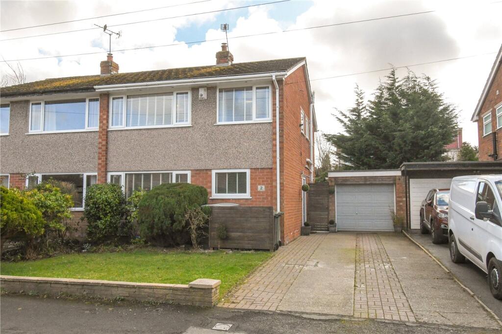
2 KINGSLEY CLOSE
WIRRAL, MERSEYSIDE, CH61 5XX
£321,000
Location
Nearby
Nearest stations, universities and amenities (distance from property).
| Type | Name | Distance |
|---|---|---|
| Bus stop | PENSBY ROAD/KINGSLEY CLOSE | 0.1 miles |
| Shop | Huws Gray | 0.2 miles |
| Train station | Heswall | 1.2 miles |
| Hospital | Clatterbridge Cancer Centre - Wirral | 2.8 miles |
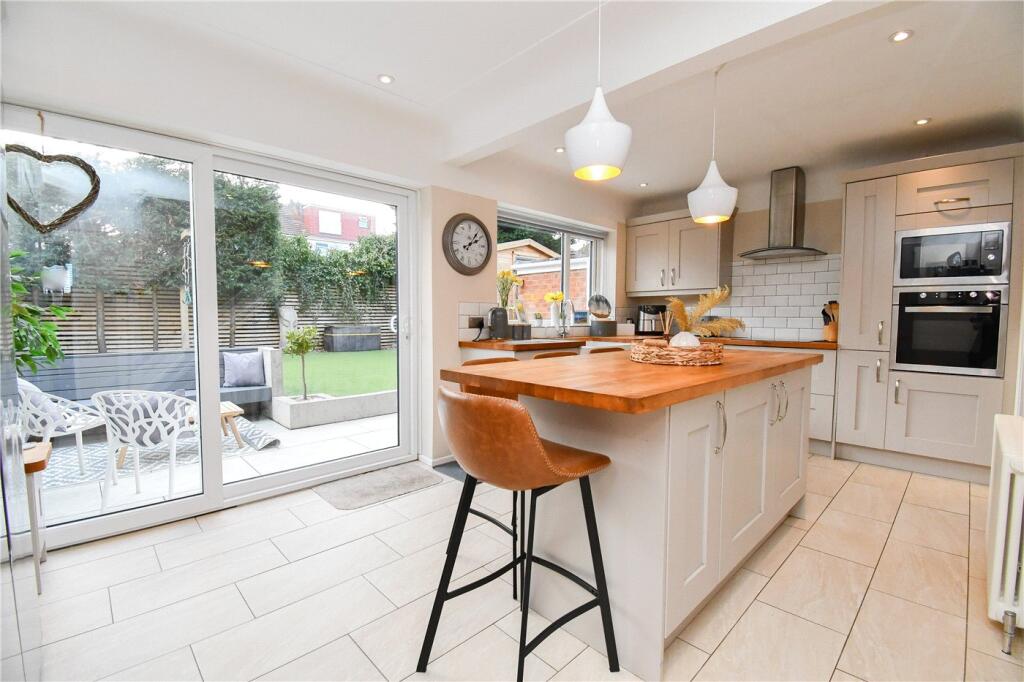
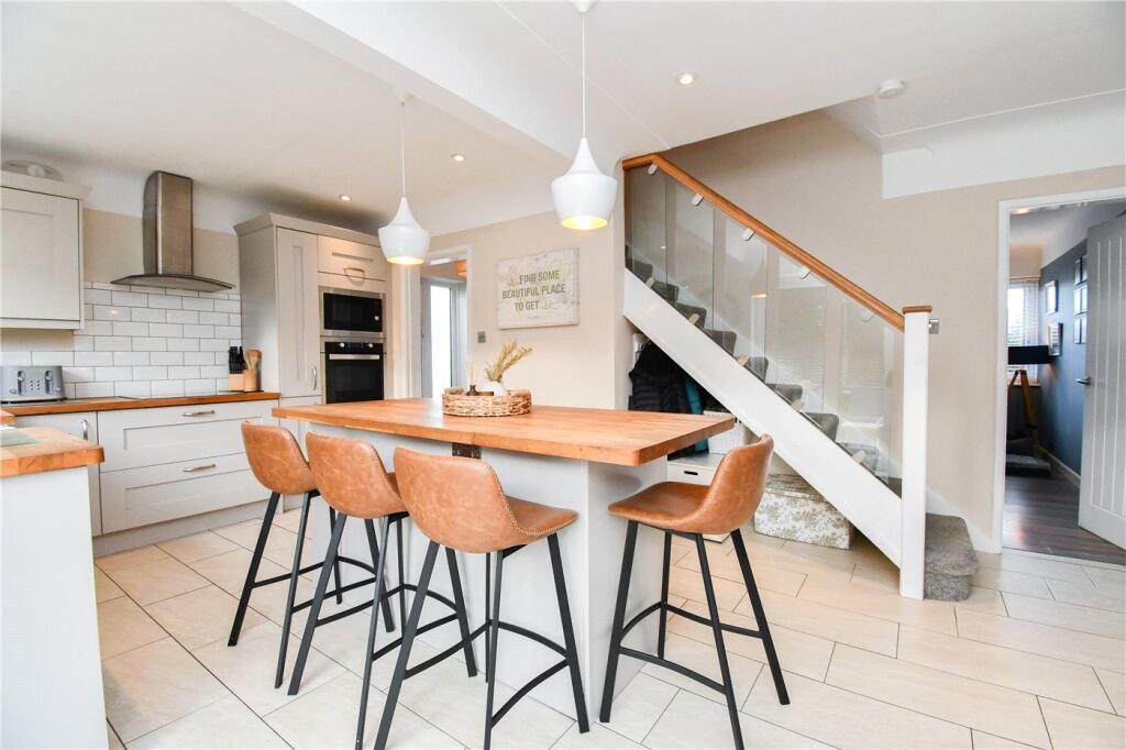
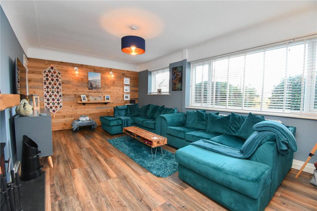
Property details
Tenure
Freehold
Property type
Semi-detached
Bedrooms
3
Bathrooms
1
Floor area
90 m²
EPC rating
C
Year built
England and Wales: 1967-1975
Last sold
£321,000 Feb 2026
Price per m²
£3,567/m²
Local average
£261,287 (47 sales)
Street crime
56 incidents within 1 mile (Apr 2026)
EPC Rating & Upgrade Cost
Current rating: C
Potential rating: C
Inspection date: 07/08/2025
Expiry date: 06/08/2035
Current heating cost: £836/year
Potential heating cost: £779/year
Est. upgrade cost to C: £16,500
Recommendations
- Floor insulation (solid floor) (£5,000 - £10,000)
- Solar photovoltaic panels, 2.5 kWp (£8,000 - £10,000)
Price history
| Event | Date | Price | Type | % change | Today’s value (HPI) | Action |
|---|---|---|---|---|---|---|
| Sold | 06/02/2026 | £321,000 | Semi-detached | +88.8% | £321,573 to March 2026 | View transaction |
| Sold | 18/02/2014 | £170,000 | Semi-detached | — | £306,164 to March 2026 | View transaction |
Historic listings
Listing and sale events only where we matched the listing page to a Land Registry sale already on record for this address.
| Event | Date | Price |
|---|---|---|
| sold | 01/01/2026 | £321,000 |
| listed | 19/07/2025 | £325,000 |
| sold | 01/01/2014 | £170,000 |
| sold | 01/01/2003 | £132,000 |
| sold | 01/01/1997 | £67,000 |
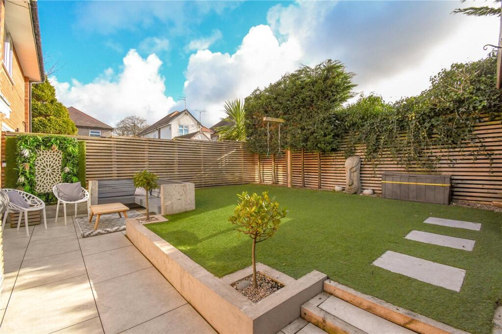
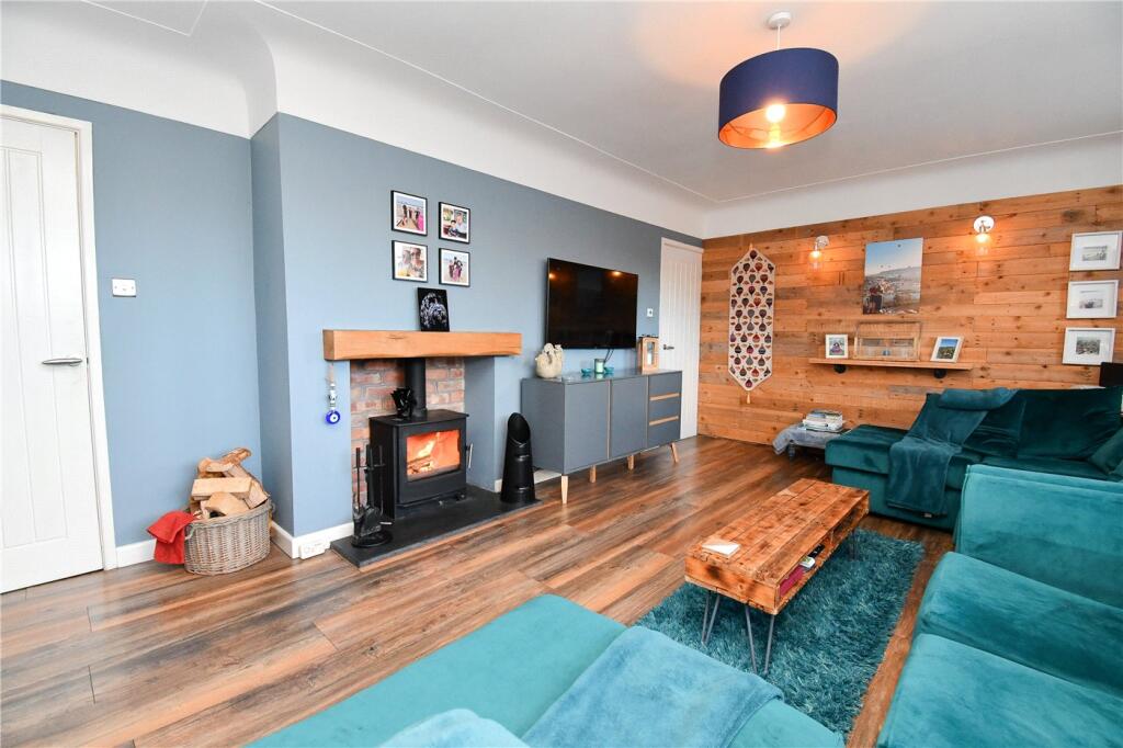
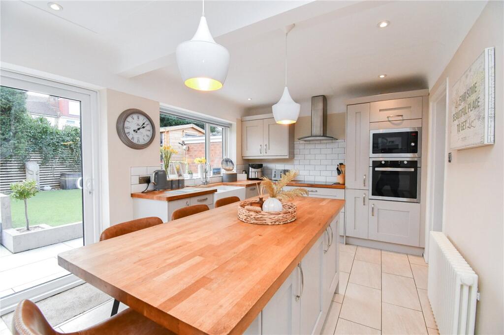
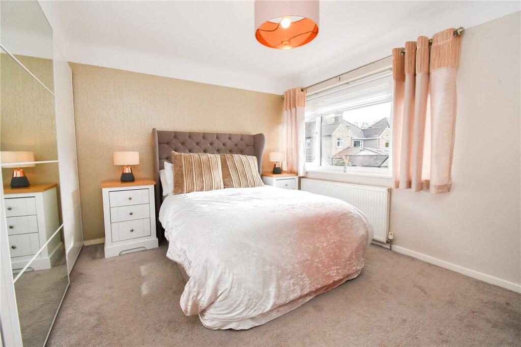
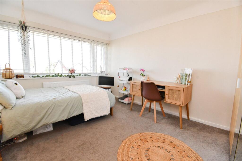
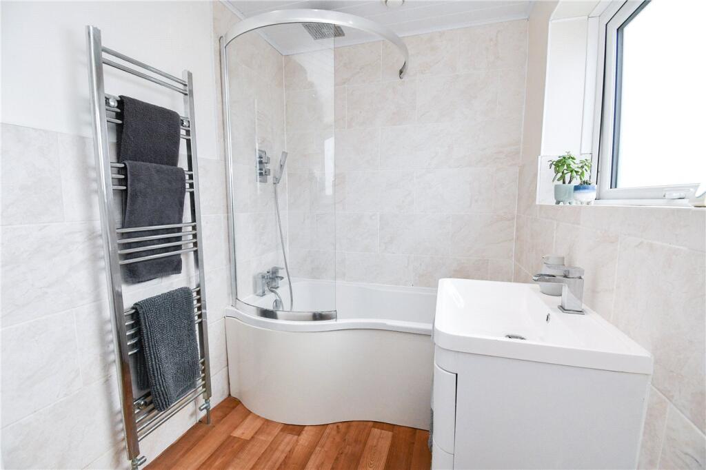
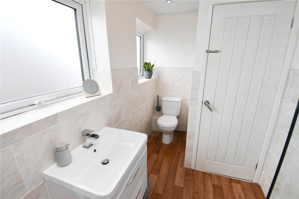
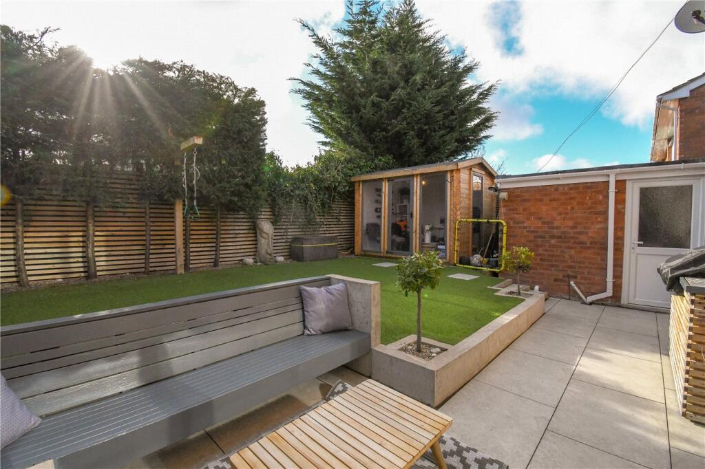
Photos · Open listing
 Open image 1 from listing 164727191
 Open image 2 from listing 164727191
 Open image 3 from listing 164727191
 Open image 4 from listing 164727191
 Open image 5 from listing 164727191
 Open image 6 from listing 164727191
 Open image 7 from listing 164727191
 Open image 8 from listing 164727191
 Open image 9 from listing 164727191
 Open image 10 from listing 164727191
 Open image 11 from listing 164727191
 Open image 12 from listing 164727191
Sold comparables
Same street and nearby sales within 0.25 miles (last 5 years). Land Registry Price Paid Data.
| Address | Price | Date | Type |
|---|---|---|---|
| 23 BELMONT DRIVE, WIRRAL, MERSEYSIDE, CH61 9NA | £390,000 | 12/12/2025 | Semi-detached |
| 37 GREENBANK DRIVE, WIRRAL, MERSEYSIDE, CH61 5UE | £315,000 | 11/12/2025 | Semi-detached |
| 26 BELMONT DRIVE, WIRRAL, MERSEYSIDE, CH61 9NB | £235,000 | 25/04/2025 | Semi-detached |
| 51 BELMONT DRIVE, WIRRAL, MERSEYSIDE, CH61 9NA | £322,000 | 28/11/2023 | Semi-detached |
| 23 BELMONT DRIVE, WIRRAL, MERSEYSIDE, CH61 9NA | £305,000 | 13/10/2023 | Semi-detached |
| 6 GREENBANK DRIVE, WIRRAL, MERSEYSIDE, CH61 5UF | £303,000 | 13/10/2023 | Semi-detached |
| 4 PINE VIEW DRIVE, WIRRAL, MERSEYSIDE, CH61 6UH | £287,500 | 11/08/2023 | Semi-detached |
| 5 PENMON DRIVE, WIRRAL, MERSEYSIDE, CH61 5UJ | £320,000 | 07/07/2023 | Semi-detached |
| 32 HILLFIELD DRIVE, WIRRAL, MERSEYSIDE, CH61 5UH | £330,000 | 16/06/2023 | Semi-detached |
| 23 GREENBANK DRIVE, WIRRAL, MERSEYSIDE, CH61 5UE | £249,500 | 14/04/2023 | Semi-detached |
| 3 KINGSLEY CLOSE, WIRRAL, MERSEYSIDE, CH61 5XX | £215,000 | 06/01/2023 | Semi-detached |
| 55 ASHLEA ROAD, PENSBY, WIRRAL, MERSEYSIDE, CH61 5UQ | £264,000 | 02/12/2022 | Semi-detached |
| 11 KYLEMORE DRIVE, WIRRAL, MERSEYSIDE, CH61 6UG | £300,000 | 02/12/2022 | Semi-detached |
| 23 PENMON DRIVE, WIRRAL, MERSEYSIDE, CH61 5UJ | £285,000 | 01/12/2022 | Semi-detached |
| 41 BELMONT DRIVE, WIRRAL, MERSEYSIDE, CH61 9NA | £321,750 | 18/10/2022 | Semi-detached |
| 279 PENSBY ROAD, HESWALL, WIRRAL, MERSEYSIDE, CH61 5UB | £358,000 | 25/08/2022 | Semi-detached |
| 44 ASHLEA ROAD, PENSBY, WIRRAL, MERSEYSIDE, CH61 5UN | £260,000 | 08/08/2022 | Semi-detached |
| 31 PINE VIEW DRIVE, WIRRAL, MERSEYSIDE, CH61 6UH | £240,000 | 04/08/2022 | Semi-detached |
| 23 PINE VIEW DRIVE, WIRRAL, MERSEYSIDE, CH61 6UH | £280,000 | 27/06/2022 | Semi-detached |
| 35 BELMONT DRIVE, WIRRAL, MERSEYSIDE, CH61 9NA | £295,000 | 24/06/2022 | Semi-detached |
Area average: £293,788 (20 sales)
For sale comparables
No active for-sale comparables found within 1 mile for the same bedrooms and property type.
Capital growth trend
Land Registry outcode average: last 12 months vs 5y and 10y ago (from sold prices).
House Price Index (HM Land Registry — official index, not sold-price averages): Wirral. Series: Semi-detached. As of March 2026.
Rental Range
Estimated market rent for Wirral. Low = conservative, Realistic = average, Optimistic = best case.
Based on Local Authority from postcode lookup → Wirral.
LHA (30th percentile) floor for Wirral: Apr 2025 – Mar 2026
Rental Comparables
Residential lets from OpenRent and Rightmove for the area (same bedroom count). Use to validate rent estimates. Student lets are excluded.
| Title | Rent | Beds | Distance | As seen on |
|---|---|---|---|---|
| 3 Bed Semi-Detached House, East O Hills, CH60 | £1,350/mo | 3 | 0.52 miles | OpenRent |
Average rent: £1,350/mo (1 listing)
Rent-driven metrics
Based on OpenRent comparables.
- Rent ratio — Monthly rent ÷ purchase price (1% rule). 1%+ = strong, 0.8–1% = okay, <0.8% = weak for cashflow.
- Max investor price — Rent ÷ 0.8%; the price at which rent would be 0.8% of price (Stoke-style target).
- Target investor price — Rent ÷ 1%; the price at which rent would be 1% of price (strong cashflow band).
- Gross yield — Annual rent as % of purchase price (no costs).
- Cost-to-rent — Price ÷ annual rent (from OpenRent comparables). Under 14× = strong, 14–16× = acceptable, 17×+ = compressed.
- Cashflow — Rent minus mortgage, 10% maintenance, £25/mo compliance. Assumes 75% LTV, 3.95% APR (5yr fixed), 25yr term.
- ROI — Annual profit ÷ cash in (deposit + 4% purchase costs).
Flood risk
Zone: 1
Risk: Low
Not in Flood Risk Area (no data)
Street-level crime
| Category | Count |
|---|---|
| Violence and sexual offences | 23 |
| Anti-social behaviour | 12 |
| Drugs | 6 |
| Shoplifting | 5 |
| Other theft | 4 |
| Criminal damage and arson | 3 |
| Public order | 2 |
| Other crime | 1 |
| Total incidents | 56 |
Within 1 mile during Apr 2026. Source: data.police.uk (England & Wales).
Schools nearby
Nearest open schools with Ofsted ratings (England). Closed schools are not shown. Data from Get Information about Schools and Ofsted.
| Name | Type | Distance | Ofsted |
|---|---|---|---|
| Stanley School | Other | 0.1 miles | Good — 28 Mar 2013 |
| Pensby Primary School | Primary | 0.2 miles | Good — 4 May 2017 |
| Ladymount Catholic Primary School | Primary | 0.4 miles | Good — 11 Jul 2024 |
| Heswall Primary School | Primary | 0.6 miles | Good — 29 Mar 2012 |
| Pensby High School | Secondary | 0.8 miles | Good — 28 Feb 2018 |
FENSA
Window and door installation certificates found for this address.
| Issued | Work completed | Windows | Doors |
|---|---|---|---|
| 16/05/2021 | 13/05/2021 | 9 | 2 |
| 15/10/2002 | 27/05/2002 | 1 | — |