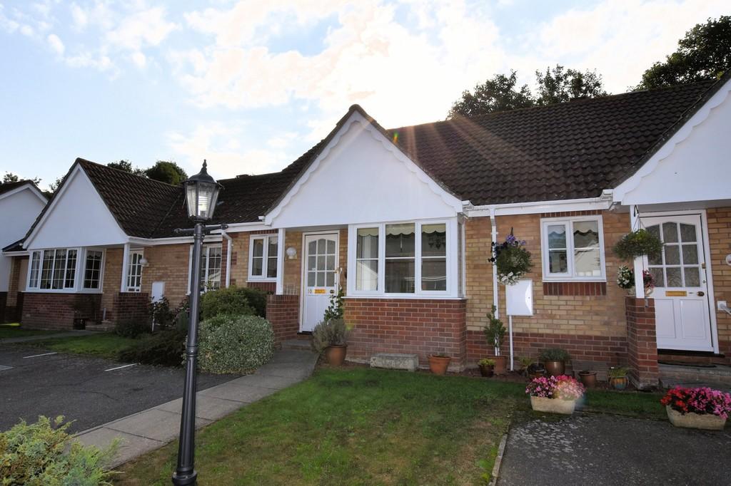
10 BANHAM DRIVE
SUDBURY, BABERGH, SUFFOLK, CO10 2GN
£145,500
Location
Nearby
Nearest stations, universities and amenities (distance from property).
| Type | Name | Distance |
|---|---|---|
| Bus stop | Banham Drive | 0.1 miles |
| Shop | Sudbury Convenience Store | 0.2 miles |
| Train station | Sudbury | 0.4 miles |
| Hospital | Sudbury Community Health Centre | 0.7 miles |
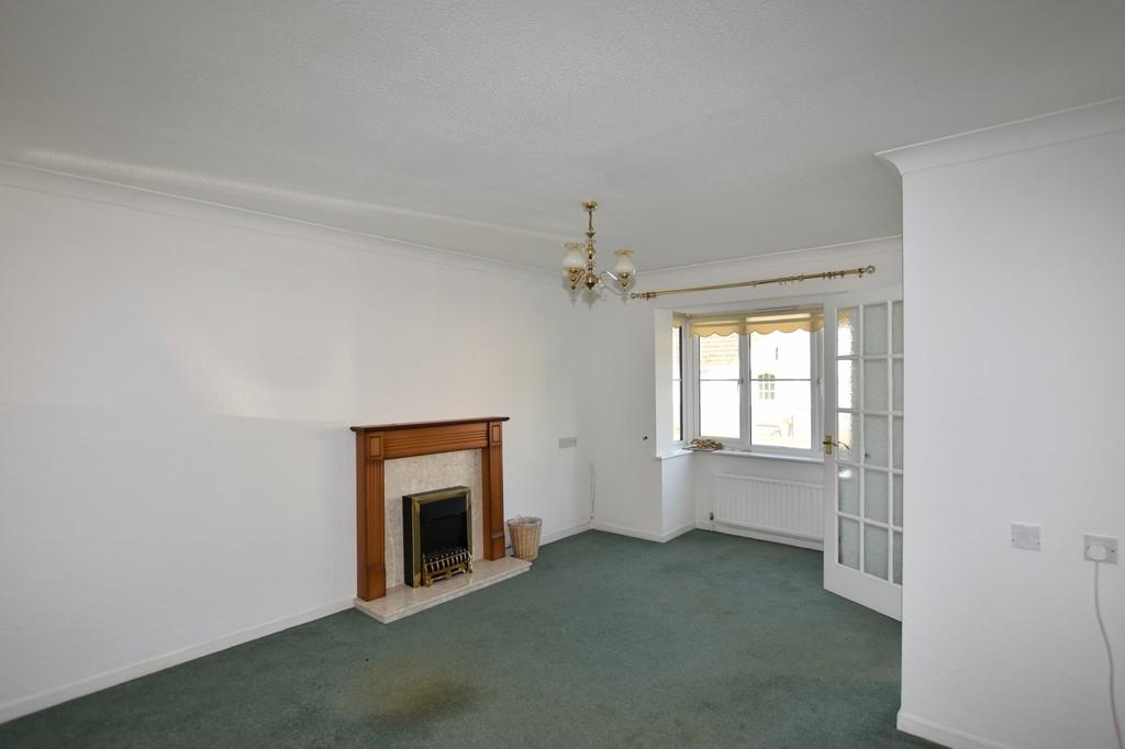
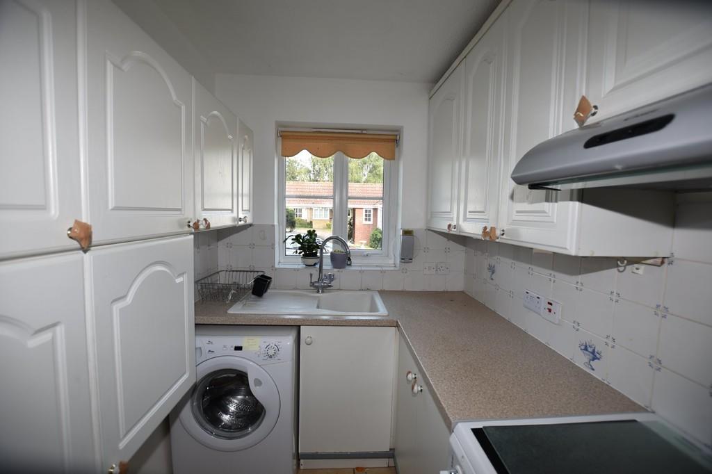
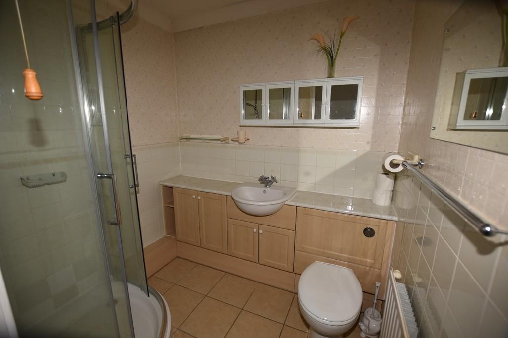
Property details
Tenure
Leasehold
Property type
Terraced
Bedrooms
2
Bathrooms
1
Floor area
52 m²
EPC rating
D
Year built
England and Wales: 1991-1995
Last sold
£145,500 Jun 2004
Price per m²
£2,798/m²
Local average
£268,127 (55 sales)
Street crime
112 incidents within 1 mile (Apr 2026)
EPC Rating & Upgrade Cost
Current rating: D
Potential rating: B
Inspection date: 30/08/2018
Current heating cost: £436/year
Potential heating cost: £398/year
Recommendations
- Floor insulation (suspended floor) (1,200)
- Low energy lighting for all fixed outlets (30)
- Solar water heating (6,000)
- Solar photovoltaic panels, 2.5 kWp (8,000)
Price history
| Event | Date | Price | Type | % change | Today’s value (HPI) | Action |
|---|---|---|---|---|---|---|
| Sold | 21/06/2004 | £145,500 | Terraced | +69.2% | £294,220 to March 2026 | View transaction |
| Sold | 28/11/2001 | £86,000 | Terraced | — | £263,506 to March 2026 | View transaction |
Historic listings
Listing and sale events only where we matched the listing page to a Land Registry sale already on record for this address.
| Event | Date | Price |
|---|---|---|
| sold | 01/01/2026 | £165,000 |
| listed | 02/09/2021 | £750 |
| sold | 01/01/2004 | £145,500 |
| sold | 01/01/2001 | £86,000 |
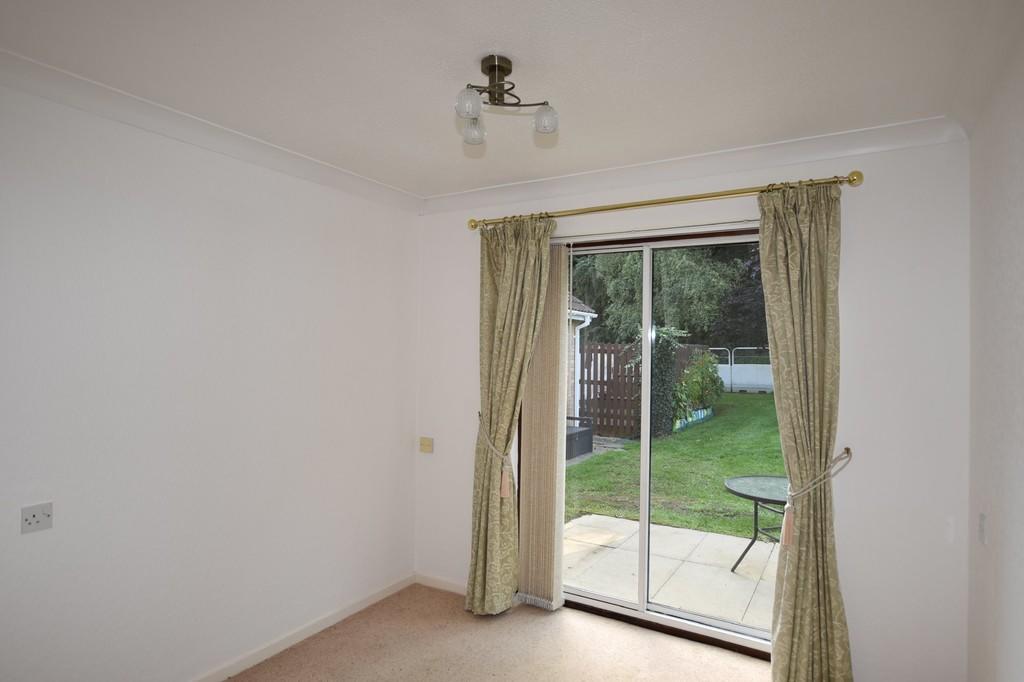
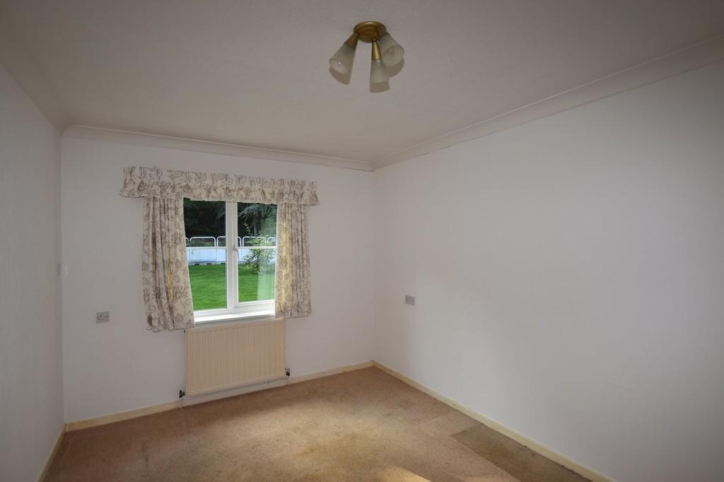
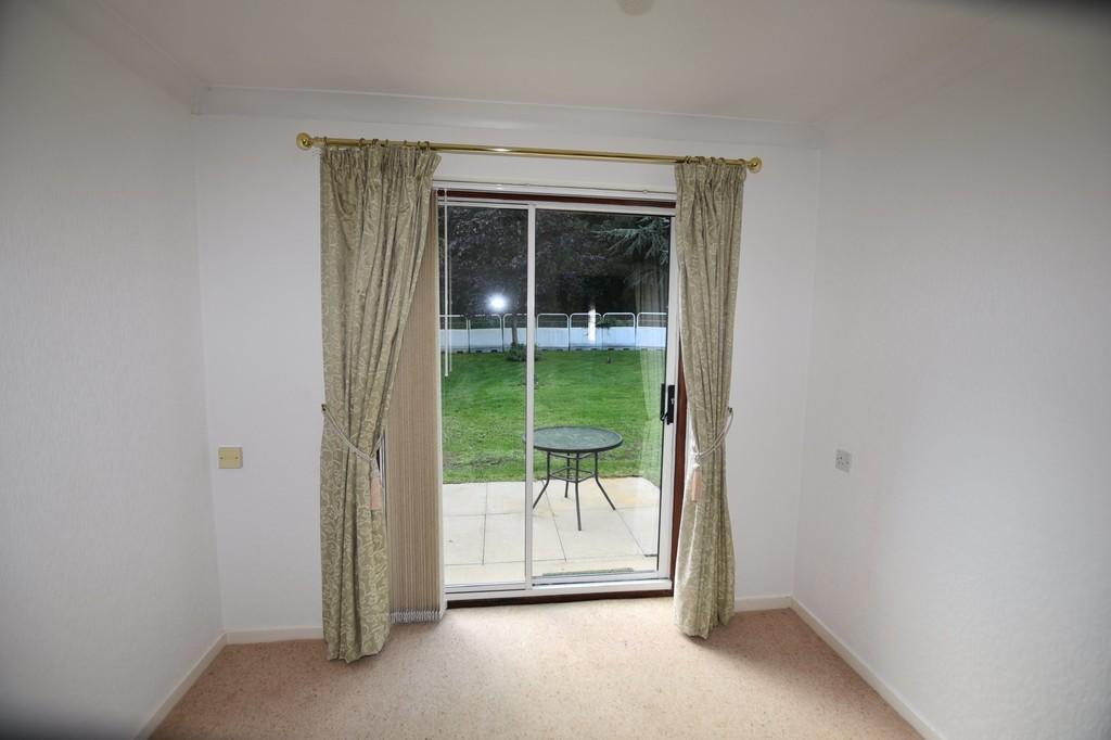
Photos · Open listing
 Open image 1 from listing 112858160
 Open image 2 from listing 112858160
 Open image 3 from listing 112858160
 Open image 4 from listing 112858160
 Open image 5 from listing 112858160
 Open image 6 from listing 112858160
 Open image 7 from listing 112858160
 Open image 8 from listing 112858160
 Open image 9 from listing 112858160
Sold comparables
Same street and nearby sales within 0.25 miles (last 5 years). Land Registry Price Paid Data.
| Address | Price | Date | Type |
|---|---|---|---|
| 10 BANHAM DRIVE, SUDBURY, BABERGH, SUFFOLK, CO10 2GN | £165,000 | 20/03/2026 | Terraced |
| 34 EAST STREET, SUDBURY, BABERGH, SUFFOLK, CO10 2TU | £210,000 | 17/11/2025 | Terraced |
| 49 BANHAM DRIVE, SUDBURY, BABERGH, SUFFOLK, CO10 2GN | £160,000 | 03/10/2025 | Terraced |
| 1 BRIDGE TERRACE, SUDBURY, BABERGH, SUFFOLK, CO10 2TT | £260,000 | 12/10/2023 | Terraced |
| 48 MINDEN ROAD, SUDBURY, BABERGH, SUFFOLK, CO10 2TY | £175,000 | 26/06/2023 | Terraced |
| 10 HARP CLOSE ROAD, SUDBURY, BABERGH, SUFFOLK, CO10 1QP | £245,500 | 12/05/2023 | Terraced |
| 46 EAST STREET, SUDBURY, BABERGH, SUFFOLK, CO10 2TR | £202,000 | 24/03/2023 | Terraced |
| 55 EAST STREET, SUDBURY, BABERGH, SUFFOLK, CO10 2TR | £280,000 | 16/02/2023 | Terraced |
| 33A EAST STREET, SUDBURY, BABERGH, SUFFOLK, CO10 2TU | £131,000 | 13/02/2023 | Terraced |
| 33 EAST STREET, SUDBURY, BABERGH, SUFFOLK, CO10 2TU | £141,000 | 03/02/2023 | Terraced |
| 7 HARP CLOSE ROAD, SUDBURY, BABERGH, SUFFOLK, CO10 1QP | £292,500 | 03/11/2022 | Terraced |
| 18 BANHAM DRIVE, SUDBURY, BABERGH, SUFFOLK, CO10 2GN | £190,000 | 24/10/2022 | Terraced |
| 13 WALDINGFIELD ROAD, SUDBURY, BABERGH, SUFFOLK, CO10 2PU | £280,000 | 16/09/2022 | Terraced |
| 79 ACTON LANE, SUDBURY, BABERGH, SUFFOLK, CO10 1QW | £315,000 | 12/08/2022 | Terraced |
| 55 EAST STREET, SUDBURY, BABERGH, SUFFOLK, CO10 2TR | £210,000 | 12/07/2022 | Terraced |
| 4 ACTON CLOSE, SUDBURY, BABERGH, SUFFOLK, CO10 1QZ | £130,000 | 31/05/2022 | Terraced |
| 39 BANHAM DRIVE, SUDBURY, BABERGH, SUFFOLK, CO10 2GN | £182,500 | 19/05/2022 | Terraced |
| 77 ACTON LANE, SUDBURY, BABERGH, SUFFOLK, CO10 1QW | £300,000 | 19/05/2022 | Terraced |
| 2 BRIDGE TERRACE, SUDBURY, BABERGH, SUFFOLK, CO10 2TT | £248,500 | 30/03/2022 | Terraced |
| 45 WALDINGFIELD ROAD, SUDBURY, BABERGH, SUFFOLK, CO10 2PU | £220,000 | 04/03/2022 | Terraced |
Area average: £216,900 (20 sales)
For sale comparables
No active for-sale comparables found within 1 mile for the same bedrooms and property type.
Capital growth trend
Land Registry outcode average: last 12 months vs 5y and 10y ago (from sold prices).
House Price Index (HM Land Registry — official index, not sold-price averages): Babergh. Series: Terraced. As of March 2026.
Rental Range
Estimated market rent for Babergh. Low = conservative, Realistic = average, Optimistic = best case.
Based on Local Authority from postcode lookup → Babergh.
LHA (30th percentile) floor for Bury St Edmunds: Apr 2025 – Mar 2026
Rental Comparables
Residential lets in the area (all bedroom counts shown — none matched the 2-bedroom count for this property). Student lets are excluded.
| Title | Rent | Beds | Distance | As seen on |
|---|---|---|---|---|
| 1 Bed Terraced House, Newton Croft, CO10 | £875/mo | 1 | 0.32 miles | OpenRent |
| 1 Bed Flat, Station Road, CO10 | £875/mo | 1 | 0.42 miles | OpenRent |
| 1 Bed Flat, Station Road, CO10 | £895/mo | 1 | 0.42 miles | OpenRent |
| 1 Bed Flat, Station Road, CO10 | £950/mo | 1 | 0.42 miles | OpenRent |
| 3 Bed Terraced House, Drake Road, CO10 | £800/mo | 3 | 0.56 miles | OpenRent |
| 4 Bed Terraced House, Priory Walk, CO10 | £1,400/mo | 4 | 0.68 miles | OpenRent |
| 3 Bed Terraced House, Cross Street, CO10 | £1,300/mo | 3 | 0.76 miles | OpenRent |
| 1 Bed Bungalow, Bures Road, CO10 | £825/mo | 1 | 0.79 miles | OpenRent |
| 1 Bed Flat, Dove House Meadow, CO10 | £875/mo | 1 | 1.02 miles | OpenRent |
| 4 Bed End Terrace, Rede Way, CO10 | £1,250/mo | 4 | 1.04 miles | OpenRent |
| 4 Bed Terraced House, Dove House Meadow, CO10 | £1,500/mo | 4 | 1.09 miles | OpenRent |
Average rent: £1,050/mo (11 listings)
Rent-driven metrics
Based on OpenRent comparables.
- Rent ratio — Monthly rent ÷ purchase price (1% rule). 1%+ = strong, 0.8–1% = okay, <0.8% = weak for cashflow.
- Max investor price — Rent ÷ 0.8%; the price at which rent would be 0.8% of price (Stoke-style target).
- Target investor price — Rent ÷ 1%; the price at which rent would be 1% of price (strong cashflow band).
- Gross yield — Annual rent as % of purchase price (no costs).
- Cost-to-rent — Price ÷ annual rent (from OpenRent comparables). Under 14× = strong, 14–16× = acceptable, 17×+ = compressed.
- Cashflow — Rent minus mortgage, 10% maintenance, £25/mo compliance. Assumes 75% LTV, 3.95% APR (5yr fixed), 25yr term.
- ROI — Annual profit ÷ cash in (deposit + 4% purchase costs).
Flood risk
Zone: 1
Risk: Low
Not in Flood Risk Area (no data)
Street-level crime
| Category | Count |
|---|---|
| Violence and sexual offences | 40 |
| Other theft | 18 |
| Criminal damage and arson | 17 |
| Public order | 8 |
| Anti-social behaviour | 7 |
| Shoplifting | 7 |
| Drugs | 5 |
| Other crime | 4 |
| Vehicle crime | 3 |
| Burglary | 1 |
| Robbery | 1 |
| Theft from the person | 1 |
| Total incidents | 112 |
Within 1 mile during Apr 2026. Source: data.police.uk (England & Wales).
Schools nearby
Nearest open schools with Ofsted ratings (England). Closed schools are not shown. Data from Get Information about Schools and Ofsted.
| Name | Type | Distance | Ofsted |
|---|---|---|---|
| Tudor Church of England Primary School, Sudbury | Primary | 0.3 miles | Good — 11 Jun 2018 |
| Ormiston Sudbury Academy | Secondary | 0.4 miles | Requires improvement — 18 Oct 2023 |
| St Joseph's Roman Catholic Primary School | Primary | 0.5 miles | Good — 6 Sep 2017 |
| Hillside Special School | Other | 0.5 miles | Outstanding — 12 Feb 2014 |
| Woodhall Primary School | Primary | 0.6 miles | Good — 8 Jan 2020 |
FENSA
Window and door installation certificates found for this address.
| Issued | Work completed | Windows | Doors |
|---|---|---|---|
| 04/07/2011 | 23/06/2011 | 3 | — |