3 SETLEY WAY
BRACKNELL, BRACKNELL FOREST, RG12 9FF
£655,000
Location
Nearby
Nearest stations, universities and amenities (distance from property).
| Type | Name | Distance |
|---|---|---|
| Bus stop | Allsmoor Lane | 0.2 miles |
| Train station | Martins Heron | 0.2 miles |
| Shop | Morrisons Daily | 0.5 miles |
| Hospital | St Mark's Hospital | 8.1 miles |
| University | University of Reading - Whiteknights Campus | 9.9 miles |
Property details
Tenure
Freehold
Property type
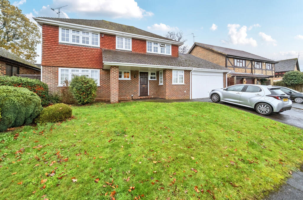
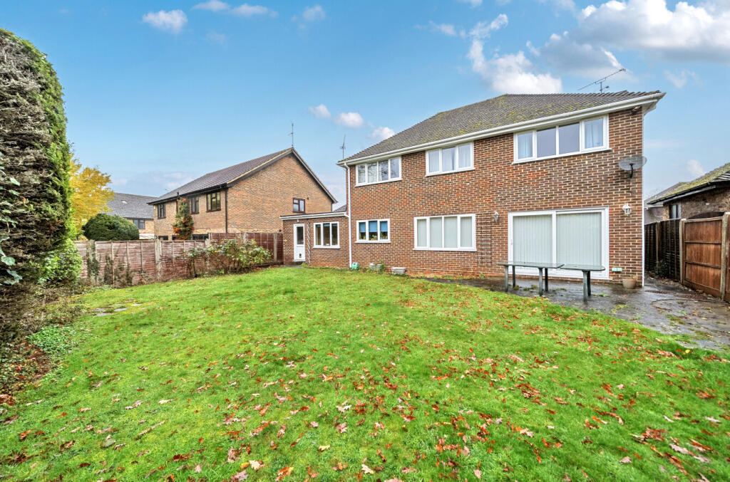
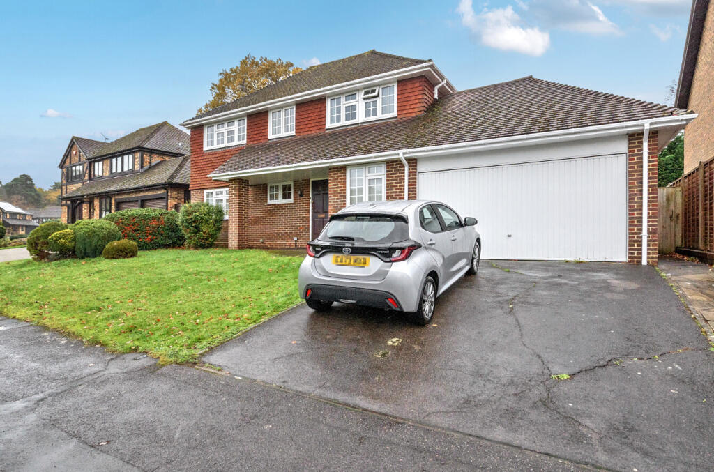
Detached
Bedrooms
4
Bathrooms
2
Floor area
133 m²
EPC rating
C
Year built
England and Wales: 1991-1995
Last sold
£655,000 May 2026
Price per m²
£4,925/m²
Local average
£603,771 (36 sales)
Street crime
116 incidents within 1 mile (Aug 2026)
EPC Rating & Upgrade Cost
Current rating: C
Potential rating: C
Inspection date: 01/12/2025
Expiry date: 30/11/2035
Current heating cost: £1,024/year
Potential heating cost: £840/year
Est. upgrade cost to C: £17,550
Recommendations
- Increase loft insulation to 270 mm (£900 - £1,200)
- Floor insulation (solid floor) (£5,000 - £10,000)
- Solar photovoltaic panels, 2.5 kWp (£8,000 - £10,000)
Price history
| Event | Date | Price | Type | % change | Today’s value (HPI) | Action |
|---|---|---|---|---|---|---|
| Sold | 08/05/2026 | £655,000 | Detached | — | £643,280 to July 2026 | View transaction |
Historic listings
Listing and sale events only where we matched the listing page to a Land Registry sale already on record for this address.
| Event | Date | Price |
|---|---|---|
| sold | 01/01/2026 | £655,000 |
| listed | 02/12/2025 | £650,000 |
| sold | 01/01/2001 | £323,000 |
Sold comparables
Same street and nearby sales within 0.25 miles (last 5 years). Land Registry Price Paid Data.
| Address | Price | Date | Type |
|---|---|---|---|
| 17 LYNDHURST CLOSE, BRACKNELL, BRACKNELL FOREST, RG12 9QP | £635,000 | 05/01/2026 | Detached |
| 24 SETLEY WAY, BRACKNELL, WOKINGHAM, RG12 9FF | £450,000 | 12/09/2025 | Detached |
| 5 SETLEY WAY, BRACKNELL, BRACKNELL FOREST, RG12 9FF | £810,000 | 29/07/2025 | Detached |
| 40 SETLEY WAY, BRACKNELL, BRACKNELL FOREST, RG12 9FF | £465,000 | 06/09/2024 | Detached |
| 6 LYNDHURST CLOSE, BRACKNELL, BRACKNELL FOREST, RG12 9QP | £770,000 | 25/09/2023 | Detached |
| 19 SETLEY WAY, BRACKNELL, BRACKNELL FOREST, RG12 9FF | £455,000 | 02/12/2022 | Detached |
| 33 EMERY DOWN CLOSE, BRACKNELL, BRACKNELL FOREST, RG12 9FH | £782,500 | 30/11/2022 | Detached |
| 38 CROSS GATES CLOSE, BRACKNELL, BRACKNELL FOREST, RG12 9TY | £522,500 | 29/11/2022 | Detached |
| 1 BEAULIEU CLOSE, BRACKNELL, BRACKNELL FOREST, RG12 9QL | £740,000 | 26/10/2022 | Detached |
| 3 RADNOR ROAD, BRACKNELL, BRACKNELL FOREST, RG12 9FD | £475,000 | 26/10/2022 | Detached |
| 5 HIGH BEECH, BRACKNELL, BRACKNELL FOREST, RG12 9YY | £800,000 | 29/07/2022 | Detached |
| 5 OLD TOLLGATE CLOSE, BRACKNELL, BRACKNELL FOREST, RG12 9RQ | £720,000 | 30/06/2022 | Detached |
| 4 MINSTEAD CLOSE, BRACKNELL, BRACKNELL FOREST, RG12 9FE | £635,000 | 15/06/2022 | Detached |
| 32 LYNDHURST CLOSE, BRACKNELL, BRACKNELL FOREST, RG12 9QP | £665,000 | 06/05/2022 | Detached |
| 7 OLD TOLLGATE CLOSE, BRACKNELL, BRACKNELL FOREST, RG12 9RQ | £745,000 | 11/03/2022 | Detached |
| 3 BEAULIEU CLOSE, BRACKNELL, BRACKNELL FOREST, RG12 9QL | £711,000 | 06/01/2022 | Detached |
| 19 LYNDHURST CLOSE, BRACKNELL, BRACKNELL FOREST, RG12 9QP | £707,500 | 06/01/2022 | Detached |
| 6 EMERY DOWN CLOSE, BRACKNELL, BRACKNELL FOREST, RG12 9FH | £500,000 | 16/12/2021 | Detached |
| 20 EMERY DOWN CLOSE, BRACKNELL, BRACKNELL FOREST, RG12 9FH | £475,000 | 25/11/2021 | Detached |
Area average: £634,921 (19 sales)
For sale comparables
No active for-sale comparables found within 1 mile for the same bedrooms and property type.
Capital growth trend
Land Registry outcode average: last 12 months vs 5y and 10y ago (from sold prices).
House Price Index (HM Land Registry — official index, not sold-price averages): Bracknell Forest. Series: Detached. As of July 2026.
Rental Range
Estimated market rent for Bracknell Forest. Low = conservative, Realistic = average, Optimistic = best case.
Based on Local Authority from postcode lookup → Bracknell Forest.
Rental Comparables
Rental comparables data is not available for this property.
Rent-driven metrics
Based on Area rent estimate.
- Rent ratio — Monthly rent ÷ purchase price (1% rule). 1%+ = strong, 0.8–1% = okay, <0.8% = weak for cashflow.
- Max investor price — Rent ÷ 0.8%; the price at which rent would be 0.8% of price (Stoke-style target).
- Target investor price — Rent ÷ 1%; the price at which rent would be 1% of price (strong cashflow band).
- Gross yield — Annual rent as % of purchase price (no costs).
Flood risk
Zone: 1
Risk: Low
Job (default Low)
Registered land (INSPIRE)
This location falls inside an HM Land Registry INSPIRE registered freehold polygon.
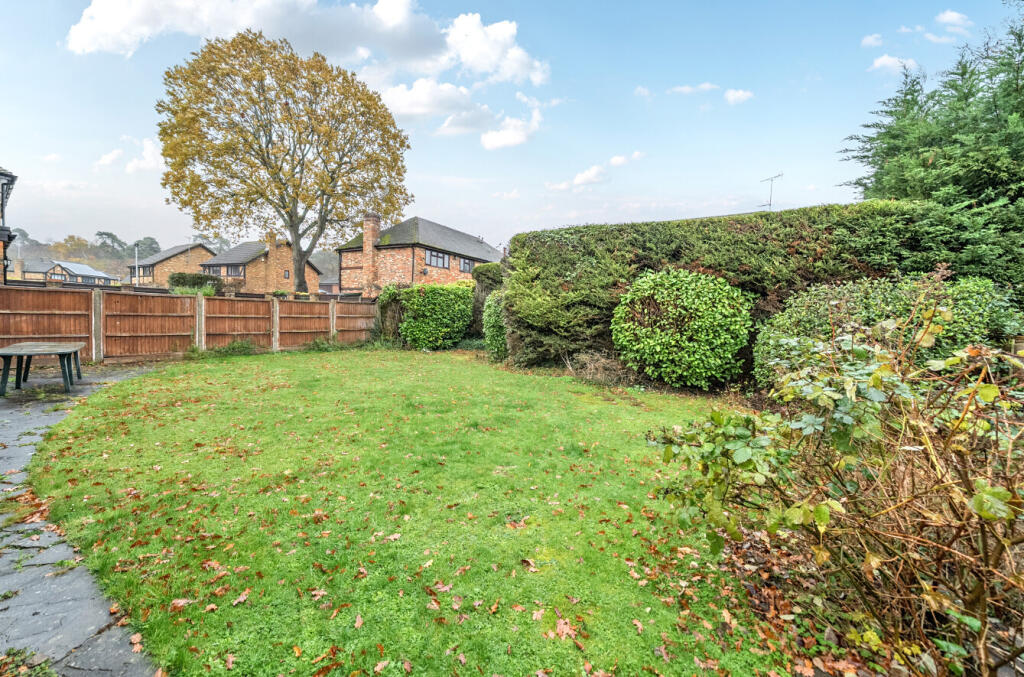
Plot: ~228 m² (0.06 acres)
Source: HM Land Registry INSPIRE Index Polygons.
Street-level crime
| Category | Count |
|---|---|
| Violence and sexual offences | 49 |
| Anti-social behaviour | 15 |
| Public order | 11 |
| Criminal damage and arson | 10 |
| Shoplifting | 8 |
| Other theft | 7 |
| Vehicle crime | 7 |
| Burglary | 4 |
| Other crime | 3 |
| Robbery | 1 |
| Theft from the person | 1 |
| Total incidents | 116 |
Within 1 mile during Aug 2026. Source: data.police.uk (England & Wales).
Schools nearby
Nearest open schools with Ofsted ratings (England). Closed schools are not shown. Data from Get Information about Schools and Ofsted.
| Name | Type | Distance | Ofsted |
|---|---|---|---|
| Heathfield School | Other | 0.6 miles | — (No rating) |
| Holly Spring Primary School | Primary | 0.6 miles | Good — 6 May 2024 |
| Harmans Water Primary School | Primary | 0.7 miles | Good — 20 Jul 2021 |
| LVS Ascot | Other | 0.8 miles | — (No rating) |
| St Joseph's Catholic Primary School, Bracknell | Primary | 0.9 miles | Good — 2 Mar 2022 |
FENSA
Window and door installation certificates found for this address.
| Issued | Work completed | Windows | Doors |
|---|---|---|---|
| 15/08/2016 | 20/07/2016 | 15 | 2 |