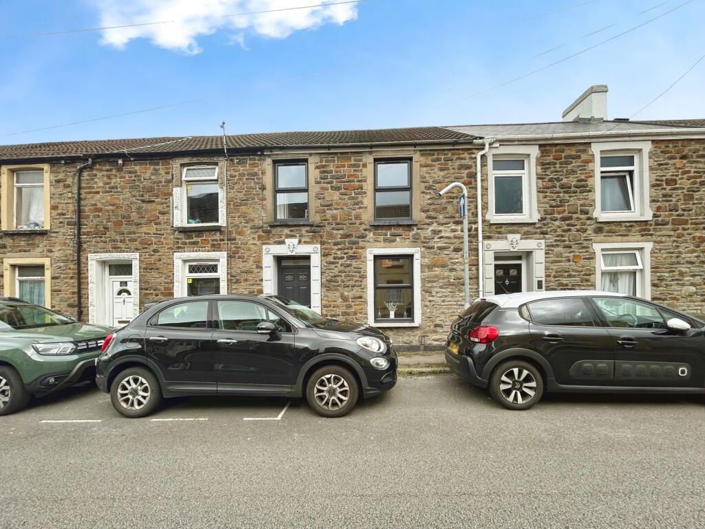
40 CRYTHAN ROAD
NEATH, NEATH PORT TALBOT, SA11 1SR
£135,050
Location
Nearby
Nearest stations, universities and amenities (distance from property).
| Type | Name | Distance |
|---|---|---|
| Shop | One Stop Shop | 0.2 miles |
| Bus stop | Victoria Gardens 11 | 0.5 miles |
| Train station | Neath | 0.5 miles |
| University | Swansea University | 6.1 miles |
| Hospital | St John Ambulance - Not manned 24/7 | 8.9 miles |
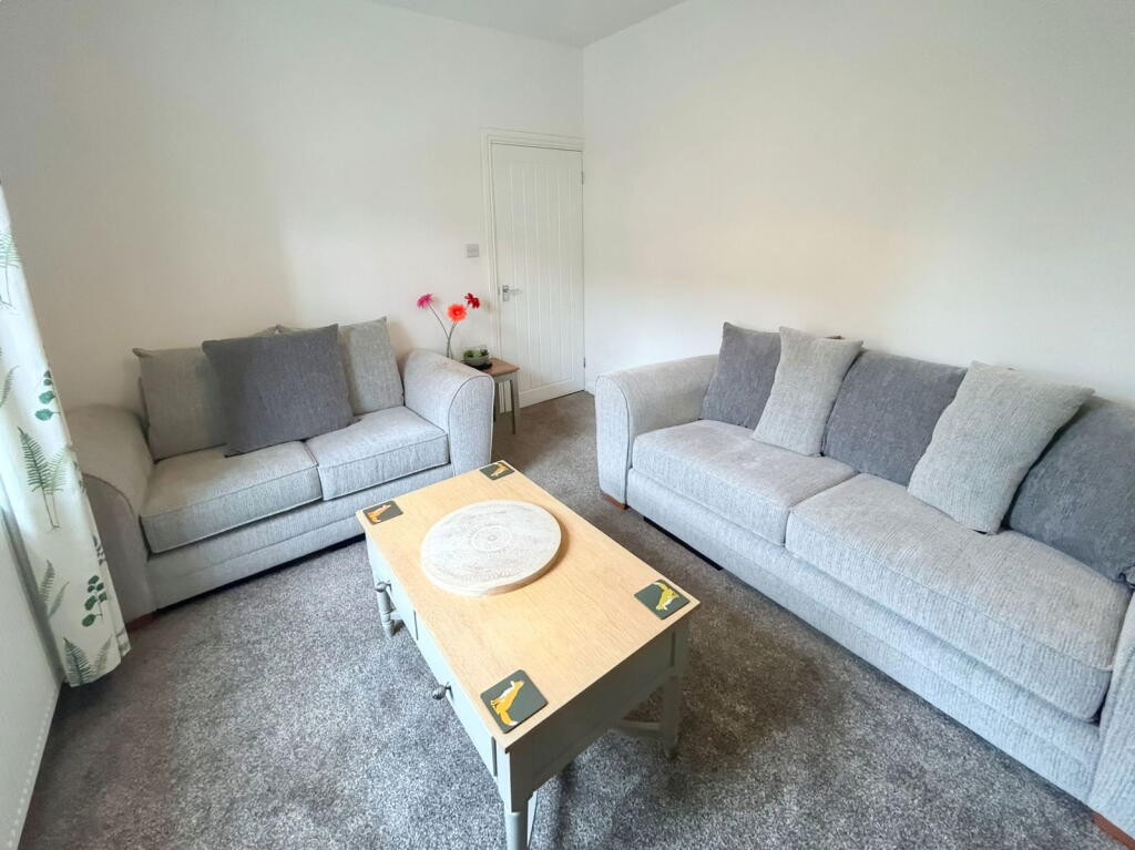
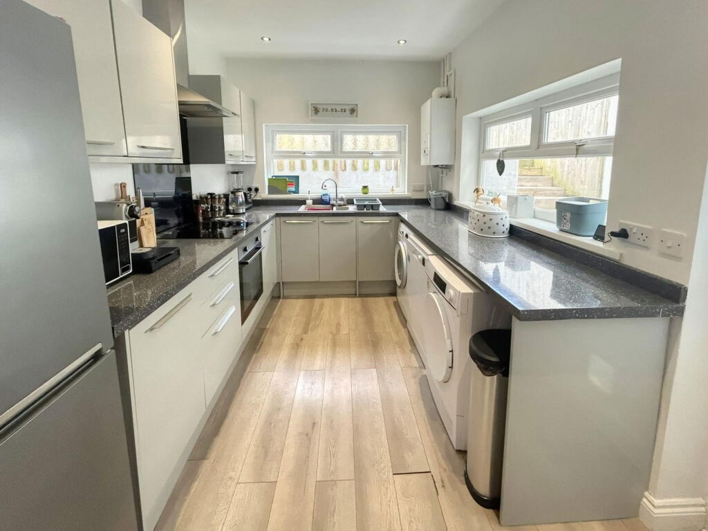
Property details
Tenure
Freehold
Property type
Terraced
Bedrooms
3
Bathrooms
2
Floor area
89 m²
EPC rating
C
Year built
England and Wales: 1900-1929
Last sold
£135,050 Feb 2026
Price per m²
£1,517/m²
Local average
£124,060 (80 sales)
Street crime
238 incidents within 1 mile (May 2026)
EPC Rating & Upgrade Cost
Current rating: C
Potential rating: B
Inspection date: 08/12/2020
Expiry date: 07/12/2030
Current heating cost: £545/year
Potential heating cost: £379/year
Est. upgrade cost to C: £24,525
Recommendations
- Cavity wall insulation (£500 - £1,500)
- 50 mm internal or external wall insulation (£4,000 - £14,000)
- Floor insulation (solid floor) (£4,000 - £6,000)
- Low energy lighting for all fixed outlets (£25)
- Solar water heating (£4,000 - £6,000)
- Solar photovoltaic panels, 2.5 kWp (£3,500 - £5,500)
Price history
| Event | Date | Price | Type | % change | Today’s value (HPI) | Action |
|---|---|---|---|---|---|---|
| Sold | 20/02/2026 | £135,050 | Terraced | +31.1% | £133,869 to April 2026 | View transaction |
| Sold | 31/03/2021 | £103,000 | Terraced | +136.8% | £134,348 to April 2026 | View transaction |
| Sold | 22/11/2018 | £43,500 | Terraced | — | £65,250 to April 2026 | View transaction |
Historic listings
Listing and sale events only where we matched the listing page to a Land Registry sale already on record for this address.
| Event | Date | Price |
|---|---|---|
| sold | 01/01/2026 | £135,050 |
| listed | 31/07/2025 | £130,000 |
| sold | 01/01/2021 | £103,000 |
| sold | 01/01/2018 | £43,500 |
| sold | 01/01/1997 | £19,000 |
Photos · Open listing
 Open image 1 from listing 165175754
 Open image 2 from listing 165175754
 Open image 3 from listing 165175754
 Open image 4 from listing 165175754
 Open image 5 from listing 165175754
 Open image 6 from listing 165175754
 Open image 7 from listing 165175754
 Open image 8 from listing 165175754
 Open image 9 from listing 165175754
 Open image 10 from listing 165175754
 Open image 11 from listing 165175754
 Open image 12 from listing 165175754
Sold comparables
Same street and nearby sales within 0.25 miles (last 5 years). Land Registry Price Paid Data.
| Address | Price | Date | Type |
|---|---|---|---|
| 97 BRITON FERRY ROAD, NEATH, NEATH PORT TALBOT, SA11 1AS | £120,000 | 23/01/2026 | Terraced |
| 9 LEWIS ROAD, NEATH, NEATH PORT TALBOT, SA11 1DZ | £87,500 | 01/12/2025 | Terraced |
| 2 SOUTHGATE STREET, NEATH, NEATH PORT TALBOT, SA11 1AG | £102,000 | 14/11/2025 | Terraced |
| 3 MARSHFIELD ROAD, NEATH, NEATH PORT TALBOT, SA11 1BD | £96,500 | 13/08/2025 | Terraced |
| 37 CRYTHAN ROAD, NEATH, NEATH PORT TALBOT, SA11 1SR | £76,000 | 01/08/2025 | Terraced |
| 70 BRITON FERRY ROAD, NEATH, NEATH PORT TALBOT, SA11 1AP | £89,000 | 31/07/2025 | Terraced |
| 9 WALLACE ROAD, NEATH, NEATH PORT TALBOT, SA11 1YL | £65,000 | 18/07/2025 | Terraced |
| 26 CRYTHAN ROAD, NEATH, NEATH PORT TALBOT, SA11 1SR | £79,950 | 08/12/2023 | Terraced |
| 13 MARSHFIELD ROAD, NEATH, NEATH PORT TALBOT, SA11 1BD | £136,000 | 06/12/2023 | Terraced |
| 41 BRITON FERRY ROAD, NEATH, NEATH PORT TALBOT, SA11 1AR | £60,000 | 03/11/2023 | Terraced |
| 43 CRYTHAN ROAD, NEATH, NEATH PORT TALBOT, SA11 1SR | £115,000 | 20/10/2023 | Terraced |
| 89 BRITON FERRY ROAD, NEATH, NEATH PORT TALBOT, SA11 1AS | £135,000 | 17/10/2023 | Terraced |
| 33 CRYTHAN ROAD, NEATH, NEATH PORT TALBOT, SA11 1SR | £71,000 | 15/09/2023 | Terraced |
| 12 EXCHANGE ROAD, NEATH, NEATH PORT TALBOT, SA11 1TD | £75,000 | 12/07/2023 | Terraced |
| 10 EXCHANGE ROAD, NEATH, NEATH PORT TALBOT, SA11 1TD | £77,500 | 05/05/2023 | Terraced |
| 19 LEWIS ROAD, NEATH, NEATH PORT TALBOT, SA11 1DZ | £73,000 | 04/05/2023 | Terraced |
| 13 EVA STREET, NEATH, NEATH PORT TALBOT, SA11 1PD | £99,500 | 31/03/2023 | Terraced |
| 20 EVA STREET, NEATH, NEATH PORT TALBOT, SA11 1PD | £47,000 | 15/03/2023 | Terraced |
| 15 EVA STREET, NEATH, NEATH PORT TALBOT, SA11 1PD | £107,000 | 13/02/2023 | Terraced |
| 13 SOUTHGATE STREET, NEATH, NEATH PORT TALBOT, SA11 1AG | £117,500 | 08/12/2022 | Terraced |
Area average: £91,473 (20 sales)
For sale comparables
No active for-sale comparables found within 1 mile for the same bedrooms and property type.
Capital growth trend
Land Registry outcode average: last 12 months vs 5y and 10y ago (from sold prices).
House Price Index (HM Land Registry — official index, not sold-price averages): Neath Port Talbot. Series: Terraced. As of April 2026.
Rental Range
Estimated market rent for Neath Port Talbot. Low = conservative, Realistic = average, Optimistic = best case.
Based on Local Authority from postcode lookup → Neath Port Talbot.
Rental Comparables
Residential lets from OpenRent and Rightmove for the area (same bedroom count). Use to validate rent estimates. Student lets are excluded.
| Title | Rent | Beds | Distance | As seen on |
|---|---|---|---|---|
| 3 Bed Terraced House, Crythan Road, SA11 | £775/mo | 3 | 0.09 miles | OpenRent |
| 3 Bed Terraced House, Ethel Street, SA11 | £745/mo | 3 | 0.16 miles | OpenRent |
| 3 Bed End Terrace, Alice Street, SA11 | £950/mo | 3 | 0.2 miles | OpenRent |
| 3 Bed Terraced House, Alice Street, SA11 | £825/mo | 3 | 0.21 miles | OpenRent |
| 3 Bed Terraced House, Osborne St, SA11 | £875/mo | 3 | 0.32 miles | OpenRent |
Average rent: £834/mo (5 listings)
Rent-driven metrics
Based on OpenRent comparables.
- This street — Gross yield for this street only (Land Registry sales + rental comparables, same postcode + street).
- Rent ratio — Monthly rent ÷ purchase price (1% rule). 1%+ = strong, 0.8–1% = okay, <0.8% = weak for cashflow.
- Max investor price — Rent ÷ 0.8%; the price at which rent would be 0.8% of price (Stoke-style target).
- Target investor price — Rent ÷ 1%; the price at which rent would be 1% of price (strong cashflow band).
- Gross yield — Annual rent as % of purchase price (no costs).
- Cost-to-rent — Price ÷ annual rent (from OpenRent comparables). Under 14× = strong, 14–16× = acceptable, 17×+ = compressed.
- Cashflow — Rent minus mortgage, 10% maintenance, £25/mo compliance. Assumes 75% LTV, 3.95% APR (5yr fixed), 25yr term.
- ROI — Annual profit ÷ cash in (deposit + 4% purchase costs).
Flood risk
Zone: 1
Risk: Low
Job (default Low)
Street-level crime
| Category | Count |
|---|---|
| Violence and sexual offences | 95 |
| Anti-social behaviour | 42 |
| Public order | 31 |
| Shoplifting | 19 |
| Other theft | 13 |
| Criminal damage and arson | 12 |
| Vehicle crime | 7 |
| Burglary | 6 |
| Other crime | 5 |
| Drugs | 4 |
| Possession of weapons | 2 |
| Robbery | 2 |
| Total incidents | 238 |
Within 1 mile during May 2026. Source: data.police.uk (England & Wales).
Schools nearby
Nearest open schools with Ofsted ratings (England). Closed schools are not shown. Data from Get Information about Schools and Ofsted.
| Name | Type | Distance | Ofsted |
|---|---|---|---|
| St Joseph's Catholic Primary School (Neath) | Other | 0.4 miles | — (No rating) |
| Gnoll Primary School | Other | 0.4 miles | — (No rating) |
| Horizons Educare | Other | 0.4 miles | — (No rating) |
| Alderman Davies CIW Primary School | Other | 0.6 miles | — (No rating) |
| YGG Castell-nedd | Other | 0.6 miles | — (No rating) |
FENSA
Window and door installation certificates found for this address.
| Issued | Work completed | Windows | Doors |
|---|---|---|---|
| 31/08/2025 | 12/08/2025 | 1 | — |
| 26/03/2023 | 01/03/2023 | 3 | 1 |