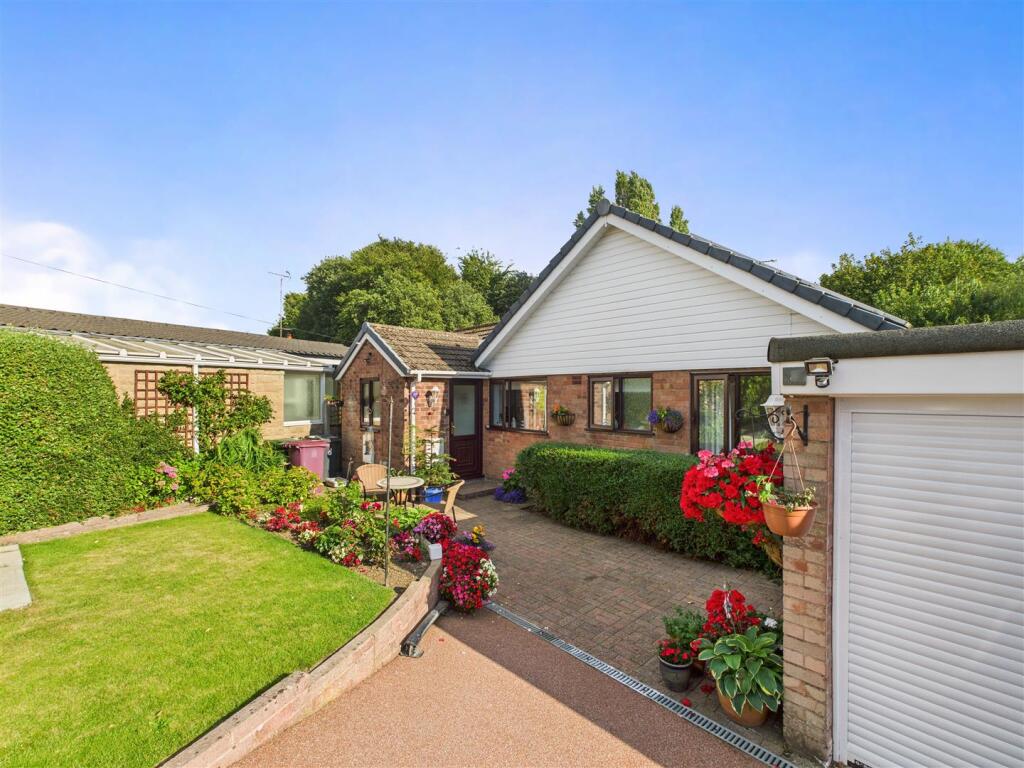
8 BEECHWOOD ROAD
DRONFIELD, NORTH EAST DERBYSHIRE, DERBYSHIRE, S18 1PW
£445,000
Location
Nearby
Nearest stations, universities and amenities (distance from property).
| Type | Name | Distance |
|---|---|---|
| Bus stop | Civic Centre | 0.1 miles |
| Shop | Geoffs DIY | 0.1 miles |
| Train station | Dronfield | 0.4 miles |
| Hospital | Argyll House | 4.4 miles |
| University | Sheffield Hallam University | 5.6 miles |
Property details
Tenure
Leasehold
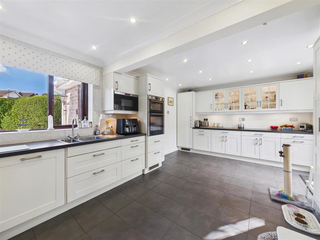
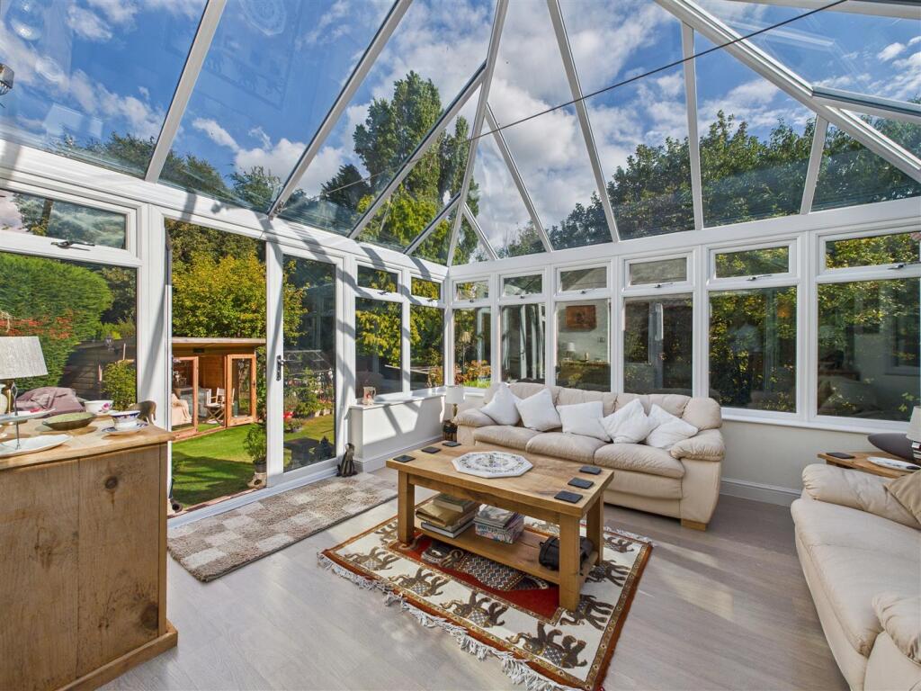
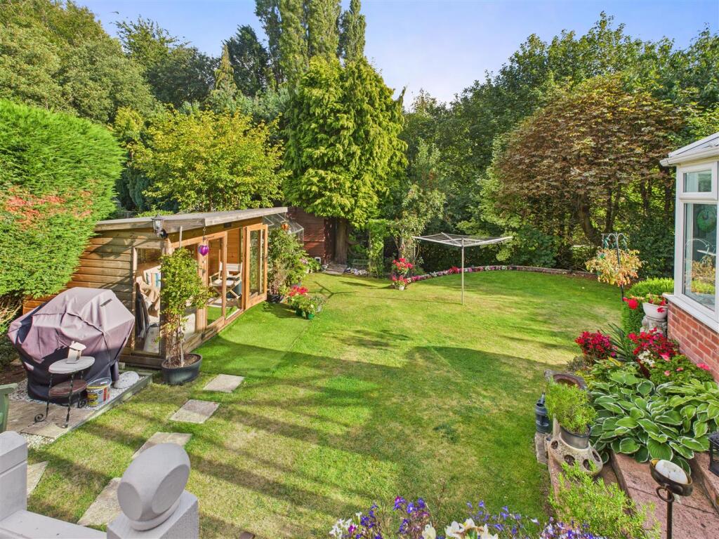
Property type
Detached
Bedrooms
4
Bathrooms
2
Floor area
107 m²
EPC rating
D
Year built
England and Wales: 1967-1975
Last sold
£445,000 Feb 2026
Price per m²
£4,159/m²
Local average
£428,121 (33 sales)
Street crime
67 incidents within 1 mile (May 2026)
EPC Rating & Upgrade Cost
Current rating: D
Potential rating: C
Inspection date: 10/09/2025
Expiry date: 09/09/2035
Current heating cost: £1,352/year
Potential heating cost: £1,127/year
Est. upgrade cost to C: £9,578
Recommendations
- Cavity wall insulation (£900 - £1,500)
- Floor insulation (suspended floor) (£5,000 - £10,000)
- Low energy lighting for all fixed outlets (£810 - £945)
Price history
| Event | Date | Price | Type | % change | Today’s value (HPI) | Action |
|---|---|---|---|---|---|---|
| Sold | 11/02/2026 | £445,000 | Detached | — | £471,176 to April 2026 | View transaction |
Historic listings
Listing and sale events only where we matched the listing page to a Land Registry sale already on record for this address.
| Event | Date | Price |
|---|---|---|
| sold | 01/01/2026 | £445,000 |
| listed | 21/11/2025 | £435,000 |
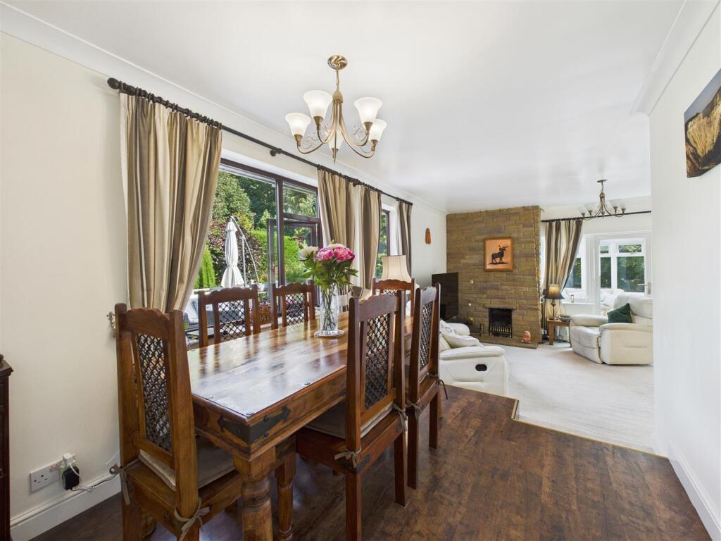
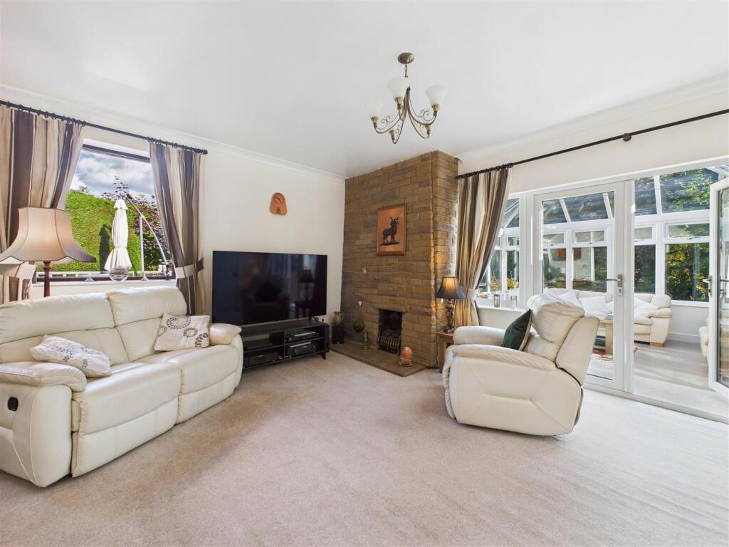
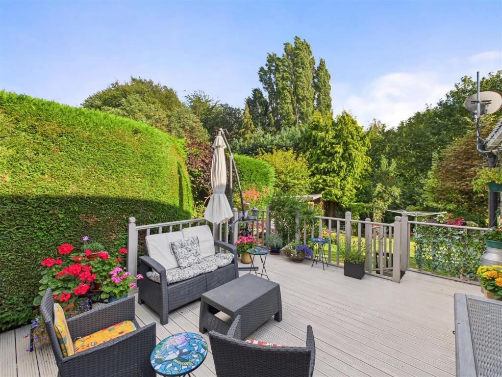
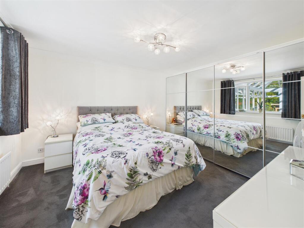
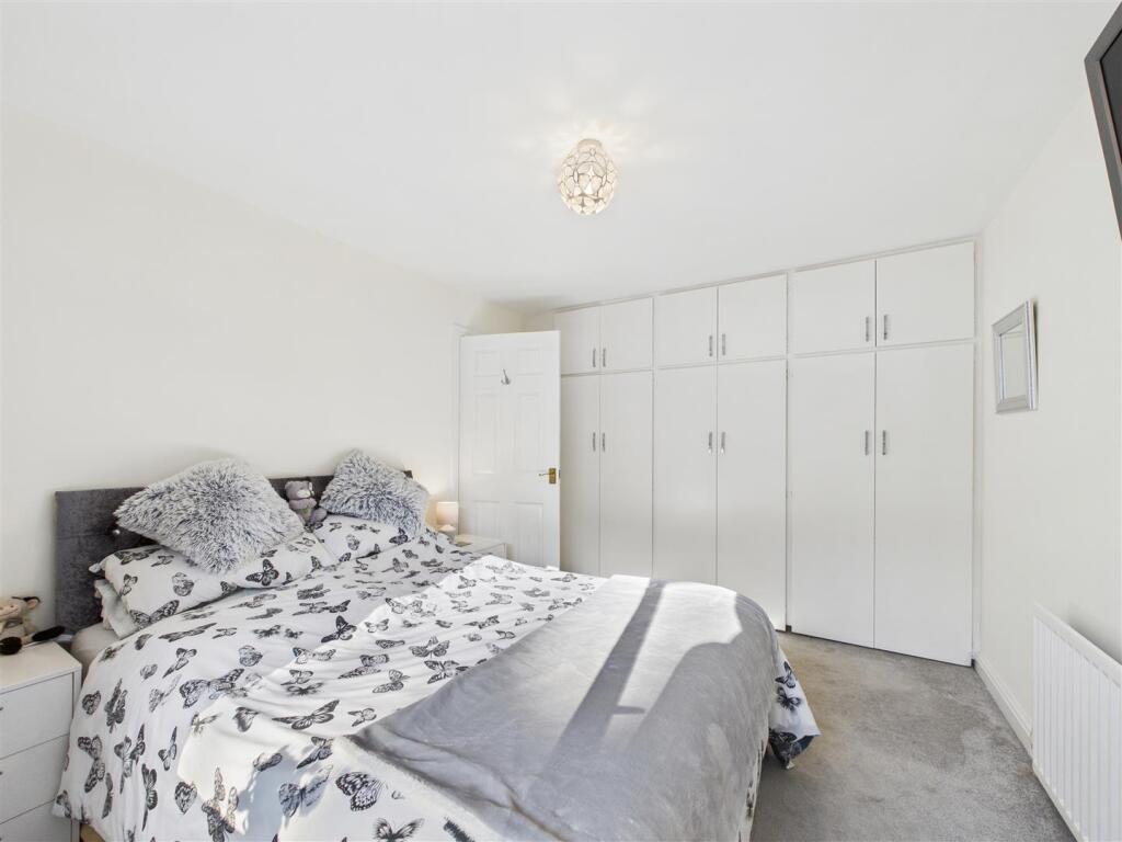
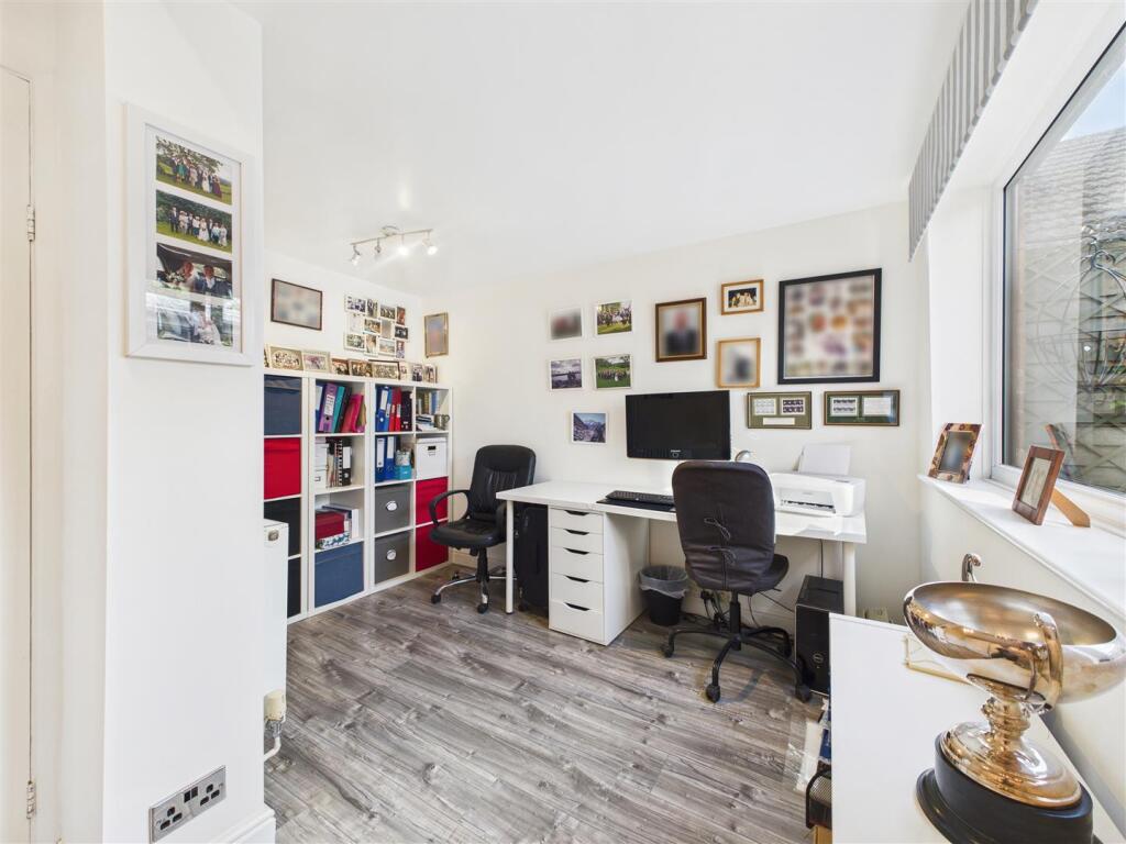
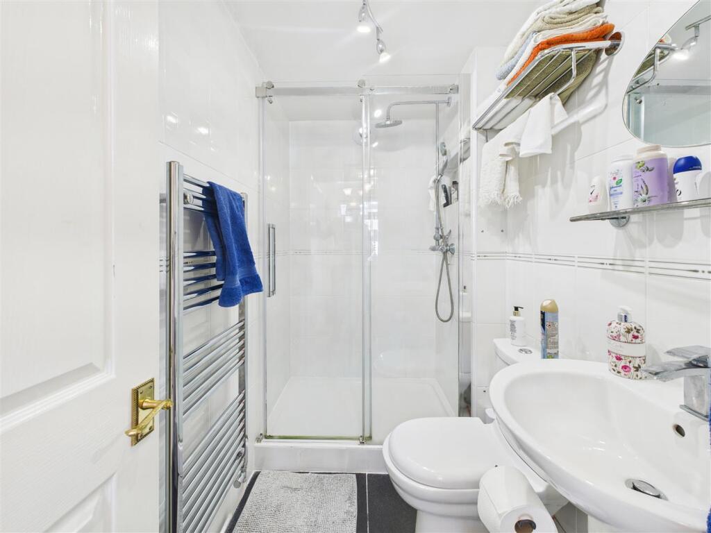
Photos · Open listing
 Open image 1 from listing 169564058
 Open image 2 from listing 169564058
 Open image 3 from listing 169564058
 Open image 4 from listing 169564058
 Open image 5 from listing 169564058
 Open image 6 from listing 169564058
 Open image 7 from listing 169564058
 Open image 8 from listing 169564058
 Open image 9 from listing 169564058
 Open image 10 from listing 169564058
 Open image 11 from listing 169564058
 Open image 12 from listing 169564058
Sold comparables
Same street and nearby sales within 0.25 miles (last 5 years). Land Registry Price Paid Data.
| Address | Price | Date | Type |
|---|---|---|---|
| 12 CROFTON RISE, DRONFIELD, NORTH EAST DERBYSHIRE, DERBYSHIRE, S18 1RH | £270,000 | 26/04/2024 | Detached |
| 18 FORD CLOSE, DRONFIELD, NORTH EAST DERBYSHIRE, DERBYSHIRE, S18 1TG | £417,500 | 03/11/2023 | Detached |
| 28 BEECHWOOD ROAD, DRONFIELD, NORTH EAST DERBYSHIRE, DERBYSHIRE, S18 1PW | £325,000 | 31/10/2023 | Detached |
| 2 MANOR CRESCENT, DRONFIELD, NORTH EAST DERBYSHIRE, DERBYSHIRE, S18 1PU | £315,000 | 18/08/2023 | Detached |
| 8 GOSFORTH CLOSE, DRONFIELD, NORTH EAST DERBYSHIRE, DERBYSHIRE, S18 1NT | £378,255 | 27/03/2023 | Detached |
| 13 MANOR CRESCENT, DRONFIELD, NORTH EAST DERBYSHIRE, DERBYSHIRE, S18 1PU | £270,000 | 16/12/2022 | Detached |
| 2 CROFTON RISE, DRONFIELD, NORTH EAST DERBYSHIRE, DERBYSHIRE, S18 1RH | £380,000 | 21/09/2022 | Detached |
| 10 GOSFORTH CLOSE, DRONFIELD, NORTH EAST DERBYSHIRE, DERBYSHIRE, S18 1NT | £315,000 | 05/08/2022 | Detached |
| 21 BEECHWOOD ROAD, DRONFIELD, NORTH EAST DERBYSHIRE, DERBYSHIRE, S18 1PW | £312,500 | 17/05/2022 | Detached |
| 39 GOSFORTH LANE, DRONFIELD, NORTH EAST DERBYSHIRE, DERBYSHIRE, S18 1PQ | £320,000 | 02/02/2022 | Detached |
| 10 CROFTON RISE, DRONFIELD, NORTH EAST DERBYSHIRE, DERBYSHIRE, S18 1RH | £340,000 | 10/01/2022 | Detached |
| 27 GOSFORTH CRESCENT, DRONFIELD, NORTH EAST DERBYSHIRE, DERBYSHIRE, S18 1PT | £295,000 | 16/12/2021 | Detached |
| 28 GOSFORTH LANE, DRONFIELD, NORTH EAST DERBYSHIRE, DERBYSHIRE, S18 1PR | £300,000 | 14/12/2021 | Detached |
| 11 WEST STREET, DRONFIELD, NORTH EAST DERBYSHIRE, DERBYSHIRE, S18 1PJ | £435,000 | 14/12/2021 | Detached |
| 6 CROFTON RISE, DRONFIELD, NORTH EAST DERBYSHIRE, DERBYSHIRE, S18 1RH | £285,000 | 07/10/2021 | Detached |
| 32 BEECHWOOD ROAD, DRONFIELD, NORTH EAST DERBYSHIRE, DERBYSHIRE, S18 1PW | £290,000 | 30/09/2021 | Detached |
| 11 BEECHWOOD ROAD, DRONFIELD, NORTH EAST DERBYSHIRE, DERBYSHIRE, S18 1PW | £252,000 | 29/09/2021 | Detached |
| 6 GARTH WAY, DRONFIELD, NORTH EAST DERBYSHIRE, DERBYSHIRE, S18 1RL | £323,500 | 09/08/2021 | Detached |
Area average: £323,542 (18 sales)
For sale comparables
No active for-sale comparables found within 1 mile for the same bedrooms and property type.
Capital growth trend
Land Registry outcode average: last 12 months vs 5y and 10y ago (from sold prices).
House Price Index (HM Land Registry — official index, not sold-price averages): North East Derbyshire. Series: Detached. As of April 2026.
Rental Range
Estimated market rent for North East Derbyshire. Low = conservative, Realistic = average, Optimistic = best case.
Based on Local Authority from postcode lookup → North East Derbyshire.
LHA (30th percentile) floor for Sheffield: Apr 2025 – Mar 2026
Rental Comparables
Loading rental comparables for this postcode. Refresh in a few minutes.
Rent-driven metrics
Based on Area rent estimate.
- Rent ratio — Monthly rent ÷ purchase price (1% rule). 1%+ = strong, 0.8–1% = okay, <0.8% = weak for cashflow.
- Max investor price — Rent ÷ 0.8%; the price at which rent would be 0.8% of price (Stoke-style target).
- Target investor price — Rent ÷ 1%; the price at which rent would be 1% of price (strong cashflow band).
- Gross yield — Annual rent as % of purchase price (no costs).
Flood risk
Zone: 1
Risk: Low
Job (default Low)
Street-level crime
| Category | Count |
|---|---|
| Violence and sexual offences | 23 |
| Public order | 7 |
| Anti-social behaviour | 6 |
| Other theft | 6 |
| Shoplifting | 6 |
| Burglary | 4 |
| Vehicle crime | 4 |
| Drugs | 3 |
| Criminal damage and arson | 2 |
| Other crime | 2 |
| Possession of weapons | 2 |
| Bicycle theft | 1 |
| Robbery | 1 |
| Total incidents | 67 |
Within 1 mile during May 2026. Source: data.police.uk (England & Wales).
Schools nearby
Nearest open schools with Ofsted ratings (England). Closed schools are not shown. Data from Get Information about Schools and Ofsted.
| Name | Type | Distance | Ofsted |
|---|---|---|---|
| Dronfield Junior School | Primary | 0.3 miles | — (Inspected (no overall grade)) |
| Dronfield Infant School | Primary | 0.3 miles | — (Inspected (no overall grade)) |
| Dronfield Henry Fanshawe School | Secondary | 0.5 miles | Good — 27 Sep 2023 |
| Gorseybrigg Primary School and Nursery | Primary | 0.6 miles | Good — 24 May 2013 |
| St Andrew's CofE Methodist (Aided) Primary School | Primary | 0.7 miles | Good — 25 May 2016 |
FENSA
Checking FENSA certificates for this address. Refresh in a few minutes.