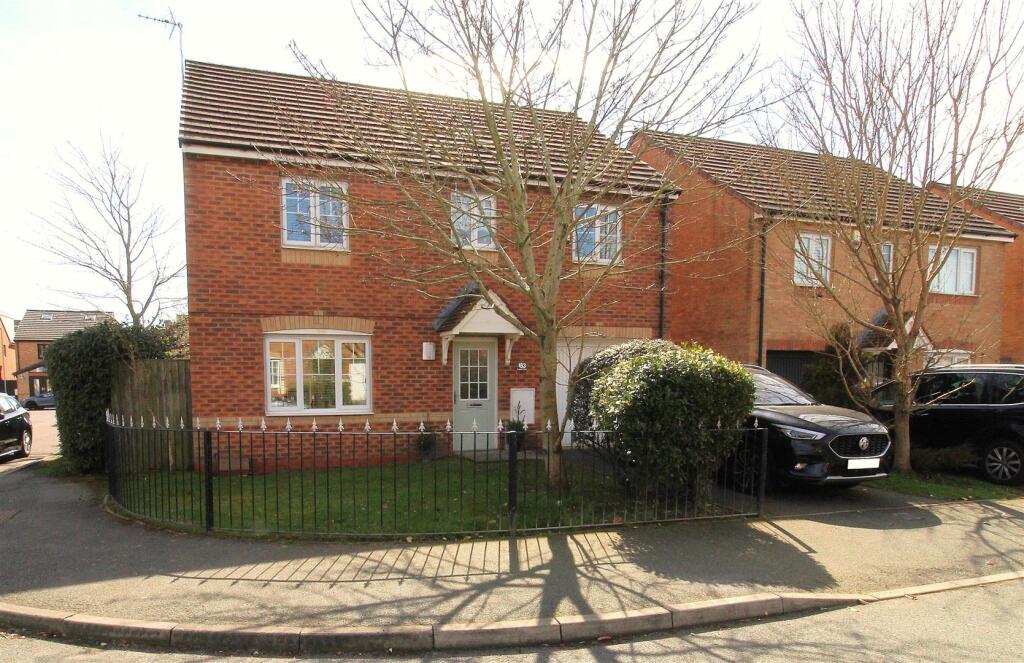
183 KINGFIELD ROAD
LIVERPOOL, MERSEYSIDE, L9 3AN
£250,000
Location
Nearby
Nearest stations, universities and amenities (distance from property).
| Type | Name | Distance |
|---|---|---|
| Bus stop | HORNBY ROAD/O/S WALTON PRISON | 0.2 miles |
| Train station | Walton | 0.3 miles |
| Shop | Thompsons | 0.4 miles |
| Hospital | DRIVE THROUGH PHLEBOTOMY | 1.6 miles |
| University | Liverpool Hope University | 5.7 miles |
Property details
Tenure
Freehold
Property type
Detached
Bedrooms
4
Floor area
122 m²
EPC rating
C
Year built
England and Wales: 2003-2006
Last sold
£250,000 Jan 2026
Price per m²
£2,049/m²
Local average
£277,962 (13 sales)
Street crime
405 incidents within 1 mile (Apr 2026)
EPC Rating & Upgrade Cost
Current rating: C
Potential rating: C
Inspection date: 25/09/2025
Expiry date: 24/09/2035
Current heating cost: £993/year
Potential heating cost: £938/year
Est. upgrade cost to C: £11,880
Recommendations
- Increase hot water cylinder insulation (£20 - £40)
- Replace boiler with new condensing boiler (£2,200 - £3,500)
- Solar photovoltaic panels, 2.5 kWp (£8,000 - £10,000)
Price history
| Event | Date | Price | Type | % change | Today’s value (HPI) | Action |
|---|---|---|---|---|---|---|
| Sold | 30/01/2026 | £250,000 | Detached | — | £252,727 to March 2026 | View transaction |
Historic listings
Listing and sale events only where we matched the listing page to a Land Registry sale already on record for this address.
| Event | Date | Price |
|---|---|---|
| sold | 01/01/2026 | £250,000 |
| listed | 16/04/2025 | £265,000 |
| sold | 01/01/2006 | £229,995 |
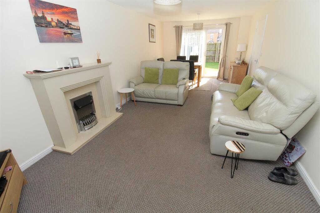
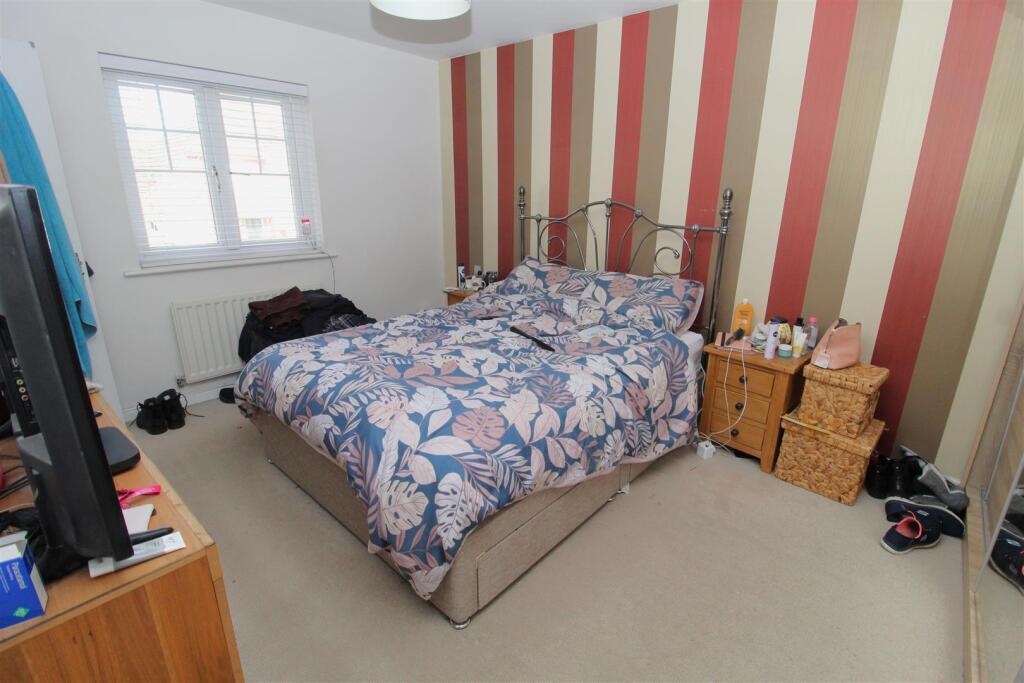
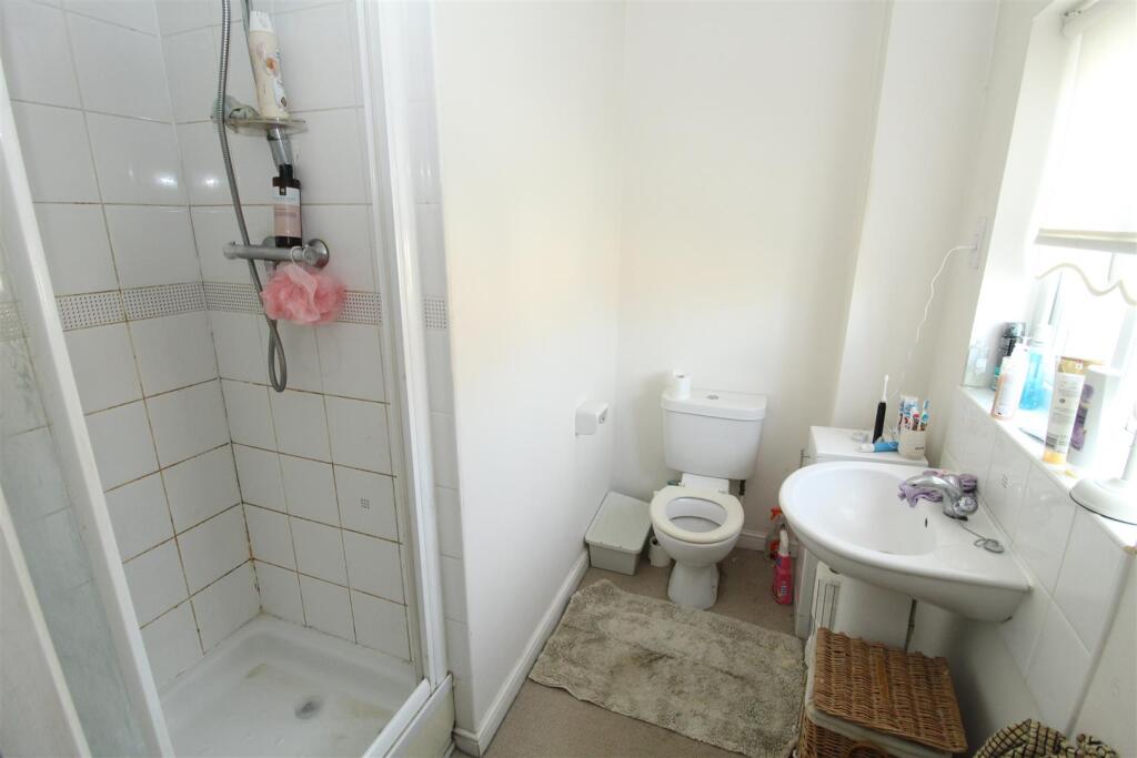
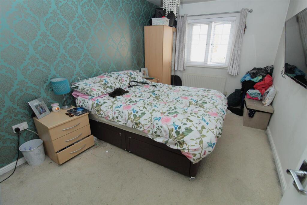
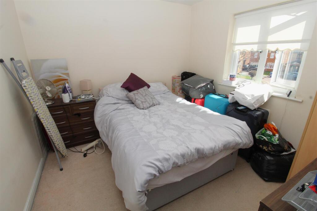
Photos · Open listing
 Open image 1 from listing 160792628
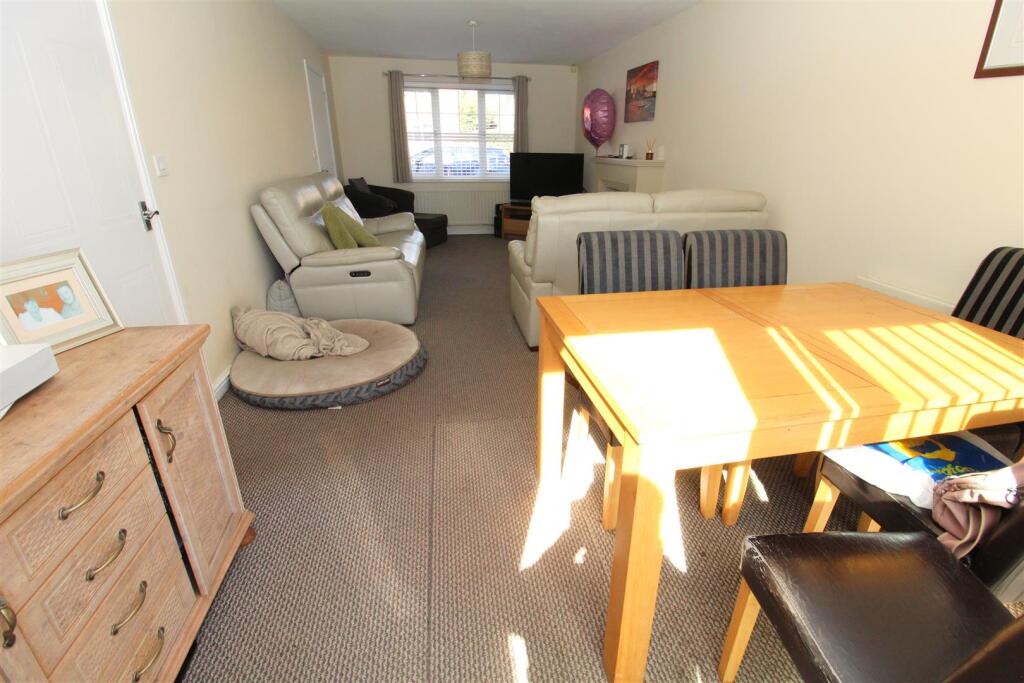
 Open image 2 from listing 160792628
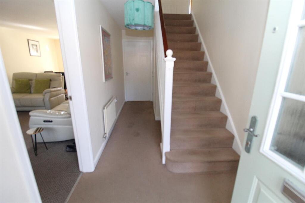
 Open image 3 from listing 160792628
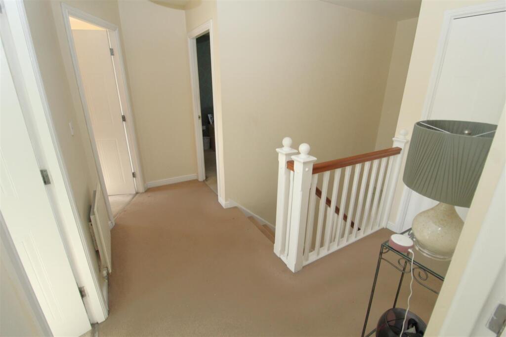
 Open image 4 from listing 160792628
 Open image 5 from listing 160792628
 Open image 6 from listing 160792628
 Open image 7 from listing 160792628
 Open image 8 from listing 160792628
 Open image 9 from listing 160792628
 Open image 10 from listing 160792628
 Open image 11 from listing 160792628
 Open image 12 from listing 160792628
Sold comparables
Same street and nearby sales within 0.25 miles (last 5 years). Land Registry Price Paid Data.
| Address | Price | Date | Type |
|---|---|---|---|
| 229 KINGFIELD ROAD, LIVERPOOL, MERSEYSIDE, L9 3AN | £265,000 | 19/12/2025 | Detached |
| 104 KINGFIELD ROAD, LIVERPOOL, MERSEYSIDE, L9 3AW | £266,000 | 15/12/2025 | Detached |
| 139 KINGFIELD ROAD, LIVERPOOL, MERSEYSIDE, L9 3AN | £244,000 | 03/11/2023 | Detached |
| 215 KINGFIELD ROAD, LIVERPOOL, MERSEYSIDE, L9 3AN | £276,000 | 13/07/2022 | Detached |
| 217 KINGFIELD ROAD, LIVERPOOL, MERSEYSIDE, L9 3AN | £250,000 | 01/02/2022 | Detached |
Area average: £260,200 (5 sales)
For sale comparables
No active for-sale comparables found within 1 mile for the same bedrooms and property type.
Capital growth trend
Land Registry outcode average: last 12 months vs 5y and 10y ago (from sold prices).
House Price Index (HM Land Registry — official index, not sold-price averages): Liverpool. Series: Detached. As of March 2026.
Rental Range
Estimated market rent for Liverpool. Low = conservative, Realistic = average, Optimistic = best case.
Based on Local Authority from postcode lookup → Liverpool.
LHA (30th percentile) floor for Greater Liverpool: Apr 2025 – Mar 2026
Rental Comparables
Residential lets in the area (all bedroom counts shown — none matched the 4-bedroom count for this property). Student lets are excluded.
| Title | Rent | Beds | Distance | As seen on |
|---|---|---|---|---|
| 1 Bed Flat, Rice Lane, L9 | £650/mo | 1 | 0.52 miles | OpenRent |
| 2 Bed Detached House, Carnarvon Road, L9 | £850/mo | 2 | 0.71 miles | OpenRent |
| 1 Bed Flat, Carnarvon Road, L9 | £774/mo | 1 | 0.78 miles | OpenRent |
| Studio Flat, Longmoor Lane, L9 | £650/mo | 1 | 0.8 miles | OpenRent |
| 2 Bed Terraced House, Peveril Street, L9 | £780/mo | 2 | 0.8 miles | OpenRent |
| 2 Bed Flat, Warbreck Moor, L9 | £675/mo | 2 | 0.84 miles | OpenRent |
| 1 Bed Flat, Warbreck Moor, L9 | £650/mo | 1 | 0.85 miles | OpenRent |
| 1 Bed Flat, Linacre Lane, L20 | £625/mo | 1 | 0.85 miles | OpenRent |
Average rent: £707/mo (8 listings)
Rent-driven metrics
Based on OpenRent comparables.
- Rent ratio — Monthly rent ÷ purchase price (1% rule). 1%+ = strong, 0.8–1% = okay, <0.8% = weak for cashflow.
- Max investor price — Rent ÷ 0.8%; the price at which rent would be 0.8% of price (Stoke-style target).
- Target investor price — Rent ÷ 1%; the price at which rent would be 1% of price (strong cashflow band).
- Gross yield — Annual rent as % of purchase price (no costs).
- Cost-to-rent — Price ÷ annual rent (from OpenRent comparables). Under 14× = strong, 14–16× = acceptable, 17×+ = compressed.
- Cashflow — Rent minus mortgage, 10% maintenance, £25/mo compliance. Assumes 75% LTV, 3.95% APR (5yr fixed), 25yr term.
- ROI — Annual profit ÷ cash in (deposit + 4% purchase costs).
Flood risk
Zone: 1
Risk: Low
Not in Flood Risk Area (no data)
Street-level crime
| Category | Count |
|---|---|
| Violence and sexual offences | 174 |
| Criminal damage and arson | 40 |
| Shoplifting | 37 |
| Drugs | 36 |
| Anti-social behaviour | 29 |
| Public order | 25 |
| Other theft | 18 |
| Other crime | 12 |
| Vehicle crime | 10 |
| Burglary | 7 |
| Robbery | 7 |
| Possession of weapons | 5 |
| Bicycle theft | 3 |
| Theft from the person | 2 |
| Total incidents | 405 |
Within 1 mile during Apr 2026. Source: data.police.uk (England & Wales).
Schools nearby
Nearest open schools with Ofsted ratings (England). Closed schools are not shown. Data from Get Information about Schools and Ofsted.
| Name | Type | Distance | Ofsted |
|---|---|---|---|
| Rice Lane Primary School and Nursery | Primary | 0.3 miles | Good — 23 Jul 2018 |
| St Monica's Catholic Primary School | Primary | 0.3 miles | Outstanding — 3 Apr 2014 |
| King's Leadership Academy Hawthornes | Secondary | 0.6 miles | Good — 8 Nov 2023 |
| Northcote Primary School | Primary | 0.7 miles | Good — 20 Nov 2019 |
| Greenacre Community Nursery School | Nursery | 0.7 miles | Good — 6 Mar 2015 |
FENSA
Checking FENSA certificates for this address. Refresh in a few minutes.