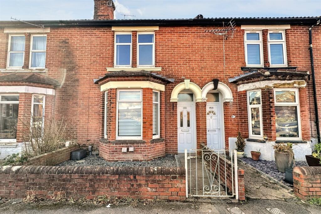
155 CRANBURY ROAD
EASTLEIGH, HAMPSHIRE, SO50 5HH
£280,000
Location
Nearby
Nearest stations, universities and amenities (distance from property).
| Type | Name | Distance |
|---|---|---|
| Shop | CK Convenience Store / Family Shopper | 0.1 miles |
| Bus stop | Nutbeem Road | 0.2 miles |
| Train station | Eastleigh | 0.4 miles |
| University | Boldrewood Innovation Campus | 2.9 miles |
| Hospital | Royal South Hants Urgent Treatment Centre | 4.0 miles |
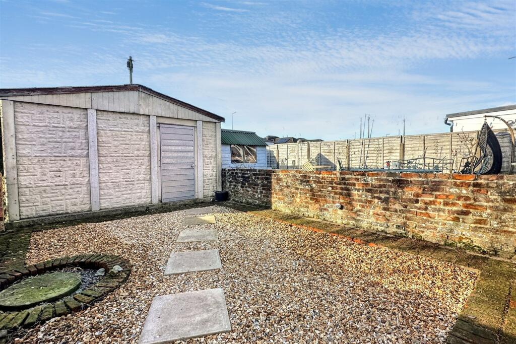
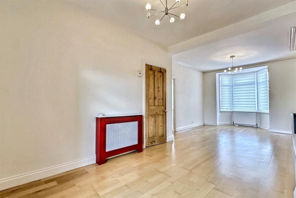
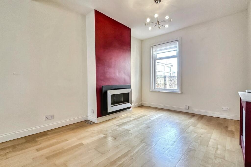
Property details
Tenure
Freehold
Property type
Terraced
Bedrooms
3
Bathrooms
1
Floor area
104 m²
EPC rating
D
Year built
England and Wales: 1930-1949
Last sold
£280,000 Jan 2026
Price per m²
£2,692/m²
Local average
£289,223 (56 sales)
Street crime
234 incidents within 1 mile (May 2026)
EPC Rating & Upgrade Cost
Current rating: D
Potential rating: B
Inspection date: 19/07/2019
Expiry date: 18/07/2029
Current heating cost: £625/year
Potential heating cost: £503/year
Recommendations
- Cavity wall insulation (1,500)
- Floor insulation (suspended floor) (1,200)
- Low energy lighting for all fixed outlets (25)
- Solar water heating (6,000)
- Solar photovoltaic panels, 2.5 kWp (5,500)
Price history
| Event | Date | Price | Type | % change | Today’s value (HPI) | Action |
|---|---|---|---|---|---|---|
| Sold | 30/01/2026 | £280,000 | Terraced | — | £275,679 to April 2026 | View transaction |
Historic listings
Listing and sale events only where we matched the listing page to a Land Registry sale already on record for this address.
| Event | Date | Price |
|---|---|---|
| listed | 13/01/2026 | £295,000 |
| sold | 01/01/2026 | £280,000 |
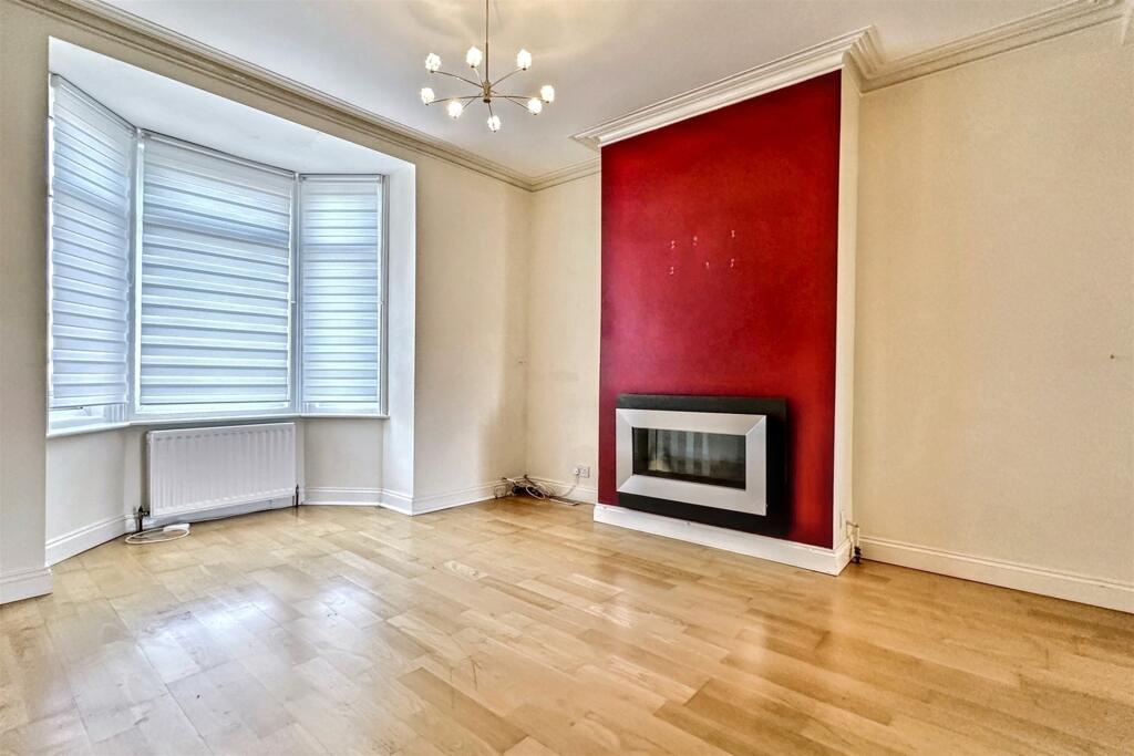
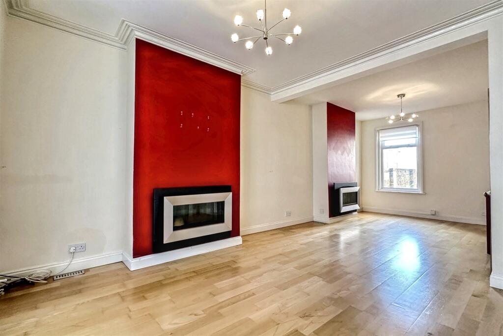
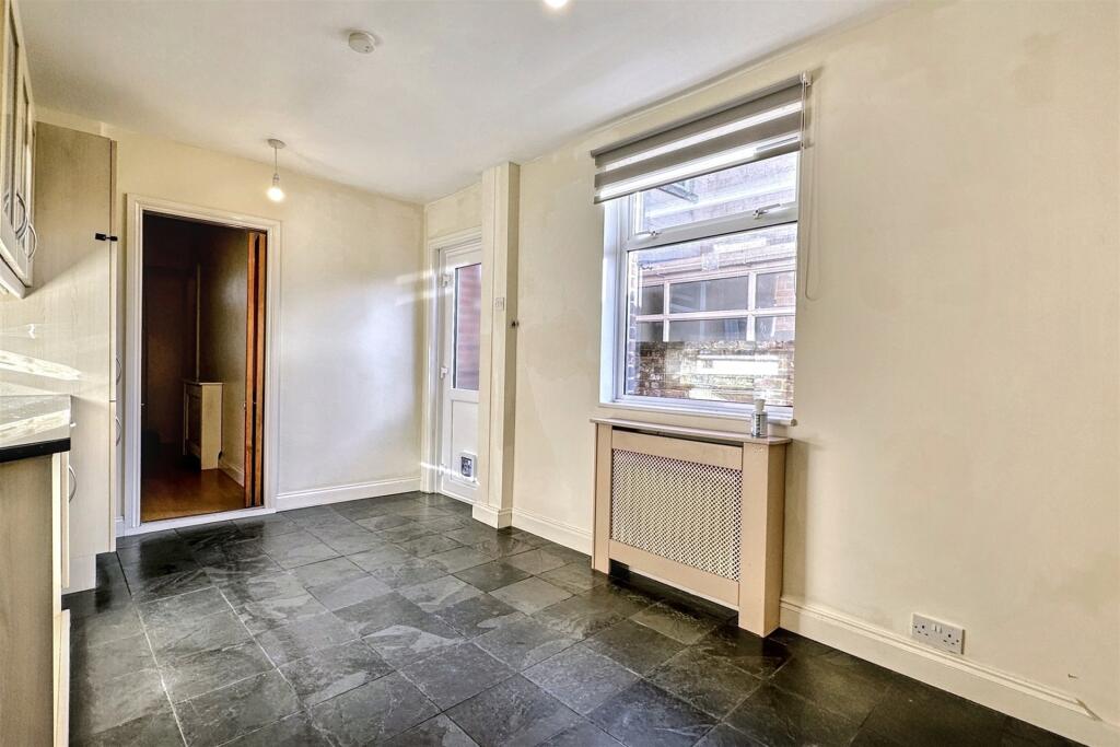
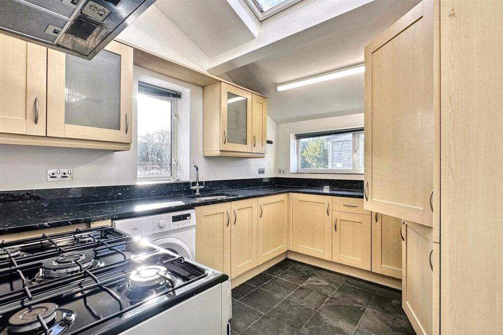
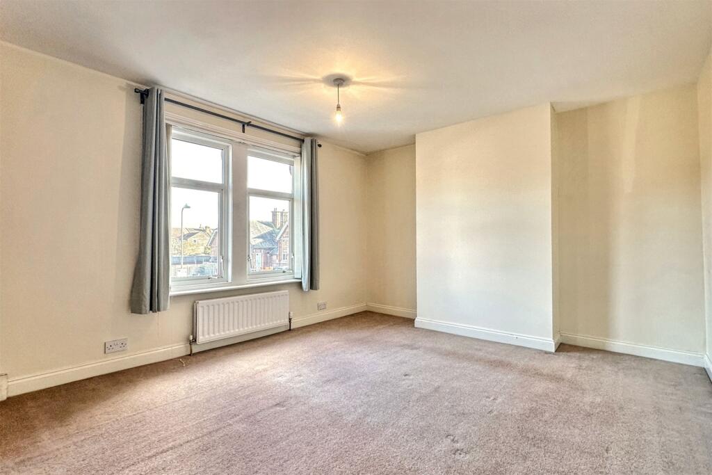
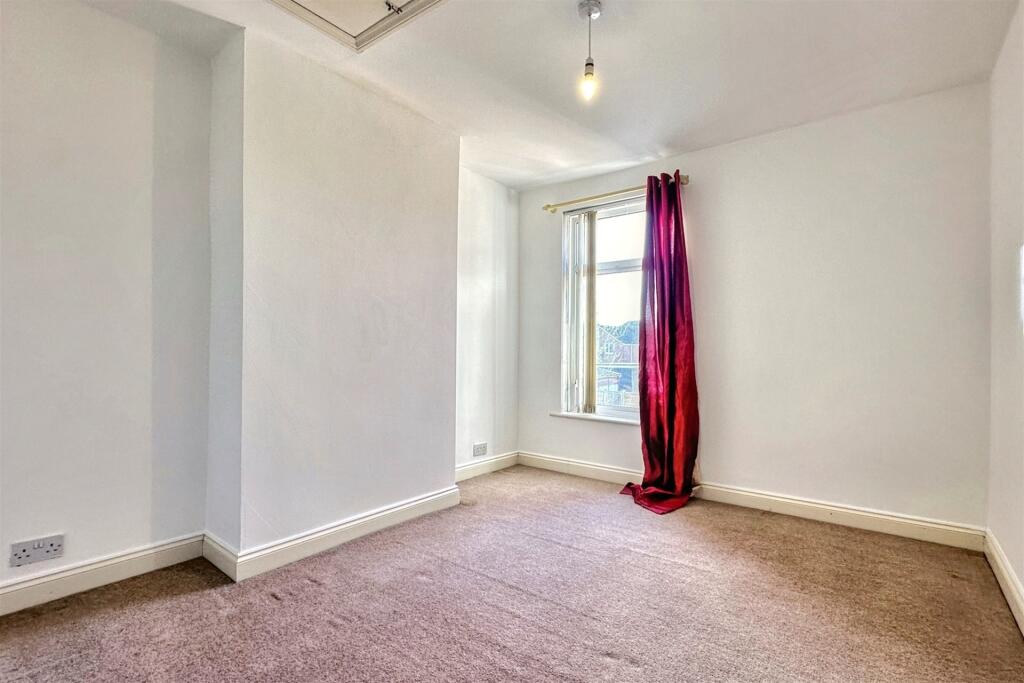
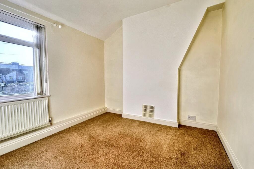
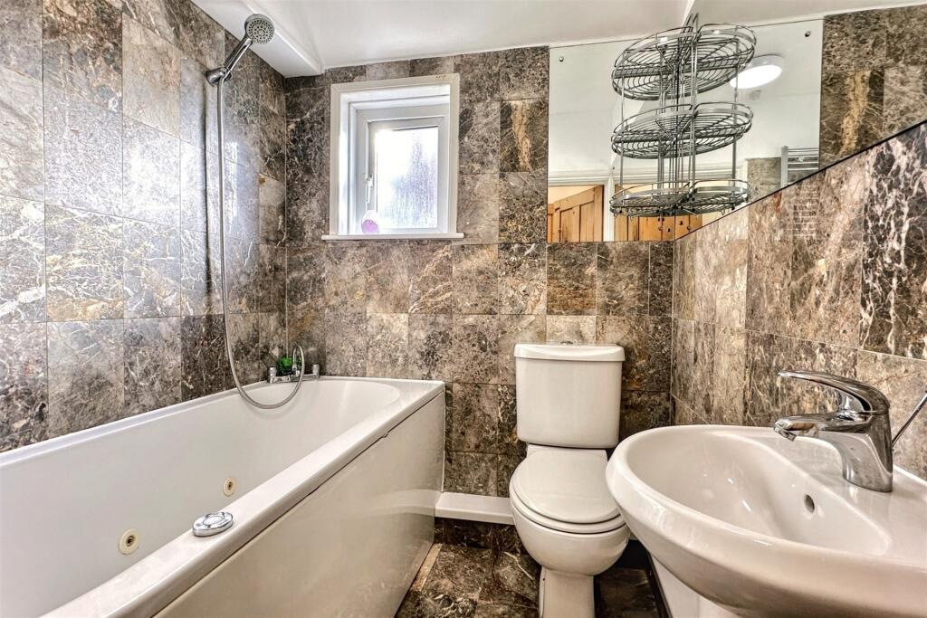
Photos · Open listing
 Open image 1 from listing 170965214
 Open image 2 from listing 170965214
 Open image 3 from listing 170965214
 Open image 4 from listing 170965214
 Open image 5 from listing 170965214
 Open image 6 from listing 170965214
 Open image 7 from listing 170965214
 Open image 8 from listing 170965214
 Open image 9 from listing 170965214
 Open image 10 from listing 170965214
 Open image 11 from listing 170965214
 Open image 12 from listing 170965214
Sold comparables
Same street and nearby sales within 0.25 miles (last 5 years). Land Registry Price Paid Data.
| Address | Price | Date | Type |
|---|---|---|---|
| 146 DESBOROUGH ROAD, EASTLEIGH, HAMPSHIRE, SO50 5NN | £280,000 | 14/01/2026 | Terraced |
| 122 DESBOROUGH ROAD, EASTLEIGH, HAMPSHIRE, SO50 5NN | £305,000 | 12/12/2025 | Terraced |
| 22 GRANTHAM ROAD, EASTLEIGH, HAMPSHIRE, SO50 5HJ | £240,000 | 15/12/2023 | Terraced |
| 98 DESBOROUGH ROAD, EASTLEIGH, HAMPSHIRE, SO50 5NN | £250,000 | 04/08/2023 | Terraced |
| 151 CRANBURY ROAD, EASTLEIGH, HAMPSHIRE, SO50 5HH | £245,000 | 05/04/2023 | Terraced |
| 173 CRANBURY ROAD, EASTLEIGH, HAMPSHIRE, SO50 5HH | £247,000 | 19/12/2022 | Terraced |
| 123 CRANBURY ROAD, EASTLEIGH, HAMPSHIRE, SO50 5HH | £330,000 | 16/12/2022 | Terraced |
| 157 DESBOROUGH ROAD, EASTLEIGH, HAMPSHIRE, SO50 5NP | £275,000 | 16/12/2022 | Terraced |
| 126 CRANBURY ROAD, EASTLEIGH, HAMPSHIRE, SO50 5HG | £335,000 | 01/12/2022 | Terraced |
| 129 DESBOROUGH ROAD, EASTLEIGH, HAMPSHIRE, SO50 5NP | £350,000 | 25/11/2022 | Terraced |
| 107 DESBOROUGH ROAD, EASTLEIGH, HAMPSHIRE, SO50 5NP | £299,000 | 07/10/2022 | Terraced |
| 155 NUTBEEM ROAD, EASTLEIGH, HAMPSHIRE, SO50 5JS | £294,000 | 27/09/2022 | Terraced |
| 100 CRANBURY ROAD, EASTLEIGH, HAMPSHIRE, SO50 5HD | £325,000 | 30/08/2022 | Terraced |
| 82 CRANBURY ROAD, EASTLEIGH, HAMPSHIRE, SO50 5HD | £283,500 | 26/08/2022 | Terraced |
| 94 DESBOROUGH ROAD, EASTLEIGH, HAMPSHIRE, SO50 5NN | £315,000 | 30/06/2022 | Terraced |
| 84 CRANBURY ROAD, EASTLEIGH, HAMPSHIRE, SO50 5HD | £260,000 | 25/02/2022 | Terraced |
| 133 DESBOROUGH ROAD, EASTLEIGH, HAMPSHIRE, SO50 5NP | £240,000 | 18/10/2021 | Terraced |
| 74 CRANBURY ROAD, EASTLEIGH, HAMPSHIRE, SO50 5HD | £276,000 | 30/09/2021 | Terraced |
| 109 CRANBURY ROAD, EASTLEIGH, HAMPSHIRE, SO50 5HE | £272,000 | 16/09/2021 | Terraced |
Area average: £285,342 (19 sales)
For sale comparables
No active for-sale comparables found within 1 mile for the same bedrooms and property type.
Capital growth trend
Land Registry outcode average: last 12 months vs 5y and 10y ago (from sold prices).
House Price Index (HM Land Registry — official index, not sold-price averages): Eastleigh. Series: Terraced. As of April 2026.
Rental Range
Estimated market rent for Eastleigh. Low = conservative, Realistic = average, Optimistic = best case.
Based on Local Authority from postcode lookup → Eastleigh.
LHA (30th percentile) floor for Southampton: Apr 2025 – Mar 2026
Rental Comparables
Residential lets in the area (all bedroom counts shown — none matched the 3-bedroom count for this property). Student lets are excluded.
| Title | Rent | Beds | Distance | As seen on |
|---|---|---|---|---|
| 4 Bed Terraced House, Desborough Road, SO50 | £1,650/mo | 4 | 0.07 miles | OpenRent |
Average rent: £1,650/mo (1 listing)
Rent-driven metrics
Based on OpenRent comparables.
- Rent ratio — Monthly rent ÷ purchase price (1% rule). 1%+ = strong, 0.8–1% = okay, <0.8% = weak for cashflow.
- Max investor price — Rent ÷ 0.8%; the price at which rent would be 0.8% of price (Stoke-style target).
- Target investor price — Rent ÷ 1%; the price at which rent would be 1% of price (strong cashflow band).
- Gross yield — Annual rent as % of purchase price (no costs).
- Cost-to-rent — Price ÷ annual rent (from OpenRent comparables). Under 14× = strong, 14–16× = acceptable, 17×+ = compressed.
- Cashflow — Rent minus mortgage, 10% maintenance, £25/mo compliance. Assumes 75% LTV, 3.95% APR (5yr fixed), 25yr term.
- ROI — Annual profit ÷ cash in (deposit + 4% purchase costs).
Flood risk
Zone: 1
Risk: Low
Not in Flood Risk Area (no data)
Street-level crime
| Category | Count |
|---|---|
| Violence and sexual offences | 95 |
| Anti-social behaviour | 52 |
| Shoplifting | 25 |
| Criminal damage and arson | 16 |
| Public order | 14 |
| Other theft | 13 |
| Vehicle crime | 7 |
| Bicycle theft | 2 |
| Burglary | 2 |
| Drugs | 2 |
| Possession of weapons | 2 |
| Theft from the person | 2 |
| Other crime | 1 |
| Robbery | 1 |
| Total incidents | 234 |
Within 1 mile during May 2026. Source: data.police.uk (England & Wales).
Schools nearby
Nearest open schools with Ofsted ratings (England). Closed schools are not shown. Data from Get Information about Schools and Ofsted.
| Name | Type | Distance | Ofsted |
|---|---|---|---|
| Norwood Primary & Pre-School | Primary | 0.2 miles | — (Inspected (no overall grade)) |
| Cherbourg Primary School | Primary | 0.2 miles | Good — 25 Jun 2023 |
| The Crescent Primary School | Primary | 0.4 miles | Good — 22 Mar 2018 |
| The Bridge Education Centre | Other | 0.4 miles | Good — 27 Apr 2015 |
| Barton Peveril Sixth Form College | Other | 0.5 miles | — (No rating) |
FENSA
Window and door installation certificates found for this address.
| Issued | Work completed | Windows | Doors |
|---|---|---|---|
| 18/04/2021 | 18/03/2021 | — | 1 |