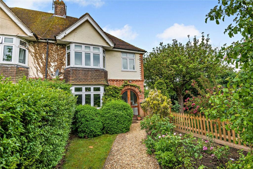
21 CATHERINE ROAD
NEWBURY, WEST BERKSHIRE, RG14 7NA
£590,000
Location
Nearby
Nearest stations, universities and amenities (distance from property).
| Type | Name | Distance |
|---|---|---|
| Train station | Newbury | 0.1 miles |
| Bus stop | Newbury Station | 0.1 miles |
| Shop | Pageant | 0.2 miles |
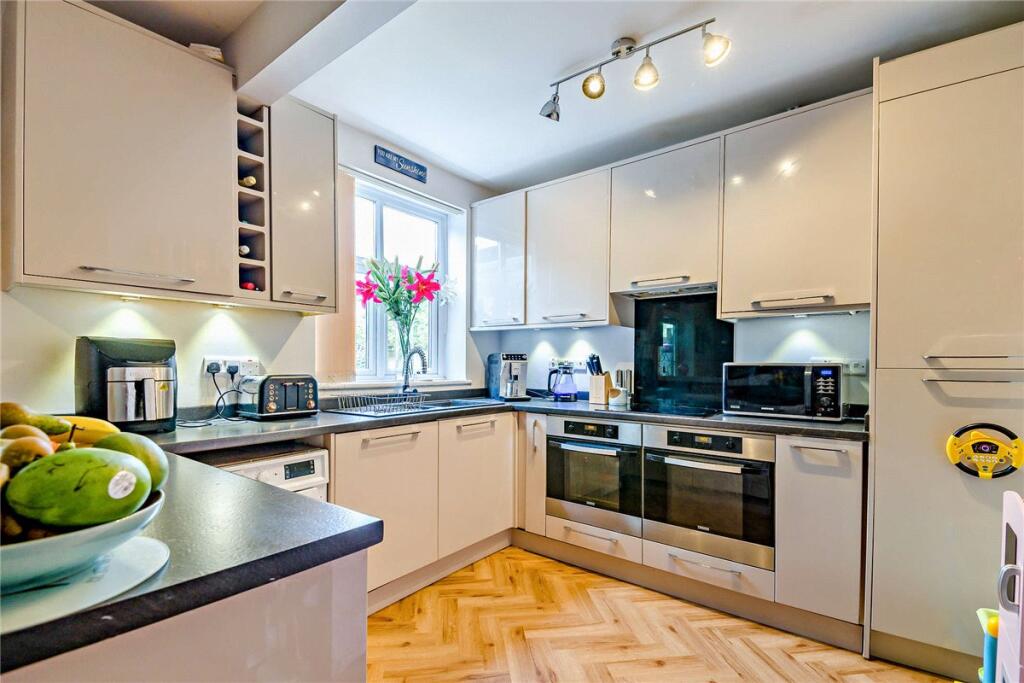
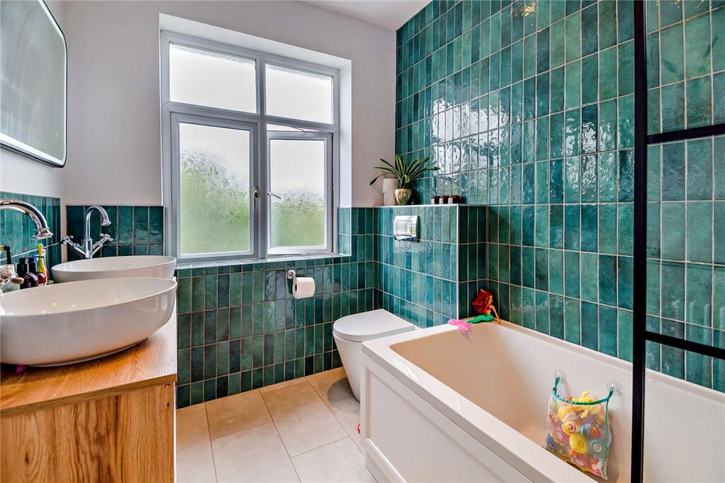
Property details
Tenure
Freehold
Property type
Semi-detached
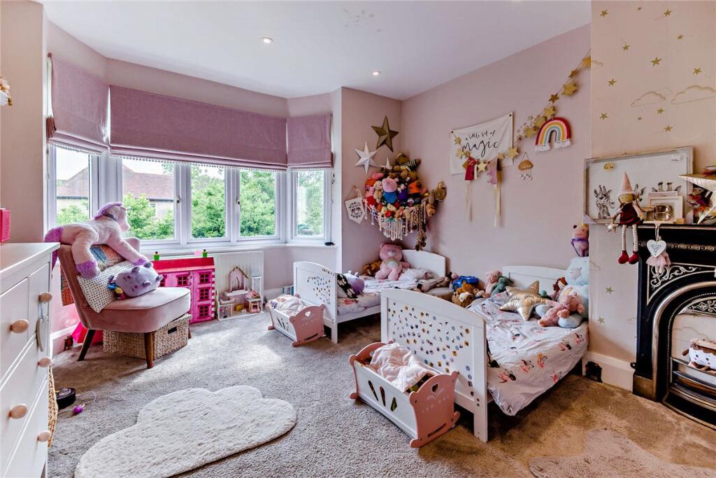
Bedrooms
5
Bathrooms
1
Floor area
164 m²
EPC rating
C
Year built
England and Wales: 1930-1949
Last sold
£590,000 Feb 2026
Price per m²
£3,598/m²
Local average
£400,878 (39 sales)
Street crime
243 incidents within 1 mile (Apr 2026)
EPC Rating & Upgrade Cost
Current rating: C
Potential rating: C
Inspection date: 12/05/2025
Expiry date: 11/05/2035
Current heating cost: £1,196/year
Potential heating cost: £1,199/year
Est. upgrade cost to C: £9,500
Recommendations
- Solar water heating (£4,000 - £6,000)
- Solar photovoltaic panels, 2.5 kWp (£3,500 - £5,500)
Price history
| Event | Date | Price | Type | % change | Today’s value (HPI) | Action |
|---|---|---|---|---|---|---|
| Sold | 20/02/2026 | £590,000 | Semi-detached | +24.2% | £586,590 to March 2026 | View transaction |
| Sold | 16/02/2018 | £475,000 | Semi-detached | +111.1% | £589,892 to March 2026 | View transaction |
| Sold | 04/06/2009 | £225,000 | Semi-detached | — | £457,087 to March 2026 | View transaction |
Historic listings
Listing and sale events only where we matched the listing page to a Land Registry sale already on record for this address.
| Event | Date | Price |
|---|---|---|
| sold | 01/01/2026 | £590,000 |
| listed | 02/06/2025 | £600,000 |
| sold | 01/01/2018 | £475,000 |
| sold | 01/01/2009 | £225,000 |
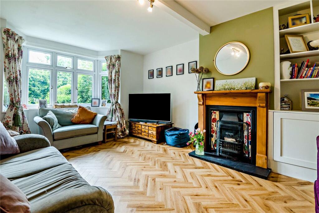
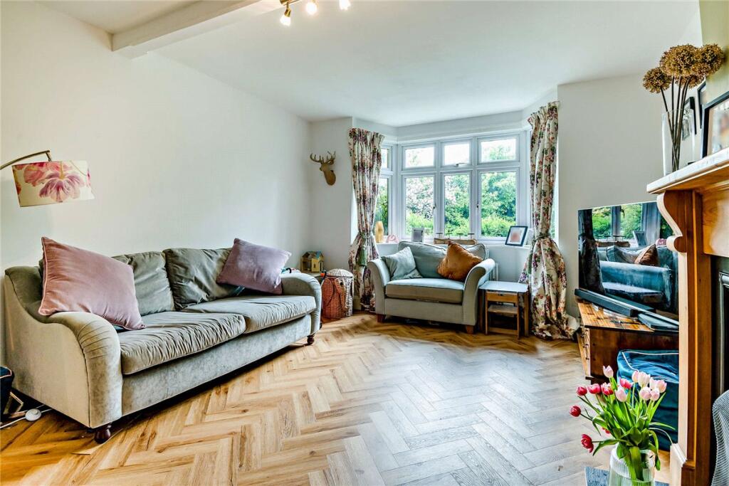
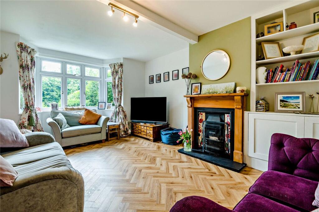
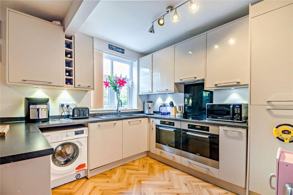
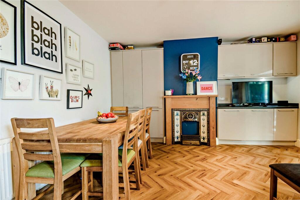
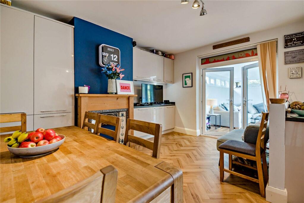
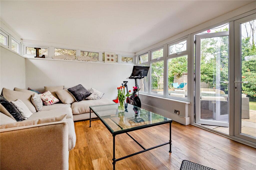
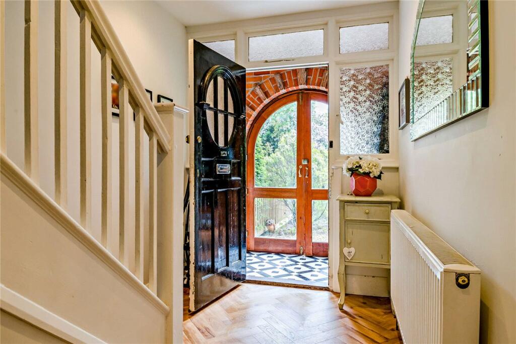
Photos · Open listing
 Open image 1 from listing 162714890
 Open image 2 from listing 162714890
 Open image 3 from listing 162714890
 Open image 4 from listing 162714890
 Open image 5 from listing 162714890
 Open image 6 from listing 162714890
 Open image 7 from listing 162714890
 Open image 8 from listing 162714890
 Open image 9 from listing 162714890
 Open image 10 from listing 162714890
 Open image 11 from listing 162714890
 Open image 12 from listing 162714890
Sold comparables
Same street and nearby sales within 0.25 miles (last 5 years). Land Registry Price Paid Data.
| Address | Price | Date | Type |
|---|---|---|---|
| 2 WESTWOOD MEWS, NEWBURY, WEST BERKSHIRE, RG14 7PP | £591,160 | 24/10/2025 | Semi-detached |
| 57 ST JOHNS ROAD, NEWBURY, WEST BERKSHIRE, RG14 7PR | £485,000 | 24/11/2022 | Semi-detached |
| 11 ST JOHNS ROAD, NEWBURY, WEST BERKSHIRE, RG14 7PY | £312,750 | 29/07/2022 | Semi-detached |
| 3 WESTWOOD MEWS, NEWBURY, WEST BERKSHIRE, RG14 7PP | £580,000 | 25/07/2022 | Semi-detached |
| CATHERINE VILLA STATION ROAD, NEWBURY, WEST BERKSHIRE, RG14 7LP | £575,000 | 17/02/2022 | Semi-detached |
| 4 WESTWOOD MEWS, NEWBURY, WEST BERKSHIRE, RG14 7PP | £490,000 | 02/12/2021 | Semi-detached |
Area average: £505,652 (6 sales)
For sale comparables
No active for-sale comparables found within 1 mile for the same bedrooms and property type.
Capital growth trend
Land Registry outcode average: last 12 months vs 5y and 10y ago (from sold prices).
House Price Index (HM Land Registry — official index, not sold-price averages): West Berkshire. Series: Semi-detached. As of March 2026.
Rental Range
Estimated market rent for West Berkshire. Low = conservative, Realistic = average, Optimistic = best case.
Based on Local Authority from postcode lookup → West Berkshire.
LHA (30th percentile) floor for Cherwell Valley: Apr 2025 – Mar 2026
Rental Comparables
Residential lets from OpenRent and Rightmove for the area (same bedroom count). Use to validate rent estimates. Student lets are excluded.
| Title | Rent | Beds | Distance | As seen on |
|---|---|---|---|---|
| 5 Bed Detached House, Lamtarra Way, RG14 | £2,700/mo | 5 | 0.86 miles | OpenRent |
Average rent: £2,700/mo (1 listing)
Rent-driven metrics
Based on OpenRent comparables.
- Rent ratio — Monthly rent ÷ purchase price (1% rule). 1%+ = strong, 0.8–1% = okay, <0.8% = weak for cashflow.
- Max investor price — Rent ÷ 0.8%; the price at which rent would be 0.8% of price (Stoke-style target).
- Target investor price — Rent ÷ 1%; the price at which rent would be 1% of price (strong cashflow band).
- Gross yield — Annual rent as % of purchase price (no costs).
- Cost-to-rent — Price ÷ annual rent (from OpenRent comparables). Under 14× = strong, 14–16× = acceptable, 17×+ = compressed.
- Cashflow — Rent minus mortgage, 10% maintenance, £25/mo compliance. Assumes 75% LTV, 3.95% APR (5yr fixed), 25yr term.
- ROI — Annual profit ÷ cash in (deposit + 4% purchase costs).
Flood risk
Zone: 1
Risk: Low
Not in Flood Risk Area (no data)
Street-level crime
| Category | Count |
|---|---|
| Violence and sexual offences | 71 |
| Anti-social behaviour | 43 |
| Shoplifting | 39 |
| Criminal damage and arson | 30 |
| Public order | 24 |
| Vehicle crime | 10 |
| Other theft | 9 |
| Burglary | 8 |
| Drugs | 5 |
| Bicycle theft | 3 |
| Robbery | 1 |
| Total incidents | 243 |
Within 1 mile during Apr 2026. Source: data.police.uk (England & Wales).
Schools nearby
Nearest open schools with Ofsted ratings (England). Closed schools are not shown. Data from Get Information about Schools and Ofsted.
| Name | Type | Distance | Ofsted |
|---|---|---|---|
| St Nicolas C.E. Junior School | Primary | 0.1 miles | — (Inspected (no overall grade)) |
| iCollege Alternative Provision | Other | 0.2 miles | Good — 15 Jun 2022 |
| St John the Evangelist CofE Infant and Nursery School | Primary | 0.4 miles | Good — 1 Feb 2011 |
| St Bartholomew's School | Secondary | 0.5 miles | Outstanding — 8 Dec 2021 |
| Victoria Park Nursery School & Family Hub | Nursery | 0.6 miles | Outstanding — 18 Oct 2012 |
FENSA
Window and door installation certificates found for this address.
| Issued | Work completed | Windows | Doors |
|---|---|---|---|
| 23/01/2007 | 08/01/2007 | 15 | — |