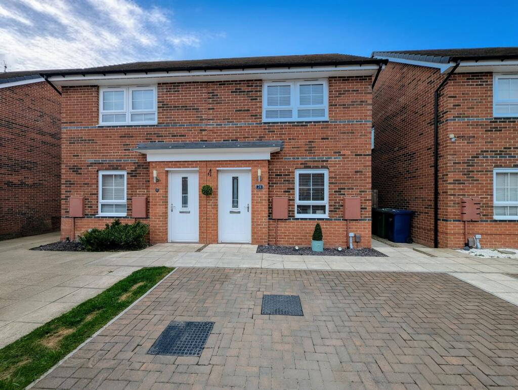
24 PORTRUSH DRIVE
HEBBURN, SOUTH TYNESIDE, TYNE AND WEAR, NE31 2FB
£165,000
Location
Nearby
Nearest stations, universities and amenities (distance from property).
| Type | Name | Distance |
|---|---|---|
| Shop | Sam’s Convenience Store | 0.2 miles |
| Bus stop | VICTORIA ROAD-JERVIS STREET-E/B | 0.2 miles |
| Train station | Jarrow | 0.5 miles |
| Hospital | Priory Day Hospital | 3.1 miles |
Property details
Tenure
Freehold
Property type
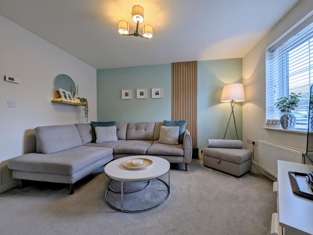
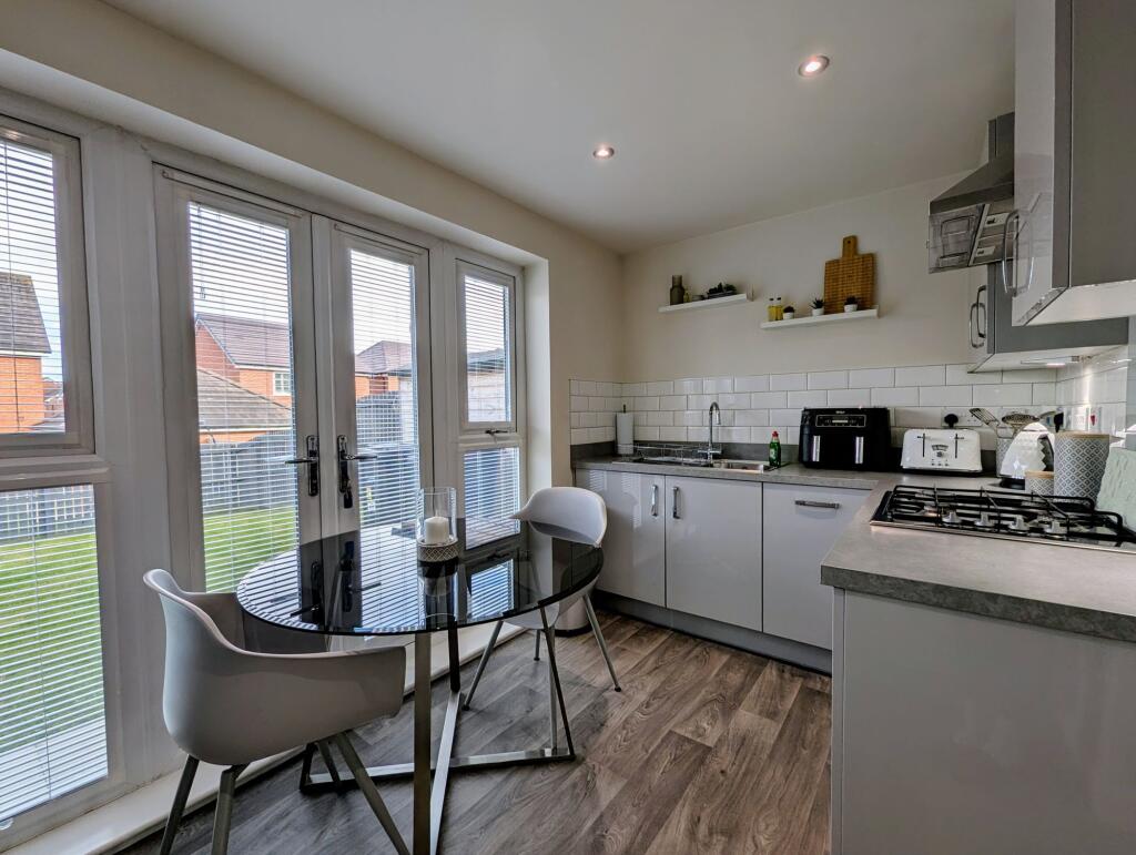
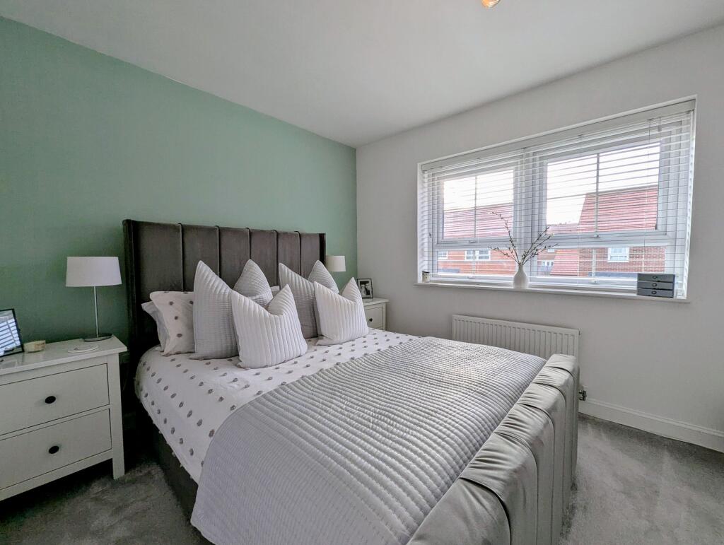
Semi-detached
Bedrooms
2
Bathrooms
1
Floor area
57 m²
EPC rating
B
Last sold
£165,000 Feb 2026
Price per m²
£2,895/m²
Local average
£179,061 (32 sales)
Street crime
233 incidents within 1 mile (Apr 2026)
EPC Rating & Upgrade Cost
Current rating: B
Potential rating: A
Inspection date: 28/08/2020
Expiry date: 27/08/2030
Current heating cost: £189/year
Potential heating cost: £189/year
Est. upgrade cost to C: £9,500
Recommendations
- Solar water heating (£4,000 - £6,000)
- Solar photovoltaic panels, 2.5 kWp (£3,500 - £5,500)
Price history
| Event | Date | Price | Type | % change | Today’s value (HPI) | Action |
|---|---|---|---|---|---|---|
| Sold | 11/02/2026 | £165,000 | Semi-detached | +13.8% | £163,028 to March 2026 | View transaction |
| Sold | 25/09/2020 | £144,995 | Semi-detached | — | £186,894 to March 2026 | View transaction |
Historic listings
Listing and sale events only where we matched the listing page to a Land Registry sale already on record for this address.
| Event | Date | Price |
|---|---|---|
| sold | 01/01/2026 | £165,000 |
| listed | 28/07/2025 | £160,000 |
| sold | 01/01/2020 | £144,995 |
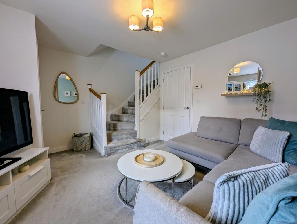
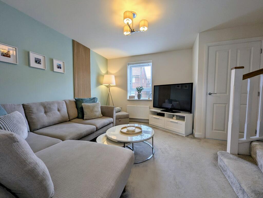
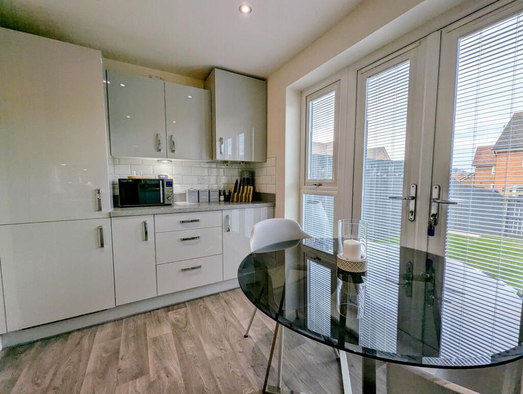
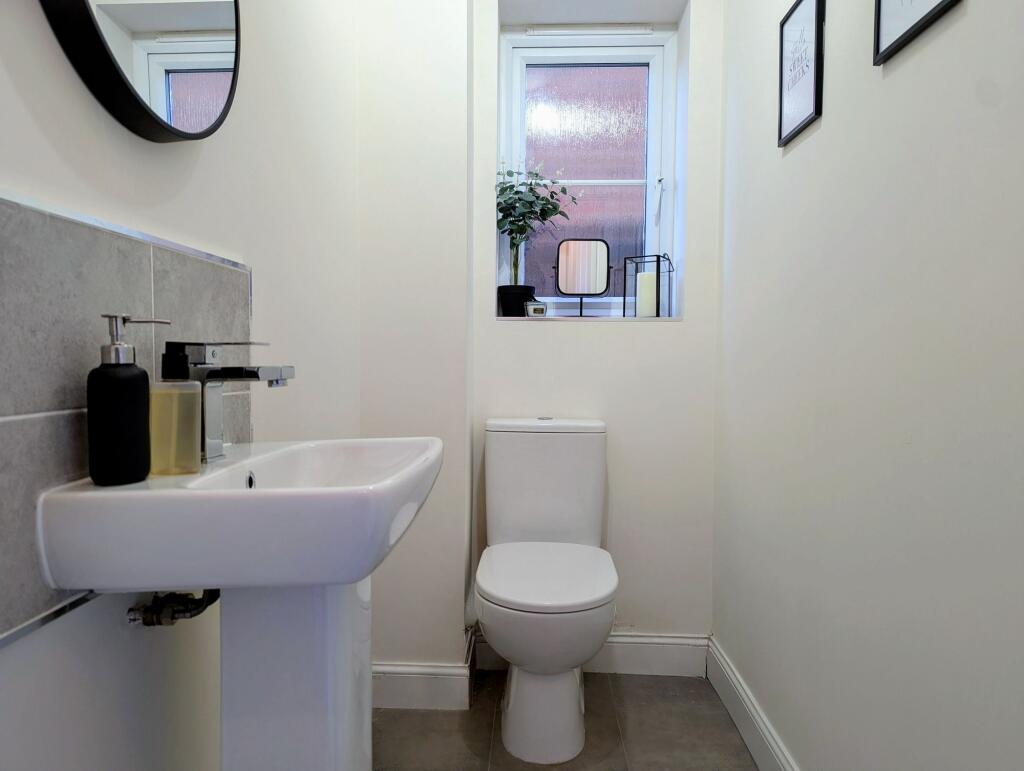
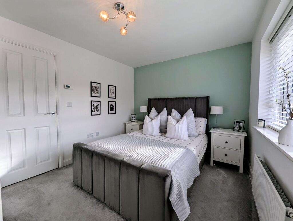
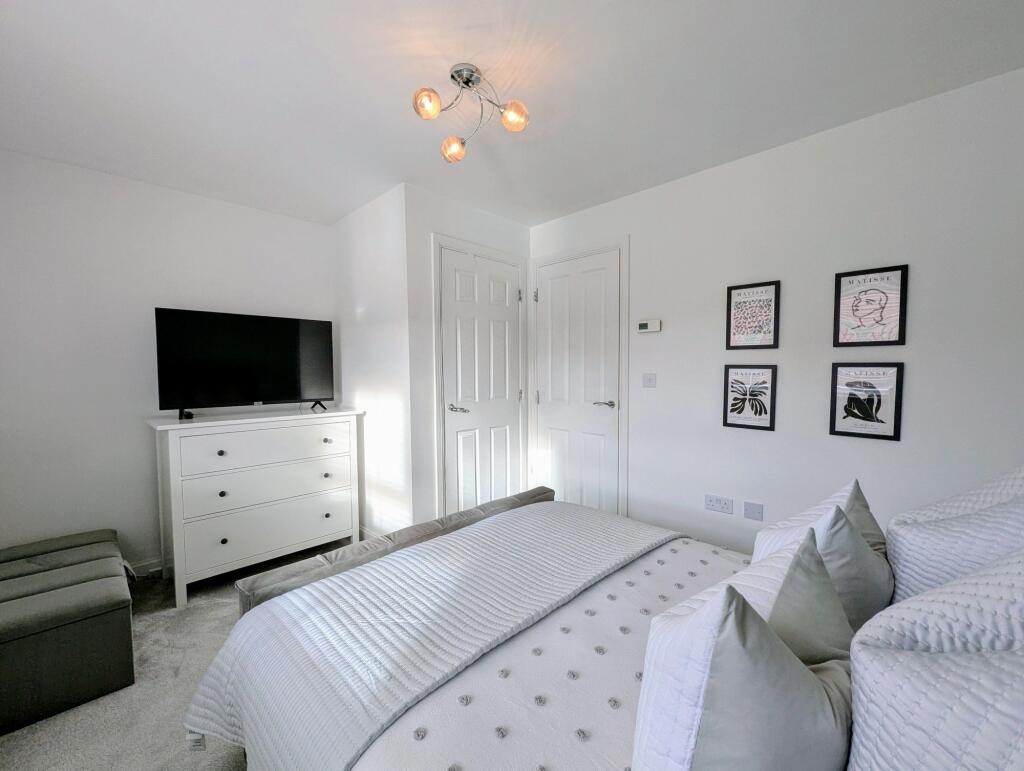
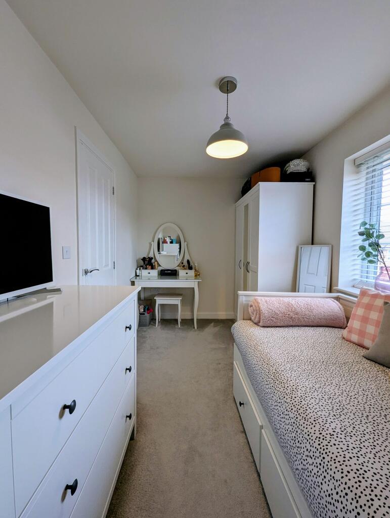
Photos · Open listing
 Open image 1 from listing 165014111
 Open image 2 from listing 165014111
 Open image 3 from listing 165014111
 Open image 4 from listing 165014111
 Open image 5 from listing 165014111
 Open image 6 from listing 165014111
 Open image 7 from listing 165014111
 Open image 8 from listing 165014111
 Open image 9 from listing 165014111
 Open image 10 from listing 165014111
 Open image 11 from listing 165014111
 Open image 12 from listing 165014111
Sold comparables
Same street and nearby sales within 0.25 miles (last 5 years). Land Registry Price Paid Data.
| Address | Price | Date | Type |
|---|---|---|---|
| 87 ADAIR WAY, HEBBURN, SOUTH TYNESIDE, TYNE AND WEAR, NE31 2BS | £112,500 | 03/10/2025 | Semi-detached |
| 51 PORTRUSH DRIVE, HEBBURN, SOUTH TYNESIDE, TYNE AND WEAR, NE31 2FA | £167,000 | 25/07/2025 | Semi-detached |
| 51 PORTRUSH DRIVE, HEBBURN, SOUTH TYNESIDE, TYNE AND WEAR, NE31 2FA | £167,000 | 25/07/2025 | Semi-detached |
| 51 PORTRUSH DRIVE, HEBBURN, SOUTH TYNESIDE, TYNE AND WEAR, NE31 2FA | £167,000 | 25/07/2025 | Semi-detached |
| 127 ADAIR WAY, HEBBURN, SOUTH TYNESIDE, TYNE AND WEAR, NE31 2BS | £218,000 | 23/07/2025 | Semi-detached |
| 99 NORTHBOURNE ROAD, JARROW, SOUTH TYNESIDE, TYNE AND WEAR, NE32 5JR | £99,950 | 15/12/2023 | Semi-detached |
| 79 PORTRUSH DRIVE, HEBBURN, SOUTH TYNESIDE, TYNE AND WEAR, NE31 2FA | £102,500 | 20/10/2023 | Semi-detached |
| 77 ADAIR WAY, HEBBURN, SOUTH TYNESIDE, TYNE AND WEAR, NE31 2BS | £274,995 | 04/08/2023 | Semi-detached |
| 48 USHAW ROAD, HEBBURN, SOUTH TYNESIDE, TYNE AND WEAR, NE31 2YA | £155,000 | 14/07/2023 | Semi-detached |
| 28 TURNBERRY DRIVE, HEBBURN, SOUTH TYNESIDE, TYNE AND WEAR, NE31 2EJ | £195,000 | 27/03/2023 | Semi-detached |
| 60 ADAIR WAY, HEBBURN, SOUTH TYNESIDE, TYNE AND WEAR, NE31 2BZ | £174,995 | 16/12/2022 | Semi-detached |
| 62 ADAIR WAY, HEBBURN, SOUTH TYNESIDE, TYNE AND WEAR, NE31 2BZ | £176,995 | 16/12/2022 | Semi-detached |
| 66 ADAIR WAY, HEBBURN, SOUTH TYNESIDE, TYNE AND WEAR, NE31 2BZ | £169,995 | 15/12/2022 | Semi-detached |
| 64 ADAIR WAY, HEBBURN, SOUTH TYNESIDE, TYNE AND WEAR, NE31 2BZ | £167,995 | 15/12/2022 | Semi-detached |
| 5 ETON SQUARE, HEBBURN, SOUTH TYNESIDE, TYNE AND WEAR, NE31 2XA | £105,000 | 12/12/2022 | Semi-detached |
| 68 ADAIR WAY, HEBBURN, SOUTH TYNESIDE, TYNE AND WEAR, NE31 2BZ | £254,995 | 09/12/2022 | Semi-detached |
| 70 ADAIR WAY, HEBBURN, SOUTH TYNESIDE, TYNE AND WEAR, NE31 2BZ | £254,995 | 09/12/2022 | Semi-detached |
| 6 TURNBERRY DRIVE, HEBBURN, SOUTH TYNESIDE, TYNE AND WEAR, NE31 2EJ | £185,995 | 18/11/2022 | Semi-detached |
| 10 TURNBERRY DRIVE, HEBBURN, SOUTH TYNESIDE, TYNE AND WEAR, NE31 2EJ | £179,995 | 18/11/2022 | Semi-detached |
| 12 TURNBERRY DRIVE, HEBBURN, SOUTH TYNESIDE, TYNE AND WEAR, NE31 2EJ | £179,995 | 18/11/2022 | Semi-detached |
Area average: £175,495 (20 sales)
For sale comparables
No active for-sale comparables found within 1 mile for the same bedrooms and property type.
Capital growth trend
Land Registry outcode average: last 12 months vs 5y and 10y ago (from sold prices).
House Price Index (HM Land Registry — official index, not sold-price averages): South Tyneside. Series: Semi-detached. As of March 2026.
Rental Range
Estimated market rent for South Tyneside. Low = conservative, Realistic = average, Optimistic = best case.
Based on Local Authority from postcode lookup → South Tyneside.
LHA (30th percentile) floor for Tyneside: Apr 2025 – Mar 2026
Rental Comparables
Residential lets from OpenRent and Rightmove for the area (same bedroom count). Use to validate rent estimates. Student lets are excluded.
| Title | Rent | Beds | Distance | As seen on |
|---|---|---|---|---|
| 2 Bed Terraced House, Edith Street, NE32 | £795/mo | 2 | 0.37 miles | OpenRent |
| 2 Bed Flat, Albert Road, NE32 | £625/mo | 2 | 0.43 miles | OpenRent |
Average rent: £710/mo (2 listings)
Rent-driven metrics
Based on OpenRent comparables.
- Rent ratio — Monthly rent ÷ purchase price (1% rule). 1%+ = strong, 0.8–1% = okay, <0.8% = weak for cashflow.
- Max investor price — Rent ÷ 0.8%; the price at which rent would be 0.8% of price (Stoke-style target).
- Target investor price — Rent ÷ 1%; the price at which rent would be 1% of price (strong cashflow band).
- Gross yield — Annual rent as % of purchase price (no costs).
- Cost-to-rent — Price ÷ annual rent (from OpenRent comparables). Under 14× = strong, 14–16× = acceptable, 17×+ = compressed.
- Cashflow — Rent minus mortgage, 10% maintenance, £25/mo compliance. Assumes 75% LTV, 3.95% APR (5yr fixed), 25yr term.
- ROI — Annual profit ÷ cash in (deposit + 4% purchase costs).
Flood risk
Zone: 1
Risk: Low
Not in Flood Risk Area (no data)
Street-level crime
| Category | Count |
|---|---|
| Violence and sexual offences | 89 |
| Anti-social behaviour | 49 |
| Criminal damage and arson | 23 |
| Shoplifting | 23 |
| Burglary | 13 |
| Other theft | 11 |
| Public order | 7 |
| Vehicle crime | 6 |
| Other crime | 5 |
| Drugs | 4 |
| Bicycle theft | 1 |
| Robbery | 1 |
| Theft from the person | 1 |
| Total incidents | 233 |
Within 1 mile during Apr 2026. Source: data.police.uk (England & Wales).
Schools nearby
Nearest open schools with Ofsted ratings (England). Closed schools are not shown. Data from Get Information about Schools and Ofsted.
| Name | Type | Distance | Ofsted |
|---|---|---|---|
| Keelman's Way School | Other | 0.3 miles | Good — 13 Feb 2014 |
| The Sue Hedley Nursery School | Nursery | 0.4 miles | Outstanding — 30 Jan 2014 |
| St Oswald's CofE Aided Primary School | Primary | 0.4 miles | — (Inspected (no overall grade)) |
| Hebburn Lakes Primary School | Primary | 0.5 miles | Good — 7 Feb 2014 |
| Jarrow School | Secondary | 0.5 miles | Good — 21 Sep 2022 |
FENSA
Checking FENSA certificates for this address. Refresh in a few minutes.