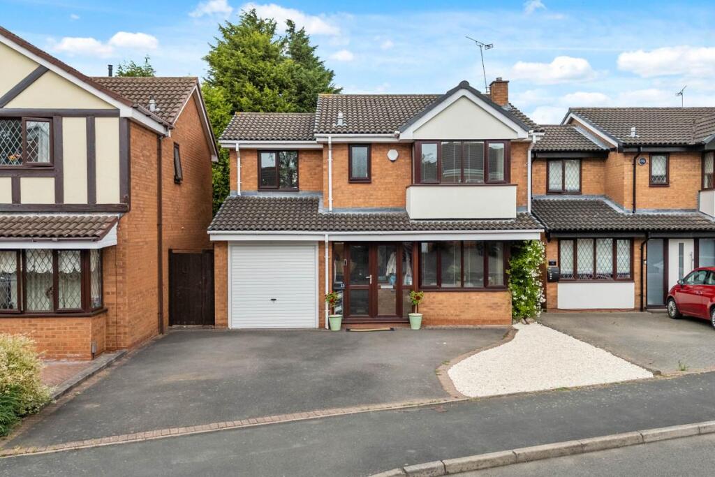
13 TEWKESBURY DRIVE
BEDWORTH, NUNEATON AND BEDWORTH, WARWICKSHIRE, CV12 9ST
£345,000
Location
Nearby
Nearest stations, universities and amenities (distance from property).
| Type | Name | Distance |
|---|---|---|
| Bus stop | Tewkesbury Drive | 0.1 miles |
| Train station | Bedworth | 0.1 miles |
| Shop | Glow by Eve | 0.2 miles |
| Hospital | George Elliot Medical Centre | 4.6 miles |
| University | Unknown | 5.3 miles |
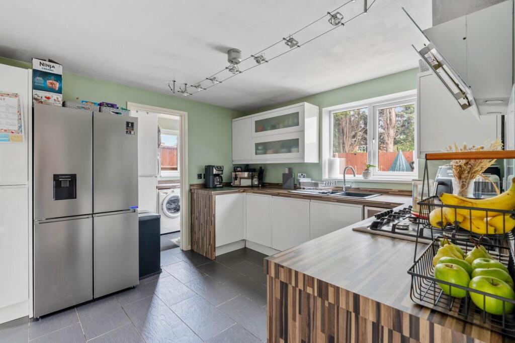
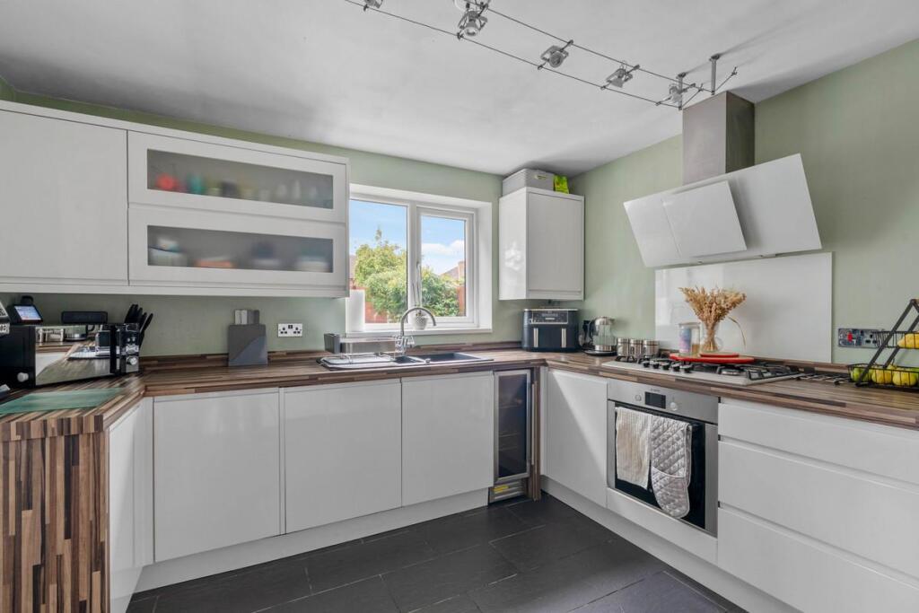
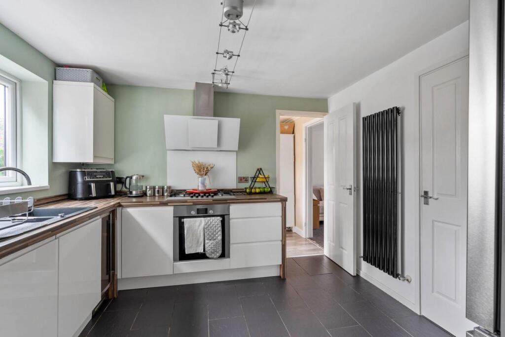
Property details
Tenure
Freehold
Property type
Detached
Bedrooms
4
Bathrooms
2
Floor area
99 m²
EPC rating
D
Year built
England and Wales: 1983-1990
Last sold
£345,000 Feb 2026
Price per m²
£3,485/m²
Local average
£357,528 (37 sales)
Street crime
201 incidents within 1 mile (Apr 2026)
EPC Rating & Upgrade Cost
Current rating: D
Potential rating: B
Inspection date: 23/02/2022
Expiry date: 22/02/2032
Current heating cost: £641/year
Potential heating cost: £563/year
Est. upgrade cost to C: £14,940
Recommendations
- Floor insulation (solid floor) (£4,000 - £6,000)
- Low energy lighting for all fixed outlets (£40)
- Upgrade heating controls (£350 - £450)
- Solar water heating (£4,000 - £6,000)
- Solar photovoltaic panels, 2.5 kWp (£3,500 - £5,500)
Price history
| Event | Date | Price | Type | % change | Today’s value (HPI) | Action |
|---|---|---|---|---|---|---|
| Sold | 20/02/2026 | £345,000 | Detached | +7.8% | £344,316 to March 2026 | View transaction |
| Sold | 30/09/2022 | £319,950 | Detached | +101.2% | £326,433 to March 2026 | View transaction |
| Sold | 29/05/2012 | £159,000 | Detached | +89.3% | £284,393 to March 2026 | View transaction |
| Sold | 10/09/1999 | £84,000 | Detached | — | £325,338 to March 2026 | View transaction |
Historic listings
Listing and sale events only where we matched the listing page to a Land Registry sale already on record for this address.
| Event | Date | Price |
|---|---|---|
| sold | 01/01/2026 | £345,000 |
| listed | 29/08/2025 | £350,000 |
| sold | 01/01/2022 | £319,950 |
| sold | 01/01/2012 | £159,000 |
| sold | 01/01/1999 | £84,000 |
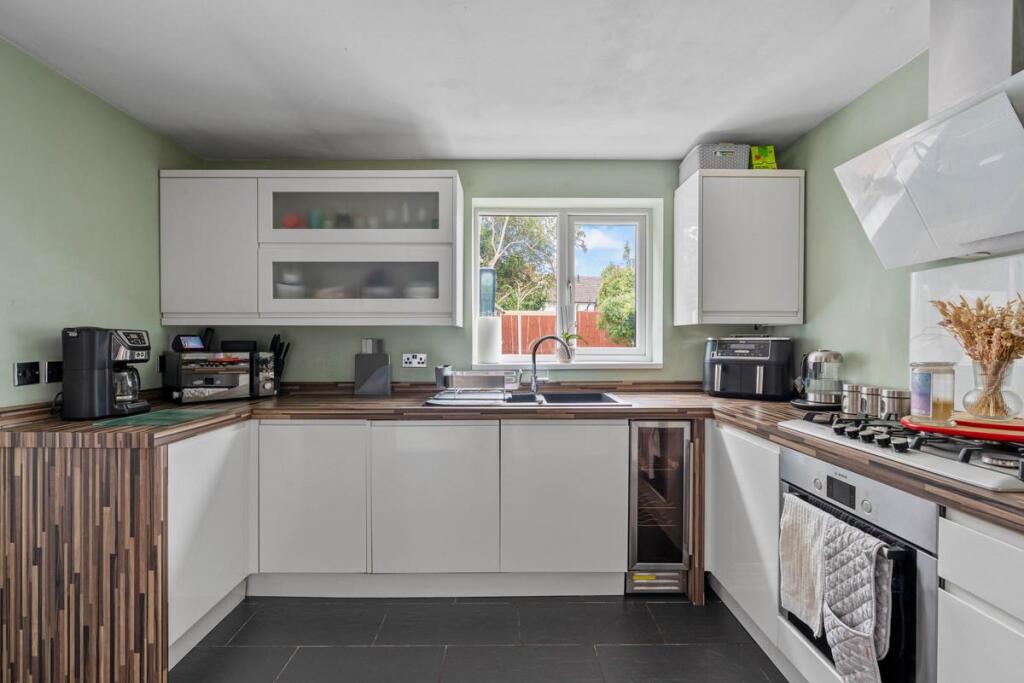
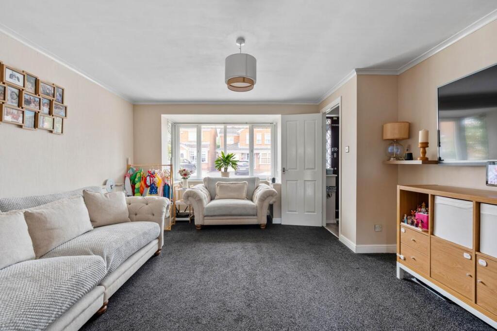
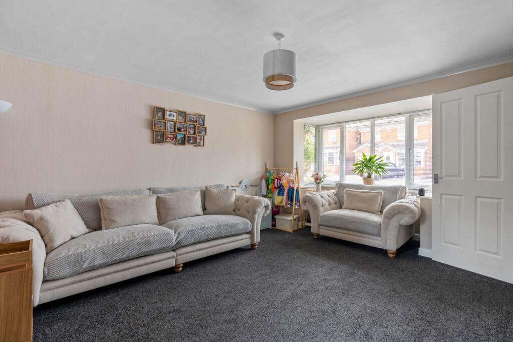
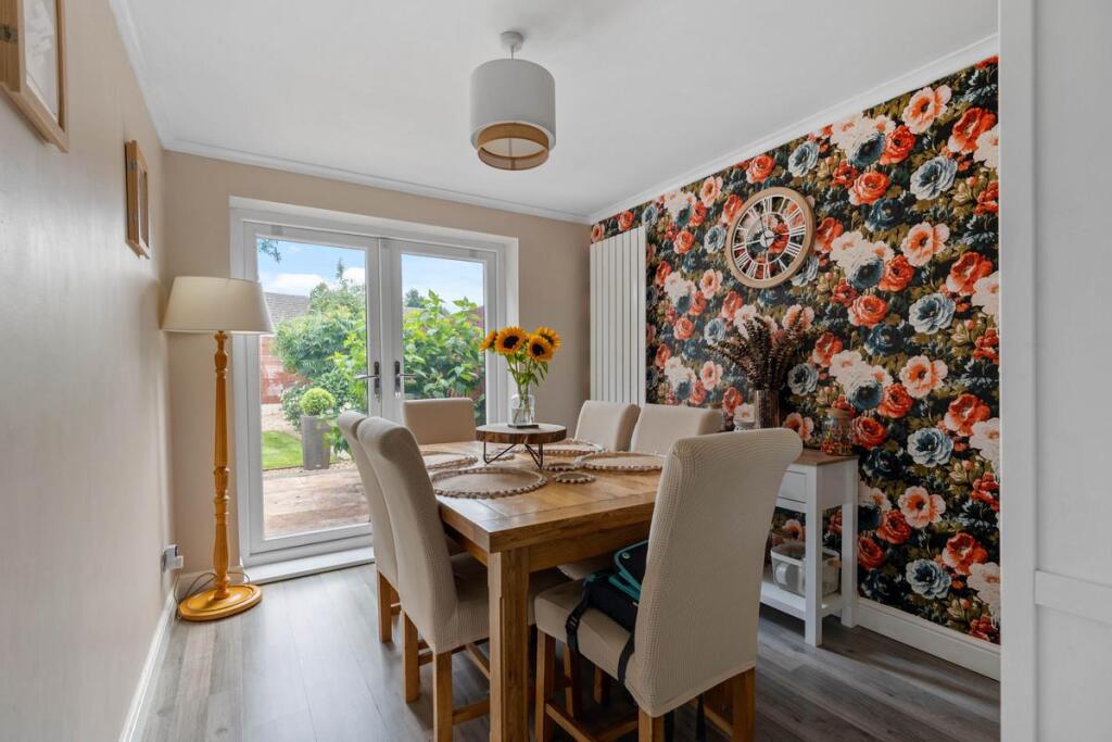
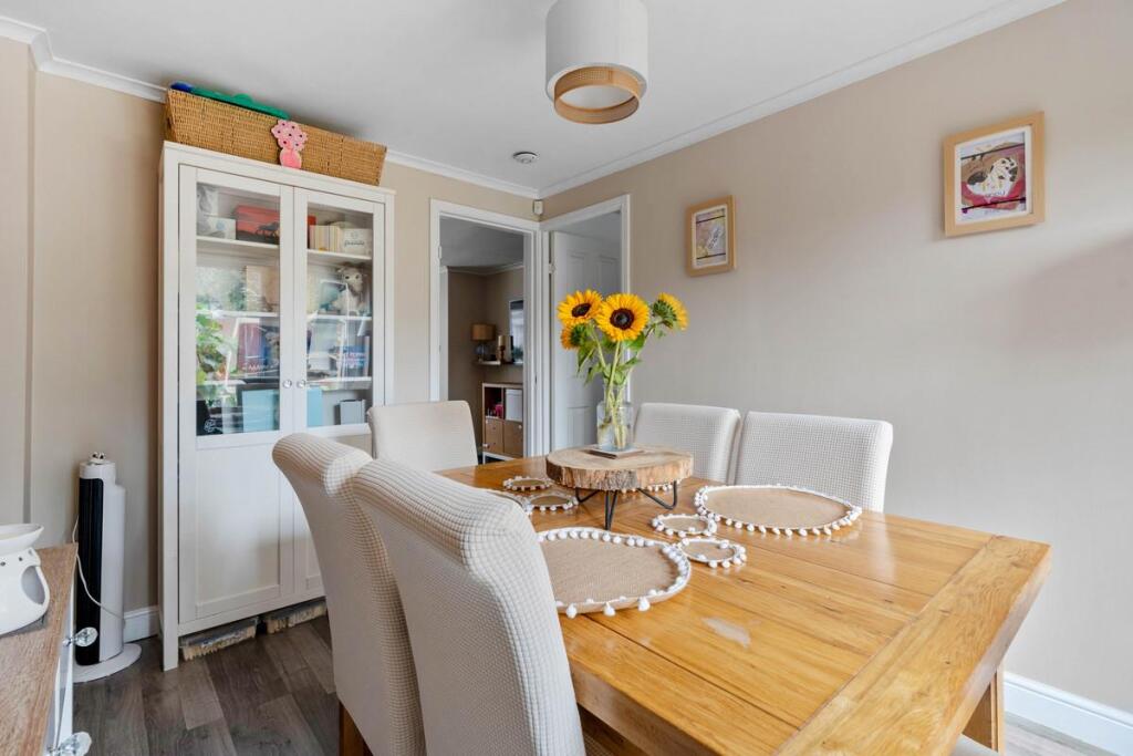
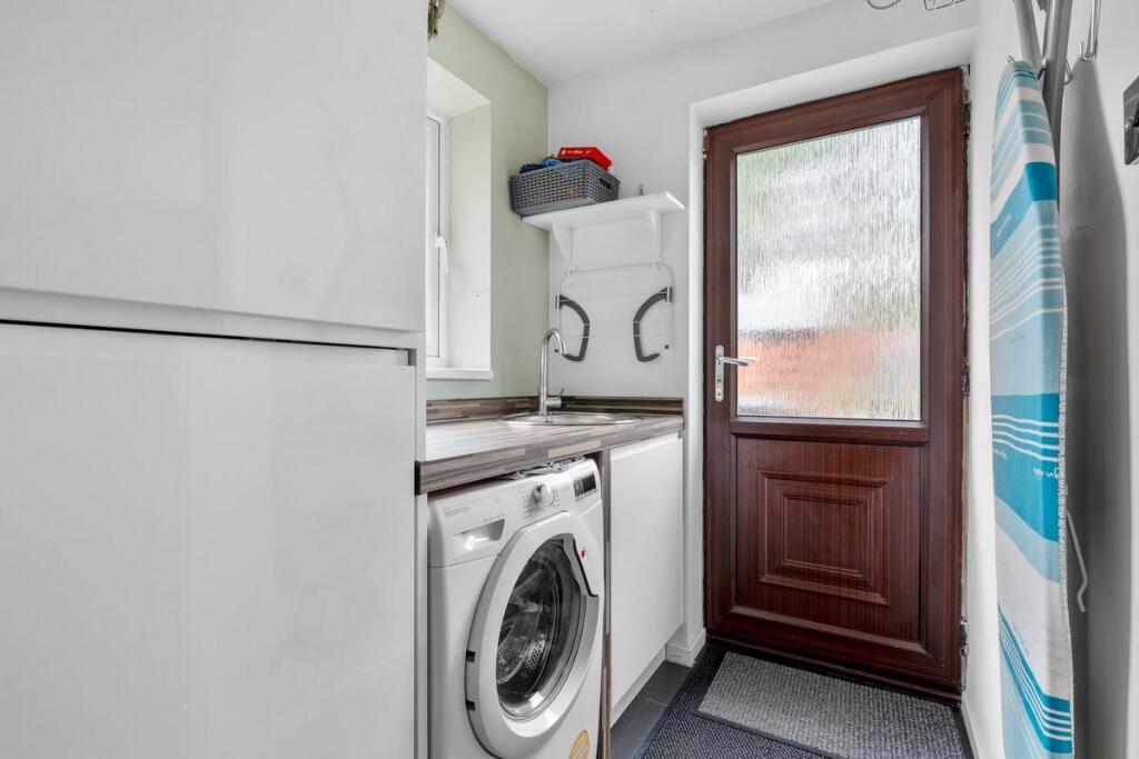
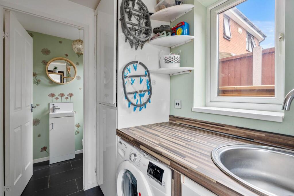
Photos · Open listing
 Open image 1 from listing 166357862
 Open image 2 from listing 166357862
 Open image 3 from listing 166357862
 Open image 4 from listing 166357862
 Open image 5 from listing 166357862
 Open image 6 from listing 166357862
 Open image 7 from listing 166357862
 Open image 8 from listing 166357862
 Open image 9 from listing 166357862
 Open image 10 from listing 166357862
 Open image 11 from listing 166357862
 Open image 12 from listing 166357862
Sold comparables
Same street and nearby sales within 0.25 miles (last 5 years). Land Registry Price Paid Data.
| Address | Price | Date | Type |
|---|---|---|---|
| 44 TINTERN WAY, BEDWORTH, NUNEATON AND BEDWORTH, WARWICKSHIRE, CV12 9SS | £355,000 | 09/12/2022 | Detached |
| 38 TINTERN WAY, BEDWORTH, NUNEATON AND BEDWORTH, WARWICKSHIRE, CV12 9SS | £375,000 | 24/10/2022 | Detached |
| 16 TINTERN WAY, BEDWORTH, NUNEATON AND BEDWORTH, WARWICKSHIRE, CV12 9SS | £190,000 | 13/07/2022 | Detached |
| 40 TINTERN WAY, BEDWORTH, NUNEATON AND BEDWORTH, WARWICKSHIRE, CV12 9SS | £275,000 | 12/07/2022 | Detached |
| 4 TINTERN WAY, BEDWORTH, NUNEATON AND BEDWORTH, WARWICKSHIRE, CV12 9SS | £325,000 | 08/07/2022 | Detached |
| 11 TEWKESBURY DRIVE, BEDWORTH, NUNEATON AND BEDWORTH, WARWICKSHIRE, CV12 9ST | £318,000 | 07/07/2022 | Detached |
| 35 TEWKESBURY DRIVE, BEDWORTH, NUNEATON AND BEDWORTH, WARWICKSHIRE, CV12 9ST | £470,000 | 10/06/2022 | Detached |
| 36 TEWKESBURY DRIVE, BEDWORTH, NUNEATON AND BEDWORTH, WARWICKSHIRE, CV12 9ST | £300,000 | 01/06/2022 | Detached |
| 4 THE BUNGALOWS, BEDWORTH, NUNEATON AND BEDWORTH, WARWICKSHIRE, CV12 9DT | £220,000 | 27/05/2022 | Detached |
| 17 HATTERS COURT, BEDWORTH, NUNEATON AND BEDWORTH, WARWICKSHIRE, CV12 9AU | £325,000 | 29/03/2022 | Detached |
| 7 TEWKESBURY DRIVE, BEDWORTH, NUNEATON AND BEDWORTH, WARWICKSHIRE, CV12 9ST | £275,000 | 04/03/2022 | Detached |
| 55 THE GROVE, BEDWORTH, NUNEATON AND BEDWORTH, WARWICKSHIRE, CV12 8JL | £390,000 | 28/02/2022 | Detached |
| 62 TEWKESBURY DRIVE, BEDWORTH, NUNEATON AND BEDWORTH, WARWICKSHIRE, CV12 9ST | £265,000 | 28/10/2021 | Detached |
| 33 TEWKESBURY DRIVE, BEDWORTH, NUNEATON AND BEDWORTH, WARWICKSHIRE, CV12 9ST | £295,000 | 28/06/2021 | Detached |
Area average: £312,714 (14 sales)
For sale comparables
No active for-sale comparables found within 1 mile for the same bedrooms and property type.
Capital growth trend
Land Registry outcode average: last 12 months vs 5y and 10y ago (from sold prices).
House Price Index (HM Land Registry — official index, not sold-price averages): Nuneaton and Bedworth. Series: Detached. As of March 2026.
Rental Range
Estimated market rent for Nuneaton and Bedworth. Low = conservative, Realistic = average, Optimistic = best case.
Based on Local Authority from postcode lookup → Nuneaton and Bedworth.
LHA (30th percentile) floor for Coventry: Apr 2025 – Mar 2026
Rental Comparables
Loading rental comparables for this postcode. Refresh in a few minutes.
Rent-driven metrics
Based on Area rent estimate.
- Rent ratio — Monthly rent ÷ purchase price (1% rule). 1%+ = strong, 0.8–1% = okay, <0.8% = weak for cashflow.
- Max investor price — Rent ÷ 0.8%; the price at which rent would be 0.8% of price (Stoke-style target).
- Target investor price — Rent ÷ 1%; the price at which rent would be 1% of price (strong cashflow band).
- Gross yield — Annual rent as % of purchase price (no costs).
Flood risk
Zone: 1
Risk: Low
Not in Flood Risk Area (no data)
Street-level crime
| Category | Count |
|---|---|
| Anti-social behaviour | 56 |
| Violence and sexual offences | 53 |
| Shoplifting | 40 |
| Criminal damage and arson | 12 |
| Public order | 10 |
| Vehicle crime | 9 |
| Burglary | 6 |
| Other theft | 5 |
| Bicycle theft | 3 |
| Other crime | 2 |
| Robbery | 2 |
| Theft from the person | 2 |
| Drugs | 1 |
| Total incidents | 201 |
Within 1 mile during Apr 2026. Source: data.police.uk (England & Wales).
Schools nearby
Nearest open schools with Ofsted ratings (England). Closed schools are not shown. Data from Get Information about Schools and Ofsted.
| Name | Type | Distance | Ofsted |
|---|---|---|---|
| St Francis Catholic Academy | Primary | 0.2 miles | Good — 9 Jan 2013 |
| St Michael's Church of England Academy | Primary | 0.3 miles | Good — 2 Jul 2018 |
| Nicholas Chamberlaine School | Secondary | 0.3 miles | Good — 22 May 2024 |
| All Saints Bedworth CofE Academy | Primary | 0.3 miles | Good — 28 Jan 2024 |
| Race Leys Infant School | Primary | 0.5 miles | Requires improvement — 24 Sep 2023 |
FENSA
No FENSA certificates found for this address.