102C DURNFORD STREET
PLYMOUTH, CITY OF PLYMOUTH, PL1 3QP
£155,000
Location
Nearby
Nearest stations, universities and amenities (distance from property).
| Type | Name | Distance |
|---|---|---|
| Bus stop | Durnford Street Square | 0.0 miles |
| Shop | The Royal William Bakery | 0.1 miles |
| Train station | Devonport | 1.1 miles |
| University | University of Plymouth | 1.2 miles |
| Hospital | Penntorr Health | 2.9 miles |
Property details
Tenure
Leasehold
Property type
Flat
Bedrooms
2
Floor area
65 m²
EPC rating
D
Year built
England and Wales: before 1900
Last sold
£155,000 Feb 2026
Price per m²
£2,385/m²
Local average
£166,317 (48 sales)
Street crime
620 incidents within 1 mile (Apr 2026)
EPC Rating & Upgrade Cost
Current rating: D
Potential rating: C
Inspection date: 26/07/2021
Expiry date: 25/07/2031
Current heating cost: £467/year
Potential heating cost: £252/year
Est. upgrade cost to C: £9,000
Recommendations
- 50 mm internal or external wall insulation (£4,000 - £14,000)
Price history
| Event | Date | Price | Type | % change | Today’s value (HPI) | Action |
|---|---|---|---|---|---|---|
| Sold | 20/02/2026 | £155,000 | Flat | +14.8% | £154,059 to March 2026 | View transaction |
| Sold | 30/07/2010 | £135,000 | Flat | +31.1% | £186,194 to March 2026 | View transaction |
| Sold | 23/06/2003 | £103,000 | Terraced | +123.9% | £263,278 to March 2026 | View transaction |
| Sold | 27/11/1998 | £46,000 | Terraced | — | £245,959 to March 2026 | View transaction |
Historic listings
Listing and sale events only where we matched the listing page to a Land Registry sale already on record for this address.
| Event | Date | Price |
|---|---|---|
| sold | 01/01/2026 | £155,000 |
| listed | 21/07/2021 | £895 |
| sold | 01/01/2010 | £135,000 |
| sold | 01/01/2003 | £103,000 |
| sold | 01/01/1998 | £46,000 |
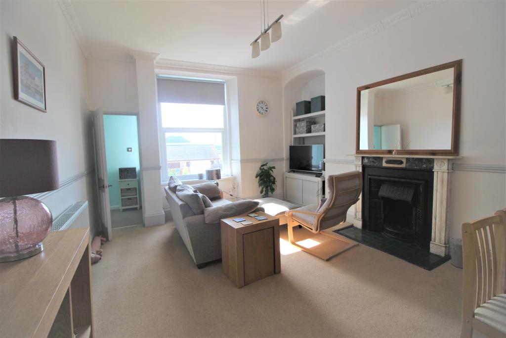
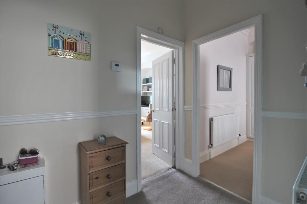
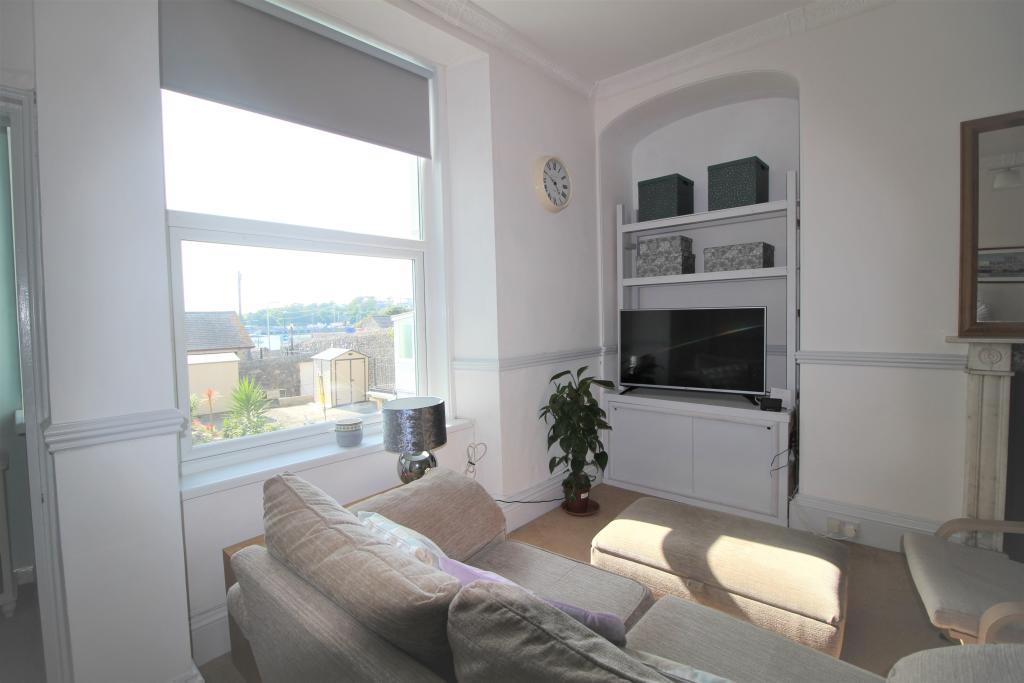
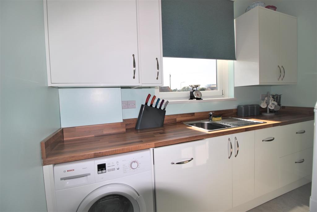
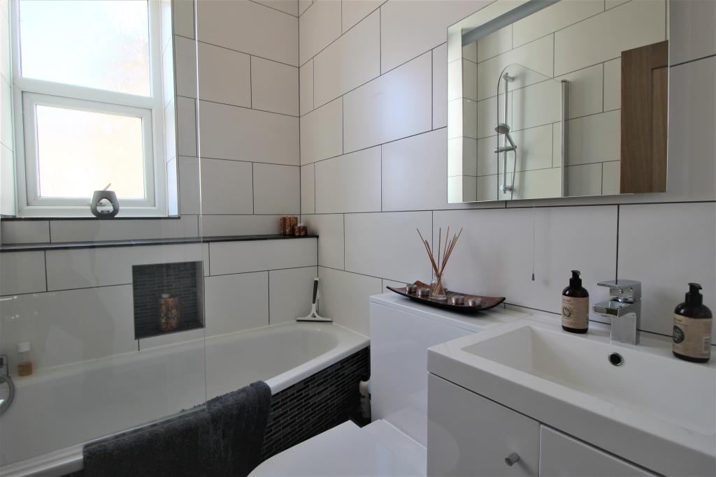
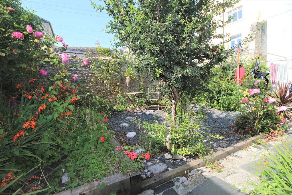
Photos · Open listing
 Open image 1 from listing 110708345
 Open image 2 from listing 110708345
 Open image 3 from listing 110708345
 Open image 4 from listing 110708345
 Open image 5 from listing 110708345
 Open image 6 from listing 110708345
 Open image 7 from listing 110708345
 Open image 8 from listing 110708345
 Open image 9 from listing 110708345
 Open image 10 from listing 110708345
 Open image 11 from listing 110708345
 Open image 12 from listing 110708345
Sold comparables
Same street and nearby sales within 0.25 miles (last 5 years). Land Registry Price Paid Data.
| Address | Price | Date | Type |
|---|---|---|---|
| EDGCUMBE COURT, 169 FLAT 35 DURNFORD STREET, PLYMOUTH, CITY OF PLYMOUTH, PL1 3QR | £305,000 | 10/11/2025 | Flat |
| 169 FLAT 5 DURNFORD STREET, PLYMOUTH, CITY OF PLYMOUTH, PL1 3QR | £190,000 | 10/11/2025 | Flat |
| 110 BASEMENT FLAT DURNFORD STREET, PLYMOUTH, CITY OF PLYMOUTH, PL1 3QP | £225,000 | 05/09/2025 | Flat |
| 28 MOUNT STONE ROAD, PLYMOUTH, CITY OF PLYMOUTH, PL1 3RW | £158,000 | 29/07/2025 | Flat |
| 4 FLAT 49 ROYAL WILLIAM YARD, PLYMOUTH, CITY OF PLYMOUTH, PL1 3GD | £195,000 | 19/12/2023 | Flat |
| EDGCUMBE COURT, 169 FLAT 7 DURNFORD STREET, PLYMOUTH, CITY OF PLYMOUTH, PL1 3QR | £280,000 | 15/12/2023 | Flat |
| 4 FLAT 50 ROYAL WILLIAM YARD, PLYMOUTH, CITY OF PLYMOUTH, PL1 3GD | £185,000 | 11/12/2023 | Flat |
| 114 FLAT B DURNFORD STREET, PLYMOUTH, CITY OF PLYMOUTH, PL1 3QP | £190,000 | 03/11/2023 | Flat |
| 4 FLAT 4 ROYAL WILLIAM YARD, PLYMOUTH, CITY OF PLYMOUTH, PL1 3GD | £182,000 | 01/11/2023 | Flat |
| 40B DURNFORD STREET, PLYMOUTH, CITY OF PLYMOUTH, PL1 3QN | £170,000 | 22/09/2023 | Flat |
| 169 FLAT 19 DURNFORD STREET, PLYMOUTH, CITY OF PLYMOUTH, PL1 3QR | £245,000 | 17/04/2023 | Flat |
| 119A DURNFORD STREET, PLYMOUTH, CITY OF PLYMOUTH, PL1 3QP | £205,000 | 03/04/2023 | Flat |
| 4 FLAT 29 ROYAL WILLIAM YARD, PLYMOUTH, CITY OF PLYMOUTH, PL1 3GD | £165,000 | 24/03/2023 | Flat |
| 30B ADMIRALTY STREET, STONEHOUSE, PLYMOUTH, CITY OF PLYMOUTH, PL1 3RX | £250,000 | 24/03/2023 | Flat |
| 4 FLAT 7 ROYAL WILLIAM YARD, PLYMOUTH, CITY OF PLYMOUTH, PL1 3GD | £175,000 | 19/12/2022 | Flat |
| 36 DURNFORD STREET, PLYMOUTH, CITY OF PLYMOUTH, PL1 3QN | £180,000 | 19/12/2022 | Flat |
| 4 FLAT 49 ROYAL WILLIAM YARD, PLYMOUTH, CITY OF PLYMOUTH, PL1 3GD | £207,000 | 16/12/2022 | Flat |
| 105 DURNFORD STREET, PLYMOUTH, CITY OF PLYMOUTH, PL1 3QP | £115,000 | 14/12/2022 | Flat |
| EDGCUMBE COURT, 169 FLAT 12 DURNFORD STREET, PLYMOUTH, CITY OF PLYMOUTH, PL1 3QR | £185,000 | 02/12/2022 | Flat |
| 169 FLAT 20 DURNFORD STREET, PLYMOUTH, CITY OF PLYMOUTH, PL1 3QR | £400,000 | 25/11/2022 | Flat |
Area average: £210,350 (20 sales)
For sale comparables
No active for-sale comparables found within 1 mile for the same bedrooms and property type.
Capital growth trend
Land Registry outcode average: last 12 months vs 5y and 10y ago (from sold prices).
House Price Index (HM Land Registry — official index, not sold-price averages): City of Plymouth. Series: Flats and maisonettes. As of March 2026.
Rental Range
Estimated market rent for Plymouth. Low = conservative, Realistic = average, Optimistic = best case.
Based on Local Authority from postcode lookup → Plymouth.
Rental Comparables
Residential lets from OpenRent and Rightmove for the area (same bedroom count). Use to validate rent estimates. Student lets are excluded.
| Title | Rent | Beds | Distance | As seen on |
|---|---|---|---|---|
| 2 Bed Flat, Mizzen Road, PL1 | £1,200/mo | 2 | 0.52 miles | OpenRent |
| 2 Bed Flat, Harwell Court, PL1 | £1,150/mo | 2 | 0.82 miles | OpenRent |
Average rent: £1,175/mo (2 listings)
Rent-driven metrics
Based on OpenRent comparables.
- Rent ratio — Monthly rent ÷ purchase price (1% rule). 1%+ = strong, 0.8–1% = okay, <0.8% = weak for cashflow.
- Max investor price — Rent ÷ 0.8%; the price at which rent would be 0.8% of price (Stoke-style target).
- Target investor price — Rent ÷ 1%; the price at which rent would be 1% of price (strong cashflow band).
- Gross yield — Annual rent as % of purchase price (no costs).
- Cost-to-rent — Price ÷ annual rent (from OpenRent comparables). Under 14× = strong, 14–16× = acceptable, 17×+ = compressed.
- Cashflow — Rent minus mortgage, 10% maintenance, £25/mo compliance. Assumes 75% LTV, 3.95% APR (5yr fixed), 25yr term.
- ROI — Annual profit ÷ cash in (deposit + 4% purchase costs).
Flood risk
Zone: 1
Risk: Low
Not in Flood Risk Area (no data)
Street-level crime
| Category | Count |
|---|---|
| Violence and sexual offences | 265 |
| Anti-social behaviour | 103 |
| Shoplifting | 57 |
| Criminal damage and arson | 43 |
| Other theft | 43 |
| Public order | 43 |
| Vehicle crime | 13 |
| Burglary | 12 |
| Drugs | 11 |
| Theft from the person | 9 |
| Possession of weapons | 8 |
| Other crime | 7 |
| Robbery | 6 |
| Total incidents | 620 |
Within 1 mile during Apr 2026. Source: data.police.uk (England & Wales).
Schools nearby
Nearest open schools with Ofsted ratings (England). Closed schools are not shown. Data from Get Information about Schools and Ofsted.
| Name | Type | Distance | Ofsted |
|---|---|---|---|
| St George's CofE Primary Academy | Primary | 0.1 miles | Good — 10 Mar 2022 |
| High Street Primary Academy | Primary | 0.5 miles | Good — 14 Sep 2023 |
| Millbay Academy | Other | 0.5 miles | Good — 24 Apr 2024 |
| St Andrew's Cof E VA Primary School | Primary | 0.6 miles | Good — 29 Nov 2022 |
| St Peter's CofE Primary School | Primary | 0.7 miles | Good — 29 Apr 2024 |
FENSA
No FENSA certificates found for this address.