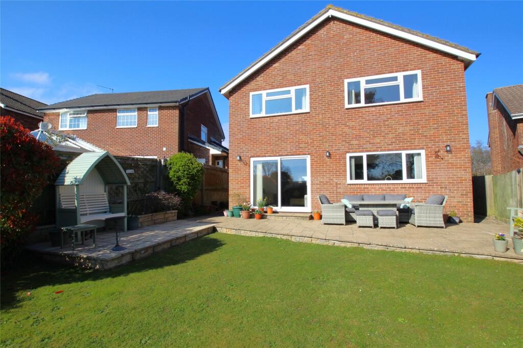
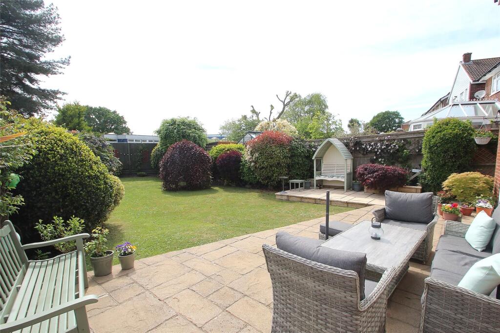
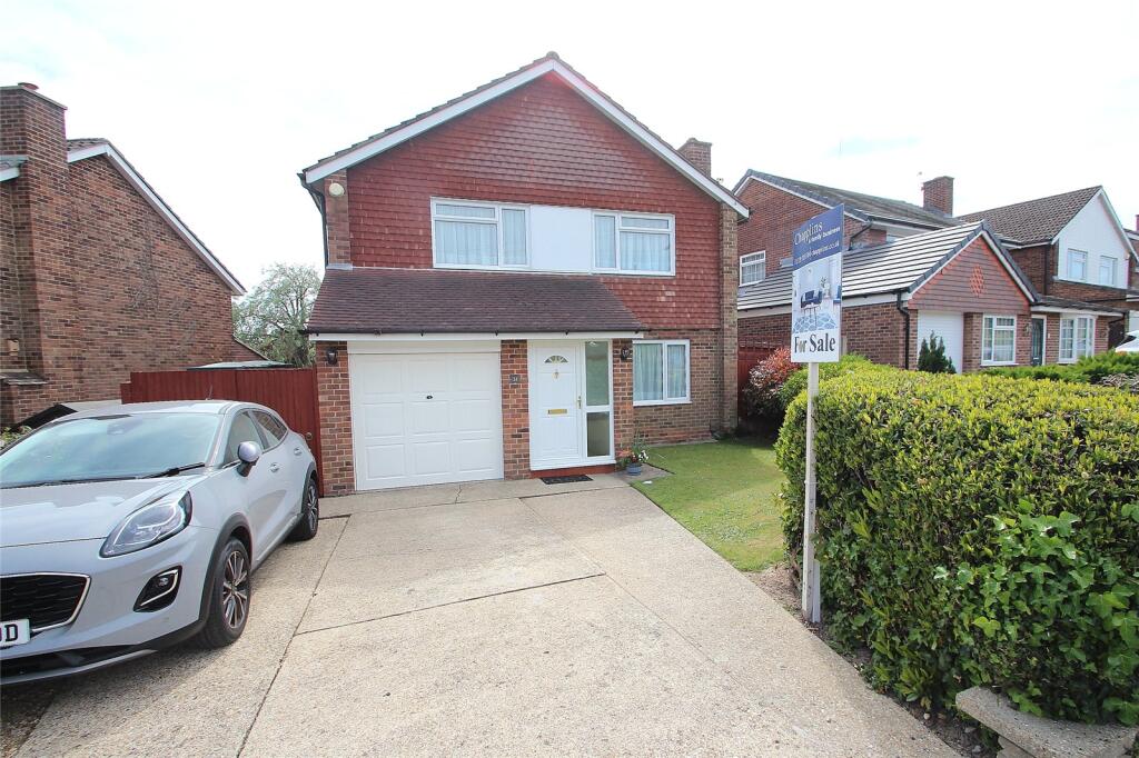
31 MALLORY CRESCENT
FAREHAM, HAMPSHIRE, PO16 7QA
£587,500
Location
Nearby
Nearest stations, universities and amenities (distance from property).
| Type | Name | Distance |
|---|---|---|
| Bus stop | Arundel Drive | 0.2 miles |
| Shop | Spar | 0.3 miles |
| Train station | Fareham | 0.6 miles |
| Hospital | Forton Medical Centre | 4.7 miles |
| University | St Andrew's Court Information Centre | 6.2 miles |
Property details
Tenure
Freehold
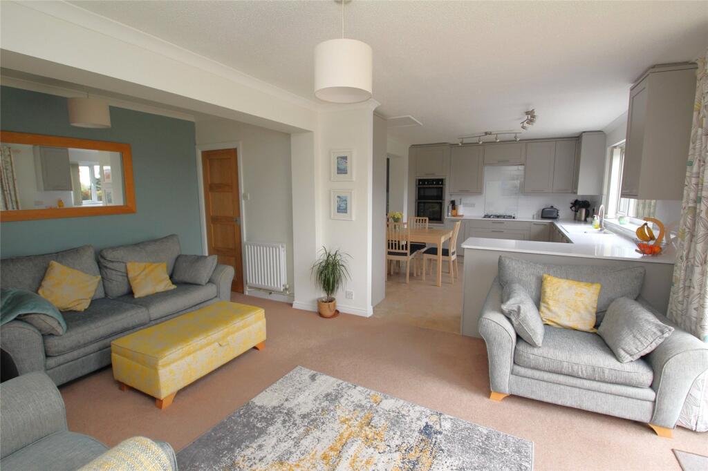
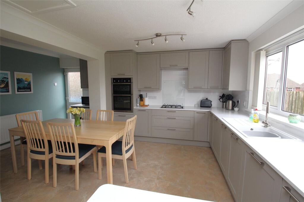
Property type
Detached
Bedrooms
5
Bathrooms
2
Floor area
155 m²
EPC rating
C
Year built
England and Wales: 1950-1966
Last sold
£587,500 Jan 2026
Price per m²
£3,790/m²
Local average
£489,321 (28 sales)
Street crime
189 incidents within 1 mile (Apr 2026)
EPC Rating & Upgrade Cost
Current rating: C
Potential rating: C
Inspection date: 04/04/2025
Expiry date: 03/04/2035
Current heating cost: £1,072/year
Potential heating cost: £1,001/year
Est. upgrade cost to C: £9,500
Recommendations
- Floor insulation (solid floor) (£4,000 - £6,000)
- Solar photovoltaic panels, 2.5 kWp (£3,500 - £5,500)
Price history
| Event | Date | Price | Type | % change | Today’s value (HPI) | Action |
|---|---|---|---|---|---|---|
| Sold | 21/01/2026 | £587,500 | Detached | — | £597,925 to March 2026 | View transaction |
Historic listings
Listing and sale events only where we matched the listing page to a Land Registry sale already on record for this address.
| Event | Date | Price |
|---|---|---|
| sold | 01/01/2026 | £587,500 |
| listed | 28/03/2025 | £575,000 |
| sold | 01/01/1996 | £89,000 |
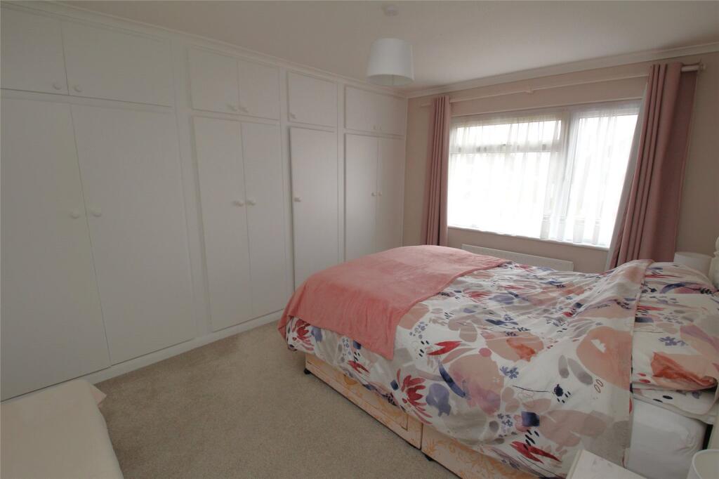
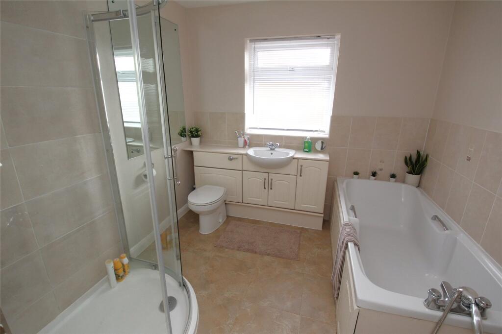
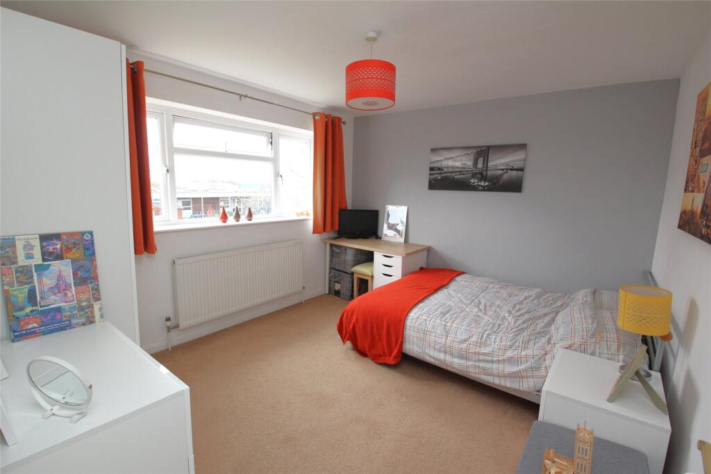
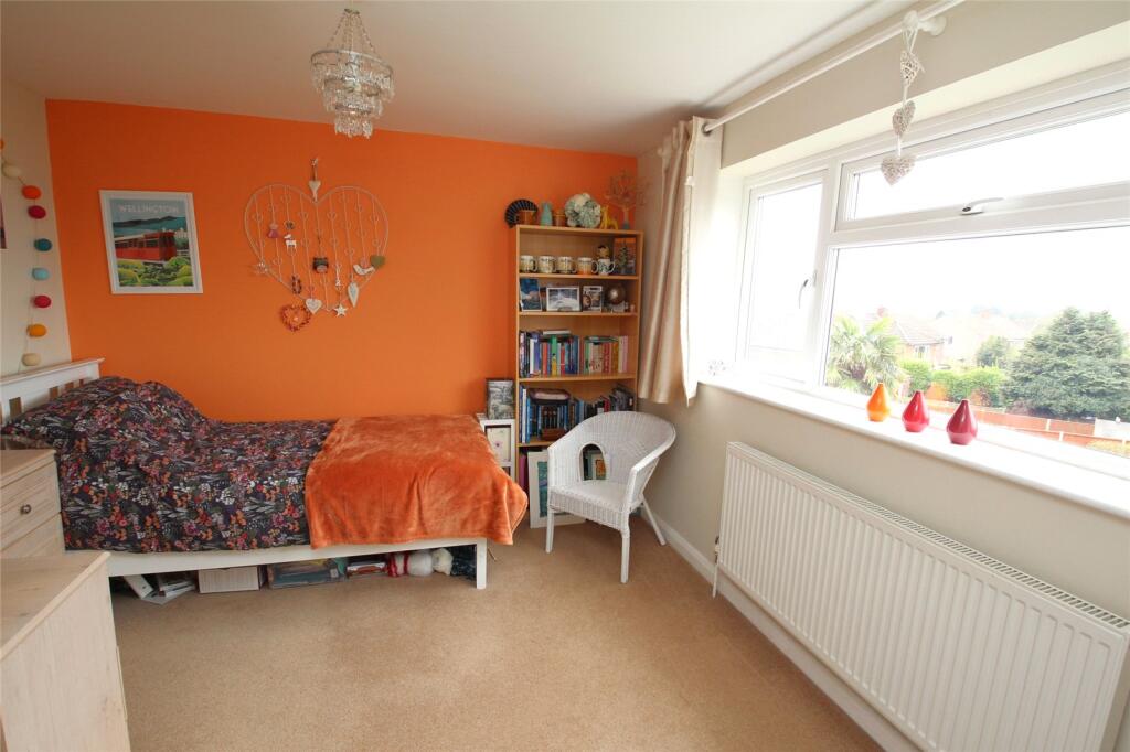
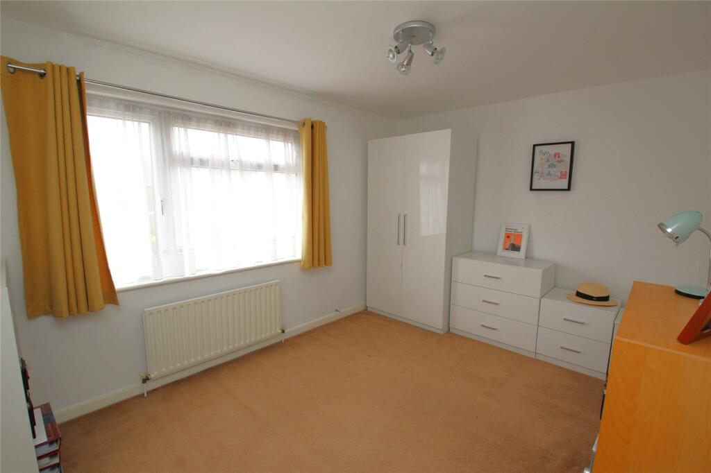
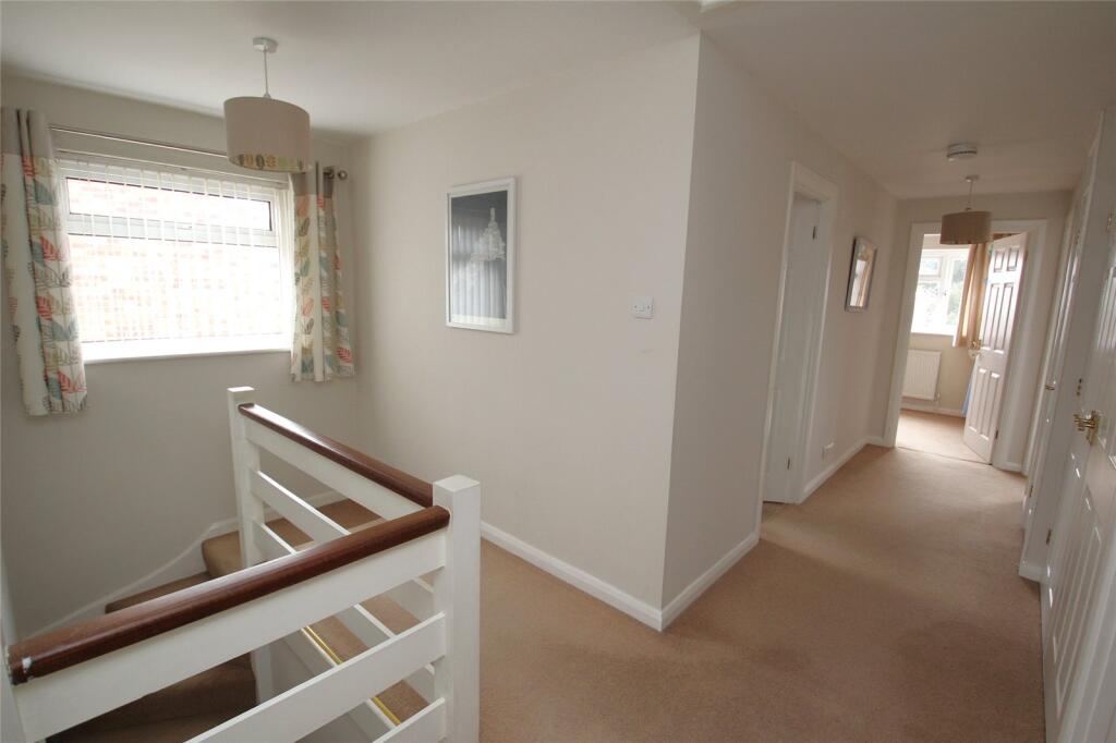
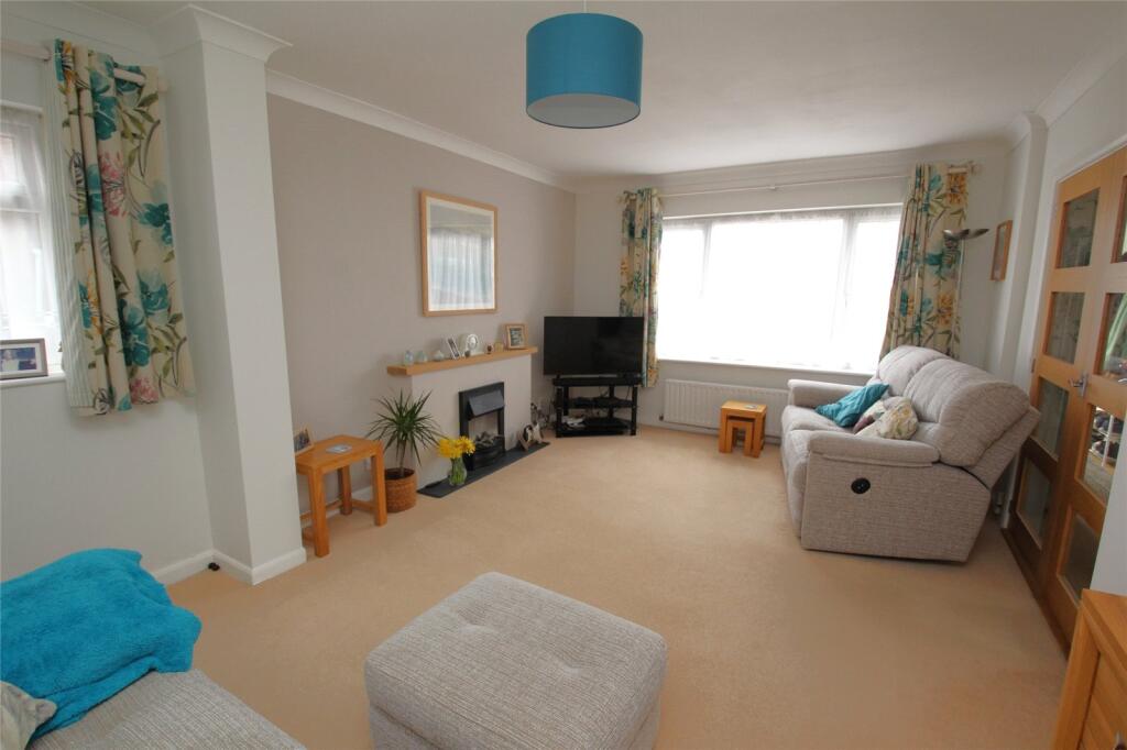
Photos · Open listing
 Open image 1 from listing 159948959
 Open image 2 from listing 159948959
 Open image 3 from listing 159948959
 Open image 4 from listing 159948959
 Open image 5 from listing 159948959
 Open image 6 from listing 159948959
 Open image 7 from listing 159948959
 Open image 8 from listing 159948959
 Open image 9 from listing 159948959
 Open image 10 from listing 159948959
 Open image 11 from listing 159948959
 Open image 12 from listing 159948959
Sold comparables
Same street and nearby sales within 0.25 miles (last 5 years). Land Registry Price Paid Data.
| Address | Price | Date | Type |
|---|---|---|---|
| 21 BURNHAM WOOD, FAREHAM, HAMPSHIRE, PO16 7UD | £530,000 | 09/12/2025 | Detached |
| 27 CRAWFORD DRIVE, FAREHAM, HAMPSHIRE, PO16 7RW | £535,000 | 14/11/2025 | Detached |
| 8 MORSHEAD CRESCENT, FAREHAM, HAMPSHIRE, PO16 7QP | £440,000 | 17/11/2023 | Detached |
| 55 MAYLINGS FARM ROAD, FAREHAM, HAMPSHIRE, PO16 7QS | £705,000 | 24/10/2023 | Detached |
| 32 MAYLINGS FARM ROAD, FAREHAM, HAMPSHIRE, PO16 7QU | £435,000 | 14/04/2023 | Detached |
| 25 MILLER DRIVE, FAREHAM, HAMPSHIRE, PO16 7LZ | £430,000 | 20/02/2023 | Detached |
| 9 TANGLE WOOD, FAREHAM, HAMPSHIRE, PO16 7UU | £730,000 | 15/12/2022 | Detached |
| 10 SOMERVELL DRIVE, FAREHAM, HAMPSHIRE, PO16 7QG | £576,000 | 11/08/2022 | Detached |
| 43 CRAWFORD DRIVE, FAREHAM, HAMPSHIRE, PO16 7RW | £570,000 | 30/05/2022 | Detached |
| 6 MALLORY CRESCENT, FAREHAM, HAMPSHIRE, PO16 7QH | £395,000 | 11/05/2022 | Detached |
| 7 MILLER DRIVE, FAREHAM, HAMPSHIRE, PO16 7LZ | £726,500 | 31/03/2022 | Detached |
| 5 GREENWOOD CLOSE, FAREHAM, HAMPSHIRE, PO16 7UF | £468,000 | 31/03/2022 | Detached |
| 1 BRUCE CLOSE, FAREHAM, HAMPSHIRE, PO16 7QJ | £505,000 | 25/02/2022 | Detached |
| 22 MORSHEAD CRESCENT, FAREHAM, HAMPSHIRE, PO16 7QR | £500,000 | 09/02/2022 | Detached |
| 46 MAYLINGS FARM ROAD, FAREHAM, HAMPSHIRE, PO16 7QS | £625,000 | 26/01/2022 | Detached |
| 25 MALLORY CRESCENT, FAREHAM, HAMPSHIRE, PO16 7QA | £458,000 | 07/01/2022 | Detached |
| 59 SOMERVELL DRIVE, FAREHAM, HAMPSHIRE, PO16 7QW | £443,000 | 07/01/2022 | Detached |
| 4 MAYLINGS FARM ROAD, FAREHAM, HAMPSHIRE, PO16 7QX | £480,000 | 15/11/2021 | Detached |
| 15 KILN ROAD, FAREHAM, HAMPSHIRE, PO16 7UA | £895,000 | 03/11/2021 | Detached |
| 30 MALLORY CRESCENT, FAREHAM, HAMPSHIRE, PO16 7QA | £495,000 | 28/09/2021 | Detached |
Area average: £547,075 (20 sales)
For sale comparables
No active for-sale comparables found within 1 mile for the same bedrooms and property type.
Capital growth trend
Land Registry outcode average: last 12 months vs 5y and 10y ago (from sold prices).
House Price Index (HM Land Registry — official index, not sold-price averages): Fareham. Series: Detached. As of March 2026.
Rental Range
Estimated market rent for Fareham. Low = conservative, Realistic = average, Optimistic = best case.
Based on Local Authority from postcode lookup → Fareham.
LHA (30th percentile) floor for Portsmouth: Apr 2025 – Mar 2026
Rental Comparables
Loading rental comparables for this postcode. Refresh in a few minutes.
Rent-driven metrics
Based on Area rent estimate.
- Rent ratio — Monthly rent ÷ purchase price (1% rule). 1%+ = strong, 0.8–1% = okay, <0.8% = weak for cashflow.
- Max investor price — Rent ÷ 0.8%; the price at which rent would be 0.8% of price (Stoke-style target).
- Target investor price — Rent ÷ 1%; the price at which rent would be 1% of price (strong cashflow band).
- Gross yield — Annual rent as % of purchase price (no costs).
Flood risk
Zone: 1
Risk: Low
Not in Flood Risk Area (no data)
Street-level crime
| Category | Count |
|---|---|
| Violence and sexual offences | 63 |
| Anti-social behaviour | 39 |
| Shoplifting | 31 |
| Criminal damage and arson | 13 |
| Drugs | 13 |
| Other theft | 10 |
| Public order | 8 |
| Vehicle crime | 4 |
| Bicycle theft | 2 |
| Burglary | 2 |
| Other crime | 2 |
| Possession of weapons | 2 |
| Total incidents | 189 |
Within 1 mile during Apr 2026. Source: data.police.uk (England & Wales).
Schools nearby
Nearest open schools with Ofsted ratings (England). Closed schools are not shown. Data from Get Information about Schools and Ofsted.
| Name | Type | Distance | Ofsted |
|---|---|---|---|
| Uplands Primary School | Primary | 0.1 miles | Good — 2 Nov 2011 |
| Harrison Primary School | Primary | 0.5 miles | Outstanding — 29 Jan 2024 |
| Kingsgate School | Other | 0.6 miles | Outstanding — 11 Jul 2024 |
| Orchard Lea Infant School | Primary | 0.7 miles | Requires improvement — 13 Sep 2023 |
| Orchard Lea Junior School | Primary | 0.7 miles | Good — 9 Sep 2024 |
FENSA
Checking FENSA certificates for this address. Refresh in a few minutes.