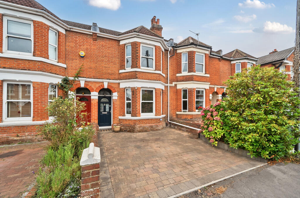
87 ATHERLEY ROAD
SOUTHAMPTON, SO15 5DT
£405,000
Location
Nearby
Nearest stations, universities and amenities (distance from property).
| Type | Name | Distance |
|---|---|---|
| Bus stop | Stafford Road | 0.2 miles |
| Shop | UK Zabka Groceries | 0.2 miles |
| Train station | Southampton Central | 0.6 miles |
| Hospital | Royal South Hants Urgent Treatment Centre | 1.0 miles |
| University | South Academic Block | 1.4 miles |
Property details
Tenure
Leasehold
Property type
Terraced
Bedrooms
3
Bathrooms
1
Floor area
131 m²
EPC rating
D
Year built
England and Wales: 1900-1929
Last sold
£405,000 Mar 2026
Price per m²
£3,092/m²
Local average
£283,897 (35 sales)
Street crime
1012 incidents within 1 mile (May 2026)
EPC Rating & Upgrade Cost
Current rating: D
Potential rating: B
Inspection date: 16/07/2020
Expiry date: 15/07/2030
Current heating cost: £721/year
Potential heating cost: £495/year
Recommendations
- 50 mm internal or external wall insulation (14,000)
- Floor insulation (suspended floor) (1,200)
- Solar water heating (6,000)
- Solar photovoltaic panels, 2.5 kWp (5,500)
Price history
| Event | Date | Price | Type | % change | Today’s value (HPI) | Action |
|---|---|---|---|---|---|---|
| Sold | 05/03/2026 | £405,000 | Terraced | +15.7% | £407,503 to April 2026 | View transaction |
| Sold | 14/10/2020 | £350,000 | Terraced | +62.8% | £415,998 to April 2026 | View transaction |
| Sold | 24/06/2010 | £215,000 | Terraced | — | £351,851 to April 2026 | View transaction |
Historic listings
Listing and sale events only where we matched the listing page to a Land Registry sale already on record for this address.
| Event | Date | Price |
|---|---|---|
| sold | 01/01/2026 | £405,000 |
| listed | 18/09/2025 | £415,000 |
| sold | 01/01/2020 | £350,000 |
| sold | 01/01/2010 | £215,000 |
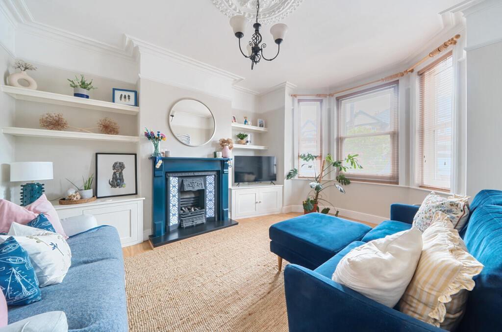
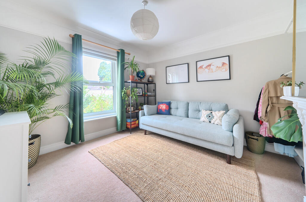
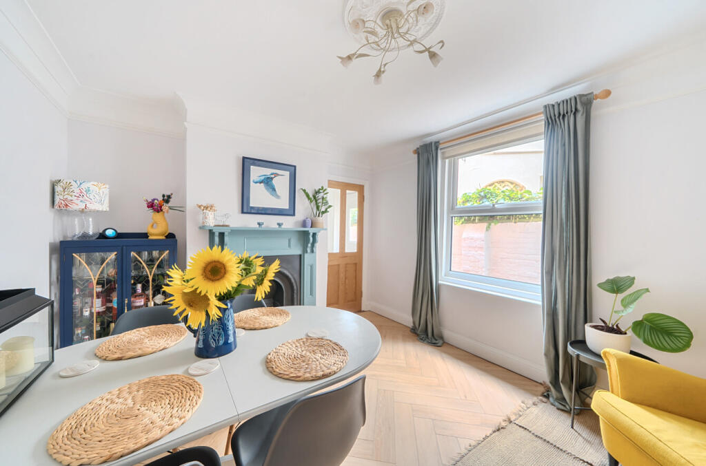
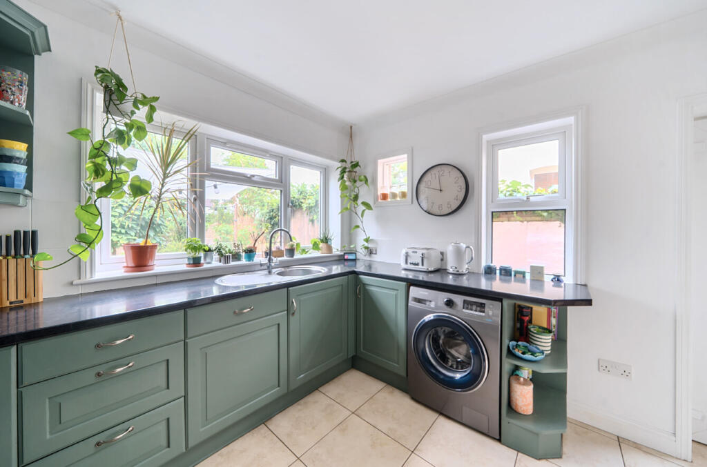
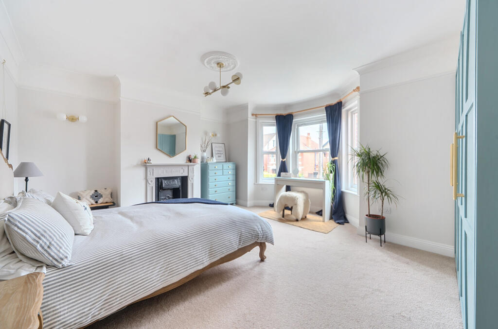
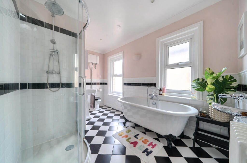
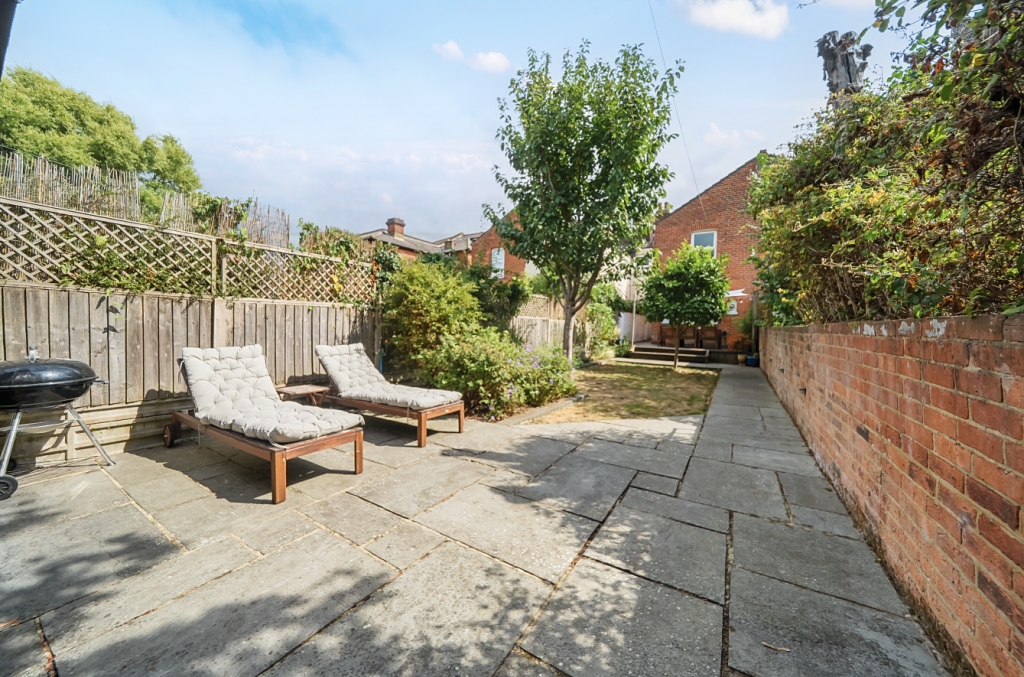
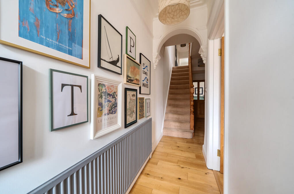
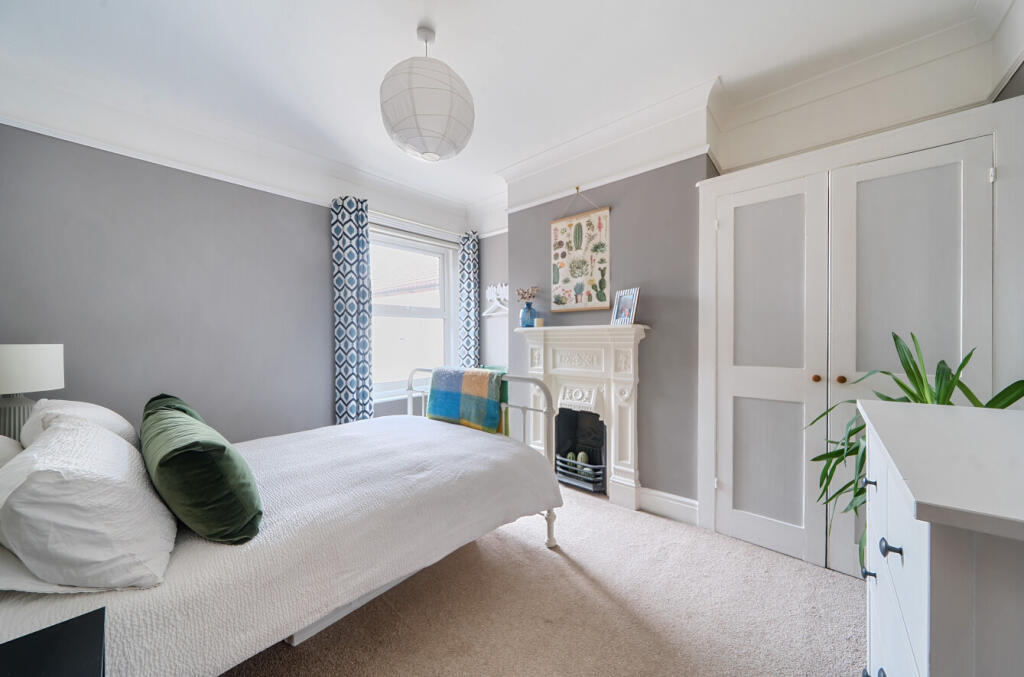
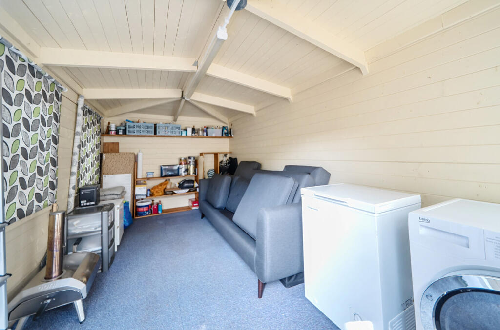
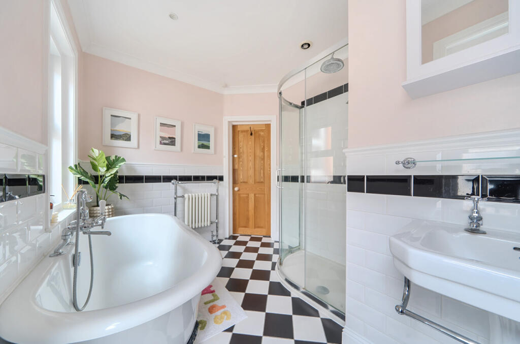
Photos · Open listing
 Open image 1 from listing 167129624
 Open image 2 from listing 167129624
 Open image 3 from listing 167129624
 Open image 4 from listing 167129624
 Open image 5 from listing 167129624
 Open image 6 from listing 167129624
 Open image 7 from listing 167129624
 Open image 8 from listing 167129624
 Open image 9 from listing 167129624
 Open image 10 from listing 167129624
 Open image 11 from listing 167129624
 Open image 12 from listing 167129624
Sold comparables
Same street and nearby sales within 0.25 miles (last 5 years). Land Registry Price Paid Data.
| Address | Price | Date | Type |
|---|---|---|---|
| 69 ATHERLEY ROAD, SOUTHAMPTON, SO15 5DT | £445,000 | 16/09/2022 | Terraced |
| 69 SUFFOLK AVENUE, SHIRLEY, SOUTHAMPTON, SO15 5EF | £395,000 | 29/07/2022 | Terraced |
| 41 SUFFOLK AVENUE, SHIRLEY, SOUTHAMPTON, SO15 5EF | £447,500 | 22/07/2022 | Terraced |
| 75 ATHERLEY ROAD, SOUTHAMPTON, SO15 5DT | £187,500 | 01/06/2022 | Terraced |
| 67 SUFFOLK AVENUE, SHIRLEY, SOUTHAMPTON, SO15 5EF | £360,000 | 06/05/2022 | Terraced |
| 45 ATHERLEY ROAD, SOUTHAMPTON, SO15 5DT | £350,000 | 26/11/2021 | Terraced |
| 3 SUFFOLK AVENUE, SHIRLEY, SOUTHAMPTON, SO15 5EF | £400,000 | 26/10/2021 | Terraced |
| 65 SUFFOLK AVENUE, SHIRLEY, SOUTHAMPTON, SO15 5EF | £370,000 | 30/09/2021 | Terraced |
Area average: £369,375 (8 sales)
For sale comparables
No active for-sale comparables found within 1 mile for the same bedrooms and property type.
Capital growth trend
Land Registry outcode average: last 12 months vs 5y and 10y ago (from sold prices).
House Price Index (HM Land Registry — official index, not sold-price averages): Southampton. Series: Terraced. As of April 2026.
Rental Range
Estimated market rent for Southampton. Low = conservative, Realistic = average, Optimistic = best case.
Based on Local Authority from postcode lookup → Southampton.
LHA (30th percentile) floor for Cherwell Valley: Apr 2025 – Mar 2026
Rental Comparables
Residential lets from OpenRent and Rightmove for the area (same bedroom count). Use to validate rent estimates. Student lets are excluded.
| Title | Rent | Beds | Distance | As seen on |
|---|---|---|---|---|
| 3 Bed Flat, Milton Road, SO15 | £2,200/mo | 3 | 0.37 miles | OpenRent |
Average rent: £2,200/mo (1 listing)
Rent-driven metrics
Based on OpenRent comparables.
- Rent ratio — Monthly rent ÷ purchase price (1% rule). 1%+ = strong, 0.8–1% = okay, <0.8% = weak for cashflow.
- Max investor price — Rent ÷ 0.8%; the price at which rent would be 0.8% of price (Stoke-style target).
- Target investor price — Rent ÷ 1%; the price at which rent would be 1% of price (strong cashflow band).
- Gross yield — Annual rent as % of purchase price (no costs).
- Cost-to-rent — Price ÷ annual rent (from OpenRent comparables). Under 14× = strong, 14–16× = acceptable, 17×+ = compressed.
- Cashflow — Rent minus mortgage, 10% maintenance, £25/mo compliance. Assumes 75% LTV, 3.95% APR (5yr fixed), 25yr term.
- ROI — Annual profit ÷ cash in (deposit + 4% purchase costs).
Flood risk
Zone: 1
Risk: Low
Not in Flood Risk Area (no data)
Street-level crime
| Category | Count |
|---|---|
| Violence and sexual offences | 299 |
| Anti-social behaviour | 126 |
| Shoplifting | 119 |
| Public order | 97 |
| Drugs | 81 |
| Criminal damage and arson | 63 |
| Vehicle crime | 53 |
| Burglary | 51 |
| Other theft | 49 |
| Robbery | 24 |
| Possession of weapons | 17 |
| Other crime | 16 |
| Bicycle theft | 10 |
| Theft from the person | 7 |
| Total incidents | 1012 |
Within 1 mile during May 2026. Source: data.police.uk (England & Wales).
Schools nearby
Nearest open schools with Ofsted ratings (England). Closed schools are not shown. Data from Get Information about Schools and Ofsted.
| Name | Type | Distance | Ofsted |
|---|---|---|---|
| St Mark's Church of England School | Other | 0.2 miles | Good — 29 Nov 2022 |
| Springhill Catholic Primary School | Primary | 0.3 miles | Outstanding — 5 May 2022 |
| Banister Primary School | Primary | 0.4 miles | Good — 29 Nov 2018 |
| Freemantle Church of England Community Academy | Primary | 0.4 miles | Good — 11 Nov 2018 |
| The Polygon School | Other | 0.5 miles | Good — 12 Jan 2017 |
FENSA
Checking FENSA certificates for this address. Refresh in a few minutes.