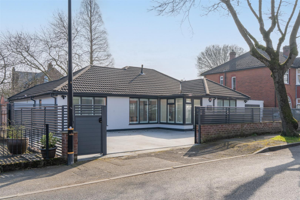
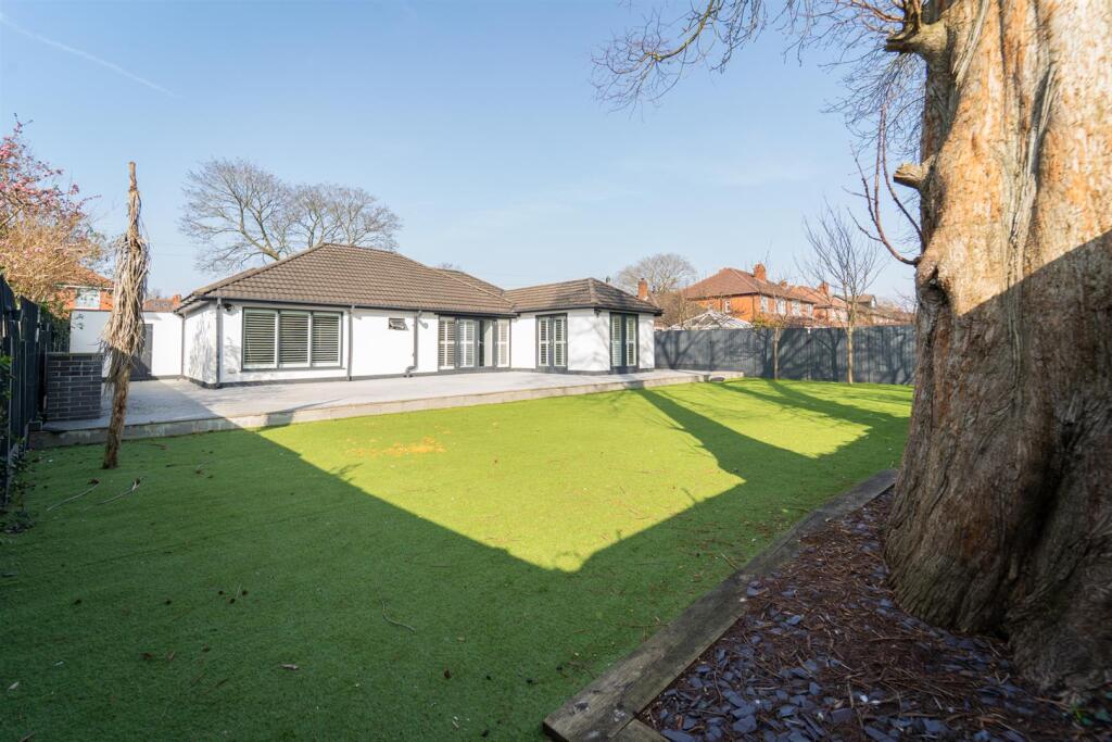
28 HILLINGDON ROAD
STRETFORD, MANCHESTER, TRAFFORD, GREATER MANCHESTER, M32 8PB
£610,000
Location
Nearby
Nearest stations, universities and amenities (distance from property).
| Type | Name | Distance |
|---|---|---|
| Bus stop | Stretford, Edge Lane / opposite Norwood Road | 0.1 miles |
| Shop | Bricktop | 0.3 miles |
| Train station | Trafford Park | 0.8 miles |
| Hospital | Salford Gastric Bypass Surgery | 2.8 miles |
| University | Manchester School of Art | 3.0 miles |
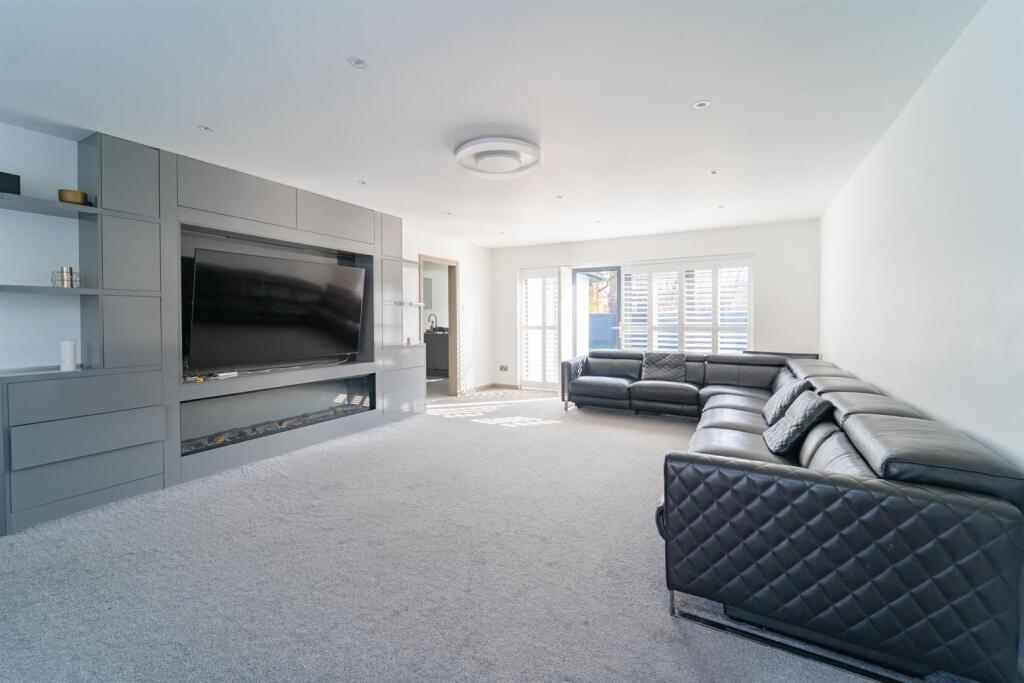
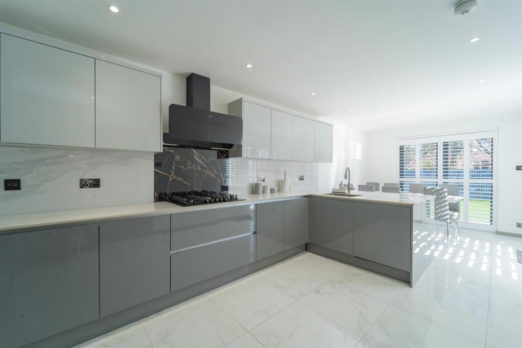
Property details
Tenure
Freehold
Property type
Detached
Bedrooms
3
Bathrooms
2
Floor area
130 m²
EPC rating
D
Year built
England and Wales: 1950-1966
Last sold
£610,000 Feb 2026
Price per m²
£4,692/m²
Local average
£582,286 (7 sales)
EPC Rating & Upgrade Cost
Current rating: D
Potential rating: B
Inspection date: 05/02/2016
Expiry date: 04/02/2026 (expired)
Current heating cost: £990/year
Potential heating cost: £694/year
Est. upgrade cost to C: £17,125
Recommendations
- Increase loft insulation to 270 mm (£100 - £350)
- Floor insulation (solid floor) (£4,000 - £6,000)
- Upgrade heating controls (£350 - £450)
- Solar water heating (£4,000 - £6,000)
- Solar photovoltaic panels, 2.5 kWp (£5,000 - £8,000)
Price history
| Event | Date | Price | Type | % change | Today’s value (HPI) | Action |
|---|---|---|---|---|---|---|
| Sold | 18/02/2026 | £610,000 | Detached | +28.4% | £612,936 to March 2026 | View transaction |
| Sold | 21/08/2020 | £475,000 | Detached | +115.9% | £603,285 to March 2026 | View transaction |
| Sold | 18/12/2015 | £220,000 | Detached | — | £363,418 to March 2026 | View transaction |
Historic listings
Listing and sale events only where we matched the listing page to a Land Registry sale already on record for this address.
| Event | Date | Price |
|---|---|---|
| sold | 01/01/2026 | £610,000 |
| listed | 04/08/2025 | £635,000 |
| sold | 01/01/2020 | £475,000 |
| sold | 01/01/2015 | £220,000 |
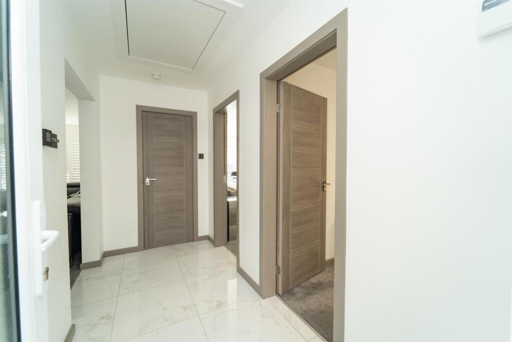
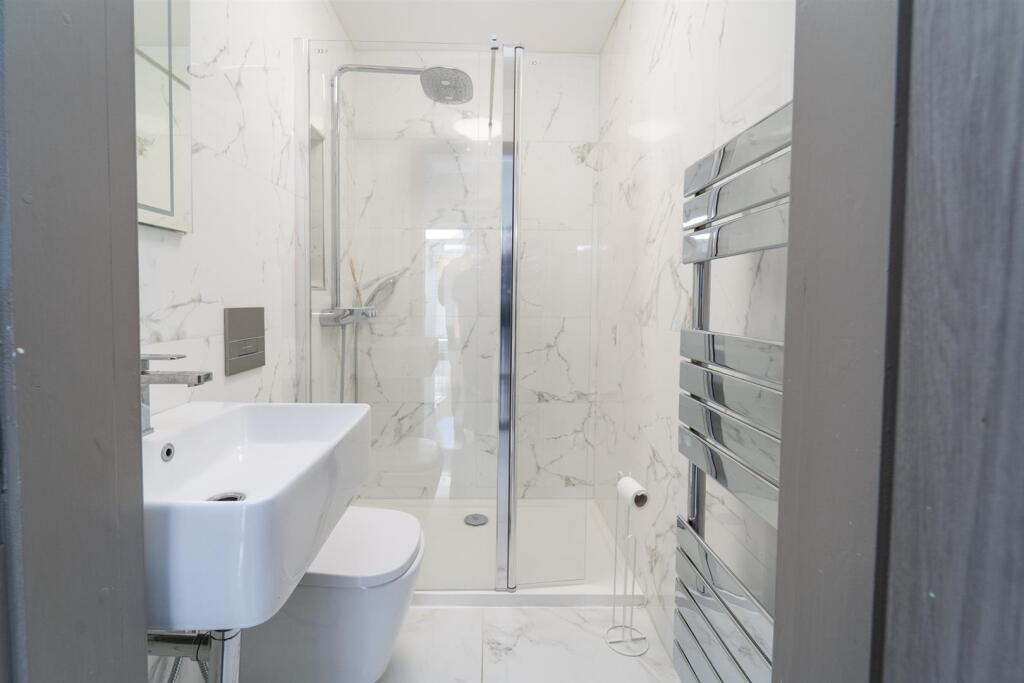
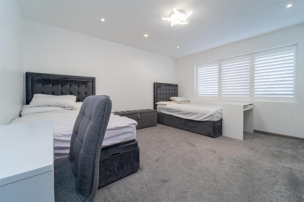
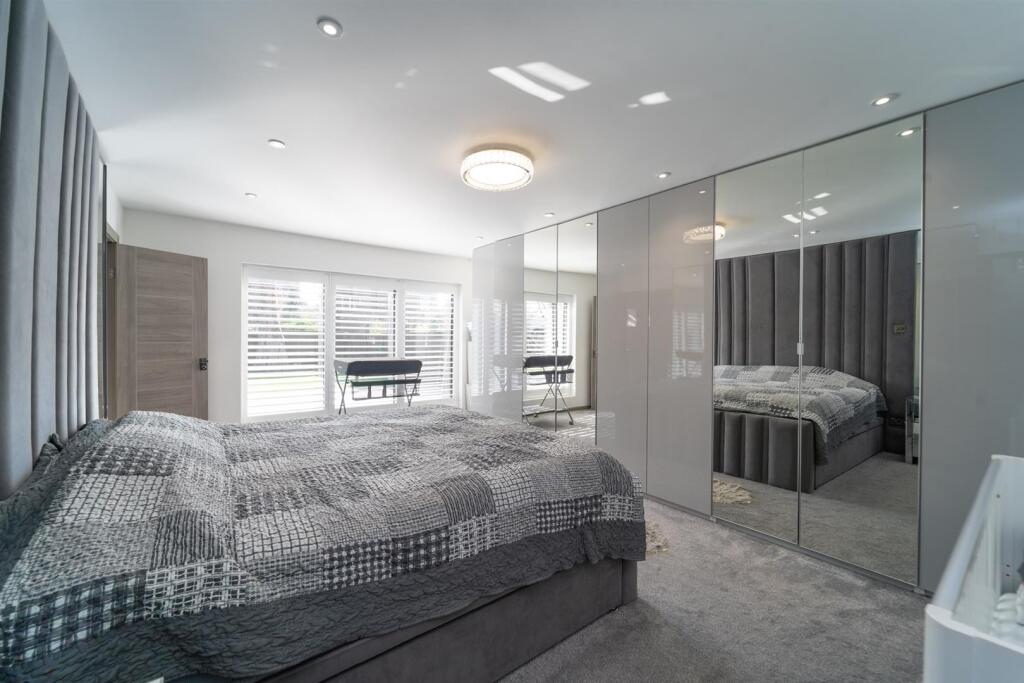
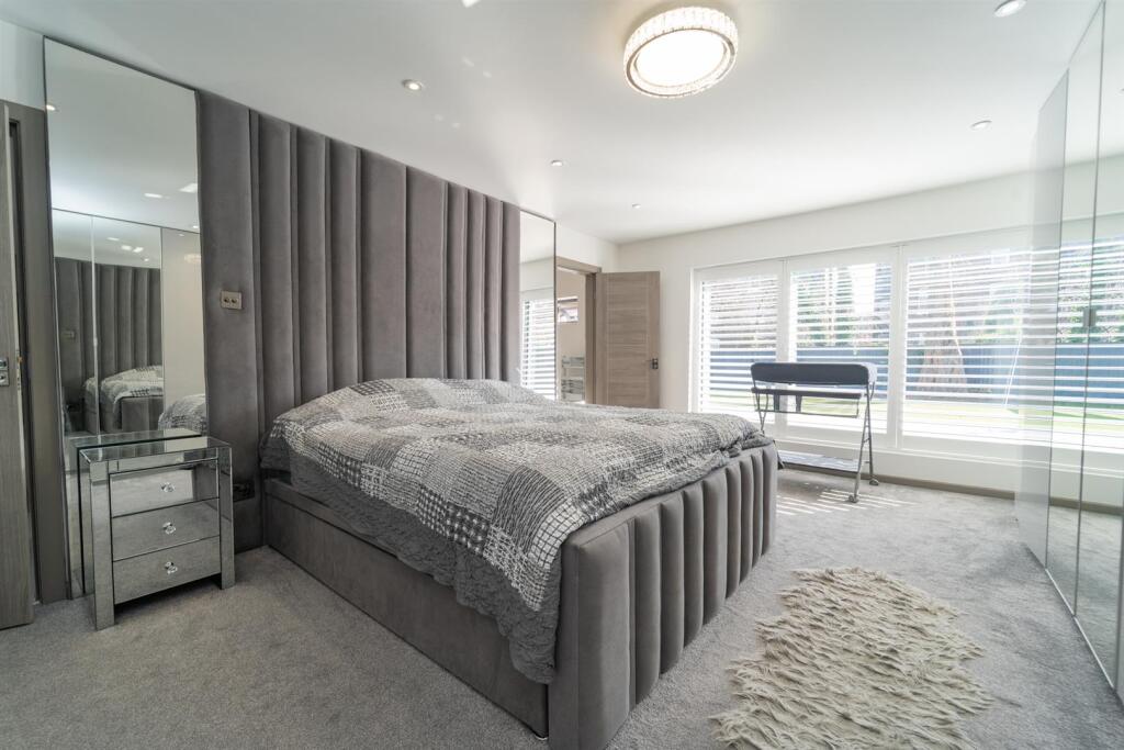
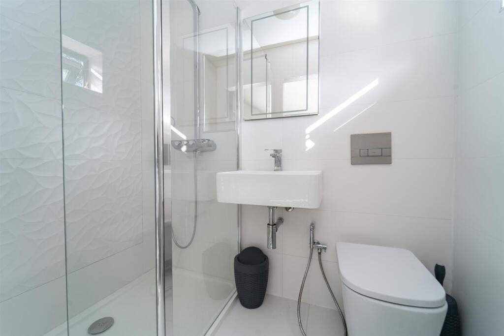
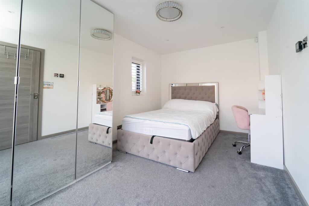
Photos · Open listing
 Open image 1 from listing 165350036
 Open image 2 from listing 165350036
 Open image 3 from listing 165350036
 Open image 4 from listing 165350036
 Open image 5 from listing 165350036
 Open image 6 from listing 165350036
 Open image 7 from listing 165350036
 Open image 8 from listing 165350036
 Open image 9 from listing 165350036
 Open image 10 from listing 165350036
 Open image 11 from listing 165350036
 Open image 12 from listing 165350036
Sold comparables
Same street and nearby sales within 0.25 miles (last 5 years). Land Registry Price Paid Data.
| Address | Price | Date | Type |
|---|---|---|---|
| 25 GRANBY ROAD, STRETFORD, MANCHESTER, TRAFFORD, GREATER MANCHESTER, M32 8JL | £565,000 | 25/06/2025 | Detached |
| 25 GRANBY ROAD, STRETFORD, MANCHESTER, TRAFFORD, GREATER MANCHESTER, M32 8JL | £565,000 | 25/06/2025 | Detached |
| 36 NORWOOD ROAD, STRETFORD, MANCHESTER, TRAFFORD, GREATER MANCHESTER, M32 8PW | £683,000 | 13/06/2025 | Detached |
| 33 CROMWELL ROAD, STRETFORD, MANCHESTER, TRAFFORD, GREATER MANCHESTER, M32 8GH | £448,500 | 20/12/2023 | Detached |
| 1 MEADOW CLOSE, STRETFORD, MANCHESTER, TRAFFORD, GREATER MANCHESTER, M32 8JF | £560,000 | 22/09/2023 | Detached |
| 67 HILLINGDON ROAD, STRETFORD, MANCHESTER, TRAFFORD, GREATER MANCHESTER, M32 8PH | £509,000 | 27/09/2022 | Detached |
| 80 EDGE LANE, STRETFORD, MANCHESTER, TRAFFORD, GREATER MANCHESTER, M32 8JP | £613,000 | 08/09/2022 | Detached |
| 9 TRURO AVENUE, STRETFORD, MANCHESTER, TRAFFORD, GREATER MANCHESTER, M32 8PF | £450,000 | 24/06/2022 | Detached |
Area average: £549,188 (8 sales)
For sale comparables
No active for-sale comparables found within 1 mile for the same bedrooms and property type.
Capital growth trend
Land Registry outcode average: last 12 months vs 5y and 10y ago (from sold prices).
House Price Index (HM Land Registry — official index, not sold-price averages): Trafford. Series: Detached. As of March 2026.
Rental Range
Estimated market rent for Trafford. Low = conservative, Realistic = average, Optimistic = best case.
Based on Local Authority from postcode lookup → Trafford.
LHA (30th percentile) floor for West Pennine: Apr 2025 – Mar 2026
Rental Comparables
Residential lets in the area (all bedroom counts shown — none matched the 3-bedroom count for this property). Student lets are excluded.
| Title | Rent | Beds | Distance | As seen on |
|---|---|---|---|---|
| 2 Bed Semi-Detached House, Dovecote Mews, M21 | £1,150/mo | 2 | 0.87 miles | OpenRent |
Average rent: £1,150/mo (1 listing)
Rent-driven metrics
Based on OpenRent comparables.
- Rent ratio — Monthly rent ÷ purchase price (1% rule). 1%+ = strong, 0.8–1% = okay, <0.8% = weak for cashflow.
- Max investor price — Rent ÷ 0.8%; the price at which rent would be 0.8% of price (Stoke-style target).
- Target investor price — Rent ÷ 1%; the price at which rent would be 1% of price (strong cashflow band).
- Gross yield — Annual rent as % of purchase price (no costs).
- Cost-to-rent — Price ÷ annual rent (from OpenRent comparables). Under 14× = strong, 14–16× = acceptable, 17×+ = compressed.
- Cashflow — Rent minus mortgage, 10% maintenance, £25/mo compliance. Assumes 75% LTV, 3.95% APR (5yr fixed), 25yr term.
- ROI — Annual profit ÷ cash in (deposit + 4% purchase costs).
Flood risk
Zone: 1
Risk: Low
Job (default Low)
Street-level crime
| Category | Count |
|---|---|
| Total incidents | 0 |
Within 1 mile during Apr 2026. Source: data.police.uk (England & Wales).
Schools nearby
Nearest open schools with Ofsted ratings (England). Closed schools are not shown. Data from Get Information about Schools and Ofsted.
| Name | Type | Distance | Ofsted |
|---|---|---|---|
| Stretford Grammar School | Secondary | 0.2 miles | Good — 14 May 2015 |
| Longford Park School | Other | 0.2 miles | Requires improvement — 9 Jun 2024 |
| Victoria Park Junior School | Primary | 0.4 miles | Good — 9 May 2024 |
| St Ann's RC Primary School | Primary | 0.4 miles | Good — 17 Mar 2020 |
| Victoria Park Infant School | Primary | 0.4 miles | Good — 30 Jan 2023 |
FENSA
Window and door installation certificates found for this address.
| Issued | Work completed | Windows | Doors |
|---|---|---|---|
| 29/07/2014 | 07/04/2014 | 4 | 3 |