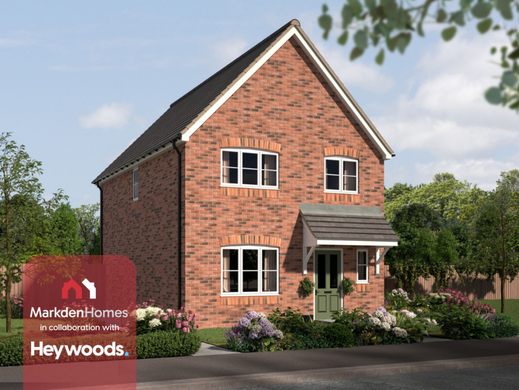
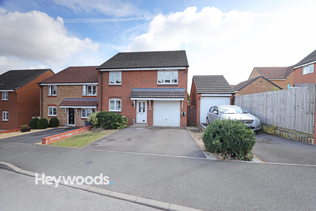
34 LAMPHOUSE WAY
WOLSTANTON, NEWCASTLE, NEWCASTLE-UNDER-LYME, STAFFORDSHIRE, ST5 0GA
£270,000
Location
Nearby
Nearest stations, universities and amenities (distance from property).
| Type | Name | Distance |
|---|---|---|
| Bus stop | Morris Square | 0.3 miles |
| Shop | The co-operative food | 0.3 miles |
| Train station | Longport | 0.6 miles |
| Hospital | Haywood Hospital Walk-in Centre | 1.8 miles |
| University | University of Staffordshire Stoke Campus | 2.4 miles |
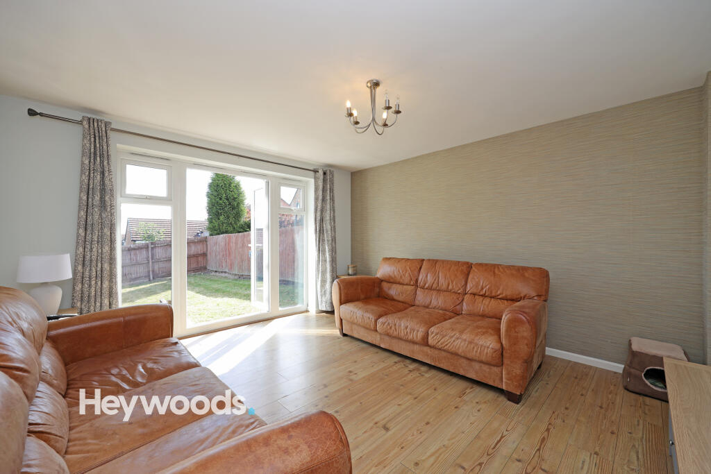
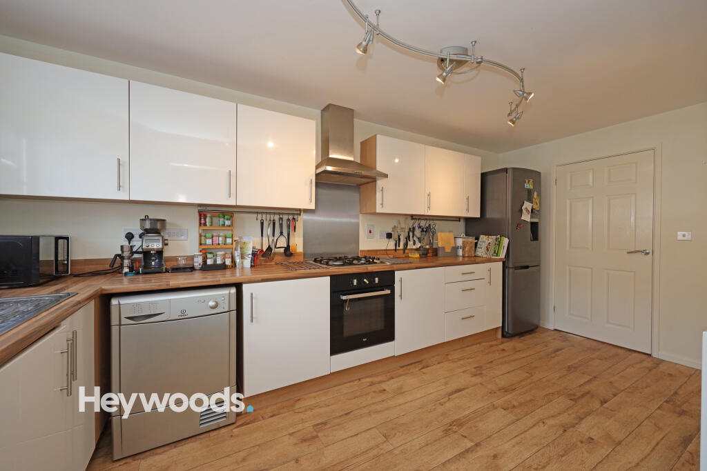
Property details
Tenure
Freehold
Property type
Detached
Bedrooms
4
Bathrooms
2
Floor area
105 m²
EPC rating
C
Year built
England and Wales: 2012 onwards
Last sold
£270,000 Feb 2026
Price per m²
£2,571/m²
Local average
£339,180 (76 sales)
Street crime
254 incidents within 1 mile (Apr 2026)
EPC Rating & Upgrade Cost
Current rating: C
Potential rating: B
Inspection date: 16/01/2025
Expiry date: 15/01/2035
Current heating cost: £926/year
Potential heating cost: £926/year
Est. upgrade cost to C: £9,500
Recommendations
- Solar water heating (£4,000 - £6,000)
- Solar photovoltaic panels, 2.5 kWp (£3,500 - £5,500)
Price history
| Event | Date | Price | Type | % change | Today’s value (HPI) | Action |
|---|---|---|---|---|---|---|
| Sold | 25/02/2026 | £270,000 | Detached | +20% | £264,380 to March 2026 | View transaction |
| Sold | 30/11/2012 | £225,000 | Detached | — | £385,555 to March 2026 | View transaction |
Historic listings
Listing and sale events only where we matched the listing page to a Land Registry sale already on record for this address.
| Event | Date | Price |
|---|---|---|
| listed | 27/05/2026 | £319,995 |
| sold | 01/01/2026 | £270,000 |
| sold | 01/01/2026 | £270,000 |
| listed | 29/08/2025 | £280,000 |
| sold | 01/01/2012 | £225,000 |
| sold | 01/01/2012 | £225,000 |
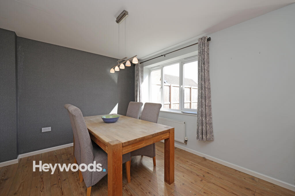
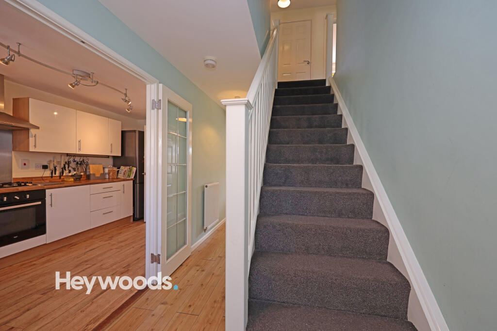
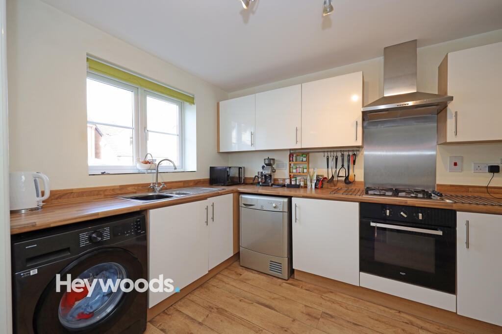
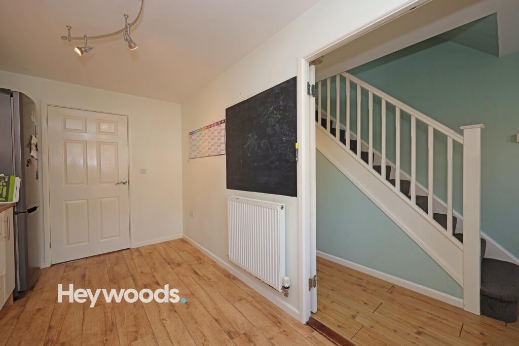
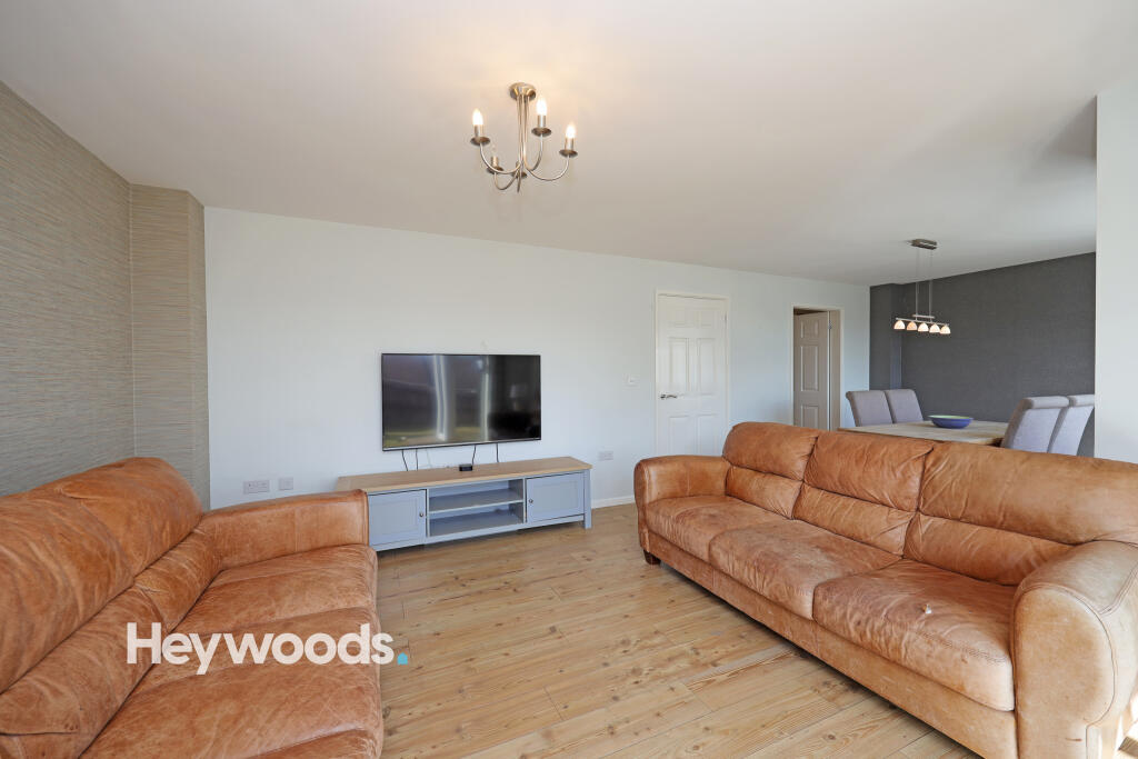
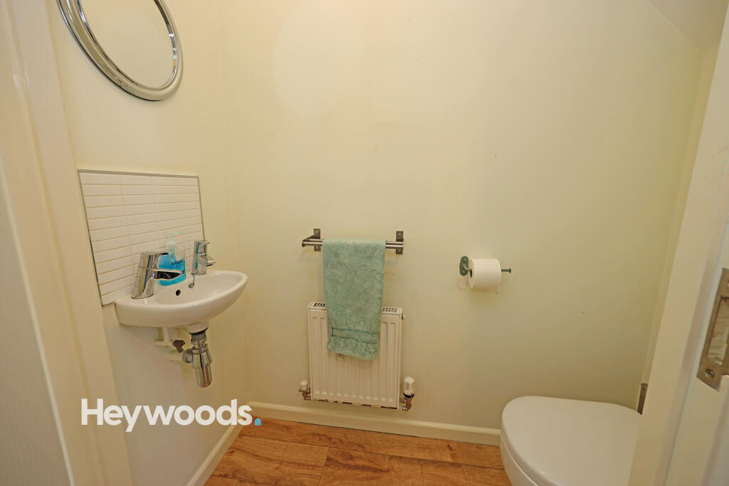
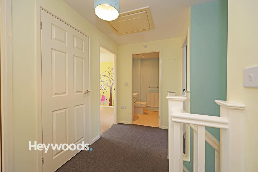
Photos · Open listing
 Open image 1 from listing 166350653
 Open image 2 from listing 166350653
 Open image 3 from listing 166350653
 Open image 4 from listing 166350653
 Open image 5 from listing 166350653
 Open image 6 from listing 166350653
 Open image 7 from listing 166350653
 Open image 8 from listing 166350653
 Open image 9 from listing 166350653
 Open image 10 from listing 166350653
 Open image 11 from listing 166350653
Sold comparables
Same street and nearby sales within 0.25 miles (last 5 years). Land Registry Price Paid Data.
| Address | Price | Date | Type |
|---|---|---|---|
| 8 GREAT ROW VIEW, WOLSTANTON, NEWCASTLE, NEWCASTLE-UNDER-LYME, STAFFORDSHIRE, ST5 0GH | £280,000 | 07/12/2023 | Detached |
| 3 GREAT ROW VIEW, WOLSTANTON, NEWCASTLE, NEWCASTLE-UNDER-LYME, STAFFORDSHIRE, ST5 0GH | £250,000 | 30/11/2022 | Detached |
| 46 LAMPHOUSE WAY, WOLSTANTON, NEWCASTLE, NEWCASTLE-UNDER-LYME, STAFFORDSHIRE, ST5 0GA | £138,000 | 23/11/2022 | Detached |
| 2 DAVEY CLOSE, WOLSTANTON, NEWCASTLE, NEWCASTLE-UNDER-LYME, STAFFORDSHIRE, ST5 0GR | £290,000 | 28/10/2022 | Detached |
| 6 PEACOCK WALK, WOLSTANTON, NEWCASTLE, NEWCASTLE-UNDER-LYME, STAFFORDSHIRE, ST5 0GL | £275,000 | 26/10/2022 | Detached |
| 95 LAMPHOUSE WAY, WOLSTANTON, NEWCASTLE, NEWCASTLE-UNDER-LYME, STAFFORDSHIRE, ST5 0GA | £255,000 | 24/08/2022 | Detached |
| 46 LAMPHOUSE WAY, WOLSTANTON, NEWCASTLE, NEWCASTLE-UNDER-LYME, STAFFORDSHIRE, ST5 0GA | £130,000 | 14/01/2022 | Detached |
| 58 LAMPHOUSE WAY, WOLSTANTON, NEWCASTLE, NEWCASTLE-UNDER-LYME, STAFFORDSHIRE, ST5 0GA | £200,000 | 10/12/2021 | Detached |
| 9 PEACOCK WALK, WOLSTANTON, NEWCASTLE, NEWCASTLE-UNDER-LYME, STAFFORDSHIRE, ST5 0GL | £327,000 | 29/11/2021 | Detached |
| 83 KEELING STREET, NEWCASTLE, NEWCASTLE-UNDER-LYME, STAFFORDSHIRE, ST5 0DH | £165,000 | 23/09/2021 | Detached |
| 62A ORFORD STREET, NEWCASTLE, NEWCASTLE-UNDER-LYME, STAFFORDSHIRE, ST5 0AQ | £161,000 | 13/08/2021 | Detached |
| 10 PEACOCK WALK, WOLSTANTON, NEWCASTLE, NEWCASTLE-UNDER-LYME, STAFFORDSHIRE, ST5 0GL | £265,000 | 24/06/2021 | Detached |
Area average: £228,000 (12 sales)
For sale comparables
Active for-sale listings within 1 mile, matched to the same property type and bedroom count.
| Address | Price | Beds | Type | Distance |
|---|---|---|---|---|
| High Street, Wolstanton, Newcastle under Lyme. ST5 0EU | £495,000 | 4 | Detached | 0.34 mi |
| Doulton Drive, Newcastle, ST5 | £350,000 | 4 | Detached | 0.66 mi |
Capital growth trend
Land Registry outcode average: last 12 months vs 5y and 10y ago (from sold prices).
House Price Index (HM Land Registry — official index, not sold-price averages): Newcastle-under-Lyme. Series: Detached. As of March 2026.
Rental Range
Estimated market rent for Newcastle-under-Lyme. Low = conservative, Realistic = average, Optimistic = best case.
Based on Local Authority from postcode lookup → Newcastle-under-Lyme.
LHA (30th percentile) floor for Staffordshire North: Apr 2025 – Mar 2026
Rental Comparables
Residential lets from OpenRent and Rightmove for the area (same bedroom count). Use to validate rent estimates. Student lets are excluded.
| Title | Rent | Beds | Distance | As seen on |
|---|---|---|---|---|
| Dimsdale Hall Drive, Wolstanton, Newcastle-under-Lyme | £1,750/mo | 4 | 0.93 miles | Rightmove |
| Car Park Lymedale Cross Industrial Estate, Newcastle Under Lyme ST5 | £1/mo | — | 1.33 miles | Rightmove |
| Modern Studio In Newcastle-Under-Lyme, Newcastle-Under-Lyme, ST5 | £560/mo | — | 1.78 miles | Rightmove |
| Snowgoose Way, Newcastle | £1,700/mo | 4 | 2.13 miles | Rightmove |
| 9 Rothesay Court, Rothesay Av, Westlands, ST5 2LX | £210/mo | — | 2.39 miles | Rightmove |
| Enstone Court, Westbury Park, Newcastle Under Lyme, Staffordshire, ST5 | £1,295/mo | 4 | 3.5 miles | Rightmove |
| Aspen Rise, Clayton | £1,995/mo | 4 | 3.81 miles | Rightmove |
| The Coach House, Butterton, Newcastle Under Lyme, Staffordshire, ST5 | £4,995/mo | 4 | 4.22 miles | Rightmove |
| Snape Hall Road, Whitmore, Newcastle, Staffordshire, ST5 | £1,800/mo | 4 | 6.15 miles | Rightmove |
| Stableford, Newcastle-Under-Lyme, Staffordshire, ST5 | £1,400/mo | 4 | 6.69 miles | Rightmove |
Average rent: £1,571/mo (10 listings)
Rent-driven metrics
Based on OpenRent comparables.
- Rent ratio — Monthly rent ÷ purchase price (1% rule). 1%+ = strong, 0.8–1% = okay, <0.8% = weak for cashflow.
- Max investor price — Rent ÷ 0.8%; the price at which rent would be 0.8% of price (Stoke-style target).
- Target investor price — Rent ÷ 1%; the price at which rent would be 1% of price (strong cashflow band).
- Gross yield — Annual rent as % of purchase price (no costs).
- Cost-to-rent — Price ÷ annual rent (from OpenRent comparables). Under 14× = strong, 14–16× = acceptable, 17×+ = compressed.
- Cashflow — Rent minus mortgage, 10% maintenance, £25/mo compliance. Assumes 75% LTV, 3.95% APR (5yr fixed), 25yr term.
- ROI — Annual profit ÷ cash in (deposit + 4% purchase costs).
Flood risk
Zone: 1
Risk: Low
Job (default Low)
Street-level crime
| Category | Count |
|---|---|
| Violence and sexual offences | 72 |
| Anti-social behaviour | 70 |
| Public order | 27 |
| Other theft | 16 |
| Vehicle crime | 16 |
| Shoplifting | 14 |
| Burglary | 13 |
| Criminal damage and arson | 13 |
| Other crime | 9 |
| Robbery | 2 |
| Bicycle theft | 1 |
| Possession of weapons | 1 |
| Total incidents | 254 |
Within 1 mile during Apr 2026. Source: data.police.uk (England & Wales).
Schools nearby
Nearest open schools with Ofsted ratings (England). Closed schools are not shown. Data from Get Information about Schools and Ofsted.
| Name | Type | Distance | Ofsted |
|---|---|---|---|
| Ellison Primary Academy | Primary | 0.2 miles | Good — 14 Sep 2023 |
| Oaklands Nursery School | Nursery | 0.3 miles | Outstanding — 15 Feb 2013 |
| Cedars - Newcastle, Moorlands and Darwin Bases | Other | 0.3 miles | Good — 26 Jun 2015 |
| St Wulstan's Catholic Primary School | Primary | 0.4 miles | Good — 19 Jul 2013 |
| St Margaret's CofE (VC) Junior School | Primary | 0.4 miles | Good — 1 May 2014 |
FENSA
No FENSA certificates found for this address.