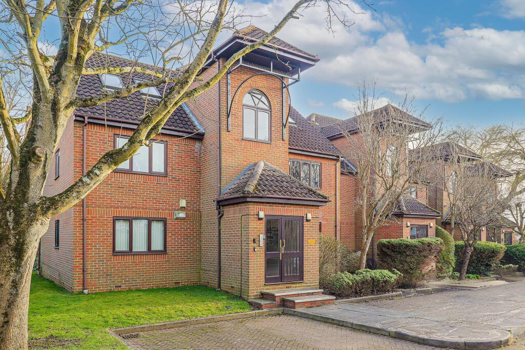
53 MILLERS LANE
STANSTEAD ABBOTTS, WARE, EAST HERTFORDSHIRE, HERTFORDSHIRE, SG12 8AF
£200,000
Location
Nearby
Nearest stations, universities and amenities (distance from property).
| Type | Name | Distance |
|---|---|---|
| Shop | Abbott Stoves & Cookers | 0.1 miles |
| Bus stop | Abbotts Court | 0.1 miles |
| Train station | St Margarets | 0.3 miles |
| Hospital | Jacob's Neuro Centre | 5.8 miles |
| University | University of Hertfordshire | 8.0 miles |
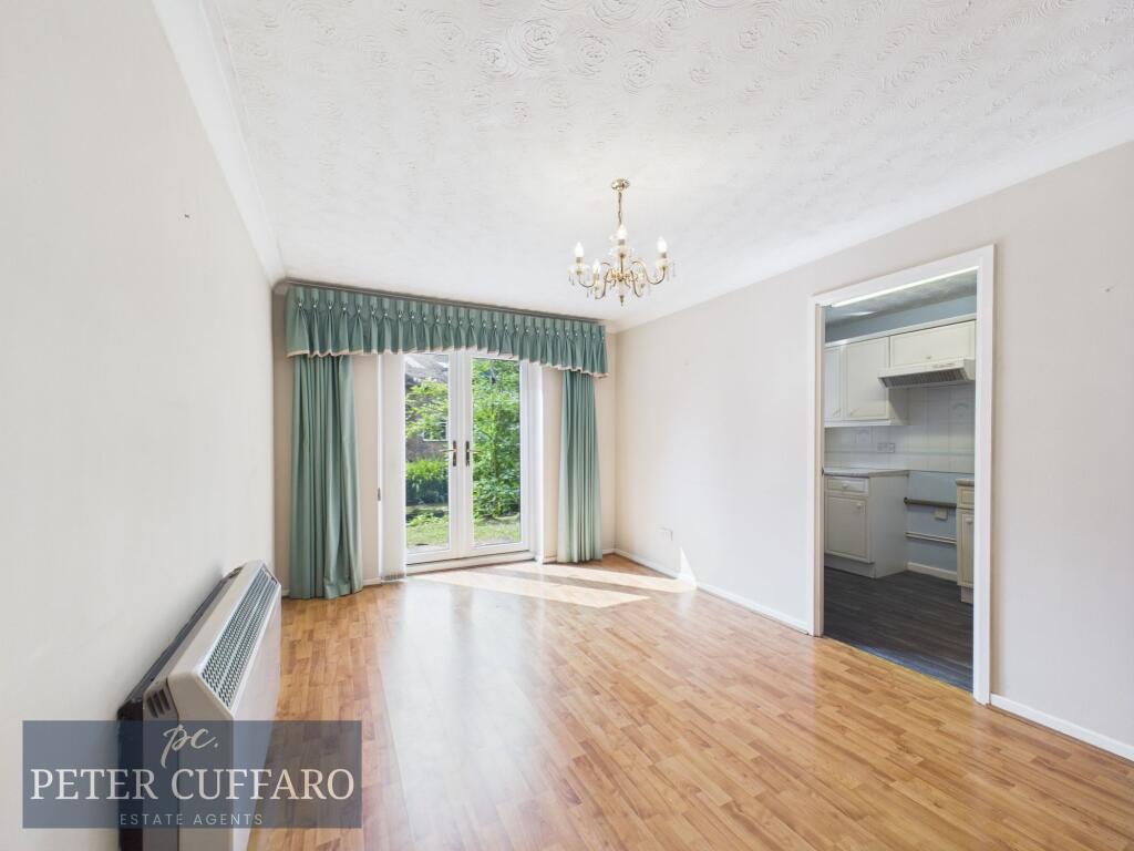
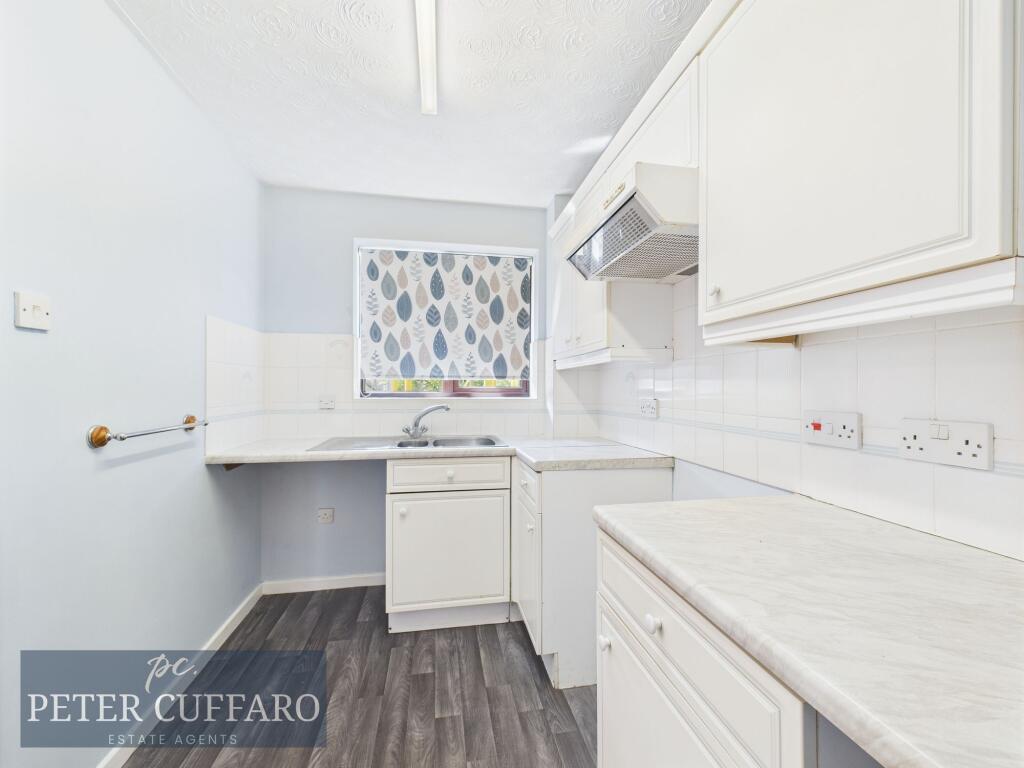
Property details
Tenure
Leasehold
Property type
Flat
Bedrooms
1
Bathrooms
1
Floor area
43 m²
EPC rating
D
Year built
England and Wales: 1983-1990
Last sold
£200,000 Feb 2026
Price per m²
£4,651/m²
Local average
£256,443 (88 sales)
Street crime
45 incidents within 1 mile (Apr 2026)
EPC Rating & Upgrade Cost
Current rating: D
Potential rating: C
Inspection date: 07/03/2025
Expiry date: 06/03/2035
Current heating cost: £749/year
Potential heating cost: £437/year
Est. upgrade cost to C: £2,015
Recommendations
- Floor insulation (suspended floor) (£800 - £1,200)
- Low energy lighting for all fixed outlets (£15)
- High heat retention storage heaters (£800 - £1,200)
Price history
| Event | Date | Price | Type | % change | Today’s value (HPI) | Action |
|---|---|---|---|---|---|---|
| Sold | 13/02/2026 | £200,000 | Flat | +109.4% | £200,404 to March 2026 | View transaction |
| Sold | 12/11/2001 | £95,500 | Flat | — | £224,799 to March 2026 | View transaction |
Historic listings
Listing and sale events only where we matched the listing page to a Land Registry sale already on record for this address.
| Event | Date | Price |
|---|---|---|
| sold | 01/01/2026 | £200,000 |
| listed | 10/06/2025 | £205,000 |
| sold | 01/01/2001 | £95,500 |
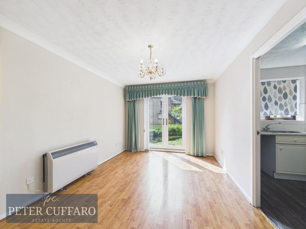
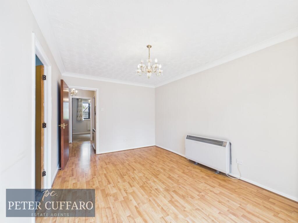
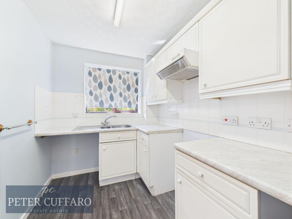
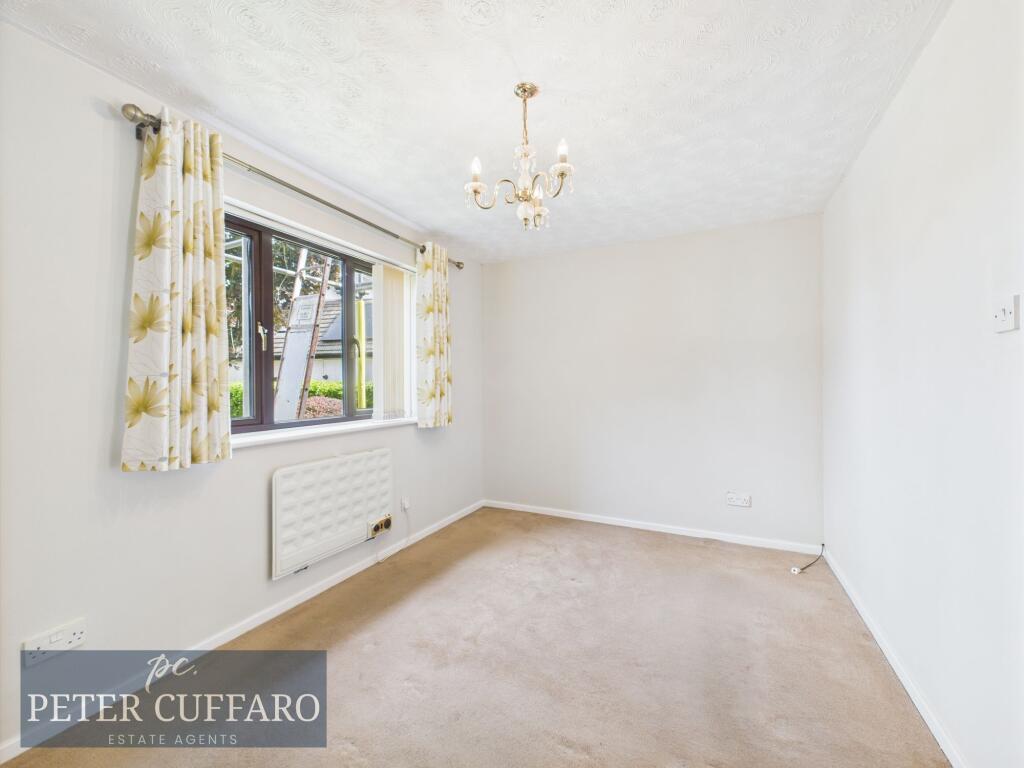
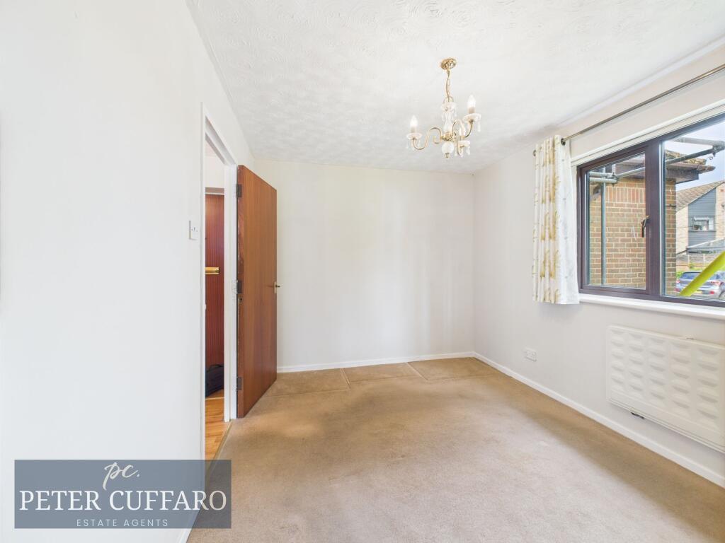
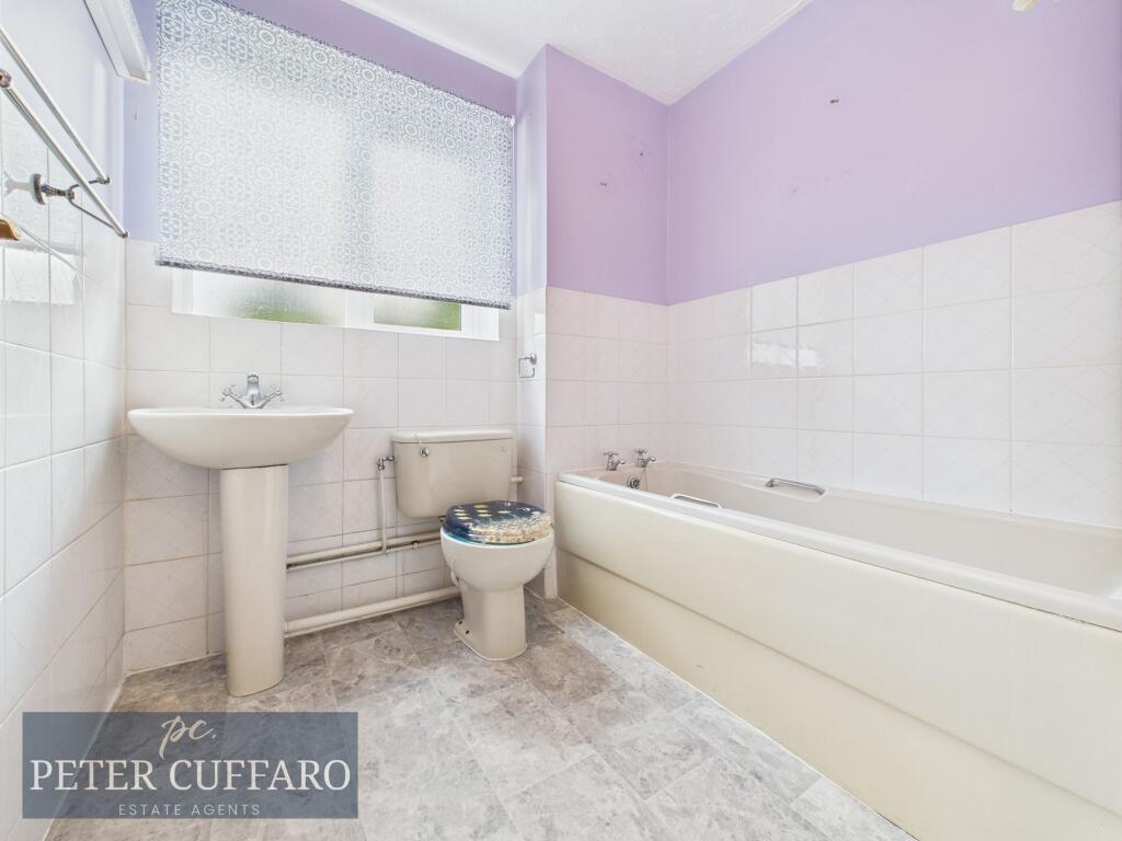
Photos · Open listing
 Open image 1 from listing 163110773
 Open image 2 from listing 163110773
 Open image 3 from listing 163110773
 Open image 4 from listing 163110773
 Open image 5 from listing 163110773
 Open image 6 from listing 163110773
 Open image 7 from listing 163110773
 Open image 8 from listing 163110773
 Open image 9 from listing 163110773
 Open image 10 from listing 163110773
Sold comparables
Same street and nearby sales within 0.25 miles (last 5 years). Land Registry Price Paid Data.
| Address | Price | Date | Type |
|---|---|---|---|
| 43 RIVER MEADS, STANSTEAD ABBOTTS, WARE, EAST HERTFORDSHIRE, HERTFORDSHIRE, SG12 8EE | £270,000 | 16/12/2025 | Flat |
| 42 HIGH STREET, STANSTEAD ABBOTTS, WARE, EAST HERTFORDSHIRE, HERTFORDSHIRE, SG12 8AG | £172,500 | 25/09/2023 | Flat |
| 25 MILLERS LANE, STANSTEAD ABBOTTS, WARE, EAST HERTFORDSHIRE, HERTFORDSHIRE, SG12 8AF | £205,000 | 16/12/2022 | Flat |
| 55 MILLERS LANE, STANSTEAD ABBOTTS, WARE, EAST HERTFORDSHIRE, HERTFORDSHIRE, SG12 8AF | £215,000 | 13/12/2022 | Flat |
| 7 LEE CLOSE, STANSTEAD ABBOTTS, WARE, EAST HERTFORDSHIRE, HERTFORDSHIRE, SG12 8JN | £245,000 | 25/11/2022 | Flat |
| 33 LEE CLOSE, STANSTEAD ABBOTTS, WARE, EAST HERTFORDSHIRE, HERTFORDSHIRE, SG12 8JN | £142,500 | 19/08/2022 | Flat |
| 17 LEE CLOSE, STANSTEAD ABBOTTS, WARE, EAST HERTFORDSHIRE, HERTFORDSHIRE, SG12 8JN | £280,000 | 19/08/2022 | Flat |
| 27 RIVER MEADS, STANSTEAD ABBOTTS, WARE, EAST HERTFORDSHIRE, HERTFORDSHIRE, SG12 8EE | £250,000 | 23/06/2022 | Flat |
| 8B HIGH STREET, STANSTEAD ABBOTTS, WARE, EAST HERTFORDSHIRE, HERTFORDSHIRE, SG12 8AB | £250,000 | 06/05/2022 | Flat |
| 66 HIGH STREET, STANSTEAD ABBOTTS, WARE, EAST HERTFORDSHIRE, HERTFORDSHIRE, SG12 8AQ | £293,000 | 25/04/2022 | Flat |
| HORSESHOE COURT 3 THELE AVENUE, STANSTEAD ABBOTTS, WARE, EAST HERTFORDSHIRE, HERTFORDSHIRE, SG12 8JA | £228,000 | 01/04/2022 | Flat |
| 43 MILLERS LANE, STANSTEAD ABBOTTS, WARE, EAST HERTFORDSHIRE, HERTFORDSHIRE, SG12 8AF | £238,000 | 18/02/2022 | Flat |
| 72 HIGH STREET, STANSTEAD ABBOTTS, WARE, EAST HERTFORDSHIRE, HERTFORDSHIRE, SG12 8AQ | £280,000 | 18/02/2022 | Flat |
| 14 LEE CLOSE, STANSTEAD ABBOTTS, WARE, EAST HERTFORDSHIRE, HERTFORDSHIRE, SG12 8JN | £300,000 | 13/01/2022 | Flat |
| 37 MILLERS LANE, STANSTEAD ABBOTTS, WARE, EAST HERTFORDSHIRE, HERTFORDSHIRE, SG12 8AF | £212,500 | 22/12/2021 | Flat |
| 74 HIGH STREET, STANSTEAD ABBOTTS, WARE, EAST HERTFORDSHIRE, HERTFORDSHIRE, SG12 8AQ | £262,500 | 21/12/2021 | Flat |
| 8A HIGH STREET, STANSTEAD ABBOTTS, WARE, EAST HERTFORDSHIRE, HERTFORDSHIRE, SG12 8AB | £255,000 | 29/10/2021 | Flat |
| 25 RIVER MEADS, STANSTEAD ABBOTTS, WARE, EAST HERTFORDSHIRE, HERTFORDSHIRE, SG12 8EE | £250,000 | 27/10/2021 | Flat |
| 30 RIVER MEADS, STANSTEAD ABBOTTS, WARE, EAST HERTFORDSHIRE, HERTFORDSHIRE, SG12 8EE | £257,500 | 08/10/2021 | Flat |
| 6B HIGH STREET, STANSTEAD ABBOTTS, WARE, EAST HERTFORDSHIRE, HERTFORDSHIRE, SG12 8AB | £230,000 | 06/08/2021 | Flat |
Area average: £241,825 (20 sales)
For sale comparables
No active for-sale comparables found within 1 mile for the same bedrooms and property type.
Capital growth trend
Land Registry outcode average: last 12 months vs 5y and 10y ago (from sold prices).
House Price Index (HM Land Registry — official index, not sold-price averages): East Hertfordshire. Series: Flats and maisonettes. As of March 2026.
Rental Range
Estimated market rent for East Hertfordshire. Low = conservative, Realistic = average, Optimistic = best case.
Based on Local Authority from postcode lookup → East Hertfordshire.
LHA (30th percentile) floor for Peterborough: Apr 2025 – Mar 2026
Rental Comparables
Residential lets from OpenRent and Rightmove for the area (same bedroom count). Use to validate rent estimates. Student lets are excluded.
| Title | Rent | Beds | Distance | As seen on |
|---|---|---|---|---|
| 1 Bed Flat, Rivermeads, SG12 | £1,250/mo | 1 | 0.34 miles | OpenRent |
Average rent: £1,250/mo (1 listing)
Rent-driven metrics
Based on OpenRent comparables.
- Rent ratio — Monthly rent ÷ purchase price (1% rule). 1%+ = strong, 0.8–1% = okay, <0.8% = weak for cashflow.
- Max investor price — Rent ÷ 0.8%; the price at which rent would be 0.8% of price (Stoke-style target).
- Target investor price — Rent ÷ 1%; the price at which rent would be 1% of price (strong cashflow band).
- Gross yield — Annual rent as % of purchase price (no costs).
- Cost-to-rent — Price ÷ annual rent (from OpenRent comparables). Under 14× = strong, 14–16× = acceptable, 17×+ = compressed.
- Cashflow — Rent minus mortgage, 10% maintenance, £25/mo compliance. Assumes 75% LTV, 3.95% APR (5yr fixed), 25yr term.
- ROI — Annual profit ÷ cash in (deposit + 4% purchase costs).
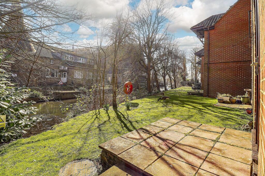
Flood risk
Zone: 1
Risk: Low
Not in Flood Risk Area (no data)
Street-level crime
| Category | Count |
|---|---|
| Violence and sexual offences | 15 |
| Anti-social behaviour | 11 |
| Vehicle crime | 7 |
| Criminal damage and arson | 3 |
| Other theft | 3 |
| Other crime | 2 |
| Public order | 2 |
| Burglary | 1 |
| Shoplifting | 1 |
| Total incidents | 45 |
Within 1 mile during Apr 2026. Source: data.police.uk (England & Wales).
Schools nearby
Nearest open schools with Ofsted ratings (England). Closed schools are not shown. Data from Get Information about Schools and Ofsted.
| Name | Type | Distance | Ofsted |
|---|---|---|---|
| St Andrew's Church of England Voluntary Controlled Primary School | Primary | 0.2 miles | Good — 4 Dec 2014 |
| Amwell View School | Other | 0.4 miles | Outstanding — 21 Oct 2014 |
| St John the Baptist Voluntary Aided Church of England Primary School | Primary | 0.8 miles | — (Inspected (no overall grade)) |
| The Cranbourne Primary School | Primary | 0.9 miles | Good — 1 Mar 2020 |
| The John Warner School | Secondary | 1.0 miles | Inadequate — 18 Dec 2022 |
FENSA
Window and door installation certificates found for this address.
| Issued | Work completed | Windows | Doors |
|---|---|---|---|
| 21/10/2013 | 04/10/2013 | — | 1 |