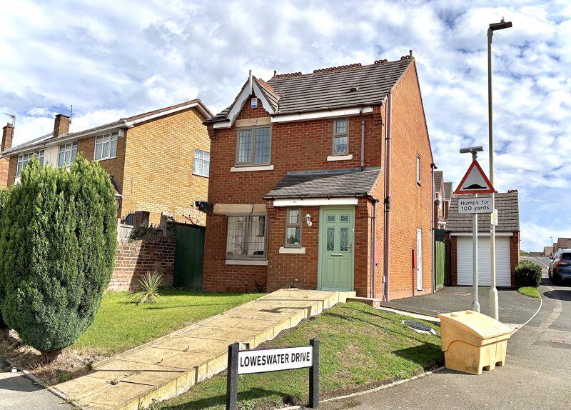
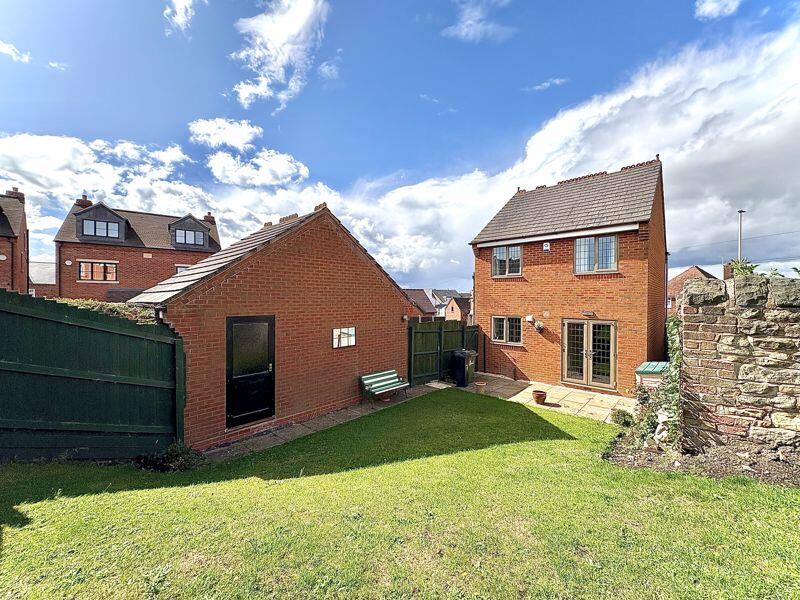
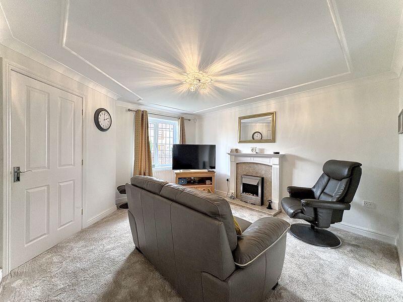
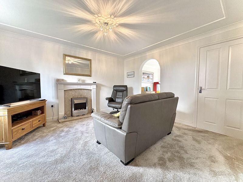
1 LOWESWATER DRIVE
LOWER GORNAL, DUDLEY, WEST MIDLANDS, DY3 2RG
£250,000
Location
Nearby
Nearest stations, universities and amenities (distance from property).
| Type | Name | Distance |
|---|---|---|
| Bus stop | Robert St / Five Ways Island | 0.1 miles |
| Shop | Tesco Express | 0.5 miles |
| Hospital | Bilston Street Surgery | 1.5 miles |
| Train station | Coseley | 2.2 miles |
| University | University of Wolverhampton Science Park | 5.7 miles |
Property details
Tenure
Freehold
Property type
Detached
Bedrooms
3
Bathrooms
1
Floor area
69 m²
EPC rating
C
Year built
England and Wales: 1996-2002
Last sold
£250,000 Jan 2026
Price per m²
£3,623/m²
Local average
£388,889 (27 sales)
Street crime
181 incidents within 1 mile (Apr 2026)
EPC Rating & Upgrade Cost
Current rating: C
Potential rating: B
Inspection date: 15/01/2025
Expiry date: 14/01/2035
Current heating cost: £938/year
Potential heating cost: £938/year
Est. upgrade cost to C: £9,500
Recommendations
- Solar water heating (£4,000 - £6,000)
- Solar photovoltaic panels, 2.5 kWp (£3,500 - £5,500)
Price history
| Event | Date | Price | Type | % change | Today’s value (HPI) | Action |
|---|---|---|---|---|---|---|
| Sold | 16/01/2026 | £250,000 | Detached | +85.2% | £248,330 to March 2026 | View transaction |
| Sold | 15/06/2006 | £135,000 | Detached | +39.2% | £244,409 to March 2026 | View transaction |
| Sold | 30/03/2001 | £96,950 | Detached | — | £331,990 to March 2026 | View transaction |
Historic listings
Listing and sale events only where we matched the listing page to a Land Registry sale already on record for this address.
| Event | Date | Price |
|---|---|---|
| sold | 01/01/2026 | £250,000 |
| listed | 11/09/2025 | £250,000 |
| sold | 01/01/2024 | £267,500 |
| sold | 01/01/2006 | £135,000 |
| sold | 01/01/2001 | £96,950 |
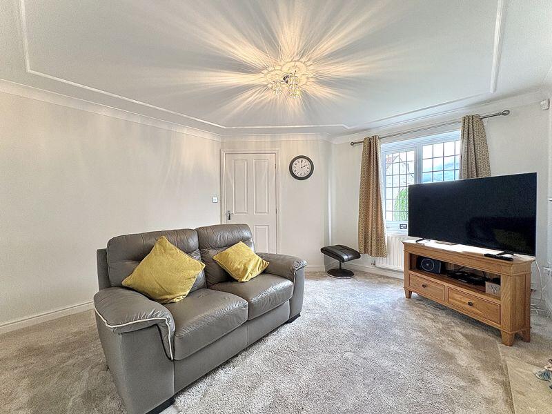
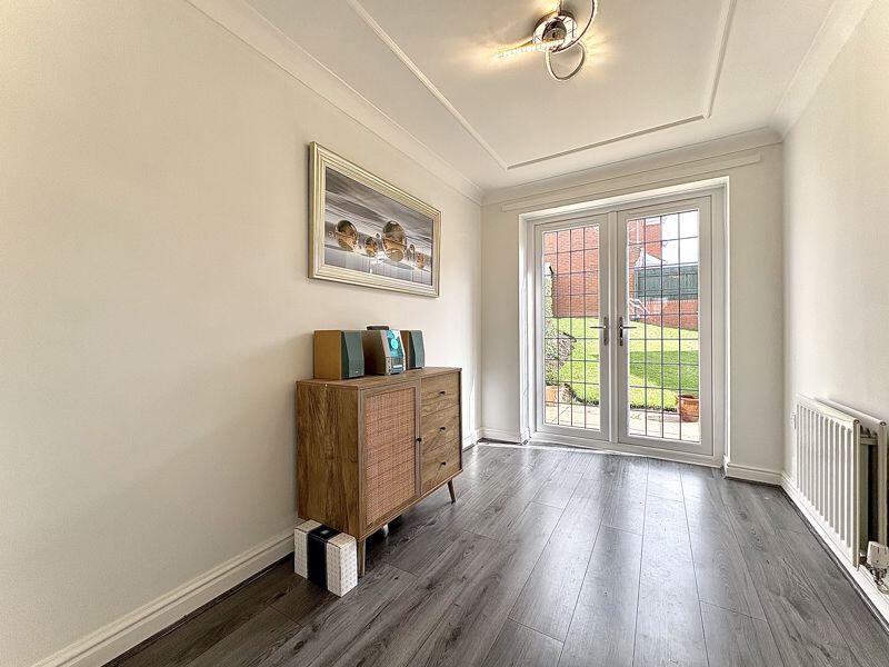
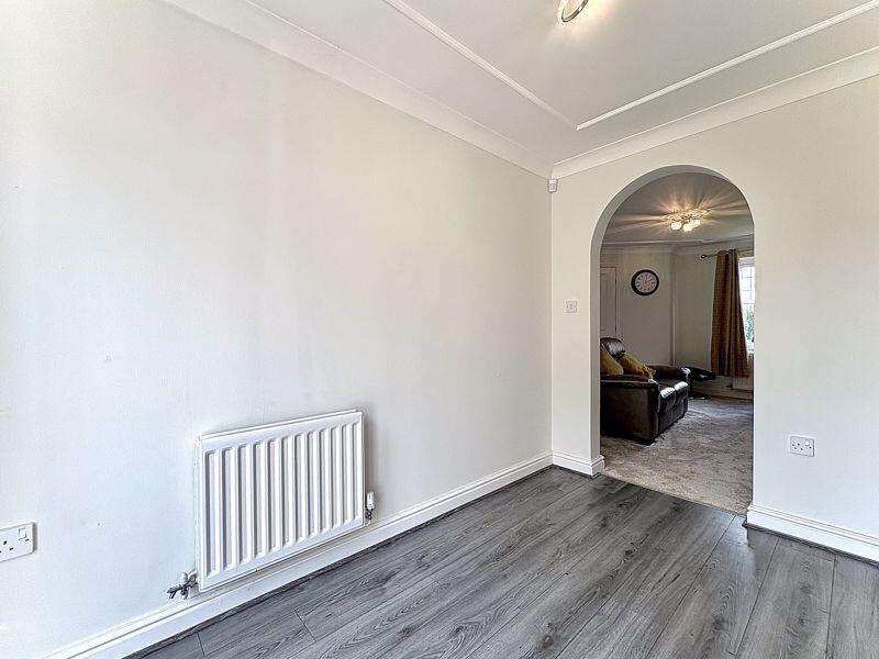
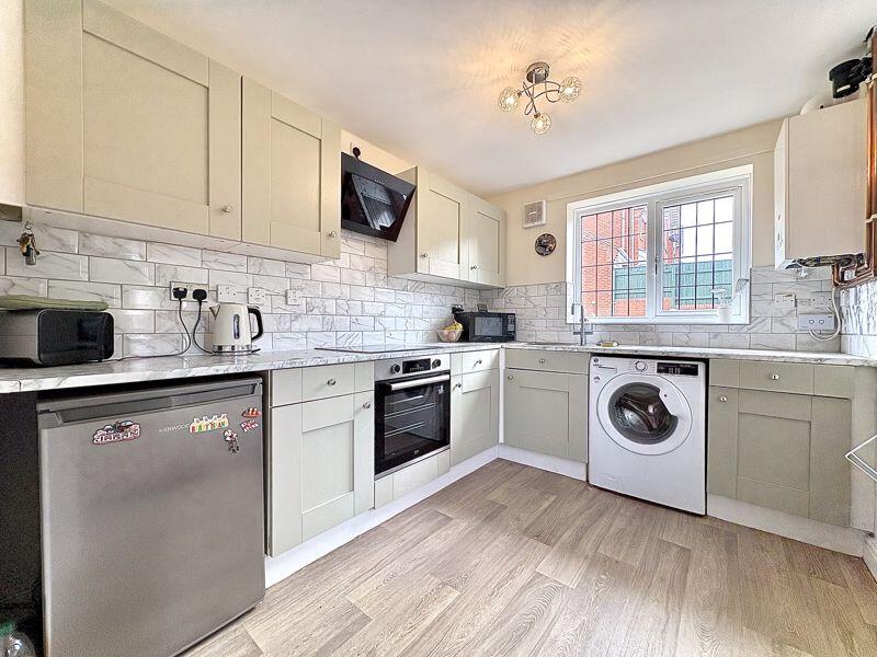
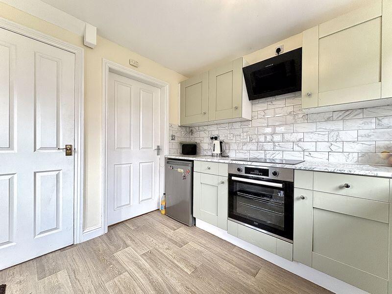
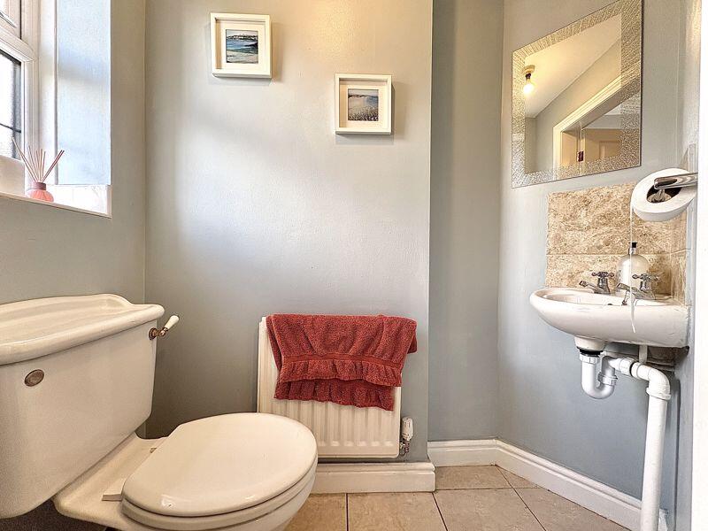
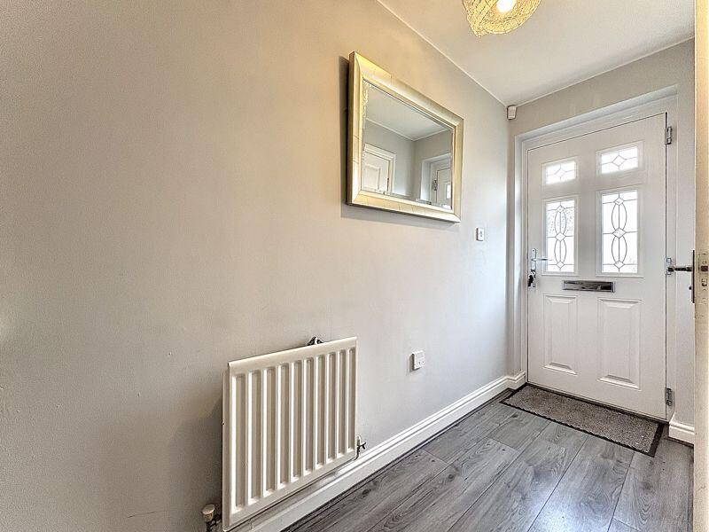
Photos · Open listing
 Open image 1 from listing 166896503
 Open image 2 from listing 166896503
 Open image 3 from listing 166896503
 Open image 4 from listing 166896503
 Open image 5 from listing 166896503
 Open image 6 from listing 166896503
 Open image 7 from listing 166896503
 Open image 8 from listing 166896503
 Open image 9 from listing 166896503
 Open image 10 from listing 166896503
 Open image 11 from listing 166896503
 Open image 12 from listing 166896503
Sold comparables
Same street and nearby sales within 0.25 miles (last 5 years). Land Registry Price Paid Data.
| Address | Price | Date | Type |
|---|---|---|---|
| 4 STOKESAY RISE, DUDLEY, WEST MIDLANDS, DY1 2GL | £423,000 | 31/10/2023 | Detached |
| 2 SHALLCROSS LANE, DUDLEY, WEST MIDLANDS, DY3 2HN | £265,000 | 22/05/2023 | Detached |
| 36 DEEPDALE LANE, LOWER GORNAL, DUDLEY, WEST MIDLANDS, DY3 2AE | £260,000 | 21/04/2023 | Detached |
| 2 ST JAMES STREET, LOWER GORNAL, DUDLEY, WEST MIDLANDS, DY3 2AS | £260,000 | 16/09/2022 | Detached |
| 8 LOWESWATER DRIVE, LOWER GORNAL, DUDLEY, WEST MIDLANDS, DY3 2RG | £287,500 | 31/08/2022 | Detached |
| 9 LAKE STREET, DUDLEY, WEST MIDLANDS, DY3 2AU | £255,000 | 12/08/2022 | Detached |
| 43 HUMPHREY STREET, LOWER GORNAL, DUDLEY, WEST MIDLANDS, DY3 2AW | £305,000 | 01/07/2022 | Detached |
| HIGH GABLES SANDSTONE CLOSE, LOWER GORNAL, DUDLEY, WEST MIDLANDS, DY3 2EQ | £450,000 | 16/05/2022 | Detached |
| 2B SANDSTONE CLOSE, DUDLEY, WEST MIDLANDS, DY3 2EQ | £265,000 | 07/04/2022 | Detached |
| 6 STOKESAY RISE, DUDLEY, WEST MIDLANDS, DY1 2GL | £420,000 | 27/08/2021 | Detached |
| 14 SHALLCROSS LANE, DUDLEY, WEST MIDLANDS, DY3 2HN | £225,000 | 22/07/2021 | Detached |
| 65 RUITON STREET, LOWER GORNAL, DUDLEY, WEST MIDLANDS, DY3 2EH | £215,000 | 16/07/2021 | Detached |
| GILL HOUSE, 62 DEEPDALE LANE, LOWER GORNAL, DUDLEY, WEST MIDLANDS, DY3 2AE | £530,000 | 30/06/2021 | Detached |
| 17 BERKSWELL CLOSE, DUDLEY, WEST MIDLANDS, DY1 2GH | £305,000 | 28/06/2021 | Detached |
Area average: £318,964 (14 sales)
For sale comparables
No active for-sale comparables found within 1 mile for the same bedrooms and property type.
Capital growth trend
Land Registry outcode average: last 12 months vs 5y and 10y ago (from sold prices).
House Price Index (HM Land Registry — official index, not sold-price averages): Dudley. Series: Detached. As of March 2026.
Rental Range
Estimated market rent for Dudley. Low = conservative, Realistic = average, Optimistic = best case.
Based on Local Authority from postcode lookup → Dudley.
LHA (30th percentile) floor for Black Country: Apr 2025 – Mar 2026
Rental Comparables
Residential lets from OpenRent and Rightmove for the area (same bedroom count). Use to validate rent estimates. Student lets are excluded.
| Title | Rent | Beds | Distance | As seen on |
|---|---|---|---|---|
| 3 Bed Semi-Detached House, Dudley, DY3 | £1,100/mo | 3 | 0.48 miles | OpenRent |
| 3 Bed Semi-Detached House, Corser St, DY1 | £995/mo | 3 | 0.8 miles | OpenRent |
| 3 Bed Semi-Detached House, Langstone Road, DY1 | £1,200/mo | 3 | 0.83 miles | OpenRent |
Average rent: £1,098/mo (3 listings)
Rent-driven metrics
Based on OpenRent comparables.
- Rent ratio — Monthly rent ÷ purchase price (1% rule). 1%+ = strong, 0.8–1% = okay, <0.8% = weak for cashflow.
- Max investor price — Rent ÷ 0.8%; the price at which rent would be 0.8% of price (Stoke-style target).
- Target investor price — Rent ÷ 1%; the price at which rent would be 1% of price (strong cashflow band).
- Gross yield — Annual rent as % of purchase price (no costs).
- Cost-to-rent — Price ÷ annual rent (from OpenRent comparables). Under 14× = strong, 14–16× = acceptable, 17×+ = compressed.
- Cashflow — Rent minus mortgage, 10% maintenance, £25/mo compliance. Assumes 75% LTV, 3.95% APR (5yr fixed), 25yr term.
- ROI — Annual profit ÷ cash in (deposit + 4% purchase costs).
Flood risk
Zone: 2
Risk: In flood risk area
Environment Agency Flood Risk Areas (APSFR)
Street-level crime
| Category | Count |
|---|---|
| Violence and sexual offences | 70 |
| Shoplifting | 28 |
| Vehicle crime | 23 |
| Criminal damage and arson | 12 |
| Other theft | 12 |
| Anti-social behaviour | 10 |
| Burglary | 8 |
| Drugs | 4 |
| Public order | 4 |
| Robbery | 4 |
| Possession of weapons | 3 |
| Other crime | 2 |
| Theft from the person | 1 |
| Total incidents | 181 |
Within 1 mile during Apr 2026. Source: data.police.uk (England & Wales).
Schools nearby
Nearest open schools with Ofsted ratings (England). Closed schools are not shown. Data from Get Information about Schools and Ofsted.
| Name | Type | Distance | Ofsted |
|---|---|---|---|
| Roberts Primary School | Primary | 0.0 miles | Requires improvement — 13 Jun 2023 |
| The King Alfred School | Other | 0.1 miles | Good — 20 Oct 2022 |
| Red Hall Primary School | Primary | 0.4 miles | Good — 4 Oct 2023 |
| Milking Bank Primary School | Primary | 0.5 miles | Good — 13 Jun 2013 |
| Ellowes Hall Sports College | Secondary | 0.5 miles | Good — 15 Jun 2023 |
FENSA
Window and door installation certificates found for this address.
| Issued | Work completed | Windows | Doors |
|---|---|---|---|
| 26/05/2024 | 16/05/2024 | 8 | 1 |