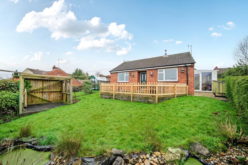
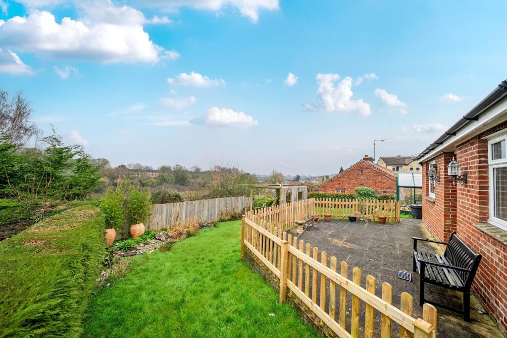
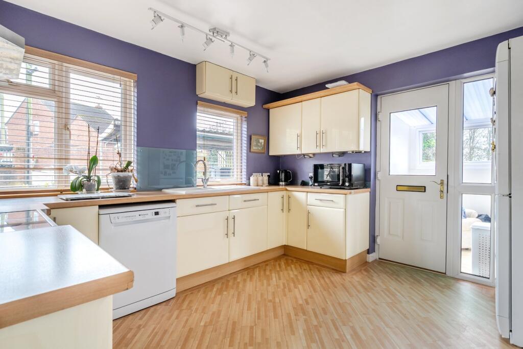
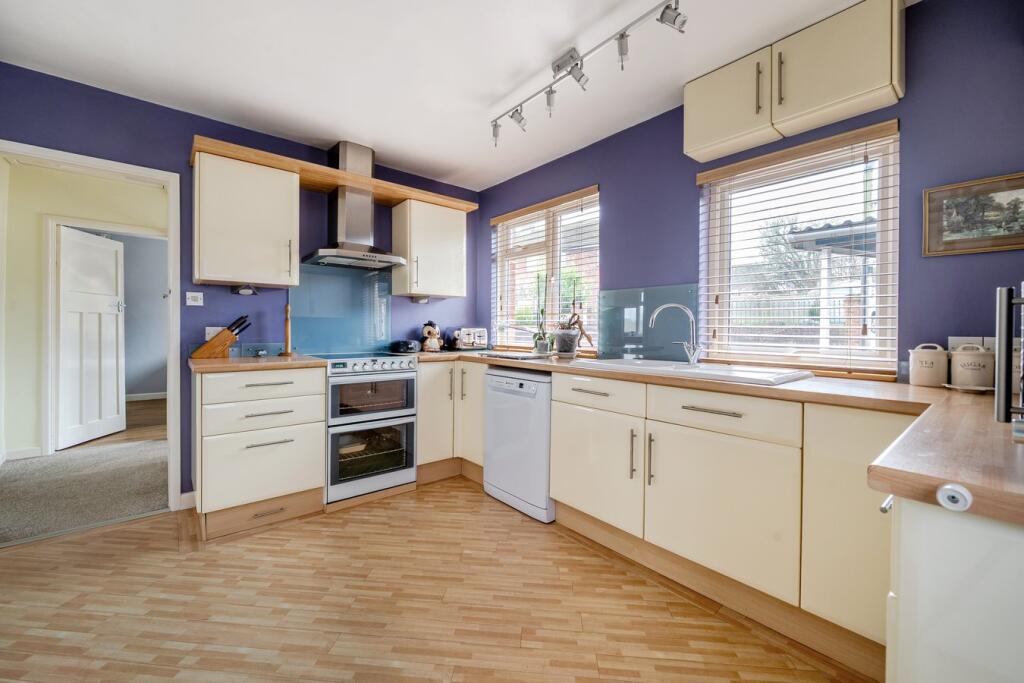
28 KING LANE
WARMINSTER, WILTSHIRE, BA12 8DH
£292,000
Location
Nearby
Nearest stations, universities and amenities (distance from property).
| Type | Name | Distance |
|---|---|---|
| Bus stop | Tesco Express | 0.1 miles |
| Shop | S L Corden & Sons | 0.8 miles |
| Train station | Warminster | 1.0 miles |
Property details
Tenure
Freehold
Property type
Detached
Bedrooms
2
Bathrooms
1
Floor area
59 m²
EPC rating
D
Year built
England and Wales: 1996-2002
Last sold
£292,000 Jan 2026
Price per m²
£4,949/m²
Local average
£470,961 (38 sales)
Street crime
74 incidents within 1 mile (Apr 2026)
EPC Rating & Upgrade Cost
Current rating: D
Potential rating: B
Inspection date: 01/06/2023
Current heating cost: £890/year
Potential heating cost: £803/year
Est. upgrade cost to C: £14,923
Recommendations
- Floor insulation (solid floor) (£4,000 - £6,000)
- Increase hot water cylinder insulation (£15 - £30)
- Upgrade heating controls (£350 - £450)
- Solar water heating (£4,000 - £6,000)
- Solar photovoltaic panels, 2.5 kWp (£3,500 - £5,500)
Price history
| Event | Date | Price | Type | % change | Today’s value (HPI) | Action |
|---|---|---|---|---|---|---|
| Sold | 16/01/2026 | £292,000 | Detached | -0.3% | £287,598 to March 2026 | View transaction |
| Sold | 22/11/2023 | £293,000 | Detached | — | £294,805 to March 2026 | View transaction |
Historic listings
Listing and sale events only where we matched the listing page to a Land Registry sale already on record for this address.
| Event | Date | Price |
|---|---|---|
| sold | 01/01/2026 | £292,000 |
| listed | 27/03/2025 | £299,950 |
| sold | 01/01/2023 | £293,000 |
| sold | 01/01/2001 | £86,000 |
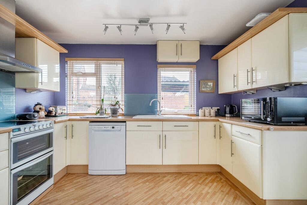
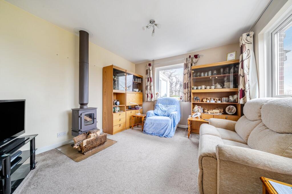
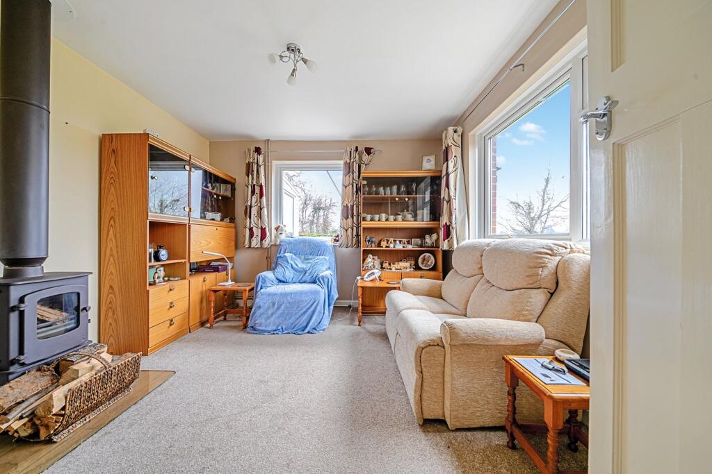
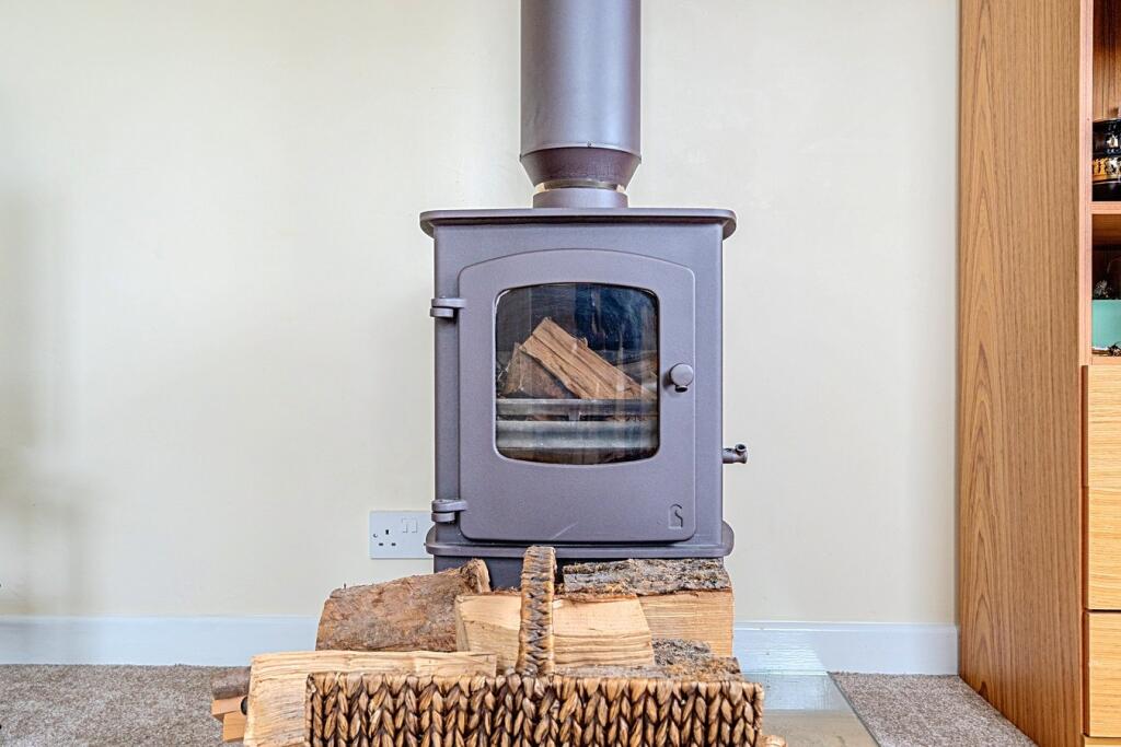
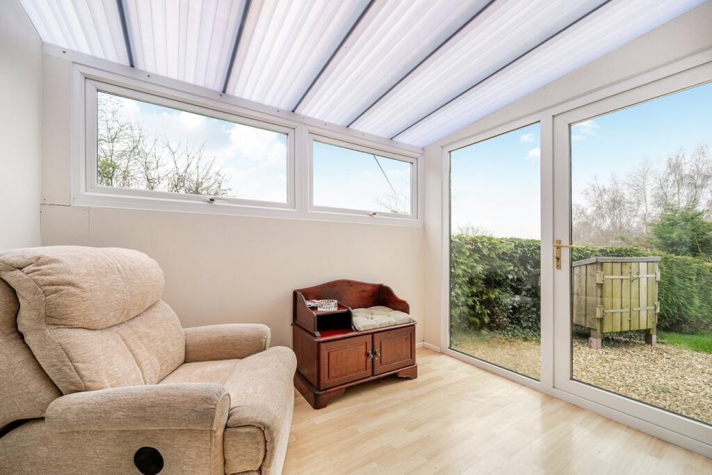
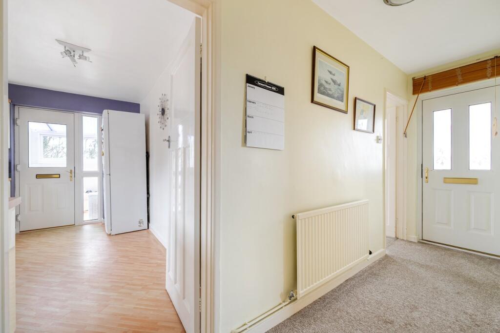
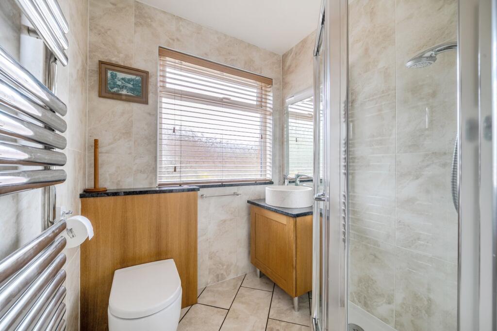
Photos · Open listing
 Open image 1 from listing 159891917
 Open image 2 from listing 159891917
 Open image 3 from listing 159891917
 Open image 4 from listing 159891917
 Open image 5 from listing 159891917
 Open image 6 from listing 159891917
 Open image 7 from listing 159891917
 Open image 8 from listing 159891917
 Open image 9 from listing 159891917
 Open image 10 from listing 159891917
 Open image 11 from listing 159891917
 Open image 12 from listing 159891917
Sold comparables
Same street and nearby sales within 0.25 miles (last 5 years). Land Registry Price Paid Data.
| Address | Price | Date | Type |
|---|---|---|---|
| 6A BROOK STREET, WARMINSTER, WILTSHIRE, BA12 8DN | £435,000 | 09/01/2026 | Detached |
| 20 KING LANE, WARMINSTER, WILTSHIRE, BA12 8DH | £298,000 | 17/12/2025 | Detached |
| 3 BROADWAY, WARMINSTER, WILTSHIRE, BA12 8EB | £355,000 | 16/12/2025 | Detached |
| 117 POUND STREET, WARMINSTER, WILTSHIRE, BA12 8NS | £348,000 | 12/12/2025 | Detached |
| 7 KING STREET, WARMINSTER, WILTSHIRE, BA12 8DG | £325,000 | 19/10/2023 | Detached |
| 5 BROADWAY, WARMINSTER, WILTSHIRE, BA12 8EB | £270,000 | 28/09/2023 | Detached |
| 4 KINGS ORCHARD, WARMINSTER, WILTSHIRE, BA12 8GA | £430,000 | 25/09/2023 | Detached |
| 13 KING STREET, WARMINSTER, WILTSHIRE, BA12 8DG | £310,000 | 05/07/2023 | Detached |
| 1 MADDOCKS HILL, WARMINSTER, WILTSHIRE, BA12 8DJ | £328,000 | 15/11/2022 | Detached |
| 3 BROADWAY, WARMINSTER, WILTSHIRE, BA12 8EB | £320,000 | 07/11/2022 | Detached |
| 21 BREAD STREET, WARMINSTER, WILTSHIRE, BA12 8DF | £320,000 | 28/10/2022 | Detached |
| 9A MADDOCKS HILL, WARMINSTER, WILTSHIRE, BA12 8DJ | £325,000 | 14/10/2022 | Detached |
| 5 BRADLEY ROAD, WARMINSTER, WILTSHIRE, BA12 8BL | £400,000 | 16/09/2022 | Detached |
| 2 KINGS RISE, WARMINSTER, WILTSHIRE, BA12 8DQ | £390,000 | 09/09/2022 | Detached |
| 28 CHAPEL STREET, WARMINSTER, WILTSHIRE, BA12 8BZ | £265,500 | 30/06/2022 | Detached |
| 16 BREAD STREET, WARMINSTER, WILTSHIRE, BA12 8DF | £512,500 | 14/04/2022 | Detached |
| 19 BROADWAY, WARMINSTER, WILTSHIRE, BA12 8EB | £317,500 | 05/01/2022 | Detached |
| 23 BRADLEY ROAD, WARMINSTER, WILTSHIRE, BA12 8BL | £311,000 | 17/11/2021 | Detached |
| 5 KING STREET, WARMINSTER, WILTSHIRE, BA12 8DG | £220,000 | 03/11/2021 | Detached |
| 9A MADDOCKS HILL, WARMINSTER, WILTSHIRE, BA12 8DJ | £290,000 | 30/09/2021 | Detached |
Area average: £338,525 (20 sales)
For sale comparables
No active for-sale comparables found within 1 mile for the same bedrooms and property type.
Capital growth trend
Land Registry outcode average: last 12 months vs 5y and 10y ago (from sold prices).
House Price Index (HM Land Registry — official index, not sold-price averages): Wiltshire. Series: Detached. As of March 2026.
Rental Range
Estimated market rent for Wiltshire. Low = conservative, Realistic = average, Optimistic = best case.
Based on Local Authority from postcode lookup → Wiltshire.
LHA (30th percentile) floor for West Wiltshire: Apr 2025 – Mar 2026
Rental Comparables
Residential lets from OpenRent and Rightmove for the area (same bedroom count). Use to validate rent estimates. Student lets are excluded.
| Title | Rent | Beds | Distance | As seen on |
|---|---|---|---|---|
| 2 Bed Terraced House, Victoria Road, BA12 | £995/mo | 2 | 0.41 miles | OpenRent |
| 2 Bed End Terrace, Camellia Drive, BA12 | £827/mo | 2 | 0.45 miles | OpenRent |
| 2 Bed Maisonette, Camellia Drive, BA12 | £900/mo | 2 | 0.47 miles | OpenRent |
| 2 Bed Terraced House, Russett Court, BA12 | £1,100/mo | 2 | 0.54 miles | OpenRent |
| 2 Bed Flat, Swaledale Road, BA12 | £950/mo | 2 | 0.55 miles | OpenRent |
| 2 Bed Maisonette, George Street, BA12 | £900/mo | 2 | 0.68 miles | OpenRent |
| 2 Bed Terraced House, North Row, BA12 | £1,100/mo | 2 | 0.82 miles | OpenRent |
| 2 Bed Flat, Orchard Close, BA12 | £795/mo | 2 | 1.15 miles | OpenRent |
Average rent: £946/mo (8 listings)
Rent-driven metrics
Based on OpenRent comparables.
- Rent ratio — Monthly rent ÷ purchase price (1% rule). 1%+ = strong, 0.8–1% = okay, <0.8% = weak for cashflow.
- Max investor price — Rent ÷ 0.8%; the price at which rent would be 0.8% of price (Stoke-style target).
- Target investor price — Rent ÷ 1%; the price at which rent would be 1% of price (strong cashflow band).
- Gross yield — Annual rent as % of purchase price (no costs).
- Cost-to-rent — Price ÷ annual rent (from OpenRent comparables). Under 14× = strong, 14–16× = acceptable, 17×+ = compressed.
- Cashflow — Rent minus mortgage, 10% maintenance, £25/mo compliance. Assumes 75% LTV, 3.95% APR (5yr fixed), 25yr term.
- ROI — Annual profit ÷ cash in (deposit + 4% purchase costs).
Flood risk
Zone: 1
Risk: Low
Job (default Low)
Street-level crime
| Category | Count |
|---|---|
| Violence and sexual offences | 21 |
| Anti-social behaviour | 15 |
| Public order | 9 |
| Shoplifting | 9 |
| Criminal damage and arson | 6 |
| Other theft | 5 |
| Burglary | 2 |
| Other crime | 2 |
| Vehicle crime | 2 |
| Drugs | 1 |
| Robbery | 1 |
| Theft from the person | 1 |
| Total incidents | 74 |
Within 1 mile during Apr 2026. Source: data.police.uk (England & Wales).
Schools nearby
Nearest open schools with Ofsted ratings (England). Closed schools are not shown. Data from Get Information about Schools and Ofsted.
| Name | Type | Distance | Ofsted |
|---|---|---|---|
| Princecroft Primary School | Primary | 0.3 miles | Good — 23 Mar 2018 |
| Sambourne Church of England Voluntary Controlled Primary School | Primary | 0.4 miles | Good — 13 Dec 2022 |
| The Minster CofE Primary School | Primary | 0.5 miles | Good — 18 Mar 2015 |
| Warminster School | Other | 0.7 miles | — (No rating) |
| The Avenue Primary School and Children's Centre | Primary | 0.9 miles | Good — 9 Jun 2024 |
FENSA
Checking FENSA certificates for this address. Refresh in a few minutes.