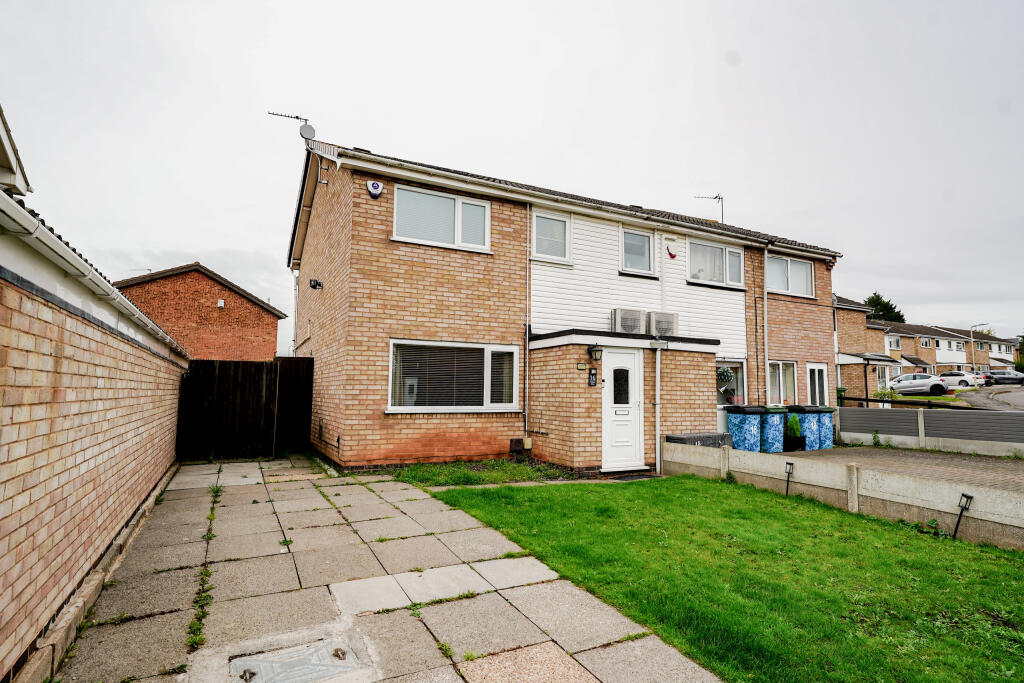
16 CLAYTON DRIVE
THURMASTON, LEICESTER, CHARNWOOD, LEICESTERSHIRE, LE4 8LQ
£270,000
Location
Nearby
Nearest stations, universities and amenities (distance from property).
| Type | Name | Distance |
|---|---|---|
| Bus stop | Walker Road | 0.1 miles |
| Shop | Tesco Express | 0.4 miles |
| Train station | Syston | 1.6 miles |
| Hospital | Leicester Nuffield Hospital | 2.0 miles |
| University | Unknown | 8.1 miles |
Property details
Tenure
Freehold
Property type
Terraced
Bedrooms
3
Bathrooms
1
Floor area
66 m²
EPC rating
C
Year built
England and Wales: 1976-1982
Last sold
£270,000 Mar 2026
Price per m²
£4,091/m²
Local average
£240,812 (77 sales)
Street crime
153 incidents within 1 mile (Apr 2026)
EPC Rating & Upgrade Cost
Current rating: C
Potential rating: B
Inspection date: 15/01/2019
Expiry date: 14/01/2029
Current heating cost: £414/year
Potential heating cost: £350/year
Recommendations
- Increase loft insulation to 270 mm (350)
- Floor insulation (solid floor) (6,000)
- Solar water heating (6,000)
- Solar photovoltaic panels, 2.5 kWp (8,000)
Price history
| Event | Date | Price | Type | % change | Today’s value (HPI) | Action |
|---|---|---|---|---|---|---|
| Sold | 12/03/2026 | £270,000 | Terraced | +10.2% | £270,000 to March 2026 | View transaction |
| Sold | 30/06/2022 | £245,000 | Terraced | +31% | £264,692 to March 2026 | View transaction |
| Sold | 07/06/2019 | £187,000 | Terraced | — | £253,663 to March 2026 | View transaction |
Historic listings
Listing and sale events only where we matched the listing page to a Land Registry sale already on record for this address.
| Event | Date | Price |
|---|---|---|
| sold | 01/01/2026 | £270,000 |
| listed | 30/09/2025 | £274,400 |
| sold | 01/01/2022 | £245,000 |
| sold | 01/01/2019 | £187,000 |
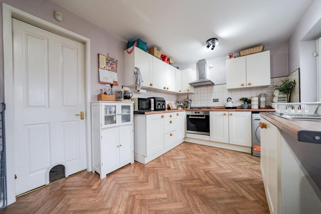
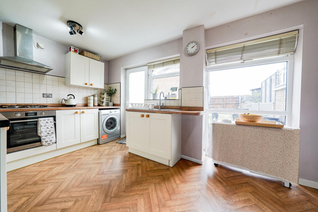
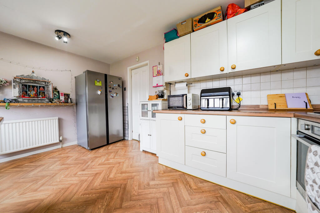
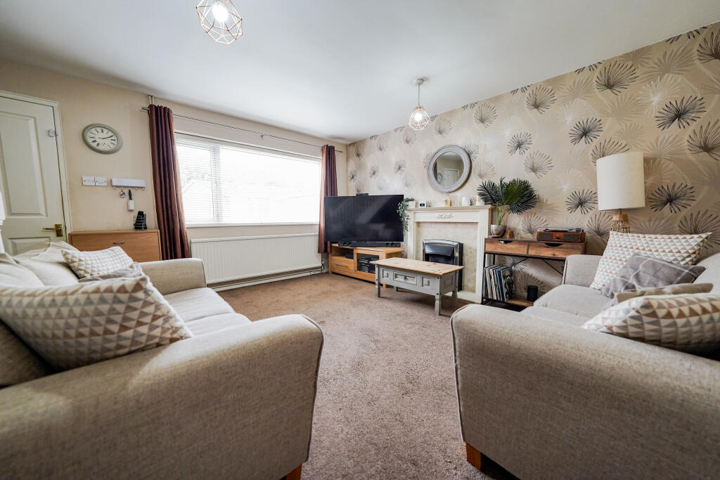
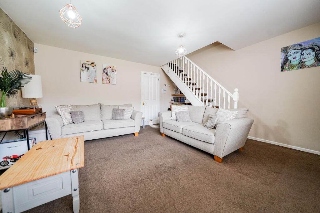
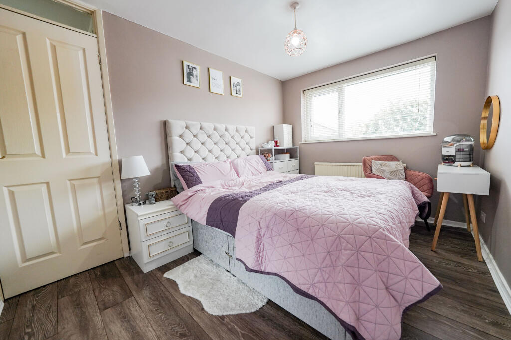
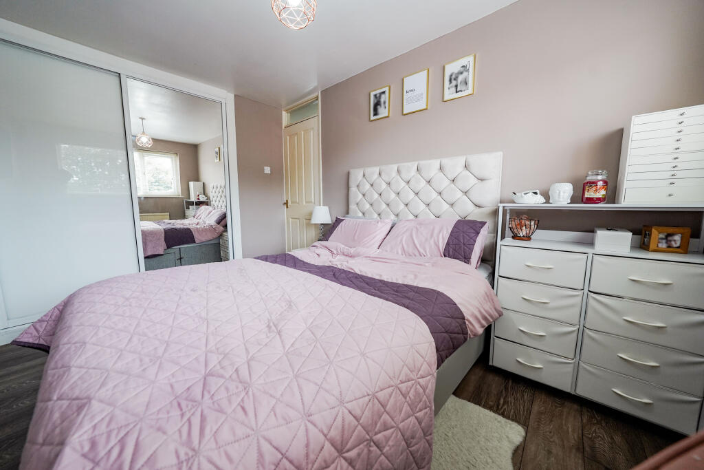
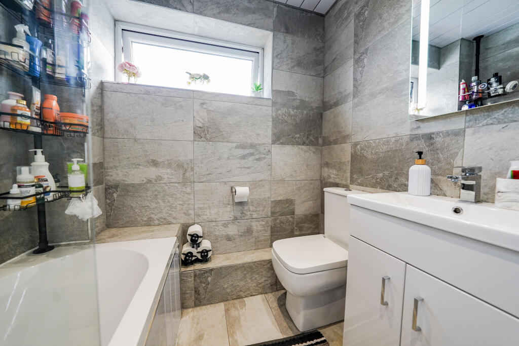
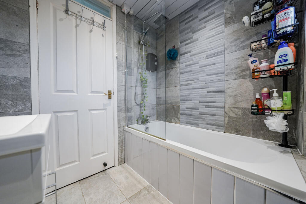
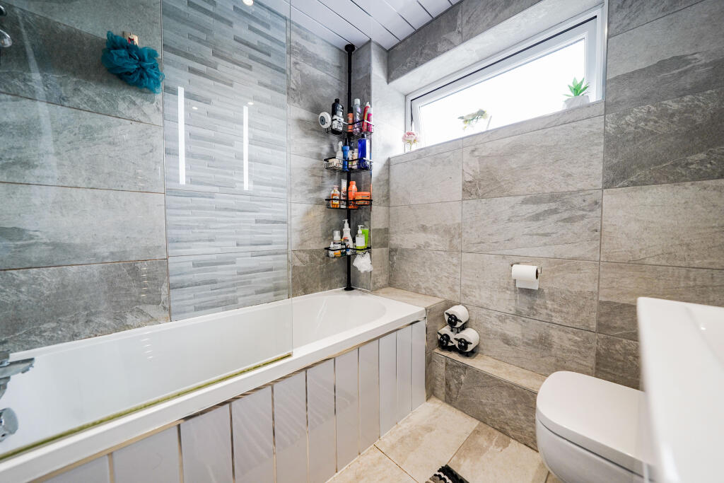
Photos · Open listing
 Open image 1 from listing 167637563
 Open image 2 from listing 167637563
 Open image 3 from listing 167637563
 Open image 4 from listing 167637563
 Open image 5 from listing 167637563
 Open image 6 from listing 167637563
 Open image 7 from listing 167637563
 Open image 8 from listing 167637563
 Open image 9 from listing 167637563
 Open image 10 from listing 167637563
 Open image 11 from listing 167637563
 Open image 12 from listing 167637563
Sold comparables
Same street and nearby sales within 0.25 miles (last 5 years). Land Registry Price Paid Data.
| Address | Price | Date | Type |
|---|---|---|---|
| 70 BLOUNT ROAD, THURMASTON, LEICESTER, CHARNWOOD, LEICESTERSHIRE, LE4 8LJ | £170,000 | 01/12/2025 | Terraced |
| 50 ONYX CRESCENT, LEICESTER, LE4 9AA | £310,000 | 14/02/2025 | Terraced |
| 39 CLAYTON DRIVE, THURMASTON, LEICESTER, CHARNWOOD, LEICESTERSHIRE, LE4 8LQ | £155,000 | 03/11/2023 | Terraced |
| 17 SMITH AVENUE, THURMASTON, LEICESTER, CHARNWOOD, LEICESTERSHIRE, LE4 8LS | £199,000 | 03/11/2023 | Terraced |
| 19 HARTSHORN CLOSE, THURMASTON, LEICESTER, CHARNWOOD, LEICESTERSHIRE, LE4 8LL | £185,000 | 27/10/2023 | Terraced |
| 19 HARTSHORN CLOSE, THURMASTON, LEICESTER, CHARNWOOD, LEICESTERSHIRE, LE4 8LL | £203,000 | 22/09/2023 | Terraced |
| 25 RIDGEWAY DRIVE, THURMASTON, LEICESTER, CHARNWOOD, LEICESTERSHIRE, LE4 8LN | £235,000 | 23/06/2023 | Terraced |
| 4 RIDGEWAY DRIVE, THURMASTON, LEICESTER, CHARNWOOD, LEICESTERSHIRE, LE4 8LN | £216,000 | 17/11/2022 | Terraced |
| 21 BLOUNT ROAD, THURMASTON, LEICESTER, CHARNWOOD, LEICESTERSHIRE, LE4 8LJ | £210,000 | 11/11/2022 | Terraced |
| 4 RIDGEWAY DRIVE, THURMASTON, LEICESTER, CHARNWOOD, LEICESTERSHIRE, LE4 8LN | £199,950 | 01/09/2022 | Terraced |
| 21 KEIGHTLEY WALK, THURMASTON, LEICESTER, CHARNWOOD, LEICESTERSHIRE, LE4 8LP | £170,000 | 30/06/2022 | Terraced |
| 33 BLOUNT ROAD, THURMASTON, LEICESTER, CHARNWOOD, LEICESTERSHIRE, LE4 8LJ | £180,000 | 19/01/2022 | Terraced |
| 17 SMITH AVENUE, THURMASTON, LEICESTER, CHARNWOOD, LEICESTERSHIRE, LE4 8LS | £177,500 | 10/12/2021 | Terraced |
| 51 BLOUNT ROAD, THURMASTON, LEICESTER, CHARNWOOD, LEICESTERSHIRE, LE4 8LJ | £172,000 | 26/11/2021 | Terraced |
| 80 PARKDALE ROAD, THURMASTON, LEICESTER, CHARNWOOD, LEICESTERSHIRE, LE4 8JR | £255,000 | 26/11/2021 | Terraced |
| 91 COLBY ROAD, THURMASTON, LEICESTER, CHARNWOOD, LEICESTERSHIRE, LE4 8LG | £169,000 | 20/08/2021 | Terraced |
Area average: £200,403 (16 sales)
For sale comparables
No active for-sale comparables found within 1 mile for the same bedrooms and property type.
Capital growth trend
Land Registry outcode average: last 12 months vs 5y and 10y ago (from sold prices).
House Price Index (HM Land Registry — official index, not sold-price averages): Charnwood. Series: Terraced. As of March 2026.
Rental Range
Estimated market rent for Charnwood. Low = conservative, Realistic = average, Optimistic = best case.
Based on Local Authority from postcode lookup → Charnwood.
LHA (30th percentile) floor for Leicester: Apr 2025 – Mar 2026
Rental Comparables
Residential lets from OpenRent and Rightmove for the area (same bedroom count). Use to validate rent estimates. Student lets are excluded.
| Title | Rent | Beds | Distance | As seen on |
|---|---|---|---|---|
| 3 Bed Semi-Detached House, Faldo Close, LE4 | £1,350/mo | 3 | 0.42 miles | OpenRent |
Average rent: £1,350/mo (1 listing)
Rent-driven metrics
Based on OpenRent comparables.
- Rent ratio — Monthly rent ÷ purchase price (1% rule). 1%+ = strong, 0.8–1% = okay, <0.8% = weak for cashflow.
- Max investor price — Rent ÷ 0.8%; the price at which rent would be 0.8% of price (Stoke-style target).
- Target investor price — Rent ÷ 1%; the price at which rent would be 1% of price (strong cashflow band).
- Gross yield — Annual rent as % of purchase price (no costs).
- Cost-to-rent — Price ÷ annual rent (from OpenRent comparables). Under 14× = strong, 14–16× = acceptable, 17×+ = compressed.
- Cashflow — Rent minus mortgage, 10% maintenance, £25/mo compliance. Assumes 75% LTV, 3.95% APR (5yr fixed), 25yr term.
- ROI — Annual profit ÷ cash in (deposit + 4% purchase costs).
Flood risk
Zone: 2
Risk: In flood risk area
Environment Agency Flood Risk Areas (APSFR)
Street-level crime
| Category | Count |
|---|---|
| Violence and sexual offences | 56 |
| Anti-social behaviour | 22 |
| Shoplifting | 17 |
| Public order | 14 |
| Vehicle crime | 12 |
| Criminal damage and arson | 11 |
| Burglary | 7 |
| Other theft | 5 |
| Other crime | 3 |
| Bicycle theft | 2 |
| Theft from the person | 2 |
| Drugs | 1 |
| Robbery | 1 |
| Total incidents | 153 |
Within 1 mile during Apr 2026. Source: data.police.uk (England & Wales).
Schools nearby
Nearest open schools with Ofsted ratings (England). Closed schools are not shown. Data from Get Information about Schools and Ofsted.
| Name | Type | Distance | Ofsted |
|---|---|---|---|
| Church Hill Infant School | Primary | 0.4 miles | Good — 5 Jun 2014 |
| Church Hill Church of England Junior School | Primary | 0.4 miles | Good — 10 Jan 2017 |
| Sandfield Close Primary School | Primary | 0.5 miles | — (Inspected (no overall grade)) |
| Eastfield Primary School | Primary | 0.6 miles | Requires improvement — 3 Dec 2023 |
| Bishop Ellis Catholic Voluntary Academy | Primary | 0.9 miles | Good — 3 Sep 2012 |
FENSA
Window and door installation certificates found for this address.
| Issued | Work completed | Windows | Doors |
|---|---|---|---|
| 27/07/2009 | 30/04/2009 | 7 | 1 |