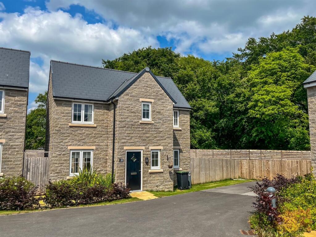
68 CAIRN DRIVE
BUXTON, HIGH PEAK, DERBYSHIRE, SK17 9XP
£272,000
Location
Nearby
Nearest stations, universities and amenities (distance from property).
| Type | Name | Distance |
|---|---|---|
| Shop | ExtraCare | 0.1 miles |
| Bus stop | Buxton, Ashbourne Road / Staden Lane | 0.1 miles |
| Hospital | Buxton Hospital & Corbar Birth Centre | 0.5 miles |
| Train station | Buxton Miniature Railway | 1.2 miles |
| University | University of Derby, Buxton | 1.4 miles |
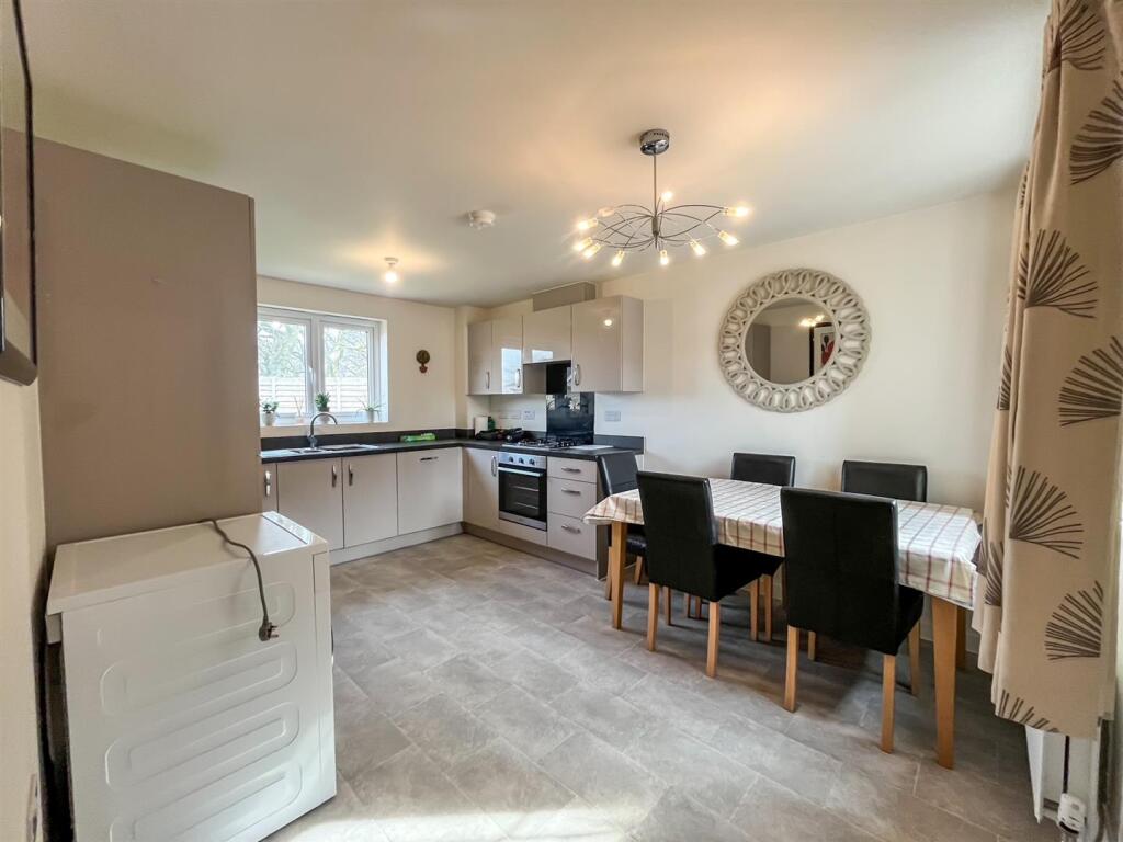
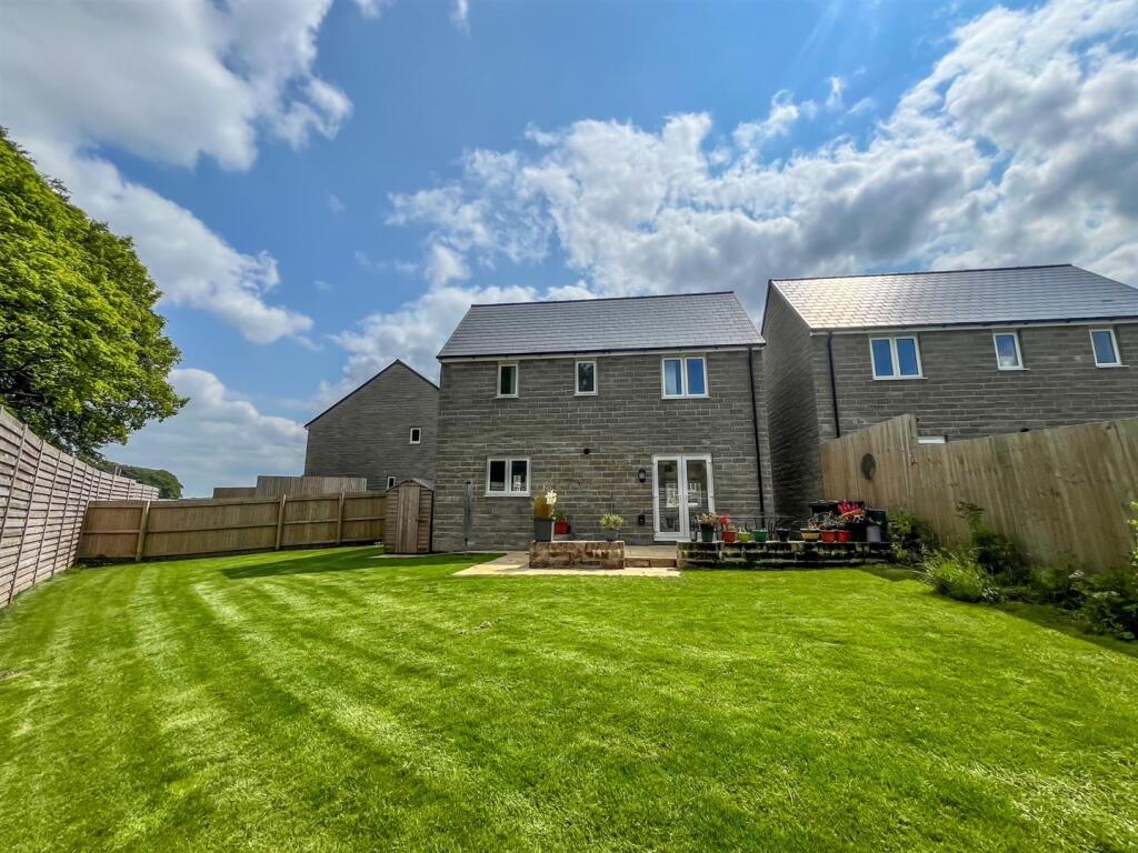
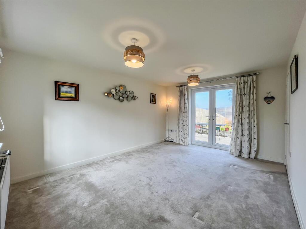
Property details
Tenure
Freehold
Property type
Detached
Bedrooms
3
Bathrooms
2
Floor area
79 m²
EPC rating
B
Last sold
£272,000 Mar 2026
Price per m²
£3,443/m²
Local average
£444,400 (20 sales)
Street crime
74 incidents within 1 mile (Apr 2026)
EPC Rating & Upgrade Cost
Current rating: B
Potential rating: A
Inspection date: 14/07/2022
Expiry date: 13/07/2032
Current heating cost: £255/year
Potential heating cost: £255/year
Est. upgrade cost to C: £9,500
Recommendations
- Solar water heating (£4,000 - £6,000)
- Solar photovoltaic panels, 2.5 kWp (£3,500 - £5,500)
Price history
| Event | Date | Price | Type | % change | Today’s value (HPI) | Action |
|---|---|---|---|---|---|---|
| Sold | 17/03/2026 | £272,000 | Detached | -5.9% | £272,000 to March 2026 | View transaction |
| Sold | 26/08/2022 | £288,995 | Detached | — | £322,781 to March 2026 | View transaction |
Historic listings
Listing and sale events only where we matched the listing page to a Land Registry sale already on record for this address.
| Event | Date | Price |
|---|---|---|
| sold | 01/01/2026 | £272,000 |
| listed | 04/04/2025 | £280,000 |
| sold | 01/01/2022 | £288,995 |
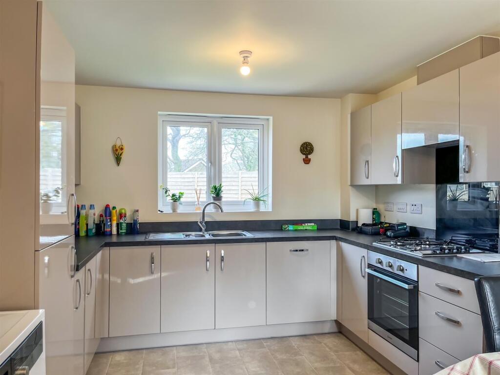
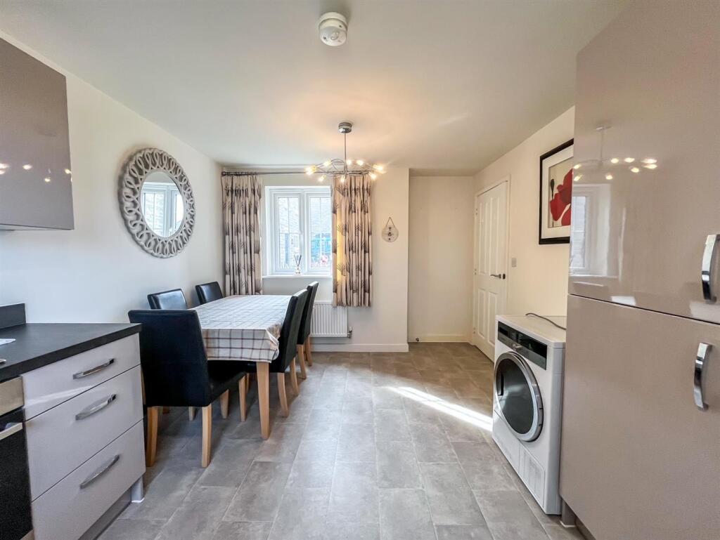
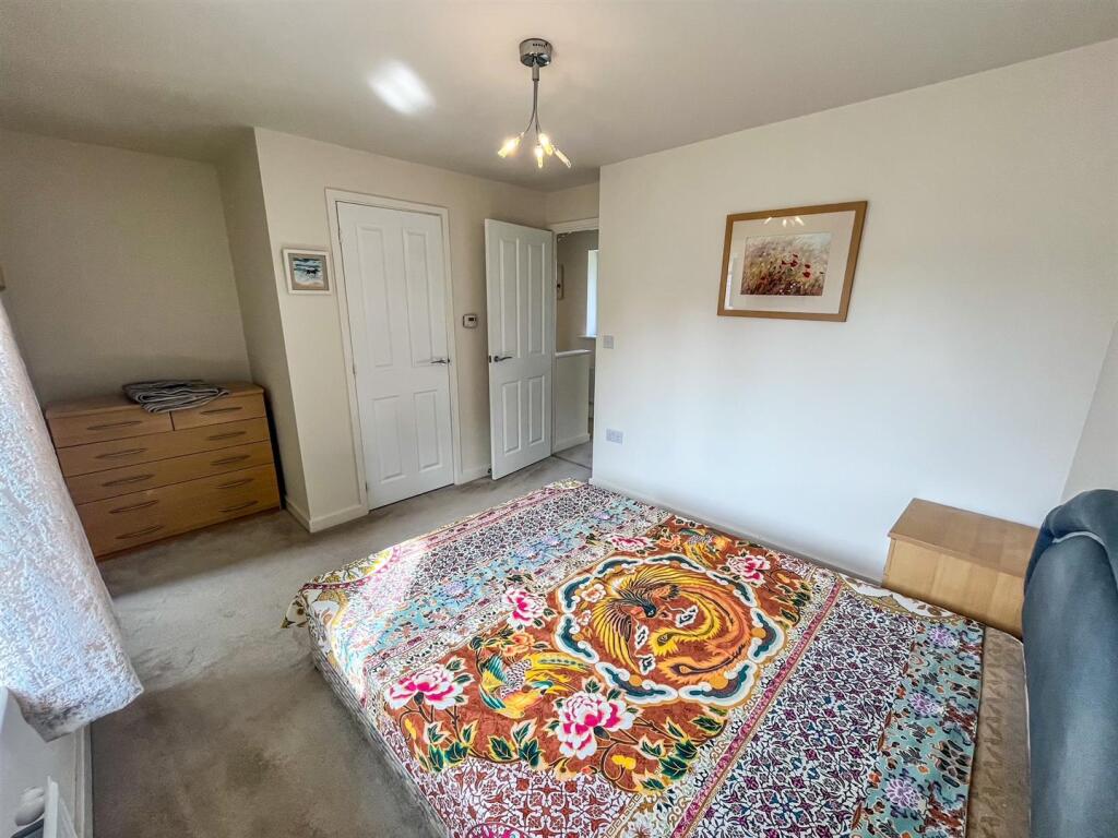
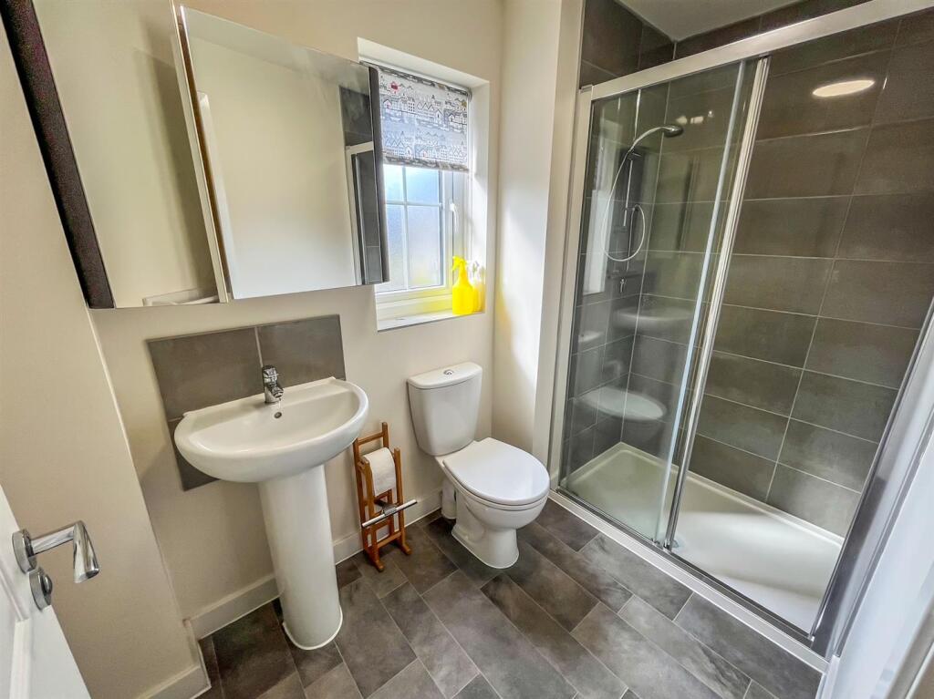
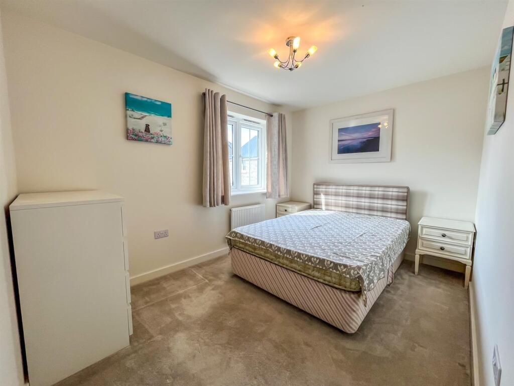
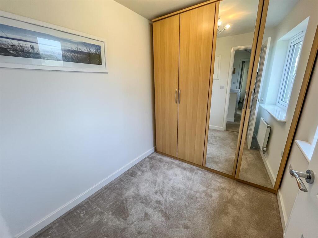
Photos · Open listing
 Open image 1 from listing 160270760
 Open image 2 from listing 160270760
 Open image 3 from listing 160270760
 Open image 4 from listing 160270760
 Open image 5 from listing 160270760
 Open image 6 from listing 160270760
 Open image 7 from listing 160270760
 Open image 8 from listing 160270760
 Open image 9 from listing 160270760
 Open image 10 from listing 160270760
 Open image 11 from listing 160270760
 Open image 12 from listing 160270760
Sold comparables
Same street and nearby sales within 0.25 miles (last 5 years). Land Registry Price Paid Data.
| Address | Price | Date | Type |
|---|---|---|---|
| 2 CLOVER LANE, BUXTON, HIGH PEAK, DERBYSHIRE, SK17 9XS | £295,000 | 21/06/2024 | Detached |
| 3 BERWICK ROAD, BUXTON, HIGH PEAK, DERBYSHIRE, SK17 9PD | £325,000 | 15/12/2023 | Detached |
| CEMETERY LODGE ASHBOURNE ROAD, BUXTON, HIGH PEAK, DERBYSHIRE, SK17 9RY | £425,000 | 14/12/2023 | Detached |
| 34 CAIRN DRIVE, BUXTON, HIGH PEAK, DERBYSHIRE, SK17 9XP | £289,995 | 19/12/2022 | Detached |
| 32 CAIRN DRIVE, BUXTON, HIGH PEAK, DERBYSHIRE, SK17 9XP | £277,000 | 16/12/2022 | Detached |
| 11 BERWICK ROAD, BUXTON, HIGH PEAK, DERBYSHIRE, SK17 9PD | £297,000 | 02/12/2022 | Detached |
| 24 CAIRN DRIVE, BUXTON, HIGH PEAK, DERBYSHIRE, SK17 9XP | £360,000 | 31/10/2022 | Detached |
| 88 BERWICK ROAD, BUXTON, HIGH PEAK, DERBYSHIRE, SK17 9LZ | £296,500 | 28/10/2022 | Detached |
| 27 CAIRN DRIVE, BUXTON, HIGH PEAK, DERBYSHIRE, SK17 9XQ | £344,000 | 21/10/2022 | Detached |
| 66 CAIRN DRIVE, BUXTON, HIGH PEAK, DERBYSHIRE, SK17 9XP | £285,000 | 14/10/2022 | Detached |
| 29 CAIRN DRIVE, BUXTON, HIGH PEAK, DERBYSHIRE, SK17 9XQ | £310,000 | 03/10/2022 | Detached |
| 52 CAIRN DRIVE, BUXTON, HIGH PEAK, DERBYSHIRE, SK17 9XP | £285,000 | 30/09/2022 | Detached |
| 35 CAIRN DRIVE, BUXTON, HIGH PEAK, DERBYSHIRE, SK17 9XQ | £210,000 | 26/08/2022 | Detached |
| 37 CAIRN DRIVE, BUXTON, HIGH PEAK, DERBYSHIRE, SK17 9XQ | £313,000 | 26/08/2022 | Detached |
| 1 THE WOODFIELD, BUXTON, HIGH PEAK, DERBYSHIRE, SK17 9YN | £320,000 | 29/07/2022 | Detached |
| 90 CAIRN DRIVE, BUXTON, HIGH PEAK, DERBYSHIRE, SK17 9XP | £310,000 | 24/06/2022 | Detached |
| THE BUNGALOW STADEN LANE, BUXTON, HIGH PEAK, DERBYSHIRE, SK17 9RZ | £880,000 | 10/06/2022 | Detached |
| 92 CAIRN DRIVE, BUXTON, HIGH PEAK, DERBYSHIRE, SK17 9XP | £292,000 | 29/04/2022 | Detached |
| 94 CAIRN DRIVE, BUXTON, HIGH PEAK, DERBYSHIRE, SK17 9XP | £292,000 | 29/04/2022 | Detached |
| 3 BERWICK ROAD, BUXTON, HIGH PEAK, DERBYSHIRE, SK17 9PD | £250,000 | 01/04/2022 | Detached |
Area average: £332,825 (20 sales)
For sale comparables
Active for-sale listings within 1 mile, matched to the same property type and bedroom count.
| Address | Price | Beds | Type | Distance |
|---|---|---|---|---|
| Clover Lane, Buxton | £310,000 | 3 | Detached | 0.11 mi |
| Central Drive, Buxton, Derbyshire, SK17 | £360,000 | 3 | Bungalow | 0.28 mi |
| College Drive, Harpur Hill, Buxton | £320,000 | 3 | Detached | 0.42 mi |
| Woodlark Close, Buxton | £325,000 | 3 | Detached | 0.46 mi |
| Ashford Drive, Buxton | £310,000 | 3 | Detached | 0.78 mi |
| Woodside, Buxton | £429,995 | 3 | Detached | 0.96 mi |
Capital growth trend
Land Registry outcode average: last 12 months vs 5y and 10y ago (from sold prices).
House Price Index (HM Land Registry — official index, not sold-price averages): High Peak. Series: Detached. As of March 2026.
Rental Range
Estimated market rent for High Peak. Low = conservative, Realistic = average, Optimistic = best case.
Based on Local Authority from postcode lookup → High Peak.
LHA (30th percentile) floor for Peaks & Dales: Apr 2025 – Mar 2026
Rental Comparables
Residential lets in the area (all bedroom counts shown — none matched the 3-bedroom count for this property). Student lets are excluded.
| Title | Rent | Beds | Distance | As seen on |
|---|---|---|---|---|
| 1 Bed Flat, Dale Road, SK17 | £600/mo | 1 | 0.93 miles | OpenRent |
| 5 Bed Terraced House, Dale Road, SK17 | £1,200/mo | 5 | 0.93 miles | OpenRent |
| Studio Flat, Market Street, SK17 | £495/mo | 1 | 0.99 miles | OpenRent |
| 1 Bed Flat, West Road, SK17 | £3,033/mo | 1 | 1.02 miles | OpenRent |
| 1 Bed Flat, Bath Road, SK17 | £495/mo | 1 | 1.05 miles | OpenRent |
| 1 Bed Flat, Bath Road, SK17 | £595/mo | 1 | 1.06 miles | OpenRent |
Average rent: £1,070/mo (6 listings)
Rent-driven metrics
Based on OpenRent comparables.
- Rent ratio — Monthly rent ÷ purchase price (1% rule). 1%+ = strong, 0.8–1% = okay, <0.8% = weak for cashflow.
- Max investor price — Rent ÷ 0.8%; the price at which rent would be 0.8% of price (Stoke-style target).
- Target investor price — Rent ÷ 1%; the price at which rent would be 1% of price (strong cashflow band).
- Gross yield — Annual rent as % of purchase price (no costs).
- Cost-to-rent — Price ÷ annual rent (from OpenRent comparables). Under 14× = strong, 14–16× = acceptable, 17×+ = compressed.
- Cashflow — Rent minus mortgage, 10% maintenance, £25/mo compliance. Assumes 75% LTV, 3.95% APR (5yr fixed), 25yr term.
- ROI — Annual profit ÷ cash in (deposit + 4% purchase costs).
Flood risk
Zone: 1
Risk: Low
Not in Flood Risk Area (no data)
Street-level crime
| Category | Count |
|---|---|
| Violence and sexual offences | 39 |
| Burglary | 8 |
| Criminal damage and arson | 6 |
| Public order | 6 |
| Anti-social behaviour | 5 |
| Shoplifting | 5 |
| Other theft | 4 |
| Drugs | 1 |
| Total incidents | 74 |
Within 1 mile during Apr 2026. Source: data.police.uk (England & Wales).
Schools nearby
Nearest open schools with Ofsted ratings (England). Closed schools are not shown. Data from Get Information about Schools and Ofsted.
| Name | Type | Distance | Ofsted |
|---|---|---|---|
| Harpur Hill Primary School | Primary | 0.3 miles | Good — 28 Apr 2019 |
| Buxton Junior School | Primary | 0.8 miles | Good — 1 Dec 2017 |
| Buxton Community School | Secondary | 1.0 miles | Good — 6 Jun 2013 |
| Buxton Infant School | Primary | 1.1 miles | Good — 30 Jan 2024 |
| Fairfield Infant and Nursery School | Primary | 1.2 miles | Good — 14 Nov 2018 |
FENSA
Checking FENSA certificates for this address. Refresh in a few minutes.