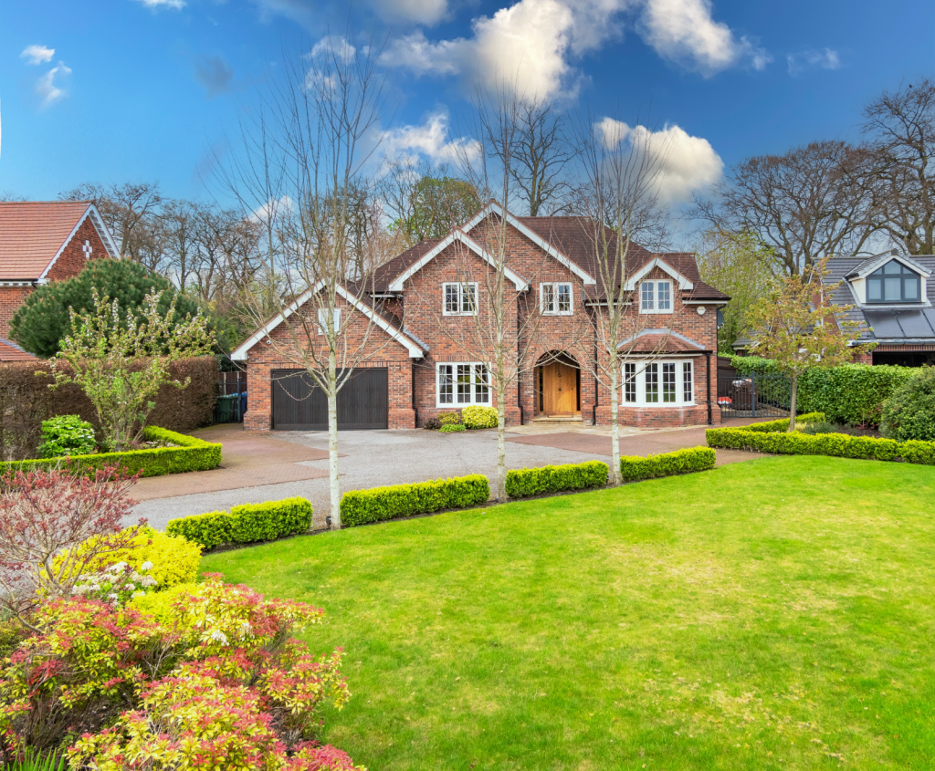
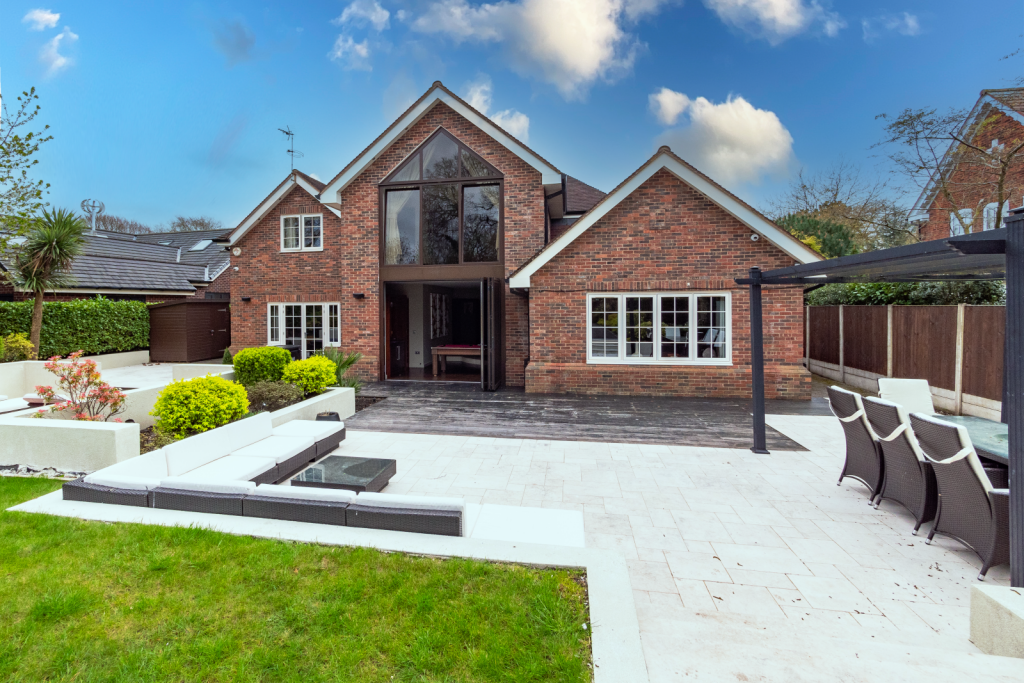
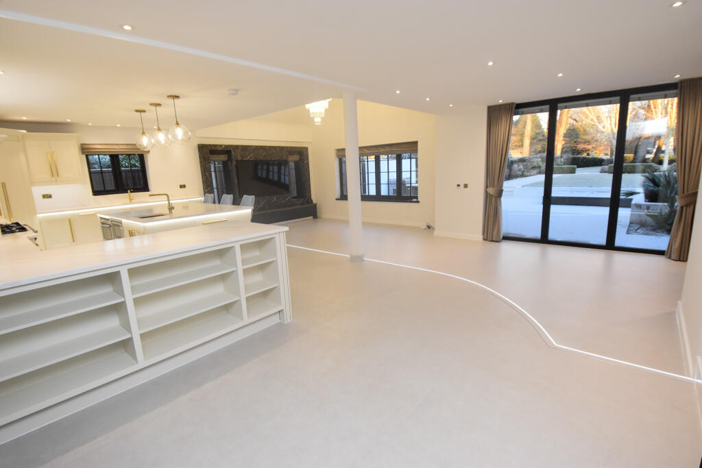
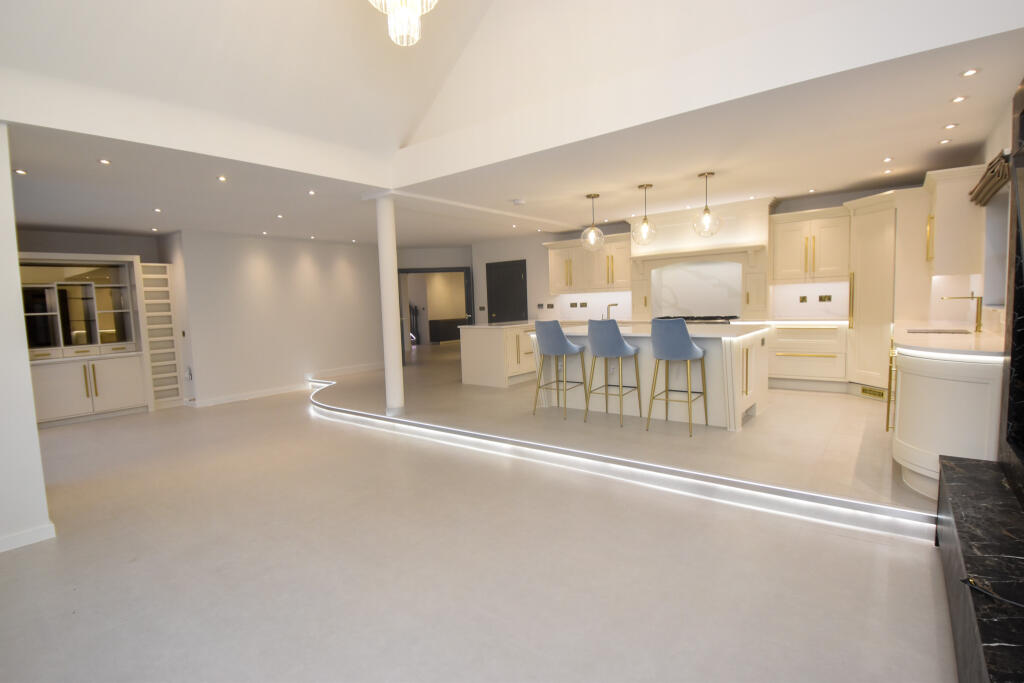
320 MOORSIDE ROAD
URMSTON, MANCHESTER, TRAFFORD, GREATER MANCHESTER, M41 5SF
£1,450,000
Location
Nearby
Nearest stations, universities and amenities (distance from property).
| Type | Name | Distance |
|---|---|---|
| Bus stop | Calder Bank, Moorside Road / opposite Mardale Avenue | 0.0 miles |
| Shop | Stewarts Shoe Repairs | 0.2 miles |
| Train station | Flixton | 0.6 miles |
| Hospital | Salford Gastric Bypass Surgery | 4.3 miles |
| University | Manchester School of Art | 6.0 miles |
Property details
Tenure
Freehold
Property type
Detached
Bedrooms
4
Bathrooms
3
Floor area
323 m²
EPC rating
C
Year built
England and Wales: 1983-1990
Last sold
£1,450,000 Mar 2026
Price per m²
£4,489/m²
Local average
£584,481 (26 sales)
EPC Rating & Upgrade Cost
Current rating: C
Potential rating: C
Inspection date: 11/09/2025
Expiry date: 10/09/2035
Current heating cost: £1,779/year
Potential heating cost: £1,779/year
Est. upgrade cost to C: £9,000
Recommendations
- Solar photovoltaic panels, 2.5 kWp (£8,000 - £10,000)
Price history
| Event | Date | Price | Type | % change | Today’s value (HPI) | Action |
|---|---|---|---|---|---|---|
| Sold | 23/03/2026 | £1,450,000 | Detached | +3.6% | £1,450,000 to March 2026 | View transaction |
| Sold | 05/07/2024 | £1,400,000 | Detached | +254.4% | £1,470,423 to March 2026 | View transaction |
| Sold | 02/03/2005 | £395,000 | Detached | — | £918,441 to March 2026 | View transaction |
Historic listings
Listing and sale events only where we matched the listing page to a Land Registry sale already on record for this address.
| Event | Date | Price |
|---|---|---|
| listed | 05/01/2026 | £1,485,000 |
| sold | 01/01/2026 | £1,450,000 |
| sold | 01/01/2024 | £1,400,000 |
| sold | 01/01/2005 | £395,000 |
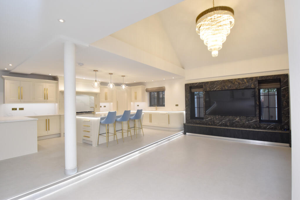
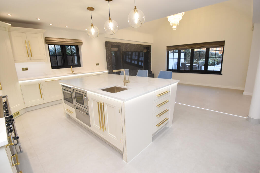
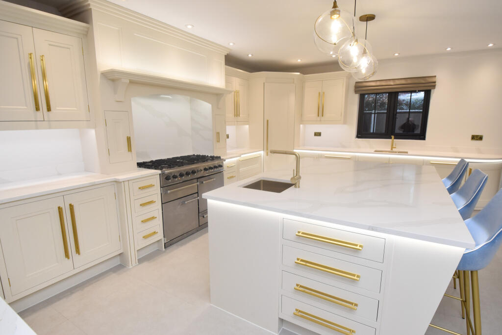
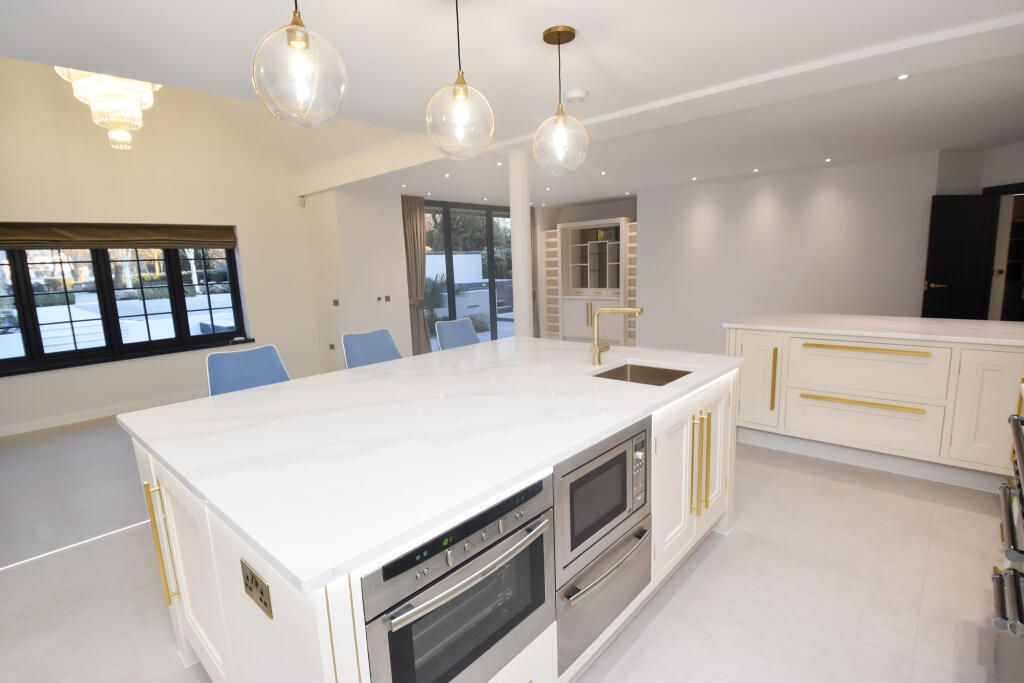
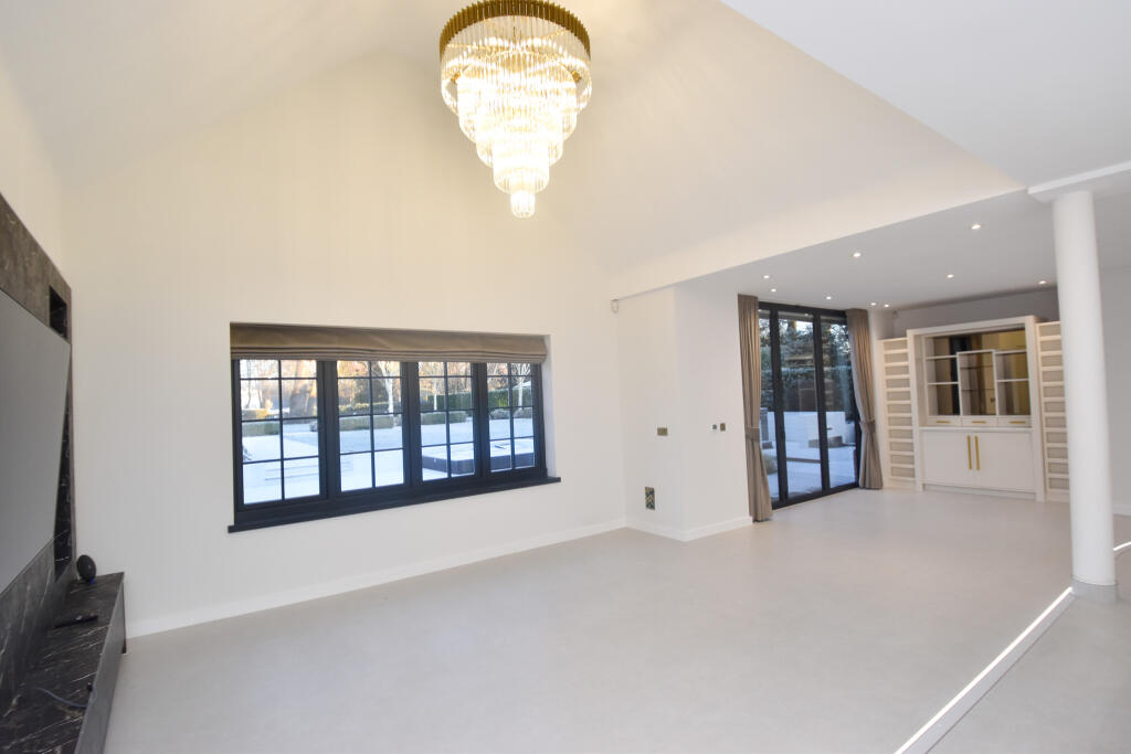
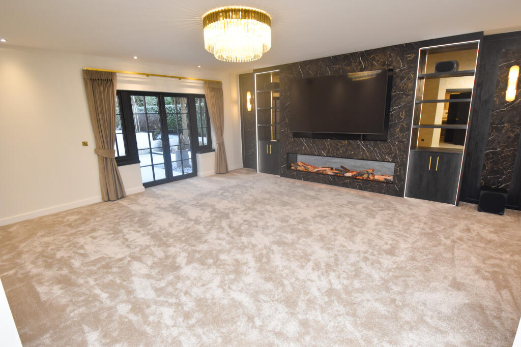
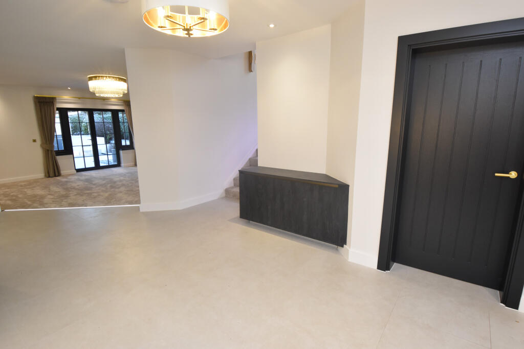
Photos · Open listing
 Open image 1 from listing 170847728
 Open image 2 from listing 170847728
 Open image 3 from listing 170847728
 Open image 4 from listing 170847728
 Open image 5 from listing 170847728
 Open image 6 from listing 170847728
 Open image 7 from listing 170847728
 Open image 8 from listing 170847728
 Open image 9 from listing 170847728
 Open image 10 from listing 170847728
 Open image 11 from listing 170847728
 Open image 12 from listing 170847728
Sold comparables
Same street and nearby sales within 0.25 miles (last 5 years). Land Registry Price Paid Data.
| Address | Price | Date | Type |
|---|---|---|---|
| 10 MARDALE AVENUE, URMSTON, MANCHESTER, TRAFFORD, GREATER MANCHESTER, M41 5SA | £595,000 | 10/11/2022 | Detached |
| 348 MOORSIDE ROAD, URMSTON, MANCHESTER, TRAFFORD, GREATER MANCHESTER, M41 5SE | £548,500 | 12/08/2022 | Detached |
| 302A MOORSIDE ROAD, URMSTON, MANCHESTER, TRAFFORD, GREATER MANCHESTER, M41 5SF | £545,000 | 29/09/2021 | Detached |
| 1 THE FOLD, URMSTON, MANCHESTER, TRAFFORD, GREATER MANCHESTER, M41 5SP | £420,000 | 20/08/2021 | Detached |
Area average: £527,125 (4 sales)
For sale comparables
Active for-sale listings within 1 mile, matched to the same property type and bedroom count.
| Address | Price | Beds | Type | Distance |
|---|---|---|---|---|
| Warwick Drive, Urmston, M41 | £600,000 | 4 | Detached | 0.75 mi |
Capital growth trend
Land Registry outcode average: last 12 months vs 5y and 10y ago (from sold prices).
House Price Index (HM Land Registry — official index, not sold-price averages): Trafford. Series: Detached. As of March 2026.
Rental Range
Estimated market rent for Trafford. Low = conservative, Realistic = average, Optimistic = best case.
Based on Local Authority from postcode lookup → Trafford.
LHA (30th percentile) floor for Central Greater Manchester: Apr 2025 – Mar 2026
Rental Comparables
Residential lets in the area (all bedroom counts shown — none matched the 4-bedroom count for this property). Student lets are excluded.
| Title | Rent | Beds | Distance | As seen on |
|---|---|---|---|---|
| 2 Bed Flat, Urmston, M41 | £711/mo | 2 | 0.68 miles | OpenRent |
| 3 Bed Semi-Detached House, Amersham Close, M41 | £1,375/mo | 3 | 0.86 miles | OpenRent |
| 1 Bed Flat, Royle Higginson Court, M41 | £618/mo | 1 | 0.9 miles | OpenRent |
| 1 Bed Flat, Wycliffe Road, M41 | £850/mo | 1 | 0.93 miles | OpenRent |
Average rent: £889/mo (4 listings)
Rent-driven metrics
Based on OpenRent comparables.
- Rent ratio — Monthly rent ÷ purchase price (1% rule). 1%+ = strong, 0.8–1% = okay, <0.8% = weak for cashflow.
- Max investor price — Rent ÷ 0.8%; the price at which rent would be 0.8% of price (Stoke-style target).
- Target investor price — Rent ÷ 1%; the price at which rent would be 1% of price (strong cashflow band).
- Gross yield — Annual rent as % of purchase price (no costs).
- Cost-to-rent — Price ÷ annual rent (from OpenRent comparables). Under 14× = strong, 14–16× = acceptable, 17×+ = compressed.
- Cashflow — Rent minus mortgage, 10% maintenance, £25/mo compliance. Assumes 75% LTV, 3.95% APR (5yr fixed), 25yr term.
- ROI — Annual profit ÷ cash in (deposit + 4% purchase costs).
Flood risk
Zone: 1
Risk: Low
Not in Flood Risk Area (no data)
Street-level crime
| Category | Count |
|---|---|
| Total incidents | 0 |
Within 1 mile during Apr 2026. Source: data.police.uk (England & Wales).
Schools nearby
Nearest open schools with Ofsted ratings (England). Closed schools are not shown. Data from Get Information about Schools and Ofsted.
| Name | Type | Distance | Ofsted |
|---|---|---|---|
| Flixton Primary School | Primary | 0.2 miles | Good — 10 Nov 2014 |
| Flixton Girls School | Secondary | 0.5 miles | Good — 23 Jan 2024 |
| Abbotsford Preparatory School | Other | 0.5 miles | — (No rating) |
| Woodhouse Primary School | Primary | 0.5 miles | Good — 21 Jun 2023 |
| Acre Hall Primary School | Primary | 0.6 miles | Requires improvement — 8 Sep 2024 |
FENSA
Checking FENSA certificates for this address. Refresh in a few minutes.